
In recent years, with the rapid development of information technology and high-tech innovations, the demand for spatial information has surged, leading to an expansion in the boundaries of surveying and mapping geographic information. This field now permeates various sectors, and the role of information technology in cultivating surveying and mapping professionals has become increasingly prominent. Particularly, the rapid advancement of drone technology has emerged as a critical support for geographic information surveying. Leveraging virtual simulation technology to achieve three-dimensional visualization in drone surveying and mapping can effectively address the disconnect between theory and practice in current talent cultivation. Traditionally, data analysis for drone flight collection relies heavily on flight paths and textual descriptions, which, while meeting basic requirements for flight control design, lack intuitiveness. This makes it challenging to observe and interpret vast amounts of data. With the rapid progress of computer graphics, virtual reality technology has gained attention and widespread application. It allows for the presentation of extensive flight data through realistic 3D imagery, enabling learners to observe and assess drone flight states in a visual, reliable, and rapid 3D environment. Consequently, virtual reality technology can fundamentally transform the traditional reliance on theoretical instruction in practical education, highlighting the pivotal role of virtual simulation in talent cultivation. It fosters a harmonious integration of theoretical and practical teaching, embedding advanced educational philosophies into hands-on training. This approach has broad prospects for enhancing drone training.
Currently, drone surveying technology and 3D laser scanning are evolving swiftly, especially with tilt photography techniques revolutionizing traditional surveying methods by improving efficiency exponentially. Major drone companies are aggressively promoting this industry, and surveying enterprises are actively adopting these methods. The rapid technological growth has created a significant demand for professionals skilled in drone surveying and data processing. However, there is a substantial gap in the talent pool, as many graduates lack proficiency in this area. Most technical institutes and universities have not yet incorporated drone surveying into their curricula, leaving students inadequately prepared. In modern educational settings, educators must consider how to effectively organize teaching activities across multiple dimensions—such as classrooms, virtual simulation labs, and technical service centers—to genuinely foster student growth through drone training.
Drone surveying has become a vital method for collecting geographic information, offering vast industry prospects. Yet, its knowledge points are intricate and numerous, requiring high-standard testing sites and being susceptible to weather and environmental factors. This makes it difficult for many educators and students to experience the full operational process. Additionally, due to the high cost of drone equipment, practical sessions are often conducted in groups, preventing each student from having hands-on access. This limitation hinders the thorough understanding and mastery of drone surveying skills. Moreover, classroom time is finite, and students may wish to borrow equipment for extra practice but hesitate due to fears of damaging the drones from inexperienced flight control. These objective factors impede the enhancement of practical skills, underscoring the necessity for virtual simulation resources in drone training.
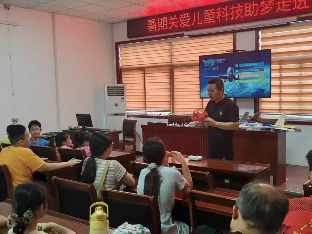
Virtual simulation experiments for drone surveying adhere to the principle of “preferring real over virtual, but combining both.” They cover logically interconnected phases such as drone image acquisition, photogrammetric control point collection, aerial image processing, and data expression. These experiments transform complex surveying principles into vivid demonstrations, overcoming spatial limitations of traditional surveying engineering education. They enable fine-grained teaching that conventional methods cannot achieve, allowing immersive experiences in the entire drone surveying process. Students can familiarize themselves with each operational step, grasp key points, and solidify skills before actual practice, thereby improving experimental outcomes. Furthermore, virtual simulations enrich information technology tools, enhance信息化 teaching levels, and cater to the habits of contemporary students who prefer internet-based learning. Through these experiments, students gain proficiency in drone flight technology, apply foundational theories to analyze and address engineering problems, and develop professional capabilities in low-altitude drone aerial photography, road and bridge inspections, and other areas. This fosters innovation in drone surveying and transportation engineering applications, making drone training more effective and accessible.
The necessity for building virtual simulation course resources stems from several factors. First, the rapid evolution of drone technology necessitates updated educational approaches. Traditional methods often lag behind industry trends, creating a skill gap. Virtual simulation addresses this by providing safe, cost-effective, and scalable training environments. Second, it mitigates risks associated with physical drone operations, such as equipment damage or safety hazards, which are paramount in drone training. Third, it allows for repetitive practice without time or space constraints, crucial for mastering complex skills like flight control and data processing. By integrating virtual simulation, educators can ensure that drone training is comprehensive, engaging, and aligned with industry standards.
The construction goals for virtual simulation resources in drone training are multifaceted. Firstly, integrating virtual simulation technology with modern intelligent surveying geographic information technology into teaching aims to elevate students’ practical proficiency. This innovative experimental project lets students experience drone flight control, image acquisition, data processing, and even modeling in a secure virtual environment. It equips them with theoretical knowledge and basic methods for drone surveying flights, enabling them to undertake engineering projects. Students develop a preliminary sense of technological innovation, foundational abilities for drone-related careers, and a basis for obtaining professional certificates like AOPA or UTC, as well as 1+X drone operation applications. This cultivates their ability to apply technical knowledge, enhances professional quality, and after mastering essential skills, they can design new experimental systems, flexibly use knowledge in practice, and foster independent problem-solving and innovation—all core aspects of effective drone training.
Secondly, identifying the relationship between the quality and efficiency of drone image acquisition and modeling effects is crucial. Virtual simulation breaks through the limitations of traditional photogrammetry teaching—such as safety, cost, time, and site conditions—by allowing observation of how drone trajectory planning, image quantity, and quality interact with 3D modeling in complex scenarios. This promotes a deeper understanding of both internal and external aspects of drone surveying, enriching drone training experiences.
Thirdly, enhancing students’ practical skills and teaching quality is a primary objective. Through simulated exercises in knowledge learning, equipment assembly, and aerial photography flights, students can authentically experience the entire drone surveying process. This prepares them thoroughly for subsequent hands-on operations and is applicable across various disciplines in transportation civil engineering, making drone training more inclusive and effective.
Adopting a student-centered approach based on the workflow of drone surveying engineering, virtual simulation practice learning allows systems to track operations in real-time and provide feedback, embodying information-based classroom management. The “combination of virtual and real” teaching method significantly improves learning outcomes in practical activities. Students immerse themselves in the complete drone surveying workflow, deepening their understanding of course knowledge points and skills in subjects like “Introduction to Drones,” “Principles and Applications of Photogrammetry,” “Remote Sensing Technology and Mapping,” “Digital Mapping,” “Drone and Its Engineering Applications,” and “3D Laser Point Cloud Technology for Buildings.” This cultivates comprehensive abilities and promotes holistic development of professionals in surveying geographic information technology, with drone training at its core.
The significance of constructing virtual simulation resources is both theoretical and practical. Theoretically, the swift advancement of modern technology drives innovation in higher vocational education, accelerating the trend toward diversified teaching methods. In university experimental teaching, virtual simulation experiments can create realistic experimental environments, objectives, and content, allowing students to autonomously design and operate experiments in open, interactive virtual settings. By incorporating scientific exploration activities, it enhances their innovation and entrepreneurship capabilities. Computers simulate actual experimental instruments and environments, reducing limitations of time, space, and geography. Students can conduct experiments anytime via virtual simulation platforms, lowering costs and resource consumption. This avoids risks from uncontrollable factors and provides more opportunities for practice. Introducing 3D virtual simulation technology into surveying geographic information teaching and developing drone surveying virtual simulation resources offer strong interactive experiences. This boosts students’ interest, initiative, and self-discipline in learning, improves teaching effectiveness, and supports integrated teaching across related disciplines. Choosing a “real-virtual” combined approach is an innovative attempt that holds significant meaning for advancing teaching in this field, particularly in drone training.
Practically, hands-on education platforms are key to nurturing innovative talents in surveying geographic information technology. As a “Double High Plan” institution, our college’s construction and research in virtual simulation practice aim to achieve “transportation civil engineering + modern intelligent surveying” geographic information innovation applications. This strongly supports talent cultivation in transportation civil engineering disciplines and serves industrial transformation and development. Leveraging platform and talent advantages, with a focus on “resource integration, advantage aggregation, dedicated product development, feature demonstration, and continuous improvement,” and adhering to the “combine virtual and real, prefer real” principle, we tailor resources to the characteristics of disciplines like surveying geographic information technology, road and bridge engineering, and construction engineering. These resources combine professional comprehensive ability shaping with vocational skill training, supporting drone surveying technology and 1+X drone operation applications. Through independent research and校企合作, we integrate virtual simulation, 3D modeling, human-computer interaction, database queries, and communication networks with talent cultivation and industry features to develop a series of virtual simulation courses. We establish reliable, eco-friendly virtual simulation test projects that are difficult or impossible in real settings, solving teaching challenges. Virtual simulation practice enhances students’ learning enthusiasm, leverages their subjective initiative, stimulates interest, showcases their character, improves learning ability, and increases teaching efficiency. Based on results and feedback, we continuously refine approaches, ensuring drone training remains dynamic and effective.
The construction content of virtual simulation resources encompasses the entire drone surveying process. Drone surveying, a subset of drone remote sensing, involves aerial photography of target areas via drones, followed by data processing to produce DOM, DLG, and 3D models. Drones offer rapid spatial information acquisition with high efficiency, low cost, accuracy, and flexibility, revolutionizing traditional surveying methods. They play an irreplaceable role in geographic information surveying, national condition monitoring, and emergency detection, meeting diverse industry needs and forming the backbone of modern drone training.
The virtual simulation experiment project is structured into theoretical and practical teaching components. Theoretical teaching includes course materials, operation demonstrations, and online testing. Practical teaching focuses on student-led virtual exercises covering device assembly, aerial photography flights, and mapping. The platform records scores and generates实验报告. Key elements are summarized in Table 1.
| Component | Description | Key Activities |
|---|---|---|
| Theoretical Teaching | Documentation, demos, tests | Learning concepts, regulations, principles |
| Practical Teaching | Virtual exercises | Device assembly, flight control, route planning, image acquisition, 4D product generation |
| Assessment | Real-time tracking, feedback | Automated scoring, reports, performance analysis |
Table 1: Overview of Virtual Simulation Experiment Project Components for Drone Training
In the drone cognition and assembly phase, virtual reality technology constructs high-definition, detailed multi-rotor drone models. Students interactively learn about drone structure and flight principles, recognizing main components like rotors, cameras, remotes, batteries, power systems, and flight control systems. They complete virtual disassembly and assembly experiments, mastering instrument selection and assembly—a foundational step in drone training. The assembly process can be modeled using formulas for component connectivity. For instance, if we denote components as set \( C = \{c_1, c_2, \dots, c_n\} \) and assembly steps as sequence \( S \), the correctness check can be expressed as:
$$ \text{Assembly Score} = \sum_{i=1}^{n} w_i \cdot I(\text{correct placement of } c_i) $$
where \( w_i \) is the weight for component \( i \), and \( I \) is an indicator function. This ensures systematic learning in drone training.
For drone flight control, a “virtual combination” method lets students enter operation interfaces for exercises like hovering, auto-rotation descent, figure-eight flights, and obstacle navigation. This helps familiarize them with manual control operations, reinforcing memory and improving subsequent real-flight efficiency and safety—a critical aspect of drone training. Flight dynamics can be described using equations of motion. For example, the thrust \( T \) generated by rotors relates to lift and maneuverability:
$$ T = k \cdot \omega^2 $$
where \( k \) is a constant and \( \omega \) is rotor angular velocity. Practicing these in simulations enhances understanding in drone training.
In route design and planning, 3D virtual scenes replicate fieldwork environments with elements like roads, buildings, vegetation, and varied terrains (mountains, plains, urban areas). Students complete full-process simulations including airspace applications, control point placement, measurement, image acquisition, flight attitude simulation, and route planning. They learn about control point measurement精度要求 and RTK methods. This phase integrates photogrammetric principles, such as the collinearity equations for image point coordinates \( (x, y) \) and object point coordinates \( (X, Y, Z) \):
$$ x = -f \frac{a_{11}(X – X_0) + a_{12}(Y – Y_0) + a_{13}(Z – Z_0)}{a_{31}(X – X_0) + a_{32}(Y – Y_0) + a_{33}(Z – Z_0)} $$
$$ y = -f \frac{a_{21}(X – X_0) + a_{22}(Y – Y_0) + a_{23}(Z – Z_0)}{a_{31}(X – X_0) + a_{32}(Y – Y_0) + a_{33}(Z – Z_0)} $$
where \( f \) is focal length, \( (X_0, Y_0, Z_0) \) is projection center, and \( a_{ij} \) are rotation matrix elements. Mastery of these concepts is essential for effective drone training.
Students then proceed to generate 4D surveying products—DOM, DEM, DLG, DRG—and perform editing. The software platform includes an “experiment performance feedback” module that tracks and analyzes student operations, producing automated evaluation reports. During experiments, students can refer to answers and hints, deepening their comprehension of drone aerial photogrammetry. This simulated teaching approach makes knowledge engaging, increases teacher-student interaction, stimulates thinking, emphasizes practical teaching and student agency, and cultivates application, practice, and innovation abilities—all vital for comprehensive drone training.
To quantify the benefits, we can use performance metrics. For example, improvement in skill acquisition can be modeled as:
$$ \Delta P = \alpha \cdot V + \beta \cdot R $$
where \( \Delta P \) is performance gain, \( \alpha \) and \( \beta \) are coefficients for virtual simulation hours \( V \) and real practice hours \( R \), respectively. Studies show that virtual simulation significantly boosts initial learning curves in drone training.
Another key aspect is cost efficiency. Traditional drone training involves high expenses for equipment, maintenance, and site rentals. Virtual simulation reduces these costs. A comparative analysis is shown in Table 2.
| Training Aspect | Traditional Method Cost (USD) | Virtual Simulation Cost (USD) | Savings (%) |
|---|---|---|---|
| Equipment Purchase | 10,000 | 2,000 (software licenses) | 80 |
| Maintenance per Year | 2,000 | 500 | 75 |
| Site Rental | 5,000 | 0 | 100 |
| Total per 100 Students | 17,000 | 2,500 | 85.3 |
Table 2: Cost Comparison Between Traditional and Virtual Simulation Methods in Drone Training
Furthermore, virtual simulation enables scalability. For instance, a single virtual lab can host hundreds of students simultaneously, whereas physical drones limit group sizes. The scalability factor \( S \) can be expressed as:
$$ S = \frac{N_v}{N_p} $$
where \( N_v \) is the number of virtual trainees and \( N_p \) is the number possible with physical drones. Typically, \( S > 5 \), demonstrating the advantage for large-scale drone training programs.
In terms of learning outcomes, pre- and post-test scores from virtual simulation exercises show significant improvements. Data from a sample group indicated an average score increase from 65% to 85% after virtual drone training, with standard deviation reduction from 15% to 8%, indicating more consistent competency. This can be modeled using a learning curve equation:
$$ L(t) = L_{\max} (1 – e^{-\lambda t}) $$
where \( L(t) \) is learning level at time \( t \), \( L_{\max} \) is maximum potential, and \( \lambda \) is learning rate. Virtual simulation accelerates \( \lambda \), making drone training more efficient.
Safety is another paramount concern. Virtual simulations eliminate risks of crashes, injuries, or regulatory violations during early learning phases. The risk reduction factor \( R_r \) can be quantified as:
$$ R_r = 1 – \frac{\text{Incidents in virtual training}}{\text{Incidents in real training}} $$
In practice, \( R_r \) approaches 1, meaning near-zero incidents in virtual environments, fostering confidence and safety awareness in drone training.
The integration of virtual simulation also supports adaptive learning. AI algorithms can customize exercises based on student performance, focusing on weak areas. For example, if a student struggles with route planning, the system can generate additional scenarios. This personalization enhances the effectiveness of drone training, ensuring that each learner achieves proficiency.
Looking ahead, advancements in augmented reality (AR) and mixed reality (MR) could further blend virtual and real elements. Imagine students wearing AR glasses to see virtual drones overlaid on physical landscapes, enhancing spatial awareness during drone training. Such innovations promise to revolutionize how we approach skill development in this field.
In conclusion, leveraging computer and virtual simulation technologies facilitates the transition from digital to informational surveying in education. It establishes a core philosophy of “keeping pace with disciplinary development, adapting to social needs, enhancing practical abilities, strengthening engineering project skills, fostering team consciousness, and boosting independent innovation.” This opens up an information management mindset of “phased training, multi-level improvement, and comprehensive practice.” Developing and implementing virtual simulation experiences allows students to intuitively and thoroughly experience all work processes in drone data surveying. They deepen their understanding of photogrammetry, remote sensing principles, drone digital imaging, and data processing technologies. Virtual simulation eliminates temporal and spatial constraints, enabling students to immerse themselves in the entire drone surveying workflow, accurately and comprehensively grasp relevant knowledge points, achieve fine-grained teaching management, and shift away from theory-dominated traditions. Practical activities underscore the significant impact of virtual simulation teaching on talent cultivation and educational work. By embedding excellent teaching理念 into operations, it harmonizes theoretical and practical instruction, facilitating extracurricular self-study. This plays a crucial role in improving students’ practical abilities, learning motivation, and outcomes, thereby nurturing innovative thinking and comprehensive competencies. Ultimately, virtual simulation technology is indispensable for modern, effective, and scalable drone training, shaping the next generation of surveying professionals.