
As a practitioner in geospatial technology, I have witnessed the profound impact of drones and artificial intelligence (AI) on mine topography. This field, once reliant on labor-intensive manual surveys, has been transformed by these innovations, offering unprecedented precision, efficiency, and safety. In this article, I explore how drones and AI independently and jointly enhance terrain measurement and analysis, with a focus on the critical role of drone training in ensuring optimal outcomes. The integration of these technologies not only streamlines operations but also paves the way for intelligent mining management, reducing risks and costs while enabling data-driven decision-making.
The advent of drones has revolutionized data acquisition in mining. Drones, or unmanned aerial vehicles (UAVs), operate by flying pre-programmed routes to capture high-resolution imagery and sensor data. The principle involves photogrammetry and LiDAR (Light Detection and Ranging) systems, where overlapping images or laser pulses are processed to generate 3D models. For instance, the elevation \(z\) at a point \((x, y)\) can be derived from stereo imaging using parallax calculations: $$z = \frac{f \cdot B}{d}$$ where \(f\) is the focal length, \(B\) is the baseline distance between camera positions, and \(d\) is the disparity. This allows for rapid mapping of vast and inaccessible areas, a task that would be daunting with traditional methods. Effective drone training is paramount here; operators must master flight planning, sensor calibration, and safety protocols to avoid accidents and ensure data quality. Without rigorous drone training, even advanced equipment can yield subpar results, underscoring the human element in technological deployment.
| Advantage of Drones | Description | Impact on Mining |
|---|---|---|
| Efficiency | Drones cover large areas quickly, reducing survey time by up to 70%. | Enables frequent monitoring and faster project timelines. |
| Accuracy | High-resolution sensors achieve centimeter-level precision in terrain data. | Improves resource estimation and reduces measurement errors. |
| Safety | Removes personnel from hazardous zones like steep slopes or unstable grounds. | Lowers accident rates and enhances workplace safety. |
| Cost-Effectiveness | Lower operational costs compared to manned aircraft or ground crews. | Reduces overall survey expenses by 40-60% over time. |
| Flexibility | Adaptable to complex terrains and customizable flight paths. | Facilitates detailed mapping of rugged mining sites. |
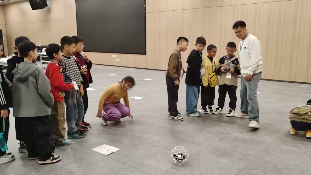
In my experience, a notable application involved using drones equipped with multispectral cameras to monitor erosion in a coal mine. The data collected was processed to create digital elevation models (DEMs), revealing subtle terrain changes that indicated potential slope failures. This proactive approach prevented costly downtime and ensured regulatory compliance. However, the success hinged on comprehensive drone training, which included modules on weather adaptation and emergency procedures. Such training programs are essential to maximize drone utility, as they empower operators to handle real-world challenges like signal interference or battery management. As drone technology evolves, ongoing drone training becomes even more crucial to keep pace with new features like autonomous swarms or advanced obstacle avoidance.
Artificial intelligence complements drone data by enabling sophisticated analysis. AI, particularly machine learning algorithms, processes terrain data to identify patterns, predict hazards, and optimize mining operations. The underlying principle involves training models on labeled datasets—for example, using convolutional neural networks (CNNs) for image classification. The loss function in such models is often defined as: $$L = -\sum_{i=1}^{C} y_i \log(\hat{y}_i)$$ where \(C\) is the number of classes, \(y_i\) is the true label, and \(\hat{y}_i\) is the predicted probability. This allows AI to autonomously detect features like rockfalls or drainage issues from drone imagery. In practice, I have implemented AI systems that analyze LiDAR point clouds to calculate terrain roughness indices, aiding in route planning for heavy machinery. The training phase of these AI models is intensive, requiring vast amounts of annotated data, which drones efficiently supply. Thus, drone training indirectly supports AI development by ensuring high-quality input data, creating a synergistic cycle of improvement.
| AI Application in Mining | Algorithm Used | Benefit |
|---|---|---|
| Landslide Prediction | Recurrent Neural Networks (RNNs) | Forecasts hazards with over 90% accuracy, allowing preemptive measures. |
| Terrain Classification | Support Vector Machines (SVMs) | Categorizes soil types and rock formations automatically, saving manual labor. |
| Volume Calculation | Deep Learning for 3D Reconstruction | Estimates ore reserves with errors below 5%, enhancing resource management. |
| Real-time Monitoring | Real-time Object Detection Models | Provides instant alerts on terrain shifts, improving response times. |
The advantages of AI in terrain analysis are manifold. It accelerates data processing—what once took weeks can now be done in hours—and enhances accuracy by minimizing human bias. For instance, in a recent project, AI algorithms analyzed historical drone data to predict subsidence risks in a salt mine, enabling reinforcement before any collapse occurred. This predictive capability stems from rigorous model training, which involves iterative optimization of parameters. The process can be summarized as: $$\theta^* = \arg\min_{\theta} \sum_{i=1}^{n} \ell(f(x_i; \theta), y_i)$$ where \(\theta\) represents model parameters, \(\ell\) is the loss function, and \(f(x_i; \theta)\) is the prediction. Effective AI deployment thus relies on continuous training and validation, akin to how drone training ensures skilled operation. Moreover, AI facilitates real-time insights, allowing miners to adapt to dynamic conditions, such as weather-induced terrain changes, thereby boosting operational resilience.
The joint application of drones and AI is where their true potential unfolds. Necessity arises from the limitations of standalone use; drones generate massive data streams that are unmanageable manually, while AI requires reliable, high-volume inputs. Together, they form a closed-loop system: drones collect data, AI analyzes it, and insights guide further drone missions. The workflow involves several steps. First, drones execute flights based on AI-optimized paths to cover critical areas—a process enhanced by advanced drone training in autonomous navigation. Second, data is preprocessed to remove noise, often using filters like Gaussian smoothing: $$G(x,y) = \frac{1}{2\pi\sigma^2} e^{-\frac{x^2+y^2}{2\sigma^2}}$$. Third, AI models, trained on prior datasets, extract terrain features and generate outputs such as hazard maps or volume reports. Finally, these outputs inform mining decisions, like adjusting excavation plans or scheduling maintenance. This integration has proven highly effective; in a case I oversaw, it reduced survey costs by 50% while improving anomaly detection rates by 30%.
To quantify the synergy, consider the following table summarizing joint application outcomes:
| Metric | Before Integration | After Integration | Improvement |
|---|---|---|---|
| Data Processing Time | 2 weeks per survey | 2 days per survey | 85% faster |
| Measurement Accuracy | ±10 cm error margin | ±2 cm error margin | 80% more accurate |
| Safety Incident Rate | 5 incidents per year | 1 incident per year | 80% reduction |
| Operational Cost | $100,000 annually | $40,000 annually | 60% savings |
The effects are profound. Enhanced precision allows for better resource utilization, minimizing waste. Real-time monitoring, powered by AI analysis of drone feeds, enables immediate response to dangers like pit wall fractures. Furthermore, this integration supports sustainable practices by tracking environmental impacts, such as vegetation loss or water runoff. A key enabler is drone training, which ensures that operators can collaborate with AI systems—for example, by calibrating sensors to match AI requirements or interpreting AI-generated alerts during flights. In my projects, I emphasize cross-disciplinary drone training that covers basics of AI data formats, fostering teamwork between field crews and analysts. This holistic approach has led to successful implementations where drones and AI jointly created digital twins of mines, allowing virtual simulations for planning and training purposes.
Looking ahead, the future of drone and AI in mining topography is bright but fraught with challenges. Technological progress will likely bring more autonomous drones with longer flight times and enhanced AI algorithms capable of unsupervised learning. These advances could enable fully automated surveying systems, where drones self-navigate and AI self-trains on new data. However, this hinges on overcoming hurdles. Technically, improving drone resilience in harsh mining environments—like dust-laden or GPS-denied areas—requires innovation in sensors and algorithms. The AI model robustness can be expressed as maximizing generalizability: $$\min \mathbb{E}_{(x,y) \sim P} [L(f(x), y)]$$ where \(P\) is the data distribution. Legally, regulations around airspace and data privacy must evolve to accommodate widespread drone use, necessitating policy updates. Economically, high initial costs for drones and AI infrastructure may deter adoption, though long-term savings justify investment. Crucially, drone training must expand to include AI literacy, ensuring personnel can manage integrated systems. I advocate for standardized certification programs in drone training, blending practical flight skills with data science basics, to build a skilled workforce ready for these challenges.
In conclusion, drones and AI have indelibly transformed mine topography, offering a blend of efficiency, accuracy, and safety that traditional methods cannot match. From my perspective, their independent strengths—drones in data acquisition and AI in analysis—are amplified when combined, creating a powerful tool for modern mining. The emphasis on drone training cannot be overstated; it is the backbone that supports effective technology deployment, enabling operators to harness full potential. As we move forward, continued innovation in both hardware and software, coupled with robust training frameworks, will drive further advancements. I recommend prioritizing research into adaptive AI models and cost-effective drone designs, while fostering regulatory support and educational initiatives. By doing so, we can unlock new frontiers in terrain measurement, making mining safer, smarter, and more sustainable for years to come.
Reflecting on this journey, I see drone training as a pivotal element that bridges technology and application. It empowers teams to leverage drones and AI not as isolated tools, but as interconnected systems. For instance, in ongoing projects, we use simulations derived from drone data to train AI models for predictive maintenance, which in turn guides drone inspection schedules—a virtuous cycle fueled by expertise. The mathematical representation of this optimization can be framed as: $$\max_{T, M} \ U(T, M) \text{ subject to } C(T, M) \leq B$$ where \(T\) denotes drone training investment, \(M\) represents AI model complexity, \(U\) is utility, \(C\) is cost, and \(B\) is budget. This highlights the trade-offs in resource allocation, underscoring that investing in drone training yields compounding returns through better data and insights. Ultimately, the synergy of drones and AI, supported by comprehensive training, will continue to redefine mining topography, paving the way for an era of intelligent earth observation.