
The rapid evolution and widespread adoption of civilian unmanned aerial vehicles (UAVs), or drones, have opened transformative avenues for data acquisition and management within the maritime sector. In the specific domain of maritime safety and navigation assurance, their utility is becoming increasingly pronounced. This discourse stems from our team’s first-hand research and practical experimentation, focusing on the deployment of multi-rotor drones for the inspection of navigation aids (NAVAIDs) within critical bridge areas and the concurrent collection of navigational environment data. This work is driven by the operational challenges inherent in traditional, manual inspection methodologies, which are often labor-intensive, time-consuming, and fraught with safety risks, especially in complex environments like high-traffic bridge zones. Our findings advocate for a systematic integration of drone technology, underpinned by rigorous drone training and standardized operational protocols, to enhance efficiency, safety, and the comprehensiveness of maritime oversight.
Bridges, as vital convergence points for both land and waterway traffic, host a concentration of AtoN critical for the safety of both domains. These aids include bridgehead markers, fixed lights, and buoyage systems marking the navigable channel. Conventional inspection methods typically involve visual checks from vessels or from the bridge structure itself. The former is logistically complex, requiring vessel coordination, favorable sea conditions, and poses inherent risks to personnel on small boats in busy waterways. The latter often necessitates traffic control or lane closures on road bridges, causing public disruption and exposing maintenance crews to hazardous proximity to high-speed traffic. The logistical and safety burdens are substantial, often leading to extended intervals between inspections or incomplete data gathering. Drones present a paradigm shift, offering a versatile, rapid, and safe platform to conduct detailed visual inspections without these significant drawbacks.
Our practical field experiments were conducted in strategically selected bridge areas within our jurisdiction, representative of common challenges. The operational scenario involved simultaneous traditional inspection and drone-based surveillance using a commercially available multi-rotor UAV. The primary objectives were to assess the drone’s capability to perform standard inspection tasks and to evaluate its operational advantages.
The drone was deployed to perform systematic visual inspections of various AtoN. Key functionalities leveraged during these missions included:
- High-Resolution Imaging: The drone’s gimbal-stabilized camera was used to capture high-definition images and video of AtoN from multiple angles. This allowed for detailed assessment of structural integrity, paint condition (color and retro-reflectivity), and the legibility of markings.
- Automatic Tracking and Orbiting: Intelligent flight modes, such as “ActiveTrack” and “Point of Interest” orbit, were employed. By designating a specific bridge pier marker or buoy as the subject, the drone autonomously maintained its camera focus on the target while orbiting it. This provided a comprehensive 360-degree view without requiring continuous manual piloting input, ensuring no aspect of the aid was missed.
- Nighttime Functionality Simulation: While our primary trials were diurnal, we evaluated the potential for nocturnal inspections. The drone was operated at a significant distance (approximately 3.6 km) from the bridge to test visual line-of-sight (VLOS) maintenance and control link stability in low-light conditions, simulating an approach for verifying light characteristics and effective range.
The data captured enabled remote inspectors to evaluate the AtoN’s position, structural state, coloration, and overall conspicuity effectively. Comparative analysis yielded a clear assessment of the drone’s efficacy, summarized in the table below.
| Inspection Aspect | Traditional Manual Method | Drone-Based Method |
|---|---|---|
| Efficiency & Coverage | Low; sequential, point-by-point checks; significant time per aid. | High; rapid sequential or parallel inspection of multiple aids; full-area coverage possible. |
| Safety | High risk (traffic, heights, water); potential for personnel injury. | Low risk; personnel operate from a safe, designated location. |
| Operational Cost | High (vessel charter, crew, traffic management costs). | Low post-initial investment; minimal recurring costs per mission. |
| Data Quality & Record | Subjective notes; limited photographic evidence. | Objective, high-resolution geotagged imagery and video for archival and analysis. |
| Environmental Flexibility | Limited by sea state, weather, and traffic conditions. | High; can operate in varied conditions (excluding extreme wind/rain); unaffected by water currents. |
| Impact on Public | Often requires lane closures, causing traffic delays. | Minimal to no disruption to road or waterway traffic. |
The empirical evidence strongly indicates that drone-based inspection is not only feasible but superior for routine condition assessments. The ability to collect persistent, high-fidelity visual data transforms maintenance from a reactive to a predictive model. Furthermore, the drone serves as a powerful platform for a secondary, equally critical function: the holistic mapping and monitoring of the bridge area’s navigational environment.
Beyond inspecting individual AtoN, drones offer an unparalleled vantage point for capturing the broader context of the waterway. This is crucial for risk assessment, planning, and providing situational awareness to mariners and authorities. Our methodology involved systematic panoramic image capture at strategic points approaching and surrounding the bridge structure. To simulate a vessel’s approach, we established a series of waypoints at varying distances and altitudes relative to the bridge. For a standardized approach, if we define the bridge center as the origin (0,0,0) in a Cartesian coordinate system (X: along-bridge, Y: cross-bridge, Z: altitude), our observation points were set at coordinates such as (0, Yobs, Zobs). We systematically collected data at positions including a long-range overview (e.g., Yobs = 600m, Zobs = 60m), a mid-range elevated perspective (Yobs = 300m, Zobs = 120m), and close-range detailed views (Yobs = 100m, Zobs = 60m).
The collected panoramic imagery was then processed and integrated into interactive digital platforms. Using software capable of creating 360-degree virtual tours, we stitched the aerial photographs to create an immersive, navigable model of the bridge zone. Within this model, key features were annotated: the precise locations and status of buoys, fixed beacons, bridge span markings, navigable spans, adjacent port facilities, and any potential hazards. This integrated information product provides a comprehensive “common operational picture.” The benefits are multifold:
- For Mariners: Offers a pre-transit visual familiarization tool, enhancing situational awareness.
- For Maritime Authorities: Serves as a baseline for monitoring changes, identifying illegal mooring, or assessing post-incident damage.
- For AtoN Managers: Provides context for aid placement and efficacy, informing strategic maintenance decisions.
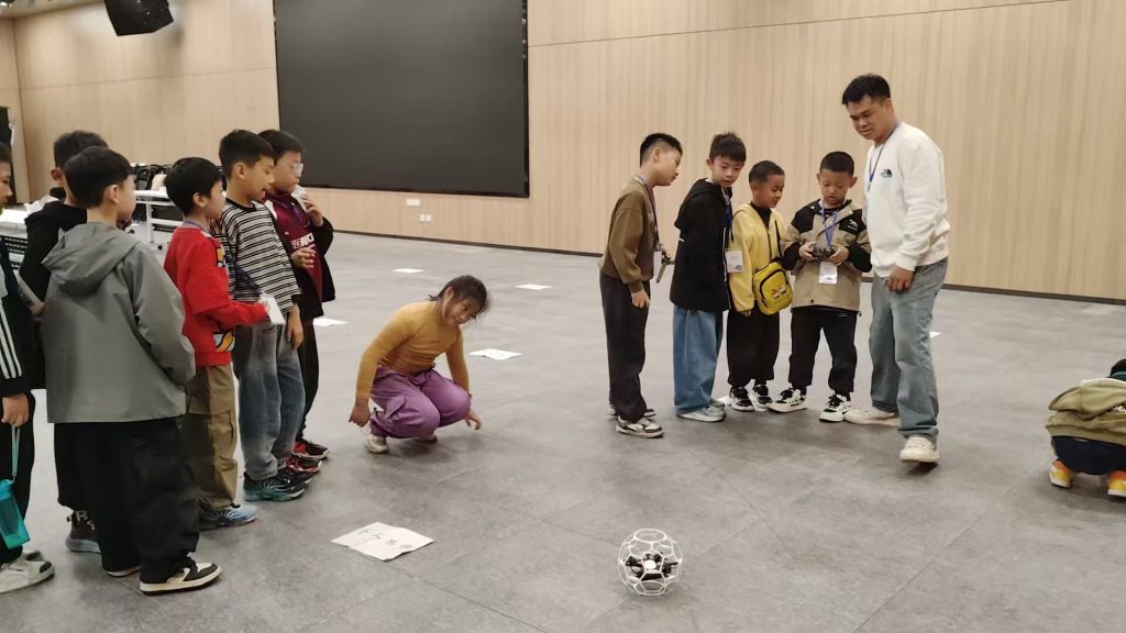
The successful and safe deployment of drones in such sensitive airspace is contingent upon strict adherence to regulations and the implementation of robust operational protocols. Crucially, the competence derived from comprehensive drone training is the linchpin of this entire framework. Our operational recommendations are structured around several core pillars, each emphasizing the role of training.
1. Regulatory Compliance and Airspace Awareness: Operators must be thoroughly versed in national and local UAV regulations. This includes registration of aircraft, understanding classifications (e.g., under 25kg for specific rules), and, most critically, airspace restrictions. Bridge areas often lie near or within controlled airspace, or may have temporary flight restrictions (TFRs). Part of essential drone training involves learning to use airspace authorization platforms (like LAANC in the U.S. or similar systems elsewhere) to obtain necessary clearances before any flight. Knowledge of no-fly zones around critical infrastructure, such as a minimum stand-off distance from power lines or railway tracks, is mandatory.
2. Pre-Mission Site Assessment and Risk Mitigation: No flight should commence without a detailed site survey. This involves assessing physical obstructions (cables, towers, bridge cables), electromagnetic interference potential from the bridge structure or nearby installations, and identifying safe take-off/landing zones (TO/LZ). A formal risk assessment matrix should be completed. Effective drone training programs teach pilots to systematically conduct these assessments, considering factors like wind patterns peculiar to bridge valleys, which can cause turbulence and instability. The dynamic equation for drone stability in wind can be conceptually simplified (ignoring complex aerodynamic factors) as a force balance where the thrust $T$ must counteract drag $D$ and weight $W$ adjusted for wind force $F_w$:
$$ \sum F = T – D – W \sin(\theta) – F_w = m a $$
where $m$ is mass and $a$ acceleration. Pilots learn to interpret weather data and understand practical flight envelopes.
3. Systematic Operational Procedures and Drone Training: Standard Operating Procedures (SOPs) must be developed and followed. This includes checklists for equipment (battery levels, propeller integrity, GPS signal strength), communication protocols within the team, and contingency plans for link loss or emergency landing. The cornerstone of safety is a well-trained pilot. Drone training must be continuous and structured, evolving from basic flight skills to mission-specific competencies. We propose a tiered training model, as summarized below:
| Training Tier | Core Objectives | Key Content |
|---|---|---|
| Basic Certification | Legal compliance & safe VLOS flight. | Regulations, airspace, meteorology, basic flight maneuvers, emergency procedures. |
| Advanced Mission Training | Bridge-specific inspection proficiency. | Orbiting and tracking moving objects, close-proximity flight, interpreting AtoN standards, data capture protocols. |
| Recurrent & Scenario-Based | Maintain proficiency & prepare for failures. | Simulated equipment failures, adverse weather decision-making, confined area operations, crew resource management. |
4. Technology and System Configuration: The choice of platform and payload is mission-critical. For bridge inspections, key technical requirements include:
- Advanced Stabilization: A 3-axis gimbal is essential for vibration-free imaging, especially in windy conditions. The gimbal’s function can be modeled as a control system working to maintain camera orientation despite platform disturbances.
- Obstacle Avoidance Sensors: Multi-directional sensing (forward, backward, downward, and sideways) is crucial for safe navigation around complex lattice structures and cables.
- Robust Communication Link: Low-latency, high-reliancy video downlink and control uplink at ranges exceeding 1-2 km are necessary. Redundant frequency hopping or Occusync-like technologies are preferred.
- Endurance: Flight time directly limits coverage. A minimum of 25-30 minutes is advisable, requiring efficient batteries and, potentially, swappable battery systems for larger areas.
A summary of a recommended system configuration is presented below:
| System Component | Minimum Specification | Recommended for Professional Use |
|---|---|---|
| Airframe | Multi-rotor (Quad/Hex), GPS/GLONASS | Hexacopter for redundancy, dual GNSS modules |
| Camera | 12 MP stills, 4K video, 1″ sensor | 20 MP stills, 6K video, 1″ or larger sensor, mechanical shutter |
| Gimbal | 3-axis mechanical | 3-axis with advanced stabilization algorithms |
| Sensors | Forward and downward obstacle sensing | Omnidirectional (6-way) vision and infrared sensing |
| Transmission | 2.4/5.8 GHz FCC, range ≥ 4 km | Dual-band, frequency hopping, range ≥ 8 km, low latency |
| Endurance | ≥ 20 minutes | ≥ 30 minutes (with high-capacity batteries) |
5. Data Management and Analysis: Post-flight, the raw data (images, video, flight logs) must be systematically organized, processed, and analyzed. Training should extend to basic photogrammetry software for creating orthomosaics or 3D models, and to data annotation tools for marking defects on AtoN. Establishing a digital asset management system is key for tracking the historical condition of each aid.
The future of drone applications in maritime safety and AtoN management is expansive. Current applications in inspection and mapping are merely the foundation. Future directions include:
- Integration with IoT and AIS: Drones could act as mobile sensor nodes, verifying Automated Identification System (AIS) signals from vessels in the bridge area or reading data from smart buoys.
- Automated Inspection Algorithms: Leveraging artificial intelligence and machine learning to automatically detect anomalies in AtoN from captured imagery—such as color fading, structural damage, or light failure—reducing human analysis time and increasing detection consistency.
- BVLOS (Beyond Visual Line of Sight) Operations: For inspecting very long bridges or remote aids, regulated BVLOS flights would dramatically increase efficiency. This will require even more advanced drone training, focusing on airspace integration, detect-and-avoid systems, and advanced operational risk management.
- Standardized Drone Training and Certification: The development of industry-wide, role-specific certification standards for maritime drone operators will be crucial for ensuring quality, safety, and regulatory acceptance. This drone training ecosystem will need to cover not only piloting but also maritime regulations, AtoN standards, and data security protocols.
In conclusion, the integration of unmanned aerial systems into the workflow of bridge area AtoN inspection and navigational environment monitoring represents a significant technological leap forward. Our practical experiments confirm substantial gains in operational safety, efficiency, data quality, and cost-effectiveness. The realization of this potential, however, is not merely a function of purchasing hardware. It is fundamentally dependent on the establishment of rigorous, comprehensive, and ongoing drone training programs coupled with detailed, safety-first standard operating procedures. As regulatory frameworks mature and technology continues to advance, drones are poised to become an indispensable tool for maritime authorities and AtoN service providers, enhancing the safety and resilience of some of the world’s most critical maritime chokepoints. The path forward is clear: invest in technology, but invest more critically in the skilled personnel who operate it through dedicated, high-quality drone training.