
In recent years, Unmanned Aerial Vehicle (UAV) photogrammetry technology has experienced vigorous development, demonstrating immense application potential across numerous fields, including fundamental surveying and mapping, natural resource investigation, agricultural and forestry monitoring, and emergency response. Compared to traditional manual surveying and aerial remote sensing, UAV photogrammetry offers significant advantages such as high flexibility, low cost, and repeatable operations, enabling the efficient acquisition of high-resolution imagery and three-dimensional data. However, alongside the rapid expansion of its applications, the issue of standardization has become increasingly prominent. The construction of a standard system severely lags behind technological advancement, urgently requiring top-level design and comprehensive implementation. The lack of unified technical specifications and operational standards seriously restricts the improvement of UAV photogrammetry efficiency, hindering its ability to fully leverage its technical advantages.
Standardization serves as the prerequisite and foundation for ensuring the quality of surveying operations and fostering orderly technological innovation. Only by establishing a sound standard system can formalization and standardization truly be implemented, leading to a comprehensive enhancement in the efficiency and service level of UAV photogrammetry technology. This article, based on an analysis of the current situation and existing problems, proposes systematic countermeasures addressing technical, procedural, personnel, and policy aspects, aiming to provide recommendations and references for the standardization of UAV photogrammetry.
Current State of UAV Photogrammetry and Its Standardization Issues
Characteristics and Application Fields of UAV Photogrammetry
UAV photogrammetry, with its unique characteristics of high efficiency, high precision, low cost, great flexibility, multi-sensor integration, and high automation, demonstrates extensive applications across multiple sectors. In land surveying and mapping, UAVs provide high-precision geographic information data, aiding cadastral management and topographic mapping. In agriculture, they monitor crop growth and pest conditions, optimizing field management and improving production efficiency. For environmental protection, UAV surveys assist in detecting environmental changes, monitoring pollution sources, and assessing ecological restoration outcomes. In urban planning, high-resolution images and modeling data offer crucial references for architectural design and infrastructure construction. In mineral exploration, accurate topographic measurements and resource prospecting data support decision-making. During disaster relief, UAVs quickly provide high-definition imagery and 3D models of affected areas, supporting rescue planning. In traffic management, they are used for road inspections, traffic flow monitoring, and accident investigation. In archaeology, high-resolution imagery and 3D modeling aid archaeological research and site preservation. Through this highly flexible and cost-effective approach, UAV photogrammetry plays an increasingly vital role in various aspects of modern society.
Relevant Standards for UAV Photogrammetry
In recent years, relevant national departments and local governments have issued a series of technical regulations, local standards, and management measures concerning UAV photogrammetry. The table below summarizes the standards and specifications related to UAV photogrammetry that had been published by the end of 2023.
| No. | Specification Name | Standard Level | Status |
|---|---|---|---|
| 1 | GB/T 39610-2020 “Technical Specification for Oblique Digital Aerial Photography” | National Standard | Current |
| 2 | GB/T 23236-2009 “Specifications for Aerotriangulation of Digital Aerial Photogrammetry” | National Standard | Current |
| 3 | CH/T 1050-2021 “Technical Specification for Quality Inspection of Oblique Digital Aerial Photography Products” | Industry Standard | Current |
| 4 | CH/T 3021-2018 “Technical Specification for Oblique Digital Aerial Photography” | Industry Standard | Current |
| 5 | CH/T 1039-2018 “Technical Specification for Quality Inspection of Aerotriangulation Products” | Industry Standard | Current |
| 6 | CH/Z 3002-2010 “Technical Requirements for UAV Aerial Photography Systems” | Industry Standard | Current |
| 7 | DB42/T 2099-2023 “Technical Specification for Production of City-level Real 3D Geographic Scene Models Based on Oblique Photogrammetry” | Local Standard | Current |
| 8 | DB64/T 1940.1-2023 “Technical Specification for Dynamic Monitoring of Ningxia Open-pit Mines Part 1: Dynamic Monitoring by UAV Oblique Photogrammetry” | Local Standard | Current |
| 9 | DB43/T 1769-2020 “Technical Specification for Quality Inspection of Data Products from Airborne Oblique Photography 3D Geographic Information Models” | Local Standard | Current |
| 10 | DB34/T 3713-2020 “Technical Specification for UAV Oblique Photogrammetry in Highway Engineering” | Local Standard | Current |
| 11 | DB5101/T 79.3-2020 “UAV Service Specification Part 3: Surveying and Mapping” | Local Standard | Current |
Furthermore, in May 2022, a significant framework was introduced which explicitly emphasized strengthening technological integration and enhancing scientific and technological support capabilities. It prioritized the deployment of standards for applying high-tech such as artificial intelligence, big data, UAVs, aerospace remote sensing, and spatial information in relevant fields, promoting the fusion of high technology with various practical tasks. This framework listed 23 standards related to UAV photogrammetry that are to be formulated or are under development, as detailed in the following table.
| No. | Standard Name | Proposed Level | Related Field | Development Status |
|---|---|---|---|---|
| 1 | Technical Specification for UAV Remote Sensing Survey in Mine Ecological Restoration | DZ/T | Mine Ecological Restoration | Under Development |
| 2 | Technical Requirements for UAV Aeromagnetic Data Acquisition | DZ/T | Geophysical Exploration | Under Development |
| 3 | Technical Specification for UAV Remote Sensing Photography | DZ/T | Remote Sensing Geology | Under Development |
| 4 | Technical Specification for UAV Airborne Hyperspectral Data Acquisition and Processing | DZ/T | – | To Be Formulated |
| 5 | Technical Specification for UAV Airborne LiDAR Data Acquisition and Processing | DZ/T | – | To Be Formulated |
| 6 | Technical Requirements for UAV Remote Sensing Application in Natural Resources Inspection | DZ/T | – | To Be Formulated |
| 7 | Data Specification for UAV Inspection Remote Sensing Monitoring Products | DZ/T | – | To Be Formulated |
| 8 | Technical Requirements for UAV Airborne Ocean Color Hyperspectral Imaging Observation | HY/T | – | Under Development |
| 9 | General Technical Requirements for UAVs for Sea Area Monitoring | HY/T | Management of Sea Area and Uninhabited Island Use | To Be Formulated |
| 10 | Technical Specification for Sea Area Dynamic Surveillance and Monitoring: Sea Area UAV Remote Sensing Monitoring | HY/T | – | To Be Formulated |
| 11 | Technical Requirements for UAV Marine Survey | HY/T | Marine Survey | Under Development |
| 12 | Specification for Marine UAV Operations | HY/T | – | To Be Formulated |
| 13 | Guidelines for UAV Application in Marine Ecological Environment Monitoring | HY/T | – | To Be Formulated |
| 14 | Technical Guidelines for UAV Remote Sensing Monitoring of Coastal Zone Ecosystems | HY/T | – | To Be Formulated |
| 15 | Technical Specification for Green Tide Monitoring by UAV | HY/T | – | To Be Formulated |
| 16 | Technical Specification for Multi-sensor Monitoring and Consistency Calibration of UAV Low-altitude Remote Sensing | GB/T | Remote Sensing Photogrammetry | Under Development |
| 17 | Aspects of UAV Video Data Acquisition, Calibration, and Processing | – | – | To Be Formulated |
| 18 | Aspects of UAV Flight Parameter Transmission Protocol | – | – | To Be Formulated |
| 19 | UAV Remote Sensing and Mapping – UAV Remote Sensing System Resource Registration Specification | GB/T | – | Under Development |
| 20 | UAV Remote Sensing and Mapping – UAV Remote Sensing Network Operation Management Information Specification | GB/T | – | Under Development |
| 21 | Verification Regulation for UAV Aerial Photography Systems | CH/T | Inspection and Testing | Under Development |
| 22 | Aspects of UAV Remote Sensing Systems | CH/T | – | To Be Formulated |
| 23 | Quality Check and Acceptance of UAV Aerial Photography Products | CH/T | – | To Be Formulated |
Key Problems in the Current Standardization Context
Despite these developments, the standardization effort in the field of UAV photogrammetry still lags behind the pace of technological advancement, presenting numerous challenges in practical applications.
Difficulty in Achieving Unified Standards for Data Acquisition
The lack of compatible technical interfaces between different brands and types of UAVs, along with the diversity of data formats obtained from various sensors, creates significant difficulties in data storage, sharing, and reuse. Furthermore, field operations are highly susceptible to terrain and meteorological conditions. In large-area surveying missions encompassing complex topography—particularly areas with plateaus, hills, and high mountains—issues such as increased blind spots, weakened signal stability, reduced operational radius, and degraded image data quality become prominent. Extended missions also face challenges related to varying lighting conditions at different flight times, which similarly impact data quality. Standardized parameters for flight planning, such as overlap rates, are crucial yet hard to maintain consistently. The forward overlap ($O_f$) and side overlap ($O_s$) are typically defined as:
$$ O_f = \left(1 – \frac{\Delta x_f}{GSD \cdot W}\right) \times 100\% $$
$$ O_s = \left(1 – \frac{\Delta x_s}{GSD \cdot L}\right) \times 100\% $$
where $\Delta x_f$ and $\Delta x_s$ are the distances between subsequent image centers along and across the flight path, $GSD$ is the Ground Sampling Distance, and $W$ and $L$ are the image dimensions. Variations in terrain elevation $H$ directly affect the $GSD$ ($GSD = \frac{s \cdot H}{f}$, with $s$ being sensor pixel size and $f$ focal length), complicating the maintenance of constant overlap.
Low Data Processing Efficiency
Firstly, the variety of data processing platforms leads to inconvenient data exchange and sharing. Interoperability between different brands and models of UAV equipment and their supporting software is often poor. For instance, the standardization of data formats and transmission protocols remains incomplete, creating efficiency bottlenecks in workflows. Secondly, the lack of comprehensive standardization in data processing and formats results in poor compatibility among various software and tools, complicating processing pipelines and reducing efficiency. Moreover, UAVs typically capture massive volumes of high-resolution imagery and video data. Inefficient storage device performance, coupled with slow data transmission and processing capabilities, significantly prolongs overall processing time. The total data volume $V_{total}$ for a project can be estimated as:
$$ V_{total} = N_{images} \cdot \left( \frac{W_{px} \cdot H_{px} \cdot B_{depth}}{8 \cdot 1024^3} \right) $$
where $N_{images}$ is the total number of images, $W_{px}$ and $H_{px}$ are image dimensions in pixels, and $B_{depth}$ is the bit depth. The processing time $T_{proc}$ is often non-linearly related to this volume: $T_{proc} \propto V_{total}^{\alpha}$, with $\alpha > 1$, highlighting the impact of data management inefficiencies.
Uneven Operator Competence
The skills, experience, and professional knowledge of UAV pilots vary greatly, affecting both operational quality and efficiency. Operators who have not undergone systematic safety training may neglect flight safety protocols, thereby increasing operational risks. Furthermore, a unified continuing education system for drone training has not been fully established. Consequently, many pilots fail to keep pace with the latest technical methods and tools, which also detrimentally impacts the overall efficiency of UAV photogrammetry missions. Comprehensive drone training programs are essential to bridge this gap. The competency level $C_{op}$ of an operator could be modeled as a function of foundational training $T_{base}$, field experience $E$, and continuing education $T_{cont}$: $C_{op} = f(T_{base}, E, T_{cont})$. The lack of standardized $T_{cont}$ leads to high variance in $C_{op}$ across the workforce.
Strategies for Enhancing UAV Photogrammetry Efficiency in a Standardization Context
Technical Optimization
In terms of algorithms, flight control algorithms should be optimized to achieve automated flight path planning under complex topographic conditions. Unified procedures and standards for mission area planning, flight line design, flight execution, quality control, and post-processing data handling should be formulated. This approach minimizes human operational errors and ensures both efficiency and quality. During flight, parameters such as speed and altitude should be adjusted in real-time based on external conditions like weather and wind speed to guarantee precise data acquisition. The flight path can be dynamically optimized using cost functions that account for wind vectors $\vec{w}$, no-fly zones, and required coverage.
Regarding data processing, integrated processing approaches should be adopted. Introducing a full-process automated inspection system can monitor key performance indicators such as image overlap rates and data acquisition rates in real-time, allowing for prompt problem identification and closed-loop optimization. Strict error control and step-by-step verification at different operational stages should be implemented. Leveraging cloud computing technology to store data in the cloud enables remote access and rapid sharing, thereby improving data interaction efficiency. The efficiency gain $G_{cloud}$ from cloud-based processing can be expressed as: $$ G_{cloud} = \frac{T_{local}}{T_{cloud}} = \frac{k \cdot V_{total} / P_{local}}{(V_{total}/B_{up}) + (k \cdot V_{total} / P_{cloud})} $$ where $T_{local}$ and $T_{cloud}$ are processing times, $k$ is a processing complexity constant, $P_{local}$ and $P_{cloud}$ are processing powers, and $B_{up}$ is the upload bandwidth.
Personnel Training
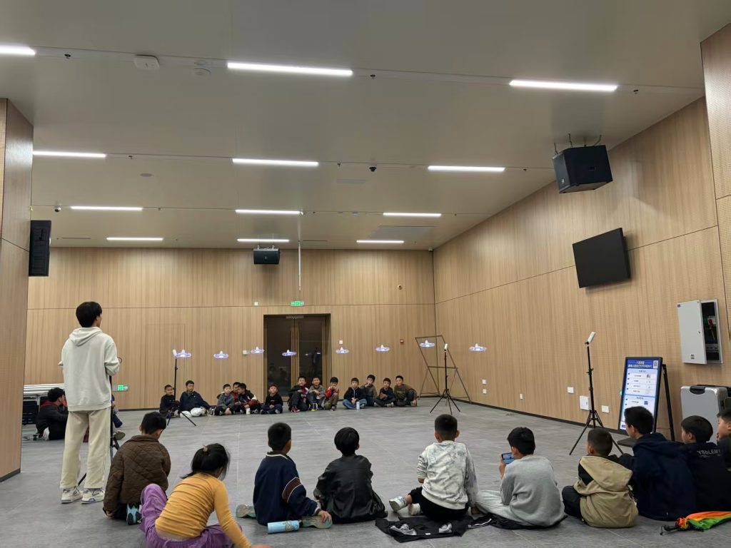
Building upon existing UAV pilot certification, it is crucial to further strengthen and expand training domains. Cultivating interdisciplinary talent proficient in multiple fields of knowledge is particularly important. This process should not only encompass UAV photogrammetry, fundamental surveying, agriculture, mining, transportation, and big data but also emphasize the integration and intersection of these diverse fields. Such cross-disciplinary drone training fosters professionals with broad knowledge backgrounds and comprehensive application abilities, better equipped to handle the complex and variable practical demands within each sector. This approach addresses the shortcomings of single-specialty personnel in the standardization process. It ensures that UAV operators possess not just isolated skills but a systematic, multi-dimensional knowledge framework, enabling them to navigate different application scenarios effectively.
Simultaneously, accelerating the establishment of training evaluation and continuing education systems for UAV operators across different fields is a vital component in elevating professional standards. A well-designed evaluation system not only objectively assesses a trainee’s knowledge and operational competence but also provides effective feedback for subsequent instruction, driving continuous optimization of drone training content. Moreover, a continuing education system offers practitioners a platform for ongoing learning and knowledge updating. Through regular skills refreshment courses, it ensures that UAV pilots remain abreast of the latest industry trends and technological developments, enhancing their competitiveness and adaptability in practical work. The combination of these two elements can effectively improve the overall quality of the UAV operator workforce, laying a solid foundation for deeper application across various sectors. The evolution of an operator’s capability over time $t$ can be modeled as: $$ C_{op}(t) = C_{op}(t_0) + \int_{t_0}^{t} \left( R_{exp}(\tau) + R_{train}(\tau) \right) d\tau $$ where $R_{exp}$ is the learning rate from experience and $R_{train}$ is the rate from structured drone training. Standardized continuing education ensures a positive and consistent $R_{train}$.
Policy Support
Firstly, government authorities in charge must prioritize the standardization of UAV photogrammetry. They should scientifically formulate medium- to long-term standardization plans and action outlines, organizing expert teams to develop technical standards covering all aspects, including testing and evaluation, data specifications, quality control, and application services.
Secondly, a robust supervision mechanism for standard implementation must be established and improved. Increased inspection and enforcement efforts are necessary to foster a regulated and orderly market environment. Enhancing the traceability system for photogrammetric data quality is also essential to comprehensively monitor data integrity.
Furthermore, the leveraging role of government funding should be fully utilized to encourage and subsidize universities and research institutions in conducting forward-looking research on fundamental theories, key generic technologies, and standard systems. This provides theoretical support for photogrammetry standardization. Actively guiding enterprises to collaborate with academia and research institutes on standardization initiatives facilitates the timely alignment of frontline application needs with cutting-edge research outcomes, thereby promoting standard implementation and practical adoption. The effectiveness $E_{policy}$ of such support can be conceptualized as a function of funding $F$, regulatory clarity $R$, and collaboration incentives $I$: $E_{policy} \propto F^{\beta_1} \cdot R^{\beta_2} \cdot I^{\beta_3}$, where the $\beta$ coefficients represent the sensitivity of the system to each policy factor.
Conclusion
UAV photogrammetry technology provides various industries with an efficient means of acquiring geospatial data. However, the relatively lagging development of its standardization has become a significant factor constraining further improvements in efficiency and quality. After analyzing the existing problems, this article proposes comprehensive strategies for advancing UAV photogrammetry standardization, focusing on technical, personnel, and policy dimensions.
First, at the technical level, the introduction of advanced equipment and intelligent algorithms, coupled with the construction of integrated, automated data processing platforms, is essential to continuously enhance data acquisition and processing capabilities.
Second, at the personnel level, strengthening professional technical and management drone training that combines theory with practice is key to cultivating interdisciplinary photogrammetry talent and improving overall workforce competence. Accelerating the establishment of training evaluation and continuing education systems for UAV operators across different fields is imperative to elevate and update the professional skills of personnel.
Finally, at the policy level, government-led development of a systematic standard system, the creation of a robust regulatory environment, and strong support for relevant scientific research and industry-academia-research collaboration are fundamental drivers.
Standardizing UAV photogrammetry is a systematic engineering endeavor that requires the synergistic coordination of technology, processes, personnel, and policy. Unified industry standards facilitate easier cooperation and data sharing among different enterprises and institutions, thereby promoting technological progress, innovation, and the overall development of the UAV photogrammetry sector. Only by accelerating the standardization process can the full potential of photogrammetry technology be unleashed, providing strong support for the sustainable and high-quality development of the economy. Looking ahead, as technology continues to advance and application demands persistently expand, UAV photogrammetry standardization will encounter new development opportunities. The industry must evolve with the times, take proactive measures, keep pace with technological and industrial frontiers, and inject new momentum into its standardized and orderly development.