
In recent years, the evolution of intelligent transportation systems has been profoundly shaped by the integration of novel aerial platforms. As a practitioner and analyst in this field, I have observed a paradigm shift where Unmanned Aerial Vehicles (UAVs), or drones, are transitioning from niche tools to fundamental components of modern transport service ecosystems. The unique capabilities of drones offer transformative potential for enhancing safety, efficiency, and resilience across the entire spectrum of passenger and freight logistics. This article synthesizes observations and analyses on the application of UAV technology within comprehensive transport services, emphasizing operational frameworks, quantified benefits, and strategic implementation pathways.
The concept of “comprehensive transport services” encompasses the integrated management and delivery of urban/rural passenger transport, freight logistics, terminal operations, and ancillary services like drone training. The operational complexity of these systems demands innovative solutions for monitoring, enforcement, and rapid response. UAVs, serving as versatile data acquisition and logistics nodes, provide a disruptive yet complementary layer to traditional ground-based infrastructure. Their value proposition lies not in replacement, but in augmentation, offering a dynamic, aerial perspective that was previously cost-prohibitive or logistically impossible.
From a technical standpoint, modern UAV systems deployed in transport are sophisticated ensembles of avionics, sensors, and communication links. Their core functionality can be modeled through a system equation representing their operational output \( O \):
$$ O = f(S_{nav}, S_{ctrl}, L_{payload}, P_{obstacle}, E_{env}) $$
where \( S_{nav} \) denotes navigation precision (GPS/BeiDou), \( S_{ctrl} \) represents control autonomy, \( L_{payload} \) is the payload capacity and adaptability, \( P_{obstacle} \) is the obstacle avoidance performance, and \( E_{env} \) accounts for environmental operating conditions. The optimization of this function is central to successful deployment.
Functional and Technical Advantages: A Systems Perspective
The advantages of UAVs can be categorized into quantifiable technical parameters and broader socioeconomic impacts. Technically, the synergy of several key systems creates their operational edge.
1. High-Fidelity Navigation and Positioning: Reliance on multi-constellation GNSS (Global Navigation Satellite System) including GPS, BeiDou, GLONASS, and Galileo ensures centimeter-to-meter level accuracy in typical transport environments. This is crucial for automated corridor flights, precise hovering for inspection, and safe landing in congested terminals. The positional error \( \epsilon_{pos} \) can be modeled as a function of satellite geometry (Dilution of Precision – \( DOP \)) and signal noise (\( \sigma \)):
$$ \epsilon_{pos} = DOP \times \sigma $$
Advanced Real-Time Kinematic (RTK) or Post-Processing Kinematic (PPK) techniques are increasingly used to minimize \( \epsilon_{pos} \) for surveying tasks.
2. Intelligent Control and Communication: Beyond direct radio control, UAVs utilize 4G/5C cellular and dedicated data links for Beyond Visual Line of Sight (BVLOS) operations. Autonomous flight is governed by algorithms for path planning, often optimizing for shortest time or minimal energy consumption. A simplified path cost \( C_{path} \) can be expressed as:
$$ C_{path} = \int_{t_0}^{t_f} [\alpha \cdot P(t) + \beta \cdot R(t)] \, dt $$
where \( P(t) \) is power consumption, \( R(t) \) represents risk exposure along the path, and \( \alpha, \beta \) are weighting coefficients.
3. Modular and Multi-Functional Payloads: The true versatility of a UAV is defined by its payload. Swappable modules allow a single platform to serve multiple roles. Common payloads in transport services include:
- High-resolution EO/IR (Electro-Optical/Infrared) cameras for surveillance and thermal leak detection.
- LiDAR (Light Detection and Ranging) for high-accuracy 3D mapping of infrastructure.
- Loudspeakers and spotlights for communication and illumination in emergencies.
- Specialized cargo hooks or compartments for logistics.
- Gas sensors and particulate matter detectors for environmental monitoring.
4. Integrated Sense-and-Avoid Systems: Safety in shared airspace and complex environments is non-negotiable. UAVs employ a fusion of sensors—ultrasonic, vision-based, and sometimes radar—to create a real-time obstacle map. The minimum detection and reaction distance \( D_{safe} \) is critical:
$$ D_{safe} = v \cdot t_{process} + \frac{v^2}{2a_{max}} + d_{buffer} $$
where \( v \) is drone velocity, \( t_{process} \) is sensor-computer reaction time, \( a_{max} \) is maximum deceleration, and \( d_{buffer} \) is a safety margin.
| Payload Type | Key Specifications | Primary Transport Application |
|---|---|---|
| Zoom EO Camera | 30x optical zoom, 4K resolution | Remote vehicle identification, license plate reading, detailed infrastructure inspection. |
| Thermal Imaging Camera | Resolution 640×512, Sensitivity < 50mK | Overheated vehicle components (brakes, tires), cargo temperature monitoring, search & rescue in accidents. |
| LiDAR Scanner | Range: 250m, Accuracy: ±3cm | High-precision digital terrain modeling for road/rail planning, volumetric measurement in logistics yards. |
| Multispectral Sensor | Green, Red, Red-Edge, NIR bands | Monitoring vegetation encroachment on transport corridors, assessing agricultural cargo health. |
| Parcel Delivery Module | Capacity: 5kg, Automated release mechanism | Last-mile and rural logistics, emergency medical supply delivery. |
Socioeconomic and Operational Impact Analysis
The adoption of UAV technology generates measurable value across multiple dimensions. The socioeconomic advantages extend far beyond direct cost savings.
Efficiency Gains and Cost Reduction: UAVs dramatically reduce the time and resources required for tasks like infrastructure inspection, traffic monitoring, and site surveying. A single UAV can inspect several kilometers of highway or railway in the time it takes a ground crew to mobilize. The economic benefit \( B_{econ} \) can be framed as:
$$ B_{econ} = (C_{traditional} – C_{UAV}) \cdot N_{missions} + \Delta V_{value-added} $$
where \( C \) represents cost per mission and \( \Delta V_{value-added} \) accounts for new services enabled (e.g., real-time data analytics).
Enhanced Safety and Risk Mitigation: By performing dangerous tasks—such as inspecting high bridges, surveying hazardous material spills, or entering disaster zones—UAVs remove human operators from harm’s way. This directly reduces occupational hazard risks and associated insurance liabilities.
Service Innovation and Accessibility: UAVs unlock services in geographically or economically constrained areas. Rural communities benefit from improved logistics connectivity and emergency medical supply chains. This aligns with equitable service delivery goals, a core tenet of comprehensive transport planning.
Improved Emergency Response and Resilience: In incidents ranging from traffic collisions to natural disasters, UAVs provide immediate situational awareness, coordinate response assets, and can deliver critical supplies. They act as a force multiplier for emergency services, compressing the timeline from event occurrence to effective intervention.
| Mission Type | Traditional Method Duration/Cost | UAV-Based Method Duration/Cost | Efficiency Gain (%) |
|---|---|---|---|
| 100km Highway Patrol | 8 hours, 2 officers, 1 vehicle | 2 hours (BVLOS), 1 operator | ~75% time reduction, ~60% cost reduction |
| Major Bridge Inspection | 3 days, lane closures, scaffolding, crew of 4 | 4 hours, minimal traffic disruption, crew of 2 | ~90% time reduction, ~70% cost reduction |
| Large Freight Yard Inventory Audit | 2 days, manual counting/measurement | 3 hours, automated LiDAR-based volumetrics | ~85% time reduction, higher accuracy |
| Post-Accident Scene Documentation | 1-2 hours for detailed measurement, traffic halted | 20 minutes for photogrammetric 3D model, partial closure | ~80% time reduction, faster road reopening |
Application Scenarios in Comprehensive Transport Service Management
The application matrix for UAVs spans regulatory oversight, operational management, and direct service delivery. The following analysis delineates these scenarios.
1. Urban and Rural Passenger Transport:
For regulatory bodies, UAVs are potent tools for safety enforcement (monitoring bus lanes, detecting illegal stops), dynamic oversight (verifying scheduled services, assessing crowding at stations), and emergency coordination at mass transit incidents. For transport operators, UAVs facilitate network optimization through aerial traffic flow analysis, innovative marketing via aerial footage, and infrastructure management of depots and stops.
2. Freight and Logistics:
In freight transport, UAVs revolutionize monitoring and operations. Authorities use them for safety compliance checks (load securing, vehicle condition), hazardous material transport escort, and corridor condition monitoring. Logistics enterprises deploy UAVs for middle-mile and last-mile delivery, particularly in congested urban areas or hard-to-reach rural locations. The model for delivery network efficiency \( \eta_{network} \) with UAV integration can be conceptualized as:
$$ \eta_{network} = \frac{\sum (Delivery_{UAV} \cdot w_{speed}) + \sum (Delivery_{Ground} \cdot w_{cost})}{Total\,Operational\,Cost} $$
where \( w \) are weighting factors for speed and cost priorities.
3. Transport Terminal Operations (e.g., Bus Stations, Freight Hubs):
UAVs provide a holistic security and operational view of terminals. Applications include perimeter surveillance, crowd monitoring and management during peaks, emergency response coordination within the facility, and environmental monitoring (noise, emissions). A UAV can rapidly generate a terminal activity heatmap, identifying bottlenecks in passenger or cargo flow.
4. Critical Infrastructure Inspection:
This is one of the most mature applications. UAVs conduct detailed, close-proximity inspections of bridges, tunnels, signage, lighting, and rail tracks. Using photogrammetry or LiDAR, they create precise 3D models and digital twins for structural health monitoring, identifying defects like cracks, corrosion, or subsidence with much greater frequency and less risk than manual methods.
5. Driver and Operator Drone Training and Assessment:
This is a rapidly emerging and critical field. UAVs are not just tools but also subjects of training. Comprehensive drone training programs are essential for building a skilled workforce to operate and manage these systems within the transport sector. Furthermore, UAVs themselves are used as training aids:
- For Regulatory Bodies: UAVs can surveil and map driver training compounds to verify their compliance with regulations and identify unauthorized operations, directly supporting regulatory drone training oversight.
- For Training Enterprises: UAVs offer an aerial platform to monitor trainee drivers’ performance on test tracks, providing instructors with a unique, comprehensive view of vehicle positioning, lane discipline, and maneuver execution. This enriches the drone training ecosystem by using drones to improve traditional driver training.
- Specialized Drone Training: As UAVs become integral to transport operations, dedicated drone training curricula for pilots, data analysts, and maintenance technicians become a necessary service subset of the transport industry.
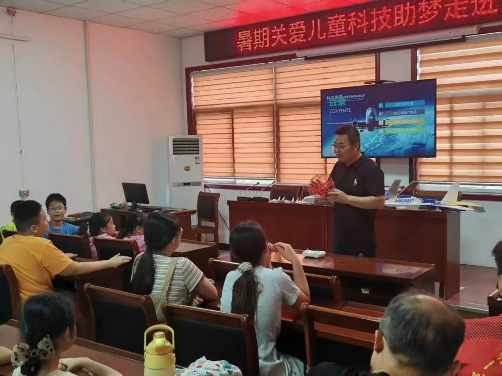
The image above conceptually represents the intersection of aviation technology and ground-based operations, underscoring the need for integrated drone training facilities that simulate real-world transport environments, from busy corridors to complex logistics hubs.
Practical Scenario Implementation and Operational Models
Translating theory into practice requires structured deployment models. Below are detailed analyses of key scenarios.
Scenario A: Hazardous Material Transport Corridor Monitoring
Objective: Enhance safety and security for high-risk freight movements.
Operation: A UAV equipped with EO/IR and gas detection sensors performs parallel BVLOS flight along a designated HazMat route, maintaining a safe standoff distance.
- It provides real-time escort, monitoring for vehicle deviations, stops, or visible leaks.
- The IR camera can detect abnormal heat signatures from tankers or tires.
- In a suspected incident, it can approach for closer inspection without endangering ground crews, transmitting data to the command center for analysis using a gas concentration dispersion model:
$$ C(x,y,z,t) = \frac{Q}{(2\pi)^{3/2} \sigma_x \sigma_y \sigma_z} \exp\left[-\left( \frac{(x-ut)^2}{2\sigma_x^2} + \frac{y^2}{2\sigma_y^2} + \frac{z^2}{2\sigma_z^2} \right)\right] $$
where \( C \) is concentration, \( Q \) is release rate, \( u \) is wind speed, and \( \sigma \) are dispersion coefficients.
Scenario B: Integrated Urban Logistics Delivery Network
Objective: Decongest urban roads and enable rapid, predictable deliveries.
Operation: A hub-and-spoke model using medium-capacity VTOL (Vertical Take-Off and Landing) UAVs.
- Goods are consolidated at a city-edge micro-fulfillment center.
- UAVs fly along pre-approved, optimized aerial corridors to neighborhood delivery “nests” (e.g., rooftop landing pads at convenience stores).
- Final delivery to the consumer is via ground robot or pedestrian courier from the nest.
- The system optimizes routes using an algorithm minimizing total energy consumption \( E_{total} \):
$$ E_{total} = \sum_{i=1}^{N} \left( E_{hover,i} + E_{cruise,i}(d_i, w_i) \right) $$
where \( d_i \) is leg distance, \( w_i \) is payload weight for leg \( i \), and \( N \) is the number of delivery points per sortie.
| Scenario | Recommended UAV Type | Key Payloads | Flight Mode | Key Performance Metric |
|---|---|---|---|---|
| Highway/Traffic Monitoring | Fixed-wing Hybrid VTOL | 30x Zoom Camera, 4G/5G Modem, ADS-B Receiver | BVLOS, Automated Patrol Loiter | Area Coverage (km²/hour), Incident Detection Latency |
| Bridge/Tunnel Inspection | Multi-rotor (High-Stability) | 4K Camera, LiDAR, Laser Rangefinder, Ultrasonic Sensors | VLOS/BVLOS, Manual Control for Close Proximity | Surface Coverage Completeness (%), Defect Detection Resolution (mm) |
| Rural Medical Logistics | Multi-rotor (Heavy Lift) | Temperature-Controlled Cargo Box, Parachute Recovery System | BVLOS, Pre-programmed Routes | Payload Capacity (kg), Mission Range (km), Delivery Time vs. Ground |
| Transport Terminal Security | Multi-rotor (Indoor/Outdoor) | 360° Camera, Loudspeaker, Spotlight, AI Edge Processor | VLOS, Automated Geo-fenced Patrol | Anomaly Detection Rate, Response Time to Alert |
Future Trajectory and Concluding Synthesis
The integration of UAVs into comprehensive transport services is an irreversible and accelerating trend. The future will be defined by increased autonomy, swarm intelligence for large-area operations, and seamless integration into Unified Traffic Management (UTM) systems. Key to this evolution will be the maturation of robust regulatory frameworks governing BVLOS operations, airspace access, and data privacy. Furthermore, the human element remains paramount; investment in specialized drone training and certification programs will be as critical as the technology itself to ensure safe, efficient, and ethical deployment.
In conclusion, UAVs represent a versatile and powerful toolset for reimagining transport services. Their ability to provide rapid, high-resolution data acquisition, perform risky tasks safely, and create new logistical paradigms offers unparalleled opportunities for enhancing system safety, efficiency, and equity. For transport authorities and enterprises, the strategic adoption of UAV technology, coupled with comprehensive drone training initiatives, is no longer merely an innovative option but a necessary step towards building the resilient, intelligent, and customer-centric transport systems of the future. The journey involves continuous technological adaptation, regulatory collaboration, and workforce development, with the aerial perspective of the drone illuminating the path forward.