
The evolution of geospatial technology has fundamentally transformed the landscape of surveying and mapping engineering. Among the most impactful innovations is the integration of Unmanned Aerial Vehicle (Urological Sensor Systems (UAVs) or drones). From my professional standpoint, this technology is not merely a tool but a paradigm shift, addressing long-standing limitations of traditional ground-based and manned aerial survey methods. This article delves into the technical advantages, systematic workflows, diverse applications, and critical implementation strategies, with a particular emphasis on the foundational role of comprehensive drone training in ensuring project success and data integrity.
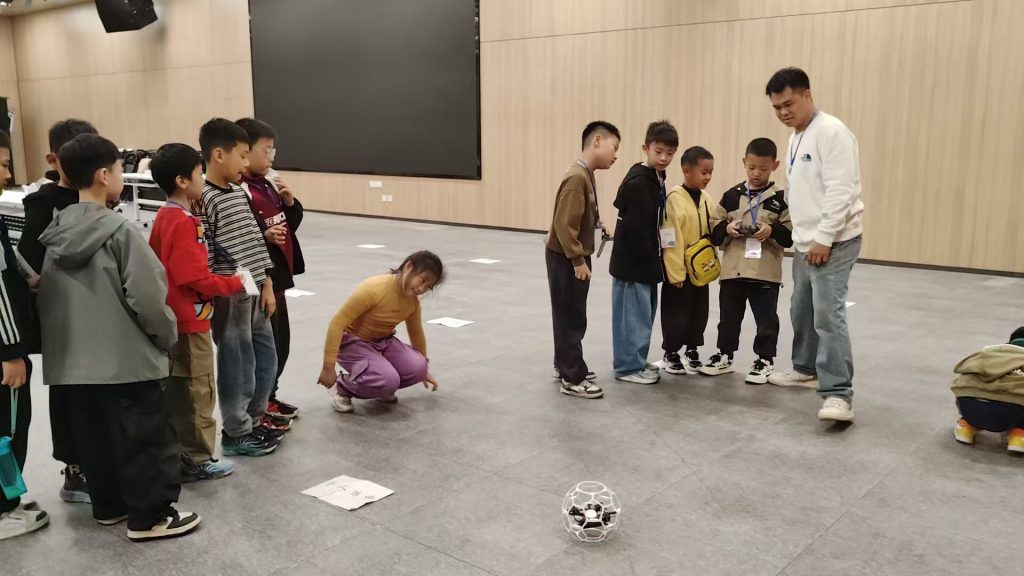
The imperative for adopting drone-based remote sensing stems from the increasing demand for high-precision, rapid, and cost-effective data acquisition in complex projects. Traditional techniques often struggle with accessibility, temporal resolution, and operational safety, especially in hazardous or expansive terrains. Drone remote sensing, leveraging advanced photogrammetry, LiDAR, and multispectral sensors, offers a compelling solution. Its efficacy, however, is intrinsically linked to a robust understanding of its principles and rigorous operational protocols, which are instilled through targeted drone training programs.
Systematic Advantages Over Conventional Methods
The superiority of drone remote sensing in surveying can be quantified across several key performance indicators (KPIs). The following table contrasts its capabilities with traditional surveying techniques:
| Performance Indicator | Traditional Ground Surveying | Manned Aerial Surveying | Drone Remote Sensing |
|---|---|---|---|
| Spatial Coverage Efficiency | Low (Point-based) | High | Very High (Area-based) |
| Data Acquisition Speed | Slow | Moderate (logistics-heavy) | Very Rapid (rapid deployment) |
| Operational Flexibility & Accessibility | Limited by terrain | Limited by airspace/weather | High (low-altitude, complex terrain) |
| Environmental Intrusiveness | High (physical footprint) | Moderate | Very Low (minimal disturbance) |
| Real-time Data Potential | Low | Low | High (live telemetry/imagery) |
| Cost per Unit Area | High (labor-intensive) | Very High | Low to Moderate |
The core technical advantages can be mathematically conceptualized. For instance, the efficiency gain in area coverage can be modeled. If a ground surveyor covers an area \( A_g \) per day, and a drone system covers an area \( A_d \) per flight, the efficiency ratio \( E \) is:
$$ E = \frac{A_d}{A_g} $$
where \( E \) is typically >> 1, often by orders of magnitude for large or difficult sites.
Furthermore, the resolution and accuracy are governed by the Ground Sample Distance (GSD). The GSD, representing the size of one pixel on the ground, is a critical parameter calculated as:
$$ GSD = \frac{H \times s}{f} $$
where \( H \) is the flight altitude above ground, \( s \) is the sensor pixel size, and \( f \) is the lens focal length. Precise control over \( H \) and understanding sensor characteristics, a core part of technical drone training, allows surveyors to specify the exact output accuracy required for a project, from centimeter-level for cadastral surveys to decimeter-level for large-scale topographic mapping.
The Core Workflow: From Mission Planning to Deliverables
The application of drone technology in surveying follows a meticulously planned workflow. Mastery of this workflow is the ultimate goal of structured drone training.
1. Pre-flight Planning & Mission Design
This phase determines the success of the entire data acquisition. Key parameters are defined:
- Flight Plan: Automated flight paths are generated using specialized software. Critical parameters include:
- Forward Overlap \( (O_f) \): Typically 70-80%. $$ O_f = \left(1 – \frac{\text{distance between consecutive photo centers along flight line}}{\text{image coverage length}}\right) \times 100\% $$
- Side Overlap \( (O_s) \): Typically 60-70%. $$ O_s = \left(1 – \frac{\text{distance between adjacent flight lines}}{\text{image coverage width}}\right) \times 100\% $$
High overlap is essential for robust 3D model reconstruction.
- Ground Control Points (GCPs): Strategically placed and precisely surveyed (using GNSS) markers that provide absolute geospatial accuracy and scale to the model.
- Sensor Configuration: Selection of appropriate sensor (RGB, multispectral, thermal, LiDAR) and settings (shutter speed, ISO) based on project requirements.
2. Data Acquisition & In-field Execution
The automated execution of the flight plan. A qualified pilot, certified through practical drone training, monitors the operation, ensuring safety and adapting to unforeseen field conditions like changing weather. Redundancy in data storage and real-time telemetry monitoring are essential.
3. Data Processing & Analysis
This computational phase transforms raw images into actionable geospatial products. The process involves:
- Photogrammetric Processing: Using Structure from Motion (SfM) algorithms in software like Pix4D, Agisoft Metashape, or DJI Terra. The core outputs are:
- Dense Point Cloud: Millions of georeferenced 3D points. The density \( \rho_{points} \) can be expressed as points per square meter.
- Digital Surface Model (DSM): Represents the topmost surface, including buildings and vegetation.
- Digital Terrain Model (DTM): Represents the bare earth, derived by filtering vegetation and structures from the DSM.
- Orthomosaic: A geometrically corrected, georeferenced image with uniform scale, free of distortion.
- Accuracy Assessment: Validating the model against check points (independent from GCPs). The Root Mean Square Error (RMSE) is calculated:
$$ RMSE = \sqrt{\frac{\sum_{i=1}^{n} (Z_{model,i} – Z_{check,i})^2}{n}} $$
where \( Z_{model} \) is the elevation from the model and \( Z_{check} \) is the surveyed elevation at the \( i \)-th check point. This quantifies vertical accuracy.
| Deliverable | Description | Key Application in Surveying |
|---|---|---|
| 2D Orthomosaic | Geometrically accurate, stitched aerial map. | Site documentation, feature extraction, planimetric mapping, change detection. |
| 3D Textured Mesh | Photorealistic 3D model of the site. | Visualization, volume calculations (stockpiles), architectural surveys, virtual inspections. |
| Digital Surface Model (DSM) | Raster representing top-surface elevations. | Solar potential analysis, flood modeling, vegetation height analysis. |
| Digital Terrain Model (DTM) | Raster representing bare-earth elevations. | Civil engineering design (grading, drainage), contour generation, geological analysis. |
| Contour Line Map | Lines connecting points of equal elevation, derived from DTM. | Topographic mapping, construction planning, land development. |
| Volumetric Report | Calculation of cut/fill volumes between surfaces. | Earthworks monitoring, quarry and landfill management, construction progress tracking. |
Targeted Applications in Surveying and Mapping Engineering
Topographic and Cadastral Surveying
Drones generate high-accuracy DTMs and orthomosaics efficiently, revolutionizing traditional topographic surveys. For cadastral mapping, especially in regions with irregular boundaries or informal settlements, drone imagery provides an indisputable visual record that can be digitized to update land registries, a process greatly enhanced by operators with specialized legal and technical drone training.
Construction and Engineering Surveying
Throughout the project lifecycle, drones provide invaluable data:
- Pre-construction: Accurate baseline topographic data.
- Progress Monitoring: Weekly or monthly flights track earthwork volumes, compare as-built vs. as-planned status. The volume \( V \) between two surfaces (e.g., design vs. current) is calculated from the DTM difference:
$$ V = \iint\limits_{A} \left( Z_{current}(x,y) – Z_{design}(x,y) \right) \,dx\,dy $$
approximated in practice by software over the project area \( A \). - Infrastructure Inspection: Detailed 3D models of bridges, dams, and towers for defect identification without risky manned access.
Mining and Quarry Operations
This is a premier application. Drones perform rapid, frequent surveys of pit walls, stockpiles, and tailings dams. Key metrics include:
- Stockpile Volume Calculation: Using the generated surface model against a base plane.
- Stripping Ratio Analysis: Monitoring overburden vs. ore volumes.
- Slope Stability Monitoring: Detecting millimeter-level deformations over time through repeat surveys (monitoring).
The complex, dangerous, and dynamic environment of a mine makes advanced site-specific drone training non-negotiable for survey teams.
Urban Planning and Smart Cities
Drones facilitate the creation of detailed 3D city models essential for urban planning, zoning, shadow analysis, and line-of-sight studies for new developments. They are also crucial for monitoring urban sprawl and green space distribution.
Disaster Response and Geohazard Monitoring
In post-earthquake, flood, or landslide scenarios, drones provide rapid situational awareness, mapping affected areas, identifying access routes, and quantifying debris volumes. For geohazards, periodic surveys enable the calculation of displacement vectors \( \vec{d} \) for slope movement:
$$ \vec{d} = (E_{t2} – E_{t1}, N_{t2} – N_{t1}, Z_{t2} – Z_{t1}) $$
where \( E, N, Z \) are coordinates at times \( t1 \) and \( t2 \). Operating in such critical, post-disaster environments requires not only piloting skill but also crisis management protocols, a vital component of advanced emergency response drone training.
Critical Measures for Enhancing Application Efficacy
1. Institutionalizing Comprehensive Drone Training
The single greatest investment for any organization is in its personnel. Effective drone training must be multi-faceted, moving beyond basic piloting to create true geospatial professionals. A holistic curriculum should cover:
| Module | Core Topics | Objective |
|---|---|---|
| Regulatory & Safety | National aviation regulations (e.g., FAA Part 107, EASA), airspace classification, risk assessment, insurance. | Ensure legal and safe operations. |
| Platform & Sensor Technology | UAV mechanics, GNSS/RTK principles, sensor types (RGB, LiDAR, multispectral), calibration. | Enable informed hardware selection and understanding of data sources. |
| Mission Planning & Design | Flight planning software, GSD/overlap calculation, GCP network design, weather impact analysis. | Design efficient, accuracy-guaranteed surveys. |
| Geomatics & Data Processing | Photogrammetry/SfM theory, coordinate systems, processing software workflows, accuracy validation (RMSE). | Transform imagery into accurate, reliable geospatial products. |
| Data Analysis & Integration | GIS software, volumetric analysis, change detection, integration with BIM/CAD platforms. | Extract actionable insights and deliverables for clients. |
| Specialized Application | Best practices for mining, construction, agriculture, or inspection verticals. | Tailor skills to specific industry needs and challenges. |
2. Ensuring Robust Data Link and Signal Integrity
Data transmission quality between the drone and ground control station is paramount. Interference, latency, or loss of link can jeopardize a mission. Technical measures include:
- Using frequency bands with lower interference (e.g., 900 MHz for longer range in complex terrain).
- Implementing automated Return-to-Home (RTH) protocols upon signal loss.
- Conducting thorough pre-flight site surveys to identify potential signal obstructions.
Understanding these technical aspects is a key part of operational drone training.
3. Implementing Rigorous Equipment Maintenance and Calibration
Survey-grade accuracy is impossible with uncalibrated or poorly maintained equipment. A strict maintenance regimen includes:
- Sensor Calibration: Regular calibration of cameras (for focal length and distortion parameters) and LiDAR sensors. The camera calibration model (e.g., Brown-Conrady) corrects radial \( (k_1, k_2, k_3) \) and tangential \( (p_1, p_2) \) distortion:
$$ x_{corrected} = x(1 + k_1 r^2 + k_2 r^4 + k_3 r^6) + 2p_1xy + p_2(r^2 + 2x^2) $$
$$ y_{corrected} = y(1 + k_1 r^2 + k_2 r^4 + k_3 r^6) + p_1(r^2 + 2y^2) + 2p_2xy $$
where \( r^2 = x^2 + y^2 \). - Platform Checks: Inspecting propellers, motors, batteries, and the airframe for wear before every flight.
- GNSS/RTK System Verification: Testing base station setup and rover connectivity to ensure centimeter-level positioning is functional.
4. Fostering Continuous Innovation and Workflow Integration
The field is rapidly advancing. Surveying teams must stay abreast of trends like:
- AI-powered Processing: Automated feature extraction (roads, buildings) from orthomosaics.
- Real-time Processing: On-board or edge computing generating preliminary models during flight.
- Hybrid Sensor Payloads: Combining LiDAR for terrain under vegetation with high-resolution cameras for texture.
- Integration with BIM: Direct import of 3D drone data into Building Information Modeling software for construction verification.
Continuous learning and adaptation, fostered by ongoing advanced drone training, are essential to leverage these innovations.
Conclusion and Future Trajectory
Drone remote sensing has indisputably established itself as a cornerstone technology in modern surveying and mapping engineering. Its ability to deliver high-density, accurate, and timely geospatial data with unparalleled operational flexibility addresses the core needs of industries ranging from construction and mining to urban planning and environmental monitoring. The mathematical frameworks governing its operation—from GSD calculation and overlap optimization to volumetric analysis and accuracy assessment—provide a rigorous, quantifiable foundation for its application.
However, the technology’s potential is fully realized only when deployed by skilled professionals. Therefore, the most critical success factor is the establishment of a culture of excellence rooted in comprehensive, continuous, and certified drone training. This training must bridge the gap between simple piloting and sophisticated geospatial analysis, creating surveyors who are not only operators but also data scientists and spatial problem-solvers. As sensor capabilities advance, automation increases, and regulations evolve, the human expertise cultivated through such drone training will remain the constant driver of quality, safety, and innovation in the profession. The future of surveying is airborne, intelligent, and data-rich, and it will be navigated by those who have invested in mastering its tools and principles.