
In my experience, on-site investigation of geological hazards is the foundational work for hazard prevention and mitigation. It provides critical, timely baseline data and scientific evidence for emergency response, monitoring and early warning, relocation planning, and engineering remediation. The traditional field survey, heavily reliant on the geologist’s “big three” – the hammer, compass, and hand lens – often encounters significant limitations. The core areas of an unstable slope or landslide are frequently inaccessible or too hazardous for direct human approach. This access barrier leads to incomplete collection of key data on fracture patterns, scarp geometry, and material composition, which in turn compromises the accuracy of hazard trend analysis and the assessment of its potential scale. This data gap represents a persistent and critical shortcoming in our field.
To address this exact challenge, I have increasingly adopted and championed the modern evolution of field tools: the “New Big Three” comprising portable lightweight drones, rugged field data collection tablets, and cloud-based data management platforms. This article details my practical methodology and application cases focusing on one powerful synthesis of these tools: VR panoramic imagery generated from drone photography. This technology has fundamentally transformed how we document, analyze, and communicate geological hazard information.
1. Introduction: Bridging the Data Gap with Aerial Intelligence
The rapid advancement of Virtual Reality (VR) technology has seen its adoption across diverse sectors like real estate, entertainment, and live streaming. In geoscience, its potential is immense. A panorama is a complete spherical image formed by stitching multiple photographs covering 360° horizontally and 180° vertically. Modern drones have automated this process, enabling the capture and in-device synthesis of a high-resolution spherical image within minutes. When such a panorama is processed for interactive viewing – allowing the user to control the viewing direction via touch or mouse for an immersive, 360° experience – it becomes a VR panorama, also known as 3D real-scene imagery.
Platforms like 720yun have democratized the creation and sharing of such content. For geologists and hazard surveyors, this means we can now capture a comprehensive, high-fidelity visual record of a hazard site from a safe, aerial vantage point. This VR asset can be instantly uploaded, managed, and shared via the cloud, dramatically enhancing the timeliness of data sharing and collaborative decision-making. In essence, we are constructing immersive digital twins of hazard sites.
The core value proposition is clear: by rapidly constructing VR panoramas, we can intuitively and accurately understand key parameters such as the hazard’s boundary, the spatial distribution of deformation features, and the location of vulnerable assets (population, infrastructure). This visual intelligence directly supports critical tasks in emergency command, optimal placement of monitoring instruments, planning of evacuation routes, and the design of mitigation structures. The entire workflow underscores the necessity for comprehensive drone training, ensuring operators can safely and effectively capture this vital data under often challenging field conditions.
2. Technology Overview: The Tools of the Trade
The effective implementation of this methodology rests on three pillars: the drone, the VR panorama platform, and the trained operator.
2.1 The Drone Platform: In my work, I utilize drones like the DJI Mavic 3E, which is representative of the capabilities required. Key specifications include:
- A 4/3-inch CMOS, 20-megapixel wide-angle camera for high-detail imagery.
- An integrated RTK (Real-Time Kinematic) module for centimeter-level geotagging accuracy, crucial for spatial reference.
- A mechanical shutter with speeds up to 1/2000s to prevent motion blur.
- A telephoto camera with hybrid zoom, useful for detailed inspection of specific features from a distance.
These features ensure the collected imagery is not only visually rich but also metrically reliable for preliminary measurements and comparisons.
2.2 The VR Panorama & Cloud Platform: The 720yun platform serves as the processing and dissemination hub. It allows for the straightforward upload of spherical images, their conversion into navigable VR experiences, and the enrichment of these experiences with interactive elements like information hot-spots, directional arrows (guided tours), and embedded audio narration. The final product is accessible via web link or QR code, requiring no specialized software for the end-user (e.g., emergency managers, the public).
2.3 The Human Element: Drone Training: The technology is only as good as the operator. Systematic drone training is non-negotiable. This goes beyond basic flight controls and must encompass:
- Mission Planning for Photogrammetry: Understanding ground sampling distance (GSD), overlap requirements, and optimal flight paths for different survey objectives.
- Site-Specific Risk Assessment: Evaluating wind conditions, terrain, airspace restrictions, and electromagnetic interference near hazard zones.
- Data Capture Protocols: Mastering the drone’s panoramic modes, understanding lighting conditions (best done around solar noon to minimize shadows), and setting appropriate altitude (typically 60-120m for landslide-scale features).
- Data Management and Ethics: Handling large imagery datasets, ensuring data backup, and adhering to privacy and safety regulations.
Effective drone training transforms the operator from a simple pilot into a skilled geospatial data acquisition specialist.
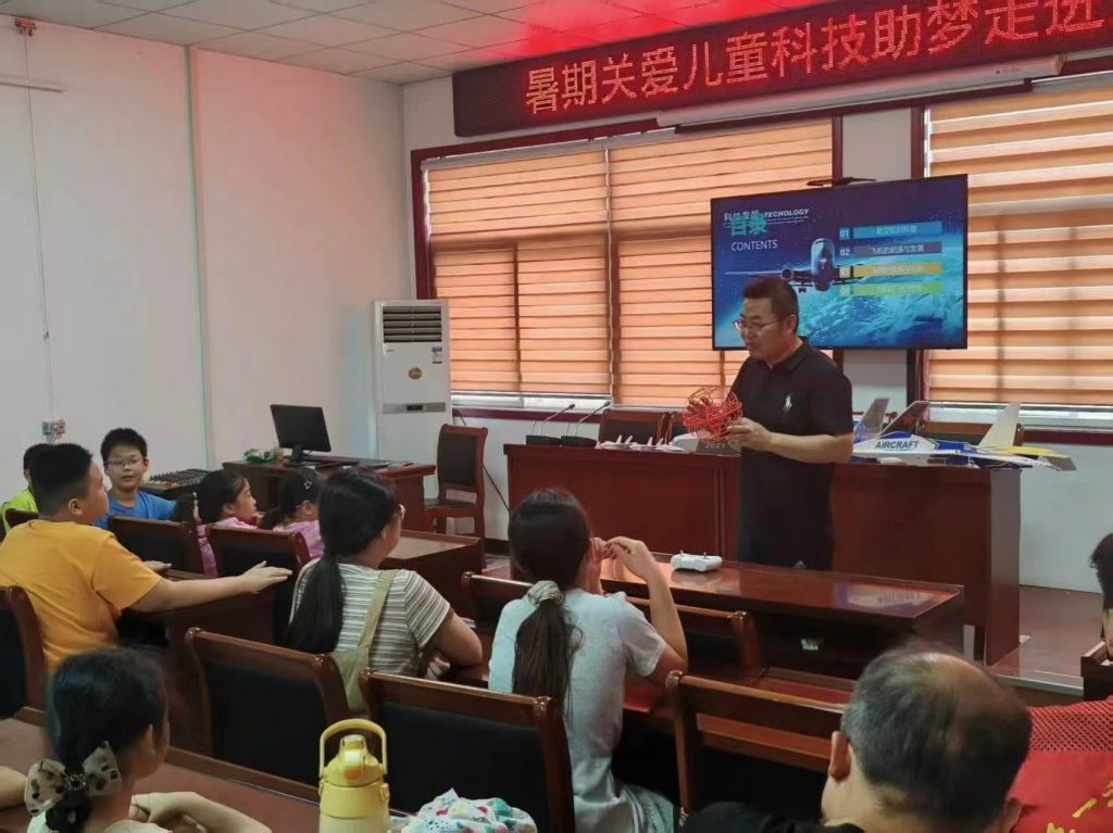
A practical drone training session is essential for mastering flight operations in complex terrain, ensuring both data quality and operational safety.
3. Technical Methodology: From Capture to Immersive Experience
The workflow can be broken down into a standardized, repeatable process.
3.1 Field Data Acquisition (Drone Photogrammetry)
The aerial survey is guided by the following principles to ensure data quality:
| Step | Action | Key Parameters & Considerations |
|---|---|---|
| 1. Pre-flight Reconnaissance | Assess site safety, identify key features, plan take-off/landing zone. | Weather (wind < 10 m/s), visibility, GNSS signal strength. |
| 2. Mission Configuration | Set drone parameters for panoramic capture. | Altitude (H): 60-120m (based on feature size). Camera: Set to “Sphere” or “Panorama” mode. RTK: Ensure fixed solution. |
| 3. Data Capture | Execute automated panoramic photo sequence. | Drone autonomously captures multiple images. Time: ~2-5 minutes. |
| 4. In-situ Processing | Allow drone/in-tablet to stitch images into a single spherical JPEG. | Output: A single *equirectangular projection* image file. |
The altitude choice is critical. A balance must be struck between covering the entire hazard area and resolving important details. The relationship between altitude, camera sensor, and ground resolution is given by:
$$ GSD = \frac{H \times \text{Sensor Width}}{f \times \text{Image Width}} $$
where \(GSD\) is the Ground Sampling Distance (size of one pixel on the ground), \(H\) is flight altitude, \(f\) is the focal length, and Sensor/Image Width are in consistent units. For a typical hazard survey, we aim for a GSD of 2-5 cm/pixel.
3.2 VR Panorama Creation & Enhancement (Cloud Platform)
Once the spherical image is captured, the creation of the interactive VR experience is streamlined on platforms like 720yun:
- Upload: Log into the cloud platform and upload the equirectangular panorama file.
- Create Project: Initiate a new “720 Tour” project and input metadata (title, location, description).
- Edit & Enhance: This is where value is added.
- Add Hotspots: Mark and label key features (e.g., “Main Scarp,” “Tension Cracks,” “Affected Road”).
- Create Guided Tours: Define a sequence of viewpoints to narrate the hazard story.
- Integrate AI Narration: Add voice-over explanations for training or public dissemination.
- Build Multi-scene Databases: Link multiple hazard site panoramas into one project, using a map sandbox for navigation.
- Publish & Share: Generate a unique URL and QR code for immediate access on any device.
The time from field capture to a shareable, insightful VR asset can be less than one hour, highlighting the operational efficiency gains.
4. Application Scenarios in Geological Hazard Prevention
The integration of drone-captured VR panoramas has permeated every stage of the hazard management cycle. The following table summarizes its multifaceted applications:
| Application Domain | Specific Use Case | Benefits & Outcomes | Link to Drone Training |
|---|---|---|---|
| Hazard Management & Database | Creating a county-wide VR panorama database of all known hazard points. | Centralized, visual inventory. Enables rapid virtual “site visits” for officials, improving situational awareness and resource allocation. | Training ensures consistent data quality and formatting for seamless database integration. |
| Public Awareness & Training | Using QR codes on hazard warning signs; Creating immersive training modules for residents and responders. | Provides public with direct, intuitive understanding of local risk. Enhances engagement and retention in training programs. | Operators must be trained to capture compelling, didactic imagery that tells the hazard story effectively to a non-technical audience. |
| Field Investigation & Assessment | Comparative analysis in “Three Checks” (pre-rainy season, during, post-season); Hazard and risk assessment surveys. | Enables precise change detection over time. Provides context for planning safe ground survey routes. Serves as a permanent, comprehensive visual record for the assessment report. | Advanced training is needed for change detection analysis and for capturing comparable imagery under different seasonal conditions. |
| Engineering Design & Monitoring | Preliminary layout of mitigation structures (e.g., drainage, retaining walls); Planning optimal locations for monitoring sensors (GPS, crackmeters, tilt sensors). | Allows engineers to visualize the site context in 3D before visiting. Enables discussion of design options directly on the VR model. Ensures monitoring network covers all critical deformation zones. | Precision flight and high-resolution capture are critical; training focuses on meeting the accuracy needs of engineering design support. |
4.1 Quantitative Advantage in Investigation Efficiency
The efficiency gain can be conceptualized. Let \(T_{traditional}\) be the time for a traditional ground survey of a complex hazard site, including time spent attempting to reach unsafe areas. Let \(T_{drone}\) be the time for a drone-based panoramic capture. The time saving \(\Delta T\) is significant, but more importantly, the data completeness \(\eta\) increases dramatically.
$$ \eta_{traditional} = \frac{A_{accessible}}{A_{total}} \quad \text{(often < 0.7)} $$
$$ \eta_{drone} = \frac{A_{visible\ from\ air}}{A_{total}} \quad \text{(typically > 0.95)} $$
where \(A\) represents the area of key hazard features. The drone’s perspective makes nearly the entire feature set “accessible” for visual inspection.
4.2 Enhancing Monitoring Network Design
When designing a monitoring network, the goal is to place a finite number of sensors \(n\) at locations \(L_i(x, y, z)\) to maximize the probability of detecting deformation \(D\). The VR panorama serves as the base map \(M_{VR}\) upon which preliminary locations \(L_{i,VR}\) are proposed based on visual interpretation of crack patterns, bulging, and topography.
$$ L_{i, optimal} = f(M_{VR}, L_{i,VR}, G_{safety}) $$
where \(G_{safety}\) represents ground accessibility and safety constraints verified during a subsequent, targeted field visit. This method ensures the network is scientifically justified before any hardware is deployed, optimizing the cost-effectiveness of monitoring programs. This planning phase heavily relies on the interpreter’s skill, which is honed through specific drone training focused on geohazard feature identification.
5. Synthesis and Future Outlook
The fusion of consumer-grade drone photogrammetry and cloud-based VR panorama platforms represents a paradigm shift in geological hazard investigation. It directly addresses the chronic “data gap” of traditional methods by providing a safe, rapid, and comprehensive means of visual data capture. The primary advantages are:
- Enhanced Safety: Removes personnel from direct exposure to hazardous zones.
- Improved Data Completeness & Accuracy: Provides an unobstructed, geotagged overview impossible to achieve from the ground.
- Superior Communication & Collaboration: The immersive, intuitive nature of VR panoramas bridges the gap between field experts, decision-makers, engineers, and the public.
- Operational Efficiency: Dramatically reduces the time from data acquisition to decision-ready intelligence.
- Cost-Effectiveness: Leverages affordable, off-the-shelf technology to generate high-value outputs.
The successful implementation of this technology is fundamentally dependent on standardized, high-quality drone training. A structured training curriculum is essential, moving beyond basic piloting to encompass photogrammetric mission planning, geohazard-specific flight operations, data processing workflows, and ethical/legal compliance. The return on investment in such drone training is measured in more reliable data, safer operations, and ultimately, more effective hazard mitigation.
Future developments will see even tighter integration. We can anticipate:
- Direct geospatial linking of VR panoramas with other datasets like InSAR displacement maps, LiDAR-derived digital terrain models, and real-time sensor data streams.
- The use of AI-powered feature detection within panoramas to automatically identify and classify hazard indicators like cracks or rockfalls.
- The evolution from static panoramas to dynamic 4D VR models (3D + time) through repeated surveys, providing an immersive view of landscape evolution.
In conclusion, from my first-person experience, embedding drone-captured VR panoramas into the geological hazard workflow is not merely an incremental improvement; it is a transformative practice. It enhances every phase of the hazard management cycle—from initial discovery and assessment through monitoring, public engagement, and engineering design. As the technology continues to evolve and, crucially, as comprehensive drone training becomes standard practice, its role as an indispensable tool for building more resilient communities will only solidify. The perspective it offers is quite literally a game-changer, allowing us to see, understand, and respond to geological risks with unprecedented clarity and speed.