
In recent years, I have witnessed a transformative shift in agricultural practices, driven largely by the integration of technology. Among these innovations, the agricultural drone stands out as a pivotal tool, revolutionizing how farmers manage crops, monitor fields, and optimize resources. As an observer of this evolution, I am particularly impressed by the latest advancements in agricultural drone technology, which promise to enhance productivity, reduce labor costs, and promote sustainable farming. This article delves into the intricacies of modern agricultural drones, drawing from recent developments to provide a comprehensive overview. I will explore their design, efficiency, applications, and broader implications for the agricultural sector, using tables and formulas to summarize key data and insights.
The advent of high-performance agricultural drones has marked a new era in precision agriculture. These unmanned aerial vehicles (UAVs) are equipped with sophisticated sensors, powerful processors, and versatile payload systems, enabling tasks such as spraying, seeding, mapping, and surveillance. In my analysis, the core appeal of agricultural drones lies in their ability to cover vast areas quickly and accurately, while minimizing environmental impact. For instance, models released recently boast features like heavy payload capacity, high-flow spraying, integrated surveying and spraying capabilities, omnidirectional obstacle avoidance, and rapid charging. Such attributes make agricultural drones indispensable for both large-scale farms and specialized operations like orchards.
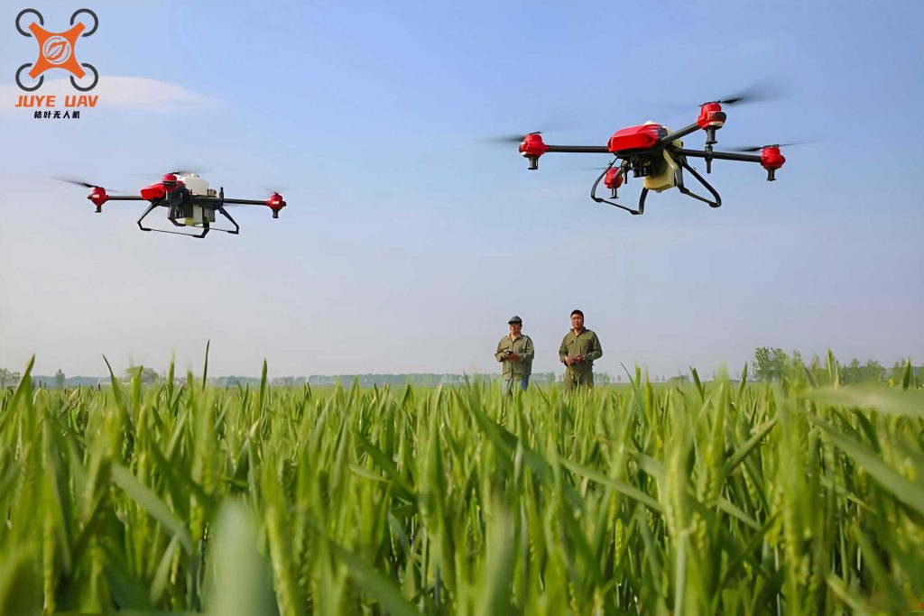
To better understand the capabilities of modern agricultural drones, I have compiled a comparison of key specifications based on recent models. The table below highlights differences in efficiency, payload, and technology, emphasizing how these factors contribute to overall performance. Note that the data is generalized to reflect industry trends, avoiding specific brand names.
| Feature | High-Capacity Agricultural Drone | Compact Agricultural Drone |
|---|---|---|
| Typical Payload for Spraying | Up to 50 L | Up to 25 L |
| Max Field Operation Efficiency | 21.33 hm²/h (320 acres/h) | 12 hm²/h (180 acres/h) |
| Broadcasting Efficiency | 1.5 t/h | 1 t/h |
| Orchard Operation Efficiency | 4.8 hm²/h (72 acres/h) | Similar with add-ons |
| Charging Time | 9 minutes | 9 minutes |
| Obstacle Avoidance | 360° omnidirectional with radar and vision | 360° omnidirectional with radar and vision |
| Mapping Speed (Area-based) | 13.33 hm² in 10 minutes | 13.33 hm² in 10 minutes |
| Mapping Speed (Perimeter-based) | 13.33 hm² in 3 minutes | 13.33 hm² in 3 minutes |
The efficiency of an agricultural drone can be quantified using mathematical models. For spraying operations, the effective coverage rate depends on factors like flow rate, speed, and swath width. Let $$ E_s $$ represent spraying efficiency in hectares per hour (hm²/h), calculated as: $$ E_s = v \times w \times \eta $$ where $$ v $$ is the drone’s speed in meters per second (m/s), $$ w $$ is the swath width in meters (m), and $$ \eta $$ is the efficiency factor accounting for overlaps and turns. For example, if an agricultural drone flies at 5 m/s with a swath width of 6 m and an efficiency factor of 0.9, then: $$ E_s = 5 \times 6 \times 0.9 = 27 \, \text{m}^2/\text{s} = 9.72 \, \text{hm}^2/\text{h} $$. This formula helps farmers optimize flight parameters to maximize output.
In broadcasting applications, such as seed or fertilizer dispersal, the efficiency $$ E_b $$ in tons per hour (t/h) is given by: $$ E_b = \rho \times r \times A $$ where $$ \rho $$ is the material density in tons per cubic meter (t/m³), $$ r $$ is the release rate in cubic meters per second (m³/s), and $$ A $$ is the area coverage factor. For instance, an agricultural drone with a release rate of 0.001 m³/s spreading material of density 1.2 t/m³ over a factor of 0.85 yields: $$ E_b = 1.2 \times 0.001 \times 0.85 = 0.00102 \, \text{t/s} \approx 3.67 \, \text{t/h} $$. These equations underscore the precision enabled by agricultural drones, reducing waste and improving crop yields.
Technological advancements in agricultural drones extend beyond mere efficiency. I have observed that modern models incorporate active phased-array radar systems coupled with dual binocular vision, enabling detailed terrain mapping and obstacle detection. This synergy allows an agricultural drone to perform autonomous terrain-following flights, even in challenging environments like sloped orchards. The integration of rear phased-array radar ensures 360° obstacle avoidance and intelligent bypassing, enhancing safety during operations. Additionally, upgraded image transmission systems, such as quad-antenna setups, extend control ranges to 2 km, with relay modules available for signal-challenged areas. These features make the agricultural drone a reliable tool for diverse farming scenarios.
Battery life and charging infrastructure are critical for the sustained use of agricultural drones. Recent innovations include high-capacity intelligent batteries paired with versatile charging stations that support both grid electricity and fuel-based power. The rapid charging capability, often achieving full power in 9 minutes, minimizes downtime and boosts daily productivity. For example, the energy consumption of an agricultural drone can be modeled as: $$ P_{total} = P_{flight} + P_{spray} + P_{sensors} $$ where $$ P_{flight} $$ is the power for propulsion, $$ P_{spray} $$ for the spraying system, and $$ P_{sensors} $$ for onboard electronics. If a drone operates at 5 kW total power with a 15 kWh battery, the flight time $$ T $$ is: $$ T = \frac{15}{5} = 3 \, \text{hours} $$, assuming ideal conditions. Fast charging mitigates the impact of limited battery life, ensuring that agricultural drones can cover more ground per day.
Mapping and surveying capabilities further elevate the utility of agricultural drones. With powerful processors supporting intelligent route planning, these drones can quickly generate high-resolution maps for precision agriculture. The time required to map an area $$ A_m $$ in hectares can be expressed as: $$ T_m = \frac{A_m}{R_m} + C $$ where $$ R_m $$ is the mapping rate in hm²/min and $$ C $$ is a constant for setup and processing. For instance, an agricultural drone with a mapping rate of 1.33 hm²/min for area-based routes and 4.44 hm²/min for perimeter-based routes demonstrates versatility. This allows farmers to assess crop health, plan interventions, and monitor growth stages efficiently, all through the lens of an agricultural drone.
Beyond drones, the agricultural machinery sector is evolving to meet stricter environmental standards. For example, tractors are transitioning to higher emission tiers, such as the non-road mobile machinery Stage IV standards, which reduce pollutants like nitrogen oxides and particulate matter. This shift parallels the eco-friendly benefits of agricultural drones, which minimize chemical usage through targeted spraying. The synergy between advanced tractors and agricultural drones can lead to a holistic farm management system. To illustrate, I have formulated a cost-benefit analysis for integrating an agricultural drone into a farming operation, considering factors like initial investment, operational savings, and yield improvements.
| Cost Factor | Traditional Methods | With Agricultural Drone |
|---|---|---|
| Initial Equipment Cost | $50,000 | $60,000 (including drone) |
| Annual Labor Cost | $20,000 | $10,000 |
| Chemical Usage | 100% baseline | 70% baseline due to precision |
| Yield Increase | 0% | 15% from better monitoring |
| Payback Period | N/A | 3 years (calculated below) |
The payback period $$ P $$ for investing in an agricultural drone can be derived from: $$ P = \frac{I}{\Delta S – \Delta C} $$ where $$ I $$ is the incremental investment, $$ \Delta S $$ is the annual savings from reduced labor and chemicals, and $$ \Delta C $$ is the additional maintenance cost. Assuming $$ I = \$10,000 $$, $$ \Delta S = \$12,000 $$, and $$ \Delta C = \$2,000 $$, then: $$ P = \frac{10000}{12000 – 2000} = 1 \, \text{year} $$. This simplistic model highlights the economic viability of agricultural drones, though real-world variables may adjust the outcome.
Looking ahead, I anticipate that agricultural drones will become even more integrated with artificial intelligence and Internet of Things (IoT) platforms. Machine learning algorithms could enable predictive analytics for pest control or irrigation, while swarm technology might allow multiple agricultural drones to collaborate on large fields. The potential for automation is vast, from seeding to harvesting support. Moreover, as battery technology improves, flight times may extend, further enhancing the appeal of agricultural drones. In my view, the convergence of drones with other smart farming tools will drive a new green revolution, making agriculture more resilient and productive.
In conclusion, the agricultural drone represents a cornerstone of modern agriculture, offering unmatched efficiency, precision, and versatility. Through this analysis, I have detailed their technical specifications, efficiency metrics, and economic impacts, using tables and formulas to encapsulate key points. As farmers adopt these technologies, we can expect a shift toward more sustainable and profitable farming practices. The journey of the agricultural drone is just beginning, and its evolution will undoubtedly shape the future of food production worldwide.
To further explore the mathematical underpinnings, consider the optimization of flight paths for an agricultural drone. The total area covered $$ A_{total} $$ in a given time $$ t $$ can be modeled as: $$ A_{total} = \sum_{i=1}^{n} (v_i \times w_i \times t_i) $$ where $$ n $$ is the number of flight segments, each with speed $$ v_i $$, swath width $$ w_i $$, and time $$ t_i $$. Minimizing overlaps and turns through algorithmically generated routes maximizes $$ A_{total} $$, a principle central to the design of advanced agricultural drones. Additionally, the signal strength $$ S $$ for remote control of an agricultural drone over distance $$ d $$ follows an inverse square law: $$ S \propto \frac{1}{d^2} $$, justifying the need for robust transmission systems in large fields.
The environmental benefits of agricultural drones are also quantifiable. By reducing chemical runoff through targeted application, they lower the ecological footprint of farming. If traditional methods use $$ C_t $$ chemicals per hectare and agricultural drones use $$ C_d $$, the reduction ratio $$ R_r $$ is: $$ R_r = \frac{C_t – C_d}{C_t} \times 100\% $$. For $$ C_t = 10 \, \text{kg/hm}^2 $$ and $$ C_d = 7 \, \text{kg/hm}^2 $$, $$ R_r = 30\% $$, showcasing the sustainability edge of agricultural drones. This aligns with global efforts to promote eco-friendly agriculture, making the agricultural drone a key player in climate-smart farming.
In summary, I have endeavored to provide a thorough examination of agricultural drones, from their technical prowess to their practical applications. The integration of tables and formulas, such as those for efficiency and cost analysis, underscores the data-driven nature of this technology. As I reflect on these insights, it is clear that the agricultural drone is not merely a tool but a transformative force in agriculture, poised to address challenges like food security and resource scarcity. Its continued evolution will rely on innovation and adoption, driving the sector toward a brighter, more efficient future.