
In recent years, the integration of unmanned aerial vehicles, commonly known as drones, into agricultural practices has revolutionized modern farming. As a researcher focusing on precision agriculture, I have observed a significant shift towards using agricultural drones for tasks such as pesticide spraying, crop monitoring, and soil analysis. The flexibility and maneuverability of these drones enable them to operate in diverse terrains, from flat plains to high-altitude regions like Tibet and Xinjiang, enhancing agricultural efficiency. However, to ensure the safe and effective deployment of agricultural drones, a robust flight management and control system is essential. This system not only governs the precise flight operations but also integrates data for informed decision-making. In this article, I will delve into the value of combining drones with agriculture, outline the construction of an agricultural drone flight management and control system, and analyze the key technological pathways that underpin its success. By emphasizing these aspects, I aim to provide insights that can enhance the operational effectiveness of agricultural drones in real-world farming scenarios.
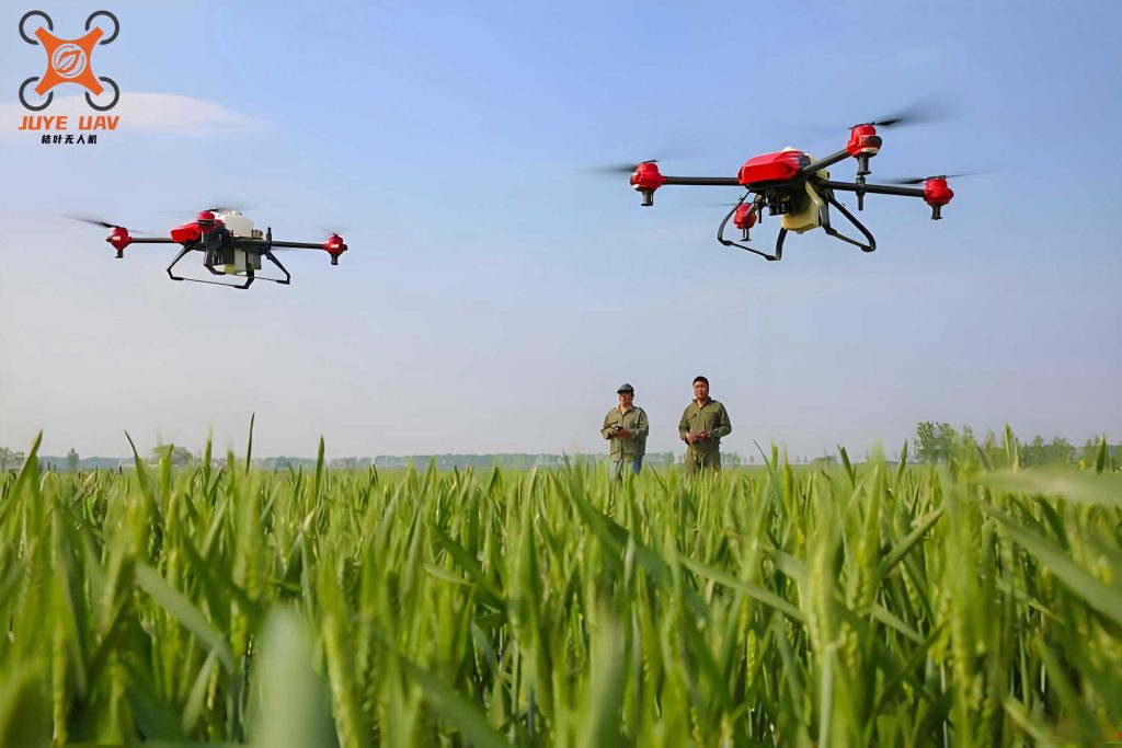
The convergence of drones and agriculture offers immense value, primarily through precision and cost reduction. Firstly, agricultural drones facilitate precise pesticide spraying. Equipped with brushless motors that minimize vibration, these drones can carry sensitive instruments, allowing for accurate application. The centrifugal nozzles enable control over droplet size, typically around 100 micrometers, ensuring uniform coverage on crop stems and leaves, including hard-to-reach areas. This precision enhances pest and weed control, leading to improved crop yields and quality. Secondly, agricultural drones help reduce production costs. In regions with challenging topography, traditional methods of spraying and monitoring are labor-intensive and expensive. Drones overcome these barriers by providing real-time data on soil moisture, nutrient levels, and crop health. For instance, by monitoring water deficiency rates and predicting pest outbreaks, farmers can optimize irrigation and fertilization, minimizing resource wastage. As I explore this topic, I recognize that the agricultural drone is not just a tool but a transformative technology that empowers farmers with data-driven insights for sustainable agriculture.
To harness the full potential of agricultural drones, a comprehensive flight management and control system must be constructed. This system serves as the backbone for coordinating drone operations, ensuring safety, and processing agricultural data. Based on my analysis, I propose a multi-layered architecture that integrates hardware, communication, and software components. The system can be divided into seven hierarchical layers: hardware layer, communication layer, environment layer, data processing layer, information processing layer, information sharing layer, and business management layer. Each layer plays a critical role in the seamless functioning of the agricultural drone ecosystem. For example, the information sharing layer enables data dissemination among stakeholders, while the business management layer includes GIS and monitoring systems for operational oversight. The logical structure involves a business management platform, communication interfaces for data exchange, and physical devices such as servers and network equipment. This design ensures that ground stations can send control commands to drones via 4G or 5G links, with real-time feedback on flight status. In my experience, such a structured approach is vital for managing the complexities of agricultural drone fleets across vast farmlands.
The functionality of the agricultural drone flight management and control system is enhanced through specialized modules. I have identified several key modules that are essential for effective operation. These include real-time status monitoring, which tracks drone speed and position on a map; startup monitoring and query functions for logging flight initiation and retrieving data; and alarm systems for speed limits, flight duration, and geofencing. For instance, if an agricultural drone exceeds predefined speed thresholds, the system triggers audible and visual alerts, recording details for analysis. Additionally, flight path setting modules allow for predefined routes, ensuring that drones operate within designated agricultural zones. To summarize these modules, I present a table that outlines their features and benefits in the context of agricultural drone management.
| Module Name | Function Description | Benefit for Agricultural Drone Operations |
|---|---|---|
| Real-Time Status Monitoring | Tracks drone location, speed, and direction via GPS and sensors. | Enables precise control over spraying and monitoring tasks, reducing overlap and missed areas. |
| Startup Monitoring and Query | Logs flight start times and allows retrieval of historical data. | Facilitates compliance with flight regulations and provides insights for optimizing drone usage. |
| Alarm System | Triggers alerts for speed violations, flight timeouts, and unauthorized movements. | Enhances safety by preventing accidents due to battery drain or boundary breaches. |
| Flight Path Setting | Defines automated routes for drones based on field maps. | Improves efficiency in large-scale farming by ensuring systematic coverage of crops. |
| Data Integration | Combines drone data with soil and weather information. | Supports decision-making for irrigation, fertilization, and pest management. |
In optimizing the agricultural drone flight management system, several key technological pathways must be addressed. From my perspective, these pathways are crucial for overcoming challenges related to reliability, communication, and hardware constraints. The first pathway involves server搭建, where the focus is on ensuring stable communication and high data forwarding efficiency. Servers must employ robust protocols and architectures that can handle network interruptions, such as using TCP for reliable transmission. For example, the data transfer rate can be modeled using the formula: $$R = \frac{B \cdot \log_2(1 + \text{SNR})}{T}$$ where \(R\) is the rate in bits per second, \(B\) is the bandwidth, SNR is the signal-to-noise ratio, and \(T\) is the transmission time. This highlights the importance of optimizing network parameters for agricultural drone data streams.
The second pathway centers on完善 system details to enhance reliability across diverse agricultural environments. This includes designing抗干扰 circuits and selecting durable connectors. In my work, I have found that a unified system design reduces failure points compared to modular setups. For instance, integrating flight recorders with control units minimizes connections, improving durability. The system should sample data at intervals, such as every second, to monitor parameters like speed and altitude. If an agricultural drone exceeds speed limits, the recorder alerts the operator, preventing potential crashes. This reliability is quantified by the mean time between failures (MTBF), expressed as: $$\text{MTBF} = \frac{\text{Total Operational Time}}{\text{Number of Failures}}$$ A higher MTBF indicates a more reliable agricultural drone system, which is vital for continuous farming operations.
The third pathway involves合理设置硬件, considering the weight and power limitations of agricultural drones. Drones often have limited battery life, so hardware must be lightweight and energy-efficient. I recommend using low-power microcontrollers and efficient sensors. For example, the power consumption \(P\) of a drone component can be calculated as: $$P = I \cdot V$$ where \(I\) is the current and \(V\) is the voltage. By selecting components with low \(I\), we extend the flight time of the agricultural drone. The table below summarizes key hardware specifications for an agricultural drone flight management system.
| Hardware Component | Specification | Impact on Agricultural Drone Performance |
|---|---|---|
| Microcontroller | ARM Cortex-M4, 180 MHz, low-power mode | Processes flight data efficiently while conserving battery life for longer missions. |
| GPS Module | Accuracy: ±1.5 m, update rate: 10 Hz | Enables precise navigation for targeted spraying and monitoring in fields. |
| Communication Chip | 4G/5G compatible, data rate up to 100 Mbps | Ensures real-time transmission of agricultural data to ground stations. |
| Sensors | Multispectral cameras, LiDAR for terrain mapping | Provides detailed crop health insights, aiding in precision agriculture decisions. |
| Power System | Lithium-polymer battery, 10,000 mAh, quick-charge capable | Supports extended flight durations, reducing downtime for recharging. |
The fourth pathway is优化协议 for communication between the agricultural drone and ground control stations. Traditional protocols like the Micro Air Vehicle Link (MAVLink) are widely used but can be bulky, leading to delays in poor channel conditions. In my analysis, I propose streamlining these protocols by removing redundant data packets. For instance, the effective data throughput \(T_{\text{eff}}\) can be improved by reducing overhead: $$T_{\text{eff}} = \frac{D_{\text{payload}}}{D_{\text{total}}} \cdot C$$ where \(D_{\text{payload}}\) is the useful data, \(D_{\text{total}}\) is the total data transmitted, and \(C\) is the channel capacity. By prioritizing essential data such as flight coordinates and sensor readings, the agricultural drone can maintain stable communication even in remote farming areas. This optimization is critical for real-time control, as delays could compromise spraying accuracy or miss critical crop data.
Furthermore, the integration of advanced algorithms enhances the agricultural drone flight management system. For path planning, I often use algorithms like A* or genetic algorithms to compute optimal routes. The cost function for path planning can be defined as: $$C = \sum_{i=1}^{n} w_i \cdot f_i(d, t)$$ where \(C\) is the total cost, \(w_i\) are weights for factors like distance \(d\) and time \(t\), and \(f_i\) are functions representing obstacles or crop rows. This allows the agricultural drone to navigate efficiently while avoiding collisions. Additionally, machine learning models can predict crop yields based on drone-captured imagery, using formulas like linear regression: $$y = \beta_0 + \beta_1 x_1 + \cdots + \beta_k x_k + \epsilon$$ where \(y\) is the yield, \(x_i\) are features such as vegetation indices, and \(\beta_i\) are coefficients. Such predictive capabilities empower farmers to make proactive decisions, leveraging the agricultural drone as a data hub.
In terms of system implementation, I emphasize the need for scalability and interoperability. As farms expand, the agricultural drone fleet must be managed seamlessly. Cloud-based platforms can store and analyze data from multiple drones, using APIs for integration with farm management software. For example, the data volume \(V\) generated by an agricultural drone per mission can be estimated as: $$V = r \cdot t \cdot s$$ where \(r\) is the data rate, \(t\) is the flight time, and \(s\) is the number of sensors. With high-resolution cameras, \(V\) can reach gigabytes, necessitating robust storage solutions. The table below compares different storage options for agricultural drone data.
| Storage Type | Capacity | Access Speed | Suitability for Agricultural Drone Systems |
|---|---|---|---|
| Onboard SD Card | Up to 512 GB | Fast read/write | Ideal for raw data collection during flights, but requires manual retrieval. |
| Cloud Storage | Scalable to TBs | Depends on internet connectivity | Enables real-time data sharing and analysis across devices, perfect for collaborative farming. |
| Edge Computing Devices | Local storage with processing | Low latency |
As I reflect on these technological pathways, it becomes clear that the success of an agricultural drone flight management system hinges on continuous innovation. Emerging trends like AI-driven autonomy and swarm robotics promise to further revolutionize agriculture. For instance, swarm algorithms allow multiple agricultural drones to coordinate tasks, such as covering large fields simultaneously. The efficiency of a swarm can be modeled using queueing theory: $$L = \lambda W$$ where \(L\) is the average number of drones in the system, \(\lambda\) is the arrival rate of tasks, and \(W\) is the average time per task. By optimizing these parameters, farmers can deploy agricultural drone swarms for rapid crop scouting or emergency spraying.
In conclusion, the development and implementation of a robust agricultural drone flight management and control system are paramount for advancing precision agriculture. Through my analysis, I have highlighted the value of drones in farming, detailed system architecture and modules, and explored key technologies from servers to protocols. The agricultural drone, as a versatile tool, not only enhances productivity but also promotes sustainable practices by minimizing resource use. As technology evolves, I anticipate further integration of IoT and big data analytics, making agricultural drones even more intelligent. By prioritizing reliability, efficiency, and scalability, we can ensure that these systems meet the growing demands of global agriculture, ultimately contributing to food security and environmental stewardship.