
In recent years, the application of unmanned aerial vehicles (UAVs) has expanded dramatically beyond their initial military reconnaissance and strike roles. One of the most visually stunning and commercially vibrant applications is the formation drone light show. Replacing traditional fireworks, these shows employ hundreds, sometimes thousands, of drones acting as synchronized pixels in the night sky to create complex, dynamic, and luminous three-dimensional animations. The core technological challenge enabling this spectacle is not merely individual flight control, but the precise, time-synchronized coordination of an entire fleet. Each drone must reach its specific position in a formation at an exact moment, following a feasible path that respects physical limits. This requirement mirrors advanced multi-UAV coordination problems found in other domains. In this article, I will detail a hierarchical framework for path planning that guarantees time-coordinated arrival, a method directly applicable to orchestrating a flawless formation drone light show.
The fundamental problem of time-coordinated multi-drone path planning can be formalized as follows. We are given a fleet of \( N \) drones. Each drone \( i \) has initial state information \( P_i^{start} = (x_i^s, y_i^s, z_i^s, v_i^s, \psi_i^s, \theta_i^s) \), representing its starting coordinates, velocity, yaw (heading), and flight path angle. Correspondingly, each has a target state \( P_i^{goal} = (x_i^g, y_i^g, z_i^g, v_i^g, \psi_i^g, \theta_i^g) \) that defines its final position and orientation within the desired formation pattern for the formation drone light show. The objective is to generate for each drone a flight path from \( P_i^{start} \) to \( P_i^{goal} \) such that all drones arrive at their respective targets simultaneously. This must be achieved while minimizing a global cost (like total flight distance or energy) and adhering to each drone’s dynamic constraints, primarily its minimum turning radius. The desired outcome is a perfectly timed merge into the formation, which for a light show translates into a crisp beginning of an animated sequence.
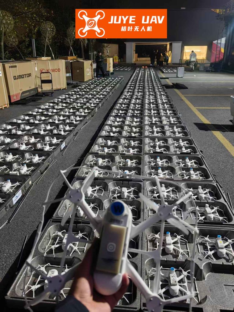
To manage this complex problem, I adopt a hierarchical decomposition strategy. The system is divided into two primary layers: a Single-Agent Path Planning Layer and a Real-Time Multi-Agent Cooperative Planning Layer. This separation simplifies the problem by first determining feasible paths for individual drones, then coordinating their speeds and timings across the fleet.
The Single-Agent Path Planning Layer is responsible for generating physically viable paths for each drone independently, ignoring the coordination with others. For a formation drone light show, where flight zones are often clear of obstacles, the primary constraint is the drone’s maneuverability. The most critical limitation is the minimum turning radius \( R_{min} \), derived from its maximum lateral load factor \( n_{max} \) and velocity \( v \):
$$ R_{min} = \frac{v^2}{n_{max}} $$
To generate paths between two oriented points, I employ the Dubins path model. Dubins paths provide the shortest possible route between two points in a plane for a vehicle with a constrained turning radius, consisting of sequences of arcs (turns at maximum curvature) and straight line segments. For any start and goal pose (x, y, heading), there exist four common feasible Dubins path types. If we denote ‘L’ as a left turn arc and ‘R’ as a right turn arc, and ‘S’ as a straight segment, the four types are: L-S-L, R-S-R, L-S-R, and R-S-L. For a drone in a formation drone light show, calculating these four options provides a set of candidate paths from its launch position to its assigned formation slot. The length of each path \( L_{i,j} \) for drone \( i \) and path type \( j \) (where \( j \in \{1,2,3,4\} \)) can be computed geometrically.
Let’s consider a simplified 2D example for a small show. The table below shows the calculated lengths (in arbitrary units) for the four Dubins path options for three drones moving from a staggered start line to a straight formation line.
| Drone | L-S-L Path Length | R-S-R Path Length | L-S-R Path Length | R-S-L Path Length |
|---|---|---|---|---|
| UAV 1 | 12.31 | 12.41 | 13.74 | 9.44 |
| UAV 2 | 15.22 | 9.18 | 10.51 | 12.32 |
| UAV 3 | 12.11 | 9.49 | 11.07 | 12.11 |
The Real-Time Multi-Agent Cooperative Planning Layer takes these candidate paths and solves the synchronization problem. Each drone \( i \) can fly at a speed within \( [v_{min}, v_{max}] \). Therefore, for a given path \( j \) with length \( L_{i,j} \), the possible time to traverse it ranges from \( T_{i,j}^{min} = L_{i,j} / v_{max} \) to \( T_{i,j}^{max} = L_{i,j} / v_{min} \). The union of time ranges for all four paths gives the feasible arrival time window for that drone: \( T_i = \bigcup_{j=1}^{4} [T_{i,j}^{min}, T_{i,j}^{max}] \).
The core of the time coordination algorithm is to find a common arrival time \( T_a \) that lies within the feasible window of every drone in the formation drone light show fleet:
$$ T_a \in \bigcap_{i=1}^{N} T_i $$
If such an intersection is non-empty, we choose the optimal coordinated time \( ET \) (Earliest feasible Time) that minimizes a global cost function \( J_c \). This function often combines path length (for energy efficiency) and flight time. For a specific drone \( i \) on path \( j \), a cooperative cost can be defined as:
$$ J_{c,i,j} = k_2 \cdot J_{i,j} + (1 – k_2) \cdot T_{i,j} $$
where \( J_{i,j} \) is the path length cost (constant once the path is chosen), \( T_{i,j} \) is the flight time on that path, and \( k_2 \) is a weighting coefficient. The system evaluates options to find the combination of paths (one per drone) and the common time \( ET \) that minimizes the sum \( \sum_{i=1}^{N} J_{c,i} \). Once \( ET \) is determined, the required constant speed for each drone \( i \) on its selected path \( j^* \) is simply:
$$ v_i^* = \frac{L_{i,j^*}}{ET} $$
provided that \( v_i^* \) falls within \( [v_{min}, v_{max}] \).
However, in a real-world formation drone light show, scenarios often arise where the intersection of feasible time windows is empty (\( \bigcap T_i = \emptyset \)). This happens when drones have vastly different path lengths or very limited speed adjustment ranges. In such cases, forcing simultaneous arrival requires some drones to deliberately increase their flight time. The most practical and safe strategy for a light show is the “loitering” or “circular waiting” maneuver. Drones that would arrive too early are commanded to orbit in a holding pattern at a designated waypoint before proceeding.
The algorithm for this is straightforward. Let \( t_i^{min} = L_i / v_{max} \) and \( t_i^{max} = L_i / v_{min} \) represent the earliest and latest possible arrival times for drone \( i \) on its shortest path \( L_i \). Without loss of generality, assume drones are ordered such that \( t_1^{min} \le t_2^{min} \le … \le t_N^{min} \). The drone with the longest minimum time \( N \) dictates the earliest possible coordinated arrival for all. Therefore, we set \( ET = t_N^{min} \). Drones that can arrive earlier must delay. If \( t_N^{min} > t_i^{max} \) for an early drone \( i \), it must loiter. The time it needs to delay is \( \Delta T_i = t_N^{min} – t_i^{max} \). If one loitering circle at the drone’s minimum turning radius \( R_{min} \) takes time \( \Delta t_i = 2 \pi R_{min} / v_i \), then the number of required loitering circles \( n_i \) is:
$$ n_i = \lceil \frac{\Delta T_i}{\Delta t_i} \rceil = \lceil \frac{t_N^{min} – t_i^{max}}{2 \pi R_{min} / v_i} \rceil $$
The table below illustrates this with an example. Three drones have different remaining distances. Their initial time windows do not overlap, making direct synchronization impossible.
| Drone (i) | Remaining Distance \( L_i \) (km) | \( t_i^{min} \) (min) at \( v_{max} \) | \( t_i^{max} \) (min) at \( v_{min} \) | Required Delay \( \Delta T_i \) (min) |
|---|---|---|---|---|
| 1 | 10 | 2.50 | 5.00 | 3.00 |
| 2 | 20 | 5.00 | 10.00 | 0.00 |
| 3 | 25 | 6.25 | 12.50 | 0.00 |
Here, \( ET = t_3^{min} = 6.25 \) min. Drone 1’s latest possible arrival without loitering is 5.00 min, which is earlier than ET. It must therefore delay by \( \Delta T_1 = 6.25 – 5.00 = 1.25 \) minutes. If Drone 1’s current speed \( v_1 \) gives a loop time \( \Delta t_1 = 0.8 \) min, then it needs \( n_1 = \lceil 1.25 / 0.8 \rceil = 2 \) loitering circles. After this adjustment, all drones can be scheduled to arrive at \( ET = 6.25 \) min by flying their shortest paths at appropriate speeds, with Drone 1 incorporating its holding pattern.
Simulating this framework confirms its effectiveness. In the first case where time windows overlap, the algorithm successfully selects paths and calculates speeds for a three-drone group, yielding a common \( ET \) and confirming synchronized arrival. In the second, non-overlapping case, the algorithm correctly prescribes loitering circles for the early-arriving drone, creating an effective intersection of arrival times and enabling synchronization. This robustness is essential for a commercial formation drone light show, where launch positions may be uneven and wind conditions can affect optimal paths.
The implications for the formation drone light show industry are significant. This hierarchical time-coordination method provides a reliable mathematical backbone for show choreography. It allows planners to:
- Design Complex Formations: By ensuring time-synchronized arrival from diverse starting points (e.g., landing pads), the transition between show segments can be seamless.
- Manage Large Fleets: The algorithm scales computationally by dealing with individual path planning first, then solving the coordination problem across the fleet.
- Ensure Safety and Reliability: By incorporating physical constraints like minimum turning radius from the outset and using predictable holding patterns for timing adjustment, flight paths remain within safe operational envelopes.
- Optimize for Efficiency: The cost function minimization helps in reducing total energy consumption, a critical factor for battery-limited show drones.
While this framework provides a solid foundation, real-world deployment for a massive formation drone light show requires integrating additional layers. These include robust inter-drone communication to share state information, real-time collision avoidance for dynamic adjustments, and compensation for external disturbances like wind. Furthermore, the geometric planning discussed here in 2D must be extended to full 3D to create the volumetric shapes that define modern light shows. The principle, however, remains: decomposing the problem into feasible path generation and fleet-wide time coordination is a powerful and effective strategy. By solving the problem of “getting to the start of the formation on time,” this framework lays the essential groundwork for the breathtaking, synchronized aerial ballet that is a modern formation drone light show.