
As the precision requirements for carbon emission monitoring continue to rise, methodologies are constantly evolving. In this review, we summarize the current state of carbon emission monitoring and quantification techniques employing UAV drones, providing a reference for subsequent research and monitoring efforts. UAV drones have emerged as a promising tool due to their flexibility, high mobility, and real-time data transmission capabilities, complementing traditional ground-based and satellite remote sensing systems. They enhance monitoring in the critical sub-hundred-meter altitude range, particularly over complex terrains and hazardous environments. This article explores the application methods, quantification models, challenges, and future prospects of UAV drone-based carbon monitoring.
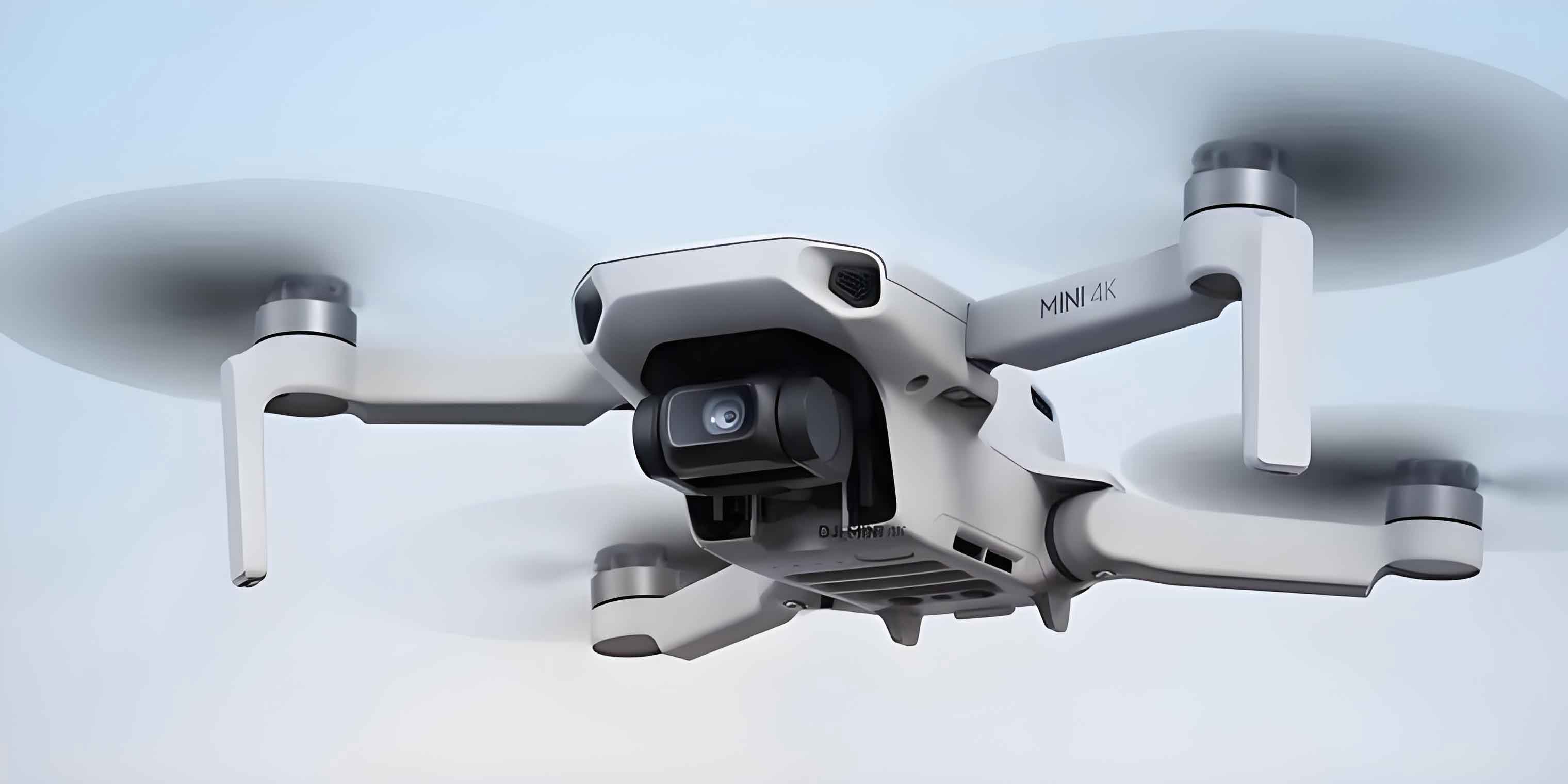
The integration of UAV drones into carbon monitoring systems allows for the deployment of various sensors to measure concentrations and fluxes of greenhouse gases such as carbon dioxide (CO₂) and methane (CH₄). By combining data from UAV drones with ground stations and meteorological information, three-dimensional spatial distributions of carbon emissions can be constructed, offering scientific support for environmental management and carbon trading. Unlike conventional methods, UAV drones can navigate obstacles and access areas unreachable by humans or other vehicles, enabling more comprehensive data acquisition. This capability is especially valuable for monitoring dispersed or hard-to-reach emission sources, making UAV drones a transformative technology in atmospheric science.
UAV Drone-Based Carbon Monitoring Application Methods
UAV drone platforms can conduct carbon emission monitoring across diverse regions and environments, including urban areas, industrial zones, and agricultural fields. Their advantage lies in their ability to fly over obstacles and enter locations inaccessible to traditional monitoring systems. After planning flight paths over selected areas, UAV drones equipped with specific sensing devices rapidly and accurately collect atmospheric greenhouse gas data, facilitating the timely detection of anomalous emissions. Some UAV drone platforms are also capable of monitoring wind speed and direction, aiding in locating gas leakage sources and quantifying emission rates. The fundamental components of a UAV drone-based carbon monitoring system typically include the aerial platform, sensor payload, data transmission unit, and ground control station. Three primary monitoring methods have been widely adopted: the mounted offline sampler method, the tethered method, and the in-situ monitoring method. Each approach has distinct principles, advantages, and limitations, as summarized in Table 1.
| Monitoring Method | Advantages | Disadvantages | Typical Applications |
|---|---|---|---|
| Mounted Offline Sampler | Enables offline analysis with high-precision instruments; full spatial freedom of the UAV drone platform; allows measurement of other variables like isotopic ratios (e.g., δ¹³C-CH₄) or other atmospheric pollutants. | Typically results in discrete (snapshot) sampling rather than continuous data; requires post-flight laboratory analysis, causing delays. | Quantifying emissions from point sources like industrial smokestacks; regional background studies. |
| Tethered Method | Utilizes high-performance ground-based equipment for detection, offering superior accuracy; allows for continuous sampling. | Complex data calculation due to lag time in sample transport through tubing; flight altitude limited by tether length, posing safety hazards; reduced maneuverability. | Continuous monitoring of fixed sites like landfills or oil and gas facilities; vertical profile measurements. |
| In-Situ Monitoring | Provides continuous spatial concentration data; full spatial freedom of the UAV drone platform; real-time data transmission streamlines analysis. | Requires balancing sensor size, weight, cost, accuracy, and measurement frequency; sensor performance may be inferior to laboratory-grade instruments. | Mapping methane hotspots at landfills; real-time leak detection; urban emission surveys. |
Mounted Offline Sampler Method
The mounted offline sampler method involves collecting air samples into containers during flight for subsequent laboratory analysis. A common system is the Air Core, which uses a micro-pump to draw air into a passivated steel tube. The sampling flow rate depends on environmental pressure, orifice size, and temperature. For instance, in some designs, the pump operates under a vacuum to create critical flow conditions. The sampler is often housed in a carbon fiber box attached to the UAV drone, with an inlet port for air intake. While effective for continuous atmospheric sampling, traditional Air Core systems can have low spatial resolution. For example, at sea level (~1000 hPa), resolution might be around 110 m for a 3-hour storage time, degrading further with longer storage. To address this, advanced UAV drone-mounted gas samplers coupled with deconvolution algorithms have been developed, achieving spatial resolutions of 3–4 m. Such systems have been applied to quantify CO₂ and CH₄ emissions from industrial point sources like coking plant smokestacks. Emission rates are estimated using mass balance or Gaussian plume inversion methods, which often show good agreement. A key limitation is the assumption of constant emission rates during the flight, and single flight tests may not capture statistical variability. The offline method’s strength lies in enabling highly accurate, multi-species analysis using laboratory equipment, provided sample integrity is maintained. However, the discrete nature of the data can limit the ability to capture continuous spatial gradients.
Tethered Method
The tethered method involves using a UAV drone to collect air samples, which are then transported via tubing to ground-based analytical instruments. This approach leverages the high accuracy and stability of ground equipment while allowing continuous sampling from elevated positions. However, it introduces complexities such as accounting for the lag time (τ) required for the sample to travel through the tubing to the sensor. This lag depends on tubing length (L), inner diameter (d), and flow rate (Q), and can be estimated using:
$$ \tau = \frac{\pi d^2 L}{4Q} $$
Correcting for this delay is crucial when synchronizing concentration data with UAV drone GPS and time stamps. Additionally, the tether restricts flight altitude and maneuverability, increasing operational risks, especially in windy conditions or near obstacles. Despite these challenges, the tethered method is valuable for applications requiring high-precision, continuous measurements at fixed locations, such as monitoring methane fluxes from ground sources or conducting vertical atmospheric profiling.
In-Situ Monitoring Method
The in-situ monitoring method employs UAV drones carrying lightweight greenhouse gas sensors that measure concentrations directly during flight, with data transmitted to the ground in real-time. Compared to offline sampling, this method imposes fewer restrictions on flight paths and offers greater flexibility than tethered systems. It enables continuous acquisition of spatial concentration data, providing a more comprehensive view of gas distributions. The real-time data transmission eliminates the need for post-flight air extraction and deconvolution, enhancing operational efficiency. As UAV drone capabilities in endurance, payload, attitude control, and hover time improve, and as lighter, more accurate sensors are developed, in-situ monitoring has become the predominant method in UAV drone-based carbon monitoring. The core challenge lies in optimizing the trade-off between sensor performance (accuracy, frequency) and constraints like size, weight, and power consumption. Table 2 compares representative greenhouse gas sensor technologies used on UAV drones.
| Sensor Technology | Key Advantages | Key Limitations | Suitability for UAV Drones |
|---|---|---|---|
| Infrared Laser Absorption Spectroscopy (e.g., TDLAS) | High sensitivity (ppb-level), precision, and accuracy; low drift; automatic water vapor correction; no consumables. | High cost; performance affected by pressure, temperature, and humidity variations. | Excellent for CH₄ and CO₂ detection; used in many advanced UAV drone payloads. |
| Off-Axis Integrated Cavity Output Spectroscopy (OA-ICOS) | High sensitivity and accuracy (ppb-level); easy maintenance of mirrors. | Larger size and weight; sensitive to water vapor; noticeable drift requiring frequent calibration; spectral cross-talk possible. | Good but may be bulky for small UAV drones; used in medium-sized platforms. |
| Gas Chromatography (GC) | Mature technology; universal for many gases; linear response for CO₂/CH₄ with low detection limits. | Requires carrier gases and complex operation; offline measurement with delayed response; high maintenance; consumables needed. | Poor due to size, weight, and operational complexity; rarely used on UAV drones. |
| Non-Dispersive Infrared (NDIR) | Mature, low-cost, and relatively accurate. | Non-linear response for CO₂; susceptible to environmental factors (T, P, humidity); sensitive to water vapor; requires frequent calibration for high accuracy. | Good for low-cost UAV drone applications; common in consumer-grade sensors. |
| Fourier Transform Infrared Spectroscopy (FTIR) | Remote, real-time, multi-component measurement; high signal-to-noise ratio and sensitivity; no sample pretreatment needed. | High cost and large size; relies heavily on spectral deconvolution techniques. | Limited to large UAV drones due to size and weight; used for specialized campaigns. |
Infrared laser sensors, particularly in the near-infrared and mid-infrared regions, are prevalent due to their compact design and high performance. For example, near-infrared tunable diode laser absorption spectrometers (weight ~6 kg) have been used on rotary-wing UAV drones for mapping methane hotspots at landfills via thermal imaging correlation. Mid-infrared sources exploit stronger absorption lines, offering enhanced sensitivity. The continuous advancement in miniaturized sensors is pivotal for expanding the applications of UAV drone-based in-situ monitoring.
Carbon Flux Quantification Models
Accurately quantifying emission fluxes from concentration data is a critical aspect of UAV drone-based carbon monitoring. Two widely used models are the Mass Balance Box Model and the Gaussian Dispersion Model. Other atmospheric inversion models also exist, each with specific applications and computational demands.
Mass Balance Box Model
The Mass Balance Box Model estimates gas flux by measuring the difference in mass of the target gas entering and leaving a defined control volume (the “box”) surrounding the source area. Specifically, it integrates the excess gas density (concentration above background) over a plane perpendicular to the prevailing wind direction to compute the net flux originating from the ground. The fundamental equation for a vertical plane crosswind integration is:
$$ F = \int_{0}^{H} \int_{-W/2}^{W/2} u(z) \cdot [C(x, y, z) – C_0] \, dy \, dz $$
where \( F \) is the flux (e.g., g/s), \( u(z) \) is the wind speed profile as a function of height \( z \), \( C \) is the measured concentration, \( C_0 \) is the background concentration, \( H \) is the mixing height, and \( W \) is the width of the integration plane. UAV drones execute flight paths encircling the area of interest to measure greenhouse gas concentrations, constructing the box. This method excels in handling multiple or diffuse emission sources and has been extensively applied to quantify emissions from landfills, mining operations, and agricultural sites. For instance, studies using UAV drones have employed mass balance to estimate CH₄ fluxes from landfills, comparing favorably with other methods. The model can be combined with meteorological data for broader applications. In oil sands regions, aircraft (and by extension, UAV drones) have been used with mass balance to map pollutant transport using algorithms like TERRA, which processes flight data to compute transport through a two-dimensional screen. While effective for known plumes, uncertainties can be higher for unidentified sources. The model’s simplicity and direct use of observational data make it attractive for rapid assessments, though it may lack detailed spatial resolution.
Gaussian Dispersion Model
The Gaussian Dispersion Model is a mathematical tool that assumes pollutant concentrations follow a Gaussian (normal) distribution influenced by source strength, meteorological conditions, and distance from the source. It is commonly used for point source emissions. The basic equation for a continuous point source at ground level under steady-state conditions is:
$$ C(x, y, z) = \frac{Q}{2\pi u \sigma_y \sigma_z} \exp\left(-\frac{y^2}{2\sigma_y^2}\right) \left[ \exp\left(-\frac{(z-H_s)^2}{2\sigma_z^2}\right) + \exp\left(-\frac{(z+H_s)^2}{2\sigma_z^2}\right) \right] $$
where \( C(x, y, z) \) is the concentration at downwind distance \( x \), crosswind distance \( y \), and height \( z \); \( Q \) is the emission rate; \( u \) is the mean wind speed; \( \sigma_y \) and \( \sigma_z \) are the horizontal and vertical dispersion parameters; and \( H_s \) is the effective source height. The model is valued for its simplicity and practicality in predicting concentration fields over wide areas. However, limitations include assumptions of steady-state conditions, homogeneous turbulence, and flat terrain, which can introduce uncertainties. Current research focuses on enhancing Gaussian models by incorporating more robust factors like building effects, terrain, and vegetation, as well as integrating data assimilation and machine learning techniques. UAV drone studies have validated Gaussian plume models for estimating facility-level emission fluxes. For example, in multiple flight campaigns targeting methane sources, derived fluxes often fell within the uncertainty bounds of the model. Improved versions combine genetic algorithms (GA) and interior point penalty functions (IPPF) for self-calibration, reducing reliance on auxiliary data and achieving high accuracy in reconstructing CH₄ concentrations. The Gaussian model typically requires prior emission inventory data for inversion, whereas the mass balance method can estimate fluxes directly from observations.
Other Atmospheric Inversion Models
Beyond the mass balance and Gaussian models, various atmospheric inversion models are used in pollutant dispersion studies. These models differ in data requirements, computational methods, and spatial resolution. Both mass balance and Gaussian models utilize wind field information, but Gaussian dispersion models often need prescribed emission inventories, while mass balance offers quicker estimation from observations. Mass balance is simpler but may lack spatial detail, whereas Gaussian and other inversion models provide finer spatial resolution at higher computational cost. Table 3 summarizes different types of atmospheric inversion models relevant to UAV drone data integration.
| Model Type | Example Models | Applicable Sources | Emission Types | Typical Output Time Scale |
|---|---|---|---|---|
| Box Model | AURORA, VITO CPB | Area, line | CO, NO₂, SO₂ | 1 h, 24 h, 1 year |
| Gaussian Plume | CALINE 4, HIWAY2 | Point, line | Inert gases | 1 h, 24 h, 1 year |
| Gaussian Puff | AEROPOL, ADMS | Point, line, area | Gases, particles | 1 h, 24 h, 1 year |
| Lagrangian | CALPUFF, GRAL | Point, line, area, volume | Gases, particles | 1 h |
| Eulerian | GATOR, ARIA | Point, line, area, volume | Gases, particles | 1 h to 1 year |
| Computational Fluid Dynamics (CFD) | Various custom codes | Point, line | Gases, particles | 10 min to 1 h |
| Hybrid (GP/Box) | OSPM | Line | NOₓ, NO₂, O₃, CO | 1 h |
These models can be adapted to incorporate data from UAV drone networks, enhancing their accuracy for local and regional scale inversions. The choice of model depends on the specific monitoring objectives, available data, and computational resources.
Summary and Future Perspectives
In the field of carbon emission monitoring, UAV drones have proven to be efficient aerial survey tools, capable of rapidly acquiring atmospheric carbon data in field environments. Despite their significant potential, UAV drone-based carbon monitoring faces several technical challenges that impact the accuracy and reliability of results. Current challenges primarily stem from two aspects: first, rotor-induced airflow turbulence can disturb surrounding air, leading to inaccurate gas concentration measurements, especially for multi-rotor UAV drones; second, the heterogeneous spatial distribution of gases due to molecular weight differences and atmospheric mixing adds complexity, particularly during low-altitude flights or over complex terrain, potentially increasing data errors. Therefore, precise flight control and highly sensitive sensors are required to adapt to these inhomogeneities.
Future research should focus on improving the accuracy of UAV drone monitoring through technological innovations that mitigate rotor effects on gas sampling and enhance stability and adaptability in complex environmental conditions. Developing novel, lightweight sensors that balance performance with UAV drone payload constraints is crucial for achieving continuous, real-time monitoring. Furthermore, integrating deep learning and artificial intelligence techniques can lead to more precise quantification models, enhancing data processing capabilities and flux estimation accuracy. For instance, AI algorithms can optimize flight paths in real-time for efficient plume chasing or automate the identification of emission hotspots from spatial data. Promoting the standardization and normalization of UAV drone monitoring technologies is essential; establishing technical standards and operational protocols will facilitate wider adoption and international collaboration. Additionally, exploring the application of UAV drone monitoring in other environmental domains, such as air quality assessment, disaster evaluation, and ecological studies, will broaden its impact. The concept of UAV drone swarms or coordinated networks presents an exciting direction, where multiple UAV drones operate synchronously to provide spatially and temporally dense data coverage, overcoming the limitations of single-platform missions. Such networks, combined with advanced modeling, could revolutionize our ability to monitor and manage carbon emissions at various scales.
In conclusion, UAV drones are transforming carbon monitoring by offering unmatched flexibility and data richness. As sensor technology, flight endurance, and data analytics continue to advance, UAV drone-based systems will become an increasingly integral component of global carbon monitoring infrastructures, contributing significantly to climate change mitigation efforts.