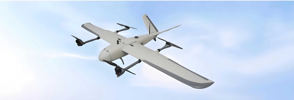
The rapid evolution of urban logistics demands innovative solutions to congestion, efficiency, and last-mile delivery challenges. The concept of logistics drones, particularly those utilizing Vertical Take-Off and Landing (VTOL) technology, has emerged as a transformative force. A VTOL drone offers significant advantages over traditional ground-based delivery: it bypasses surface traffic, operates with lower noise and emissions (especially in its electric eVTOL form), and can access difficult-to-reach areas. However, the safe, efficient, and scalable operation of a fleet of VTOL drones is not merely a matter of advanced aircraft; it critically depends on a robust, intelligent, and integrated ground infrastructure network—the vertiport system. Constructing this system requires moving beyond a component-focused view and adopting a systems thinking approach.
Systems thinking is a holistic and integrative discipline for seeing interrelationships and patterns of change rather than static snapshots. It emphasizes three core principles highly relevant to vertiport design: Hierarchy (the nesting of systems within systems), Wholeness (the emergent properties of the entire system that are not present in its isolated parts), and Interrelatedness (the dynamic connections and feedback loops between components and with the external environment). This article applies this lens to explore the construction of operation guarantee systems for logistics VTOL drone vertiports, arguing that success hinges on deliberate planning across hierarchical levels, integration of all physical and digital subsystems into a cohesive whole, and seamless interconnection with broader urban and technological ecosystems.
The operational workflow of a logistics VTOL drone mission is a closed-loop process that directly interfaces with and depends on the vertiport system at every stage. This workflow can be modeled as a sequence of interdependent states:
- Mission Planning & Assignment: An order is received, a suitable VTOL drone is assigned, and a flight path is dynamically planned considering weather, airspace restrictions, and vertiport availability.
- Pre-flight & Launch: The VTOL drone undergoes automated system checks at its origin vertiport, is loaded with cargo, receives final flight clearance from the network manager, and launches from a designated pad.
- En-route Flight: The VTOL drone navigates the approved corridor, continuously communicating its status, receiving updates, and performing automated obstacle avoidance.
- Approach, Delivery & Landing: The vehicle identifies the target vertiport, executes a precision approach, lands on a marked pad, may deliver its package via a mechanism (e.g., winch, container drop), and secures itself.
- Post-flight & Turnaround: The cargo is unloaded (if not delivered aerially), the VTOL drone‘s health data is uploaded, it undergoes automated diagnostics, is recharged or swapped, and prepared for its next mission.
This cycle highlights that the vertiport is far more than a landing pad; it is the node where physical handling, data exchange, energy management, and maintenance converge to enable the continuous flow of operations.
Hierarchy: Stratified Network Design for VTOL Drone Logistics
A systemic approach recognizes that a one-size-fits-all vertiport is inefficient. A hierarchical network structure, with different vertiport tiers serving distinct functions, optimizes flow, resource allocation, and scalability. This hierarchy aligns with the logistics supply chain, from long-haul transfer to hyper-local delivery. The classification can be structured across four primary tiers, as summarized in the table below.
| Vertiport Tier | Primary Function & Service Scope | Typical Location & Characteristics | Key Infrastructure Emphasis |
|---|---|---|---|
| Metropolitan Hub | Regional inter-city logistics gateway; bulk cargo sorting and transfer between major modes (air, rail, truck). | City periphery near highways, freight rail, or airports. Large footprint, dedicated airspace zones. | Multiple large pads, extensive cargo sorting facilities, high-capacity charging/swapping, major maintenance hangars, integration with ground freight terminals. |
| District Distribution Center | Intra-city logistics sorting and medium-range distribution; feeder from hubs to local stations. | Within urban logistics parks or industrial zones. Moderate footprint, connected to arterial roads. | Several medium pads, automated cargo transfer systems, storage buffers, fast-charging stations, basic maintenance. |
| Community Delivery Station | Last-mile and instant delivery launching point; serves a neighborhood or business district. | Rooftops of shopping malls, logistics depots, or dedicated plots in residential/commercial areas. | 2-4 small pads, secure package handling lockers, rapid charging points, minimal storage. |
| Micro Vertipoint | Ultra-last-meter delivery terminal; point-to-point drop-off for emergency or premium services. | Building parapets, parking lot corners, dedicated street furniture. Minimal footprint. | Single automated landing marker, possibly a delivery chute or winch system, no significant ground facilities. |
The flow of goods and VTOL drone movement between these tiers can be modeled. Let the demand for deliveries from a Hub \(H\) to a set of Community Stations \(C_i\) be \(D_{HC_i}\). The optimal number of District Centers \(D_j\) to intermediate this flow depends on minimizing total system cost, which includes flight distance cost and ground handling cost. A simplified model for routing could be:
$$ \text{Minimize } Z = \sum_{i} \sum_{j} ( \alpha \cdot d_{H \rightarrow D_j} \cdot x_{ij} + \beta \cdot d_{D_j \rightarrow C_i} \cdot y_{ij} ) + \sum_{j} \gamma \cdot F_{D_j} $$
Subject to:
$$ \sum_{j} x_{ij} = D_{HC_i} \quad \forall i $$
$$ \sum_{i} y_{ij} \leq \text{Capacity}_{D_j} \quad \forall j $$
Where \( \alpha, \beta \) are cost coefficients per unit distance for different leg types, \( \gamma \) is the fixed cost of operating a District Center \(D_j\), \( d \) represents distances, \( x_{ij} \) and \( y_{ij} \) are flow variables, and \( F_{D_j} \) is a binary variable for center activation. This hierarchical optimization is central to network efficiency.
Wholeness: Integrating Subsystems into a Cohesive VTOL Drone Vertiport Organism
The vertiport as a whole possesses capabilities greater than the sum of its parts. Its “wholeness” emerges from the deep integration of two core, mutually dependent macro-subsystems: the Physical Infrastructure Subsystem and the Digital Service & Assurance Subsystem.
Physical Infrastructure Subsystem: The Tangible Framework
This subsystem encompasses all hardware and civil engineering required to physically accommodate the VTOL drone. Standards, such as those outlined in CAAC’s Technical Requirements for Civil Vertical Take-off and Landing Sites, define critical areas. The core operational surface, often a Final Approach and Take-off (FATO) area, includes the Touchdown and Lift-off Area (TLOF) and safety perimeters. The system’s physical capacity can be approximated by analyzing the throughput of this area. For a vertiport with \(N\) TLOF pads, each requiring a service time \(t_s\) (including landing, unloading/loading, and take-off sequencing), the maximum theoretical throughput \( \lambda_{max} \) under ideal conditions is:
$$ \lambda_{max} = \frac{N}{t_s} $$
However, actual throughput \( \lambda_{actual} \) is reduced by variance in service time, weather holds (\(W\)), and air traffic management spacing (\(S\)):
$$ \lambda_{actual} = \lambda_{max} \cdot \eta_{W} \cdot \eta_{S} $$
where \( \eta_{W} \) and \( \eta_{S} \) are efficiency factors between 0 and 1.
Beyond the pads, the physical subsystem is comprehensive:
| Component Category | Specific Elements |
|---|---|
| Navigation & Visual Aids | Perimeter lighting, TLOF markings, wind cones, obstacle lighting. |
| Communication & Surveillance | Dedicated ground-to-air data links (e.g., 4G/5G C2), ADS-B receivers, local radar. |
| Passenger/Cargo Processing | (for future air taxi integration) Secure waiting lounges, baggage systems. For cargo: Automated sorting, temp-controlled storage, secure loading bays. |
| Energy Infrastructure | High-power charging stations, battery swapping robots, potential hydrogen refueling, on-site renewable generation (solar). |
| Maintenance & Storage | Hangars for overnight storage, workshops for repairs, de-icing facilities. |
| Safety & Security | Perimeter fencing, fire suppression systems (e.g., foam), emergency services access, cybersecurity for operational technology. |
Digital Service & Assurance Subsystem: The Neural Network
This “invisible” subsystem is the central nervous system that animates the physical hardware. It is epitomized by the Low-Altitude Flight Service Station (FSS), which acts as the node interfacing between the VTOL drone operator and the broader airspace management authorities. The FSS integrates several critical digital functions:
1. Flight Planning & Management: Processes and submits flight plans, checks for conflicts, and obtains dynamic airspace approvals (U-space services).
2. Real-Time Surveillance & Traffic Management: Fuses data from multiple sources (ADS-B, radar, network remote ID) to maintain a Common Operational Picture (COP) of all VTOL drones in the vicinity, providing separation services and conflict alerts.
3. Integrated Information Service: Disseminates real-time meteorological data (vertiport-specific wind shear, visibility), Notams (Notice to Airmen) for vertiport status, and geofencing updates.
4. Contingency & Emergency Management: Initiates alerting protocols in case of a VTOL drone emergency, coordinating with local Air Traffic Control and ground emergency services.
5. Data Analytics & Performance Monitoring: Aggregates operational data for predictive maintenance of VTOL drones, vertiport utilization analytics, and network optimization.
The interaction between a VTOL drone \(V\) and the FSS can be represented as a continuous data exchange loop. Let \( \vec{S}_V(t) \) represent the state vector of the VTOL drone at time \(t\), including position, velocity, battery level, and health status. The FSS maintains a system state matrix \( \mathbf{M}_{sys}(t) \) for all vehicles. The control law for safe navigation can be viewed as:
$$ \vec{u}_V(t) = f( \vec{S}_V(t), \mathbf{M}_{sys}(t), \vec{G}(t), \vec{W}(t) ) $$
Where \( \vec{u}_V(t) \) is the control input (guidance commands) to the VTOL drone, \( \vec{G}(t) \) is the geofencing and route constraint vector, and \( \vec{W}(t) \) is the real-time weather data vector. The function \(f\) is executed by the flight management system onboard the VTOL drone and the FSS in a synergistic loop.
Interrelatedness: The VTOL Drone Vertiport as an Urban and Technological Nexus
A systems thinker understands that no system is an island. The vertiport’s viability depends on its dynamic interrelationships with two key external systems: the Multimodal Surface Transportation Network and the National Digital Infrastructure Ecosystem.
Interrelationship 1: Fusion with Multimodal Transportation
The true value of a VTOL drone logistics network is unlocked when it is not a standalone silo but an integrated layer of urban mobility. This requires planning at two levels:
Internal Circulation: Within a large vertiport (e.g., a Metropolitan Hub), automated guided vehicles (AGVs) or conveyors must seamlessly move cargo between the VTOL drone pads, sorting facilities, and ground loading docks for trucks. The efficiency of this micro-logistics system directly impacts overall vertiport turnaround time \(t_s\).
External Connectivity: Vertiports must be sited and designed with “first and last meter” ground connectivity in mind. A District Distribution Center should have direct access to arterial truck routes. A Community Station might incorporate a dedicated curbside pickup/drop-off zone for electric vans or robots, creating a hybrid delivery model. The concept of “transfer impedance” \(I_t\) between the vertiport and other transport nodes (train station, highway ramp) must be minimized:
$$ I_t = w_1 \cdot T_{walk} + w_2 \cdot T_{vehicle} + w_3 \cdot C_{transfer} $$
where \(T\) represents time and \(C\) represents cost, weighted by coefficients \(w\). Successful integration, as piloted in “air-rail” projects, treats the VTOL drone leg as a fast, flexible feeder service to high-capacity ground corridors.
Interrelationship 2: Symbiosis with Advanced Digital Infrastructure
The performance of the vertiport’s Digital Subsystem is fundamentally enabled by and dependent on national-scale technological platforms.
| Enabling Technology | Role in VTOL Drone Vertiport Operations | Systemic Impact |
|---|---|---|
| 5G/6G Mobile Networks | Provides ultra-reliable, low-latency communication (URLLC) for real-time C2 links, high-bandwidth telemetry, and FSS data exchange. Enables dense VTOL drone operations in controlled airspace. | Reduces communication latency \( \tau_{comm} \), increasing safety margins and potential traffic density. Acts as a primary surveillance source (network remote ID). |
| BeiDou/GNSS Augmentation | Delivers centimeter-level positioning accuracy through PPP/RTK services, essential for precision approach, landing, and ground maneuvering of VTOL drones in complex urban canyons. | Minimizes navigation error \( \epsilon_{nav} \), allowing for smaller vertiport footprints and tighter operational tolerances. Critical for Required Navigation Performance (RNP) procedures. |
| Edge Computing & AI | Processes sensor data (e.g., for detect-and-avoid) and runs traffic management algorithms locally at the vertiport, reducing dependency on cloud latency for time-critical decisions. | Enhances the autonomy and resilience of the local vertiport system. Allows for real-time adaptive scheduling of VTOL drone arrivals/departures. |
| Cybersecurity Mesh | Protects the entire data lifecycle—from the VTOL drone‘s sensors to the FSS to air traffic control—against spoofing, jamming, and data breaches. | Ensures system integrity and trust, which are non-negotiable for public acceptance and regulatory approval of automated VTOL drone logistics. |
The resilience \(R\) of the vertiport system can be modeled as a function of the redundancy and robustness of these interrelationships:
$$ R = \sum_{i} ( \rho_{C_i} \cdot A_{C_i} ) + \sum_{j} ( \rho_{T_j} \cdot L_{T_j} ) $$
Where \( \rho_{C_i} \) is the reliability of communication link \(i\), \(A_{C_i}\) is its availability; \( \rho_{T_j} \) is the reliability of transport link \(j\), and \(L_{T_j}\) is its operational capacity. Strong, redundant interrelationships maximize \(R\).
Conclusion: Toward a Systemic Future for VTOL Drone Logistics
The realization of a scalable, safe, and efficient urban air logistics network hinges on the conscious application of systems thinking to vertiport design and operation. As demonstrated, this entails: (1) Embracing Hierarchy by structuring a multi-tiered network of vertiports, each optimized for its specific role in the logistics chain, from regional gateway to hyper-local terminal; (2) Engineering for Wholeness by seamlessly integrating the tangible physical infrastructure—with its pads, chargers, and hangars—with the indispensable digital service layer—the flight service station and its suite of data-driven management tools—so that they function as a single, intelligent organism; and (3) Fostering Dynamic Interrelatedness by deliberately weaving the vertiport into the fabric of the city’s multimodal transport system and anchoring its digital capabilities in the nation’s advanced communication, navigation, and computing infrastructures.
The VTOL drone is the vehicle, but the vertiport system is the enabling ecosystem. Its construction is not merely a civil engineering or IT project; it is a complex systems integration challenge. By viewing the vertiport through the lenses of hierarchy, wholeness, and interrelatedness, stakeholders—from urban planners and regulators to technology providers and logistics companies—can collaborate to build the robust, adaptive, and interconnected nodes that will form the backbone of the future low-altitude economy. The evolution of standards, operational protocols, and business models will continue, guided by this systemic perspective, to ensure that the infrastructure not only supports but accelerates the transformative potential of VTOL drone-based logistics.