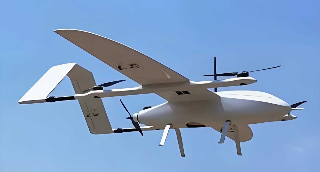
In recent years, the rapid advancement of technologies such as 5G, artificial intelligence, and the Internet of Things has spurred exponential growth in the logistics sector, accompanied by rising labor costs. The “last-mile” delivery problem in urban areas has become increasingly critical due to congested ground transportation networks. VTOL drones, with their compact size, high maneuverability, speed, and efficiency, offer a promising solution. Moreover, in contexts like pandemic containment, contactless delivery via VTOL drones can significantly reduce transmission risks. However, as the number of parcels and VTOL drones increases, the limited airspace and complex urban environments demand more sophisticated take-off and landing procedures. Simple vertical operations are insufficient to handle high traffic volumes. Therefore, designing efficient, comprehensive, and orderly VTOL drone procedures is paramount for the future of urban air mobility. In this paper, I present a structured approach to VTOL drone procedure design for urban logistics, drawing on standards from the International Civil Aviation Organization (ICAO) and the European Aviation Safety Agency (EASA), as well as traditional aviation flight procedure design principles.
The design of VTOL drone procedures must consider the integration of air route networks with terminal airspace, as well as the interface between final approach/take-off and ground infrastructure. Seamless connectivity between en-route and terminal airspace is crucial for operational efficiency, punctuality, and customer satisfaction. Ground infrastructure includes vertiports (or vertistops/vertipads) and communication, navigation, and surveillance (CNS) systems. Unlike conventional aviation with longer flights, urban air mobility involves shorter durations, making delays less tolerable. Thus, vertiport layouts should integrate charging facilities, intermodal transport links, and user interfaces efficiently. Vertiports can be mobile (e.g., vehicle-mounted) or fixed; for high-traffic scenarios, fixed vertiports are safer and more efficient. CNS can leverage Global Navigation Satellite Systems (GNSS), Automatic Dependent Surveillance-Broadcast (ADS-B), onboard cameras, and 5G technology. This paper focuses primarily on vertiport design and procedure development.
For air route networks, which are linear in nature, different routes converge at terminal airspace. When delineating terminal airspace, entry and exit points must be considered. I define nodes as designated airspace areas with favorable flight conditions, where VTOL drones can enter or exit. These nodes facilitate flow management, sequencing, and alleviation of terminal airspace congestion. In airspace-rich environments, multiple nodes can be established. Determining the connection characteristics between terminal airspace and adjacent en-route airspace, and designing appropriate nodes, are essential for creating resilient and scalable terminal airspace structures.
Ground infrastructure, particularly vertiports, involves the shape and size of take-off and landing platforms. The Final Approach and Take-off Area (FATO) must be sufficiently sized to allow VTOL drones to operate according to standard procedures. Due to downwash effects, a Safety Area (SA) should be delineated around the FATO. Based on EASA design requirements, the FATO width or radius should be 1.5D, and the surrounding SA width should be at least 3 meters or 0.25D, where D is the diameter of the smallest circle encompassing the horizontal projection of the VTOL drone. For multiple vertipads, operational modes akin to parallel runway operations can be adopted. I simplify the model to two vertipads to illustrate four operational modes: independent approach, dependent approach, independent parallel departure, and segregated parallel operations. These modes can be combined in larger vertiports to optimize efficiency based on airspace clearance, traffic flow, and ground conditions.
Several factors influence VTOL drone procedure design. Drone specifications, such as dimensions and motor axle distances, affect safety intervals and obstacle clearance requirements. Performance parameters, including maximum rotational angular velocity, climb/descent rates, wind tolerance, and horizontal speed, determine speed and gradient constraints critical for procedure design. Safety intervals in terminal airspace are derived from existing research on free airspace operations. For instance, longitudinal, lateral, and vertical separations for common VTOL drone models like the Phantom 4 or M600 Pro can be tabulated. These intervals ensure collision avoidance and operational safety.
| Drone Model | Longitudinal Separation | Lateral Separation | Vertical Separation |
|---|---|---|---|
| Phantom 4 | 8 | 5 | 3 |
| M600 Pro | 17 | 10 | 7 |
| M300 RTK | 13 | 7 | 5 |
| Mavic Air | 5 | 3 | 2 |
The procedure design for VTOL drones is divided into approach and departure procedures. The approach procedure includes initial approach, intermediate approach, final approach, and emergency alternates. The departure procedure mirrors the approach in reverse. I introduce the concept of slanted procedures rather than purely vertical ones, as slanted paths offer smoother transitions, longer distances for sequencing under high traffic, and shorter flight times closer to straight-line paths, enhancing system efficiency.
The initial approach segment begins at the initial approach fix (IAF) and ends at the intermediate approach fix (IF). At the IAF, the VTOL drone reports to the vertiport controller, who issues clearance for entry or holding instructions based on capacity. During this segment, the drone typically maintains level flight at en-route altitude, above minimum safe altitude, so obstacle clearance is not a concern. The intermediate approach segment starts at the IF and ends at the final approach fix (FAF). Here, the VTOL drone initiates a slanted descent with both horizontal and vertical components, adjusting speed, direction, and altitude to align with the vertipad. The FAF is usually located at the edge of the SA or FATO. Intermediate approach can be straight or curved, depending on terrain obstacles.
Obstacle clearance requirements for intermediate and final approach are defined using obstacle assessment surfaces (OAS). Based on ICAO and EASA standards, the protected area begins at the SA edge, with a width equal to the SA width, then expands laterally at a gradient of 10% for day operations and 15% for night operations. The centerline is perpendicular to the line through the vertiport center. The protected area expands until it reaches 7D for day and 10D for night, after which it remains constant. At this point, the VTOL drone should be approximately 152 meters above the vertipad. The descent gradient in the non-contracting phase is recommended at 8%. If an obstacle penetrates the OAS, a new gradient is calculated using the formula:
$$ \alpha = \arctan\left(\frac{1.008h_0}{d}\right) $$
where $\alpha$ is the gradient angle, $h_0$ is the obstacle height, and $d$ is the horizontal distance from the obstacle to the point where protected area width begins to contract. In the contracting phase, a steeper gradient of 16% is suggested. If obstacles exist, curved approaches or gradient adjustments are considered, with $d$ redefined as the distance to the FAF.
The final approach segment extends from the FAF to the center of the vertipad. During this segment, the VTOL drone aligns with the pad center, decelerates, and descends vertically to land. Obstacle clearance is ensured by the OAS from the intermediate phase. Considering terrain, a margin of 20 meters in the direction of motion and 5 meters in other directions is advised, accounting for the VTOL drone’s dimensions.
Departure procedures are essentially the reverse of approach, using the same OAS. Given the stable state of departing VTOL drones, simplified procedures can be designed, requiring only specified points to reach climb speeds. Minimum safety intervals are critical; for example, a separation of 26 meters in the direction of motion is recommended, with departure intervals of at least 10 seconds to ensure safety.
Missed approach procedures are necessary when landing is aborted due to unsafe conditions. At the landing decision point, if landing is not feasible, the VTOL drone follows a predefined missed approach trajectory, climbing to a safe speed before re-entering holding nodes or diverting to an alternate.
Emergency landing procedures are vital for VTOL drones experiencing failures or low battery. I propose two methods: one near holding nodes and another using alternate OAS. For holding nodes, a dedicated vertipad below the holding airspace allows emergency descent. For intermediate approach, an alternate OAS with a shallower angle enables rapid descent to an available vertipad. The choice depends on proximity and traffic density; the first method requires additional infrastructure but ensures safety in high traffic, while the second is cost-effective but demands pad availability.
To validate the designed procedures, I conduct simulations using the Anylogic platform, focusing on a vertiport at Nanjing University of Aeronautics and Astronautics. The environment includes a vertipad on a building rooftop, with clear airspace on one side. I select the DJI M600 Pro as a representative VTOL drone, with performance parameters as follows:
| Parameter | Value |
|---|---|
| Maximum Take-off Mass | 15.5 kg |
| Hovering Accuracy | ±0.5 m vertical, ±1.5 m horizontal |
| Maximum Climb Rate | 5 m/s |
| Maximum Descent Rate | 3 m/s |
| Maximum Horizontal Speed | 65 km/h (18 m/s) |
| Hovering Time | 16-38 minutes depending on payload |
For procedure parameters, let D = 5 m (considering cargo margins). Then, SA edge $d_{SA} = 1.5D = 7.5$ m. The first phase of intermediate approach has a gradient of 8%, expanding at 10% laterally until 7D. The horizontal distance $s_1$ is calculated as:
$$ s_1 = \frac{7D – 1.5D}{2 \times 0.10} = 131.25 \text{ m} $$
The height at the end of phase 1 is $h_1 = 5 + 0.08s_1 = 15.5$ m (assuming 5 m minimum hover height). Phase 2 has a gradient of 16% to reach 152 m, so distance $s_2$ is:
$$ s_2 = \frac{152 – h_1}{0.16} = 853.125 \text{ m} $$
Speed constraints are derived from maximum descent rates. For phase 1, vertical speed $v_{y1} = 3$ m/s, gradient $\alpha = \arctan(0.08)$, so resultant speed $v_1 = v_{y1} / \sin\alpha$. Horizontal component $v_{x1} = v_1 \cos\alpha$. Similarly for phase 2, $\beta = \arctan(0.16)$, $v_{y2} = 3$ m/s, $v_2 = v_{y2} / \sin\beta$, $v_{x2} = v_2 \cos\beta$. These must not exceed maximum horizontal speed $v_{xmax} = 18$ m/s. Calculations yield maximum speeds around 19 m/s. In simulations, initial speeds are set to 13-15 m/s, reducing to 6-8 m/s during final approach.
Simulation steps include: modeling approach segments based on calculated lengths and gradients; setting flight path logic; dividing holding airspace with three entry queues; applying flow restriction intensity $\mu$ (waiting time in seconds) to mimic traffic control; setting speed parameters with collision avoidance; and generating traffic as Poisson distributions with arrival rates $\lambda$ (drones per hour per direction). I test scenarios with $\mu = 0, 40, 80, 120$ seconds and $\lambda = 10, 20, 30, 40$ drones/h per direction, totaling 12, 24, 36, 48 drones/h overall. For each, 300 VTOL drone samples are run, recording time to complete approach.
Results show that with no restrictions ($\mu = 0$), average approach times remain stable across traffic densities, with low standard deviation. At $\mu = 40$ seconds, average times increase slightly with traffic, and variability grows. At $\mu = 80$ seconds, high traffic ($\lambda_{total} = 48$ drones/h) causes average times exceeding 1000 seconds, indicating system stress. At $\mu = 120$ seconds, the system becomes unstable for high traffic, with average times around 2000 seconds and high dispersion. For low to medium traffic ($\lambda_{total} \leq 36$ drones/h), the procedures remain robust even under moderate restrictions.
| Restriction $\mu$ (s) | $\lambda_{total} = 12$ drones/h | $\lambda_{total} = 24$ drones/h | $\lambda_{total} = 36$ drones/h | $\lambda_{total} = 48$ drones/h |
|---|---|---|---|---|
| 0 | 490 | 475 | 460 | 480 |
| 40 | 530 | 525 | 505 | 540 |
| 80 | 560 | 545 | 740 | 1050 |
| 120 | 600 | 595 | 710 | 2000 |
For departure procedures, simulations with departure intervals of 10, 15, 20, and 25 seconds show that average departure times remain consistent, with minimal variation, indicating that path choices do not interfere and VTOL drones can optimize their routes independently.
In conclusion, I have designed comprehensive VTOL drone procedures for urban logistics, encompassing approach, departure, missed approach, and emergency landing segments. The procedures leverage slanted paths for efficiency and are grounded in ICAO and EASA standards. Simulations demonstrate that these VTOL drone procedures perform stably under low to medium traffic and mild flow restrictions, but may experience delays under high traffic with strict controls. Future work should incorporate detailed air traffic management measures, ground infrastructure specifics, and heterogeneous VTOL drone fleets. Enhanced simulation tools could model individual drone dynamics for more precise analysis. A holistic evaluation framework covering safety, efficiency, and environmental impact will be crucial for advancing urban logistics with VTOL drones.