
The rapid proliferation of civil unmanned aerial vehicles (UAVs) has transformed industries from agriculture and logistics to emergency response and power inspection. However, this technological leap also introduces unprecedented threats to national security, public order, and individual privacy. As of January 1, 2024, the “Interim Regulations on the Flight Management of Unmanned Aircraft” explicitly assign public security organs 15 specific tasks across four major categories. In light of the increasingly complex and volatile landscape of civil UAV security, we must urgently construct and refine a new type of policing operation model to enhance our combat effectiveness. This paper examines the security risks posed by civil drones, identifies the regulatory dilemmas faced by law enforcement, and proposes a comprehensive control system that integrates technological, organizational, and legal measures. By leveraging multi-source data fusion, advanced detection techniques, and tiered response frameworks, we aim to establish a collaborative governance model led by public security organs for effective drone regulation.
1. Security Risks Associated with Civil Drones
Civil drones, while beneficial, introduce a spectrum of risks that demand rigorous drone regulation. These risks can be categorized into three domains: national security, public security, and personal security. The following table summarizes the primary risk types, typical scenarios, and their potential impacts.
| Domain | Risk Type | Example Scenarios | Impact |
|---|---|---|---|
| National Security | Espionage | Illegal filming of military bases, government facilities | Leakage of confidential information, intelligence gathering |
| Terrorist Attack | Drones carrying explosives targeting leaders or crowded events (e.g., 2018 Venezuela president assassination attempt) | Casualties, societal panic, disruption of governance | |
| Border Security | Smuggling of drugs, weapons, or assisting illegal migration | Weakening border control, increased crime flow | |
| Public Security | Civil Aviation Disruption | Drone incursions near airports (e.g., 2024 Tianjin airport incident causing 29 flight delays, 8 cancellations) | Flight safety hazards, economic losses, passenger inconvenience |
| Social Order Disturbance | Flying over large events, dropping propaganda leaflets (e.g., 2014 Serbia-Albania football match disruption) | Panic, interruption of events, political tension | |
| Traffic Interference | Collision with trains or vehicles (e.g., 2021 Chongqing metro collision) | Accidents, delays, infrastructure damage | |
| Personal Security | Privacy Invasion | Surveillance of private residences, tracking individuals (e.g., 2023 Hubei case of live-streaming women) | Violation of privacy, blackmail, cyberbullying |
| Physical Harm | Drone crashes causing injuries or property damage | Injuries, financial loss |
The probability of a drone-related incident can be modeled as a function of threat exposure, vulnerability, and countermeasure effectiveness. A simplified risk formula is:
$$ R = T \times V \times (1 – C) $$
where \( R \) is the risk level, \( T \) represents the threat probability (e.g., number of unauthorized drone flights per unit area), \( V \) is the vulnerability of the target (e.g., critical infrastructure density), and \( C \) is the coverage of drone regulation measures (e.g., detection and interception probability). This formula underscores the need for comprehensive drone regulation to reduce \( C \) towards 1, thereby minimizing residual risk.
2. Challenges in Effective Drone Regulation
Despite the legal mandate, public security organs face significant obstacles in implementing robust drone regulation. These challenges arise from technological, organizational, and legal gaps, as summarized in the table below.
| Challenge | Description | Impact on Regulation |
|---|---|---|
| Identification & Tracking Difficulty | Drones are small, fast, and use plastic materials; radar, optics, and spectrum analysis struggle with low-altitude, low-speed targets; stealth drones (no radio emission) are invisible. | Low detection probability, high false alarm rate, inability to track non-cooperative targets. |
| Lack of Countermeasure Technology at Grassroots | Most units only have handheld jammers; cannot counter frequency hopping, 4G-controlled, or pre-programmed drones; officers rely on visual observation. | Ineffective interdiction, passive response, legal risks due to unclear authority. |
| Poor Inter-Agency Coordination | Multiple stakeholders (military, civil aviation, public security, transport, agriculture) lack a unified data-sharing platform; internal public security departments (special police, public order) operate in silos. | Fragmented information, delayed response, duplicated efforts. |
| Inadequate Routine Supervision | Over 1.2 million registered drones in 2023; illegal assembly/modification is easy; “no application, no management” approach leaves many flights unmonitored. | High ratio of unregulated flights, difficulty in pre-emptive control. |
| Inconsistent Enforcement & Penalties | In one city (2022-2024), out of 50+ violations, only 2 fines and 1 detention; most cases result in warnings; low deterrence. | Weak deterrent effect, repeated offenses, public perception of low risk. |
To quantify the effectiveness of drone regulation, we define a detection-success probability model. The probability \( P_{\text{detect}} \) that a given drone is identified by a sensor network is:
$$ P_{\text{detect}} = 1 – \prod_{i=1}^{n} (1 – p_i) $$
where \( n \) is the number of sensors and \( p_i \) is the detection probability of the i-th sensor. For non-cooperative drones, typical \( p_i \) values for radar, optical, and RF sensors are low (0.3–0.6) under urban clutter, leading to overall detection probabilities below 0.8 even with multiple sensors. This highlights the need for advanced fusion techniques.
3. Construction of a Comprehensive Drone Regulation System
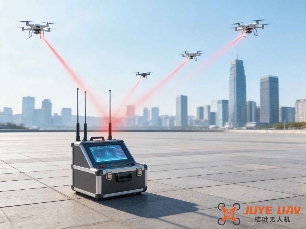
To address these challenges, we propose a multi-layered drone regulation system that integrates cooperative and non-cooperative target management. The system is built on six pillars: leadership, defense countermeasures, professional forces, basic supervision, training, and support. The following figure illustrates the conceptual architecture.
3.1 Leadership and Coordination System
A permanent inter-agency coordination mechanism should be established at provincial and municipal levels, led by a designated public security entity. Members include development & reform, transport, agriculture, culture, health, emergency, big data, and military units. This committee oversees information sharing, joint drills, and policy alignment. Internally, public security should adopt a “public order for basic control, special police for professional countermeasures, and all other departments for participation” framework, ensuring unified command.
3.2 Defense and Countermeasure System
We advocate a tiered deployment strategy: fixed defense at key sites, gradual coverage across the entire region, systematic deployment for major events, and targeted deployment for special operations. For cooperative targets (drones broadcasting remote ID), we deploy a city-level grid-based monitoring platform using Remote Broadcast Identification (similar to electronic license plates). For non-cooperative targets, we integrate Integrated Sensing and Communication (ISAC) technology, where 5G/6G base stations act as radars to detect drone position, velocity, and direction. The overall detection probability for a mixed environment can be expressed as:
$$ P_{\text{overall}} = \alpha \cdot P_{\text{coop}} + (1-\alpha) \cdot P_{\text{non-coop}} $$
where \( \alpha \) is the proportion of cooperative drones (targeted to exceed 80% through mandatory registration), \( P_{\text{coop}} \) is the detection probability using broadcast signals (typically >0.95), and \( P_{\text{non-coop}} \) is the probability using ISAC and other sensor fusion (aiming for >0.9). The goal is to achieve \( P_{\text{overall}} > 0.9 \).
The effectiveness of countermeasures (jamming, spoofing, kinetic interception) is captured by the interdiction success probability \( P_{\text{interdict}} \), which depends on the threat level and available means. For high-threat targets, we deploy directed-energy weapons; for low-threat, we use software-based takeover. A decision matrix is shown below.
| Threat Level | Detection Modality | Interdiction Means | Expected Success Probability |
|---|---|---|---|
| High (e.g., suspicious payload near VIP) | Radar+Optical+RF | Directed energy (laser/microwave) | >0.95 |
| Medium (e.g., drone in restricted zone without hostile intent) | RF/ISAC | GPS spoofing / frequency jamming | 0.85–0.95 |
| Low (e.g., hobbyist violating temporary no-fly zone) | Remote ID broadcast | Electronic warning / forced landing command | 0.98 |
3.3 Professional Force System
A three-tier force structure is recommended: at the municipal level, a specialized countermeasure squad under the special police; at the district level, a part-time team under the public order division; at the street level, a reserve team based in police stations. This ensures that every key target area has a designated responder. The total force size \( N \) required for a city is estimated by:
$$ N = \sum_{j=1}^{m} (k_j \times \lambda_j \times t_j) $$
where \( m \) is the number of risk zones, \( \lambda_j \) is the expected drone incident rate per hour in zone \( j \), \( t_j \) is the average response time (hours), and \( k_j \) is a staffing multiplier (typically 2–3 to cover shifts). For a large metropolis, this may require 200–500 trained officers.
3.4 Basic Supervision System
We must build two platforms: a “supervision platform” for cooperative targets and a “defense platform” for non-cooperative ones. The supervision platform should leverage “professional + mechanism + big data” policing. Regular ground surveys by community police will register drone owners, sellers, and trainers. AI-based databases will fuse multi-source data (registration, flight logs, social media) to pre-identify risky individuals. A graded duty management system will adjust patrol intensity based on real-time threat levels. The mathematical model for risk prediction uses logistic regression:
$$ \text{logit}(P_{\text{threat}}) = \beta_0 + \beta_1 x_1 + \beta_2 x_2 + \dots + \beta_n x_n $$
where \( x_i \) are features like flight history near sensitive sites, criminal record, drone modifications, etc. This enables proactive intervention.
3.5 Practical Training System
A comprehensive low-altitude policing curriculum should cover radio theory, sensor operation, visual identification, and electronic warfare. Use AI tools (DeepSeek, Manus) for scenario simulation. Regular “red-blue” exercises against cooperative and non-cooperative drones will refine tactics. The training effectiveness can be measured by the improvement in officer performance metrics, such as detection time \( T_{\text{det}} \) and interdiction success rate \( P_{\text{int}} \). We model learning curves as:
$$ P_{\text{int}}(n) = P_{\text{max}} – (P_{\text{max}} – P_0) e^{-kn} $$
where \( n \) is the number of training sessions, \( P_0 \) is initial performance, \( P_{\text{max}} \) is asymptotic performance, and \( k \) is the learning rate.
3.6 Support and Safeguard System
Human resources: recruit experts via special hiring channels. Technology: collaborate with industry and military to develop countermeasures against drone swarms and inertial-guided drones. Budget: secure annual funding for equipment procurement, maintenance, and R&D. The total budget \( B \) can be allocated as:
$$ B = C_{\text{sensors}} + C_{\text{interdiction}} + C_{\text{training}} + C_{\text{personnel}} $$
where each term is estimated based on coverage area and threat density. For a typical city with 3,000 km² urban area, annual investment may exceed $10 million.
4. Conclusion
Civil drone regulation is a critical enabler for the healthy development of the low-altitude economy. The challenges we face—from technological detection gaps to inconsistent enforcement—demand a systematic, data-driven approach. By building a multi-layered control system that combines cooperative target supervision with non-cooperative target defense, and by fostering inter-agency collaboration and professional training, we can significantly enhance our ability to preempt and respond to drone-related threats. The journey of drone regulation is long and evolving. We must continuously innovate, adopt advanced technologies such as AI and ISAC, and cultivate a culture of shared responsibility among all stakeholders. Only then can we ensure that the skies remain safe, secure, and conducive to both innovation and public order.
As we look ahead, the integration of drone regulation with broader smart city frameworks will be key. Future efforts should focus on standardizing remote ID protocols, expanding 5G-A coverage for ISAC, and establishing legal precedents for drone-related offenses. The ultimate goal is a resilient, adaptive drone regulation ecosystem that not only mitigates risks but also fosters trust and economic growth.