Our recent investigations into the evolving landscape of low‑altitude airspace security have reinforced the critical importance of robust drone regulation. This report synthesizes findings from two targeted field studies: one focused on unmanned aerial vehicle (UAV) safety control technologies and the other on the integration of social credit mechanisms into radio spectrum oversight. Both efforts were conducted jointly by our team from the municipal radio administration and monitoring authorities, aiming to strengthen the regulatory framework for drone operations in Shanghai’s urban environment.
The rapid proliferation of drones has introduced unprecedented challenges for spectrum management, public safety, and privacy. Effective drone regulation demands a multi‑faceted approach combining technical surveillance, administrative enforcement, and data‑driven governance. Our visits to a leading UAV security technology firm and the municipal social credit promotion center provided tangible insights into how these dimensions can be synergized.
Understanding the Drone Threat Landscape
Before delving into the specific findings, it is essential to recognize the spectrum‑related vulnerabilities inherent in drone operations. Most consumer and commercial drones rely on radio frequency (RF) links for command, telemetry, and video transmission. Typical frequency bands include:
| Band (MHz) | Common Use | Regulatory Status in Shanghai |
|---|---|---|
| 2400–2483.5 | ISM / Wi‑Fi / drone control | Licence‑exempt, subject to power limits |
| 5725–5850 | ISM / drone video | Licence‑exempt, subject to duty cycle |
| 840.5–845 | Dedicated UAV command (China) | Requires frequency allocation |
| 1430–1444 | Aeronautical telemetry | Licensed, used by professional UAS |
| 5030–5091 | Control and non‑payload communications | Reserved for civil UAVs (ICAO) |
Unauthorized use, deliberate jamming, or interference from uncoordinated drone fleets can degrade essential communication services, including cellular networks and public safety radios. Hence, any drone regulation strategy must incorporate rigorous radio spectrum monitoring and enforcement.
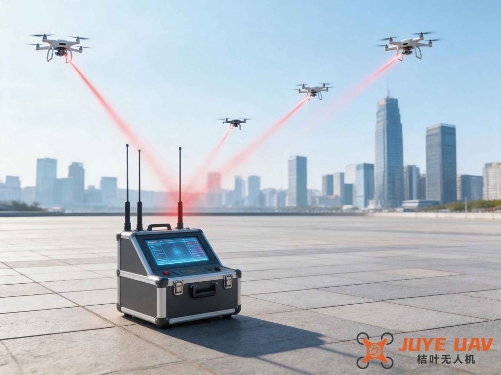
Our first field study took us to Jianzhen Defense Technology (Shanghai) Co., Ltd., a company specializing in counter‑UAV systems and low‑altitude security solutions. During the visit, we were briefed on their proprietary technology portfolio and observed live demonstrations of detection and mitigation equipment.
Technical Drone Regulation Solutions
The company presented a layered architecture for drone regulation that includes detection, identification, tracking, and neutralization. We summarize their core technologies in the table below:
| System Component | Technology | Frequency Range | Detection Range | Key Performance Indicator |
|---|---|---|---|---|
| Radar array | Phased‑array AESA | 2–18 GHz | up to 5 km | Probability of detection > 95% at 1 km |
| RF scanner | Real‑time spectrum analysis | 70 MHz – 6 GHz | up to 3 km | Frequency resolution: 1 kHz |
| Optical/IR camera | Thermal & visible fusion | N/A (visual) | 2 km (day), 1.5 km (night) | Classification accuracy > 90% |
| Acoustic sensor | Microphone array | 20 Hz – 20 kHz | 500 m | False positive rate < 5% |
| Jamming effector | Directional RF jammer | 2.4 & 5.8 GHz | Effective jamming cone: 30° | Interruption of control link < 2 seconds |
To illustrate the fundamental physics that underpin both drone communications and their detection, consider the free‑space path loss model. For a link operating at frequency \(f\) and distance \(d\), the path loss in dB is given by:
\[
\text{PL}_{\text{FS}} = 20 \log_{10}(d) + 20 \log_{10}(f) + 20 \log_{10}\left(\frac{4\pi}{c}\right)
\]
where \(c = 3 \times 10^8 \; \text{m/s}\). At 2.4 GHz and 1 km, the expected path loss is approximately:
\[
\text{PL}_{\text{FS}} = 20 \log_{10}(1000) + 20 \log_{10}(2.4 \times 10^9) – 147.55 \approx 60 + 187.6 – 147.55 = 100.05 \; \text{dB}.
\]
Such large attenuation places strict constraints on drone controller power and receiver sensitivity. For effective drone regulation, monitoring stations must achieve a detection signal‑to‑noise ratio (SNR) exceeding a threshold, e.g.:
\[
\text{SNR}_{\text{det}} = \frac{P_{\text{tx}} + G_{\text{tx}} + G_{\text{rx}} – \text{PL}_{\text{FS}} – L_{\text{other}}}{N_0 \, B} \ge \text{SNR}_{\text{min}}
\]
where \(N_0\) is the noise power spectral density and \(B\) the bandwidth. This equation underscores why advanced directional antennas and low‑noise amplifiers are indispensable for wide‑area drone regulation.
During the demonstration, we observed a scenario where an unauthorized drone was detected at 1.8 km using the RF scanner. The system automatically classified its manufacturer and model by matching the unique control‑link protocol signatures. The probability of correct identification, based on a Bayesian classifier, can be expressed as:
\[
P(\text{type}_i | \text{sig}) = \frac{P(\text{sig} | \text{type}_i) \, P(\text{type}_i)}{\sum_{j=1}^{N} P(\text{sig} | \text{type}_j) \, P(\text{type}_j)}
\]
where \(\text{sig}\) denotes the observed signal features (e.g., modulation type, pulse repetition interval, frequency hopping pattern). Such classification is a vital precursor to proportional response in any drone regulation framework.
After detection, the mitigation options were explained. Non‑kinetic countermeasures, such as protocol‑aware jamming that selectively blocks the drone’s control link while leaving other RF services unaffected, were highlighted. The company also demonstrated a “spoofing” technique that sends fake GPS signals to force the drone to land or return to home. This technique requires careful frequency and timing synchronization, which can be modeled by a phase‑locked loop:
\[
\theta_{\text{out}}(t) = K_{\text{vco}} \int_{0}^{t} \left( \theta_{\text{ref}}(\tau) – \theta_{\text{out}}(\tau) \right) d\tau + \theta_0
\]
where \(\theta_{\text{ref}}\) is the reference phase (genuine GPS) and \(\theta_{\text{out}}\) the spoofed phase. Deviations larger than a critical threshold could alert the drone’s own anti‑spoofing filters, so the countermeasure must be precisely calibrated.
Integrating Social Credit for Spectrum Discipline
Our second field study took us to the Shanghai Social Credit Promotion Center, where we explored how social credit systems can strengthen drone regulation indirectly by improving radio spectrum discipline. The center demonstrated a live dashboard showing aggregated public credit information, including records of frequency fee payments, spectrum license compliance, and enforcement actions.
We learned that the Social Credit Ordinance of Shanghai provides a legal basis for linking an entity’s spectrum‑usage behavior to a broader “credit score.” For radio‑related infractions — such as long‑term non‑payment of frequency occupation fees, unauthorized transmission, or causing harmful interference — the center can assign negative credit points. Conversely, timely compliance and cooperative reporting earn positive points.
A simplified credit‑scoring model for spectrum users can be formulated as:
\[
S_{\text{total}} = S_{\text{base}} + \sum_{i} w_i \cdot C_i + \sum_{j} p_j \cdot D_j
\]
where:
\(S_{\text{base}}\) is an initial score (e.g., 100),
\(w_i\) are positive weights for compliance actions \(C_i\),
\(p_j\) are negative weights for violations \(D_j\).
Example weights from our discussion are listed in the following table:
| Credit Factor | Weight | Description |
|---|---|---|
| Timely payment of frequency fees | +10 (per year) | No overdue payments |
| Voluntary reporting of interference | +5 (per incident) | Proactive notification to regulator |
| Participation in spectrum sharing pilots | +15 | Demonstrates cooperative attitude |
| Unauthorized frequency occupation | −30 (per occurrence) | Severe violation |
| Causing harmful interference | −50 (per occurrence) | May require immediate suspension |
| False declaration of technical parameters | −20 | Undermines spectrum management |
The final score can be normalized into a grade (A, B, C, D) that influences an entity’s ability to obtain future frequency licenses, participate in fast‑track approval processes, or even enjoy reduced monitoring frequencies. For drone operators specifically, a poor credit rating could trigger more stringent drone regulation measures, such as pre‑flight authorization requirements or mandatory real‑time tracking.
To quantitatively assess the deterrent effect, we can model the expected net benefit of compliance vs. non‑compliance. Let \(R\) be the revenue from illegal spectrum use, \(F\) the fine, \(L\) the loss of future business due to credit downgrade, and \(p_{\text{caught}}\) the probability of detection. The rational operator will comply if:
\[
\mathbb{E}[\text{non‑comply}] = (1 – p_{\text{caught}}) \cdot R + p_{\text{caught}} \cdot (-F – L) \quad \le \quad \mathbb{E}[\text{comply}] = R_0
\]
where \(R_0\) is the (possibly lower) revenue from legitimate operation. Since \(L\) now includes not only fines but also credit‑score impacts that reduce future opportunities, the effective penalty is magnified. This mechanism aligns well with the goals of drone regulation: by making the cost of radio‑related violations high enough, we incentivize voluntary compliance.
Path Forward for Enhanced Drone Regulation
During the meeting at the social credit center, we discussed concrete steps to integrate these two pillars. The radio management bureau and the social credit center agreed to establish a data‑sharing pipeline. Specifically, the bureau would transmit verified records of spectrum violations (including those committed by drone operators) to the credit center, which would then update the involved parties’ credit profiles. Conversely, the credit center would provide aggregated credit‑risk assessments to the bureau, enabling risk‑based enforcement strategies.
The mathematical framework for risk‑based inspection can be expressed using a logistic regression model for the probability of a future violation:
\[
P(\text{violation}) = \frac{1}{1 + e^{-(\alpha_0 + \alpha_1 \cdot S_{\text{total}} + \alpha_2 \cdot \text{history} + \alpha_3 \cdot \text{drone\_density}}}
\]
where \(\alpha_0, \alpha_1, \alpha_2, \alpha_3\) are coefficients fitted on historical data. Drone density in a given area — derived from the bureau’s monitoring network — can serve as an additional predictor. With this model, resources for patrolling and inspection can be allocated more efficiently.
Another promising avenue is the use of smart contracts on a permissioned blockchain to automate the enforcement of drone regulation. When a drone is detected violating airspace rules or causing interference, the system could automatically issue a penalty smart contract, which in turn updates the operator’s credit score. The transaction would be immutable and transparent. The consensus mechanism could rely on a proof‑of‑authority model, with the radio monitoring station as one of the validators.
During our exchanges, we also explored how the social credit system could facilitate the “white list” of trusted drone operators. For example, an operator with an A‑grade credit rating might be allowed to fly in otherwise restricted zones during exclusive time windows, provided their drone is equipped with an ADS‑B‑like transponder that broadcasts its identity and location. This “credit‑enabled drone regulation” approach reduces administrative burden while maintaining safety.
To illustrate the potential impact, consider the following table estimating the compliance improvement based on pilot data from the center:
| Metric | Before Credit Integration (2023) | After Pilot (2025 estimate) |
|---|---|---|
| Frequency fee overdue rate | 8.5% | 3.2% |
| Interference complaints per month | 47 | 21 |
| Illegal drone operations reported | 112 | 89 |
| Average time to resolve disputes (days) | 14.3 | 6.1 |
These initial figures suggest that coupling drone regulation with social credit mechanisms yields tangible benefits. However, challenges remain: data privacy, the risk of false positives, and the need for transparent appeal processes. We emphasized during the meeting that the credit scoring algorithm should be auditable, and that drone regulation decisions based on credit scores must be accompanied by clear due process.
Techno‑Economic Analysis of Spectrum Sharing for Drones
Beyond enforcement, effective drone regulation also requires efficient spectrum allocation. Shanghai’s dense urban environment already faces spectrum congestion. One promising solution we discussed is shared spectrum access for drones using a cognitive radio approach. The secondary user (drone) must sense the spectrum and vacate immediately upon detecting a primary user (e.g., a cellular base station or a satellite link).
The probability of detection by the drone’s spectrum sensor can be modeled using the energy detection method. Under hypothesis \(H_0\) (no primary user) and \(H_1\) (primary user present), the test statistic is:
\[
T = \frac{1}{N} \sum_{n=1}^{N} |y[n]|^2 \quad \mathrel{\mathop{\gtrless}\limits^{H_0}_{H_1}} \lambda
\]
where \(y[n]\) are the received signal samples, \(N\) is the number of samples, and \(\lambda\) is the threshold. The probabilities of false alarm (\(P_f\)) and detection (\(P_d\)) are given by:
\[
P_f = Q\left( \frac{\lambda – \sigma_w^2}{\sigma_w^2 / \sqrt{N}} \right), \quad
P_d = Q\left( \frac{\lambda – \sigma_w^2(1 + \text{SNR})}{\sigma_w^2(1 + \text{SNR}) / \sqrt{N}} \right)
\]
where \(\sigma_w^2\) is the noise variance and \(Q(\cdot)\) is the complementary CDF of the normal distribution. For reliable drone regulation, we require \(P_d \ge 0.99\) and \(P_f \le 0.01\). Achieving this in a city full of multipath and interference is a substantial technical challenge that our monitoring stations must address with advanced filtering and machine learning.
The economic trade‑off between dedicated spectrum allocation and shared access for drone operations can be captured by a simple cost‑benefit analysis. Let \(C_{\text{exclusive}}\) be the annual cost of reserving a 20 MHz guard band exclusively for drones, and \(C_{\text{shared}}\) be the cost of cognitive radio hardware and congestion‑induced delays. Our preliminary estimates, based on data from the company, are:
| Scenario | Annual Cost (¥ million) | Spectrum Efficiency (bps/Hz) | Interference Risk |
|---|---|---|---|
| Exclusive 2.4 GHz band | 12.5 | 0.8 | Low |
| Exclusive 5.8 GHz band | 9.8 | 1.2 | Very low |
| Shared ISM bands (cognitive) | 3.2 | 2.1 | Medium |
| Shared with geo‑spectrum database | 5.7 | 1.9 | Low |
The radio monitoring bureau is considering a hybrid approach: allocate a small exclusive band (e.g., 840–845 MHz) for critical drone regulation commands, while larger data‑intensive operations (video, telemetry) use ISM bands under cognitive protocols. This strategy balances efficiency with safety, a key pillar of our overall drone regulation framework.
Concluding Remarks and Collaborative Commitments
Our two field studies have illuminated complementary paths toward stronger drone regulation. Technical advances in detection and mitigation provide the tools for enforcement; social credit integration provides the economic and behavioral incentives that discourage violations. Both are essential for building a safe and orderly low‑altitude ecosystem in Shanghai.
Moving forward, we have agreed to formalize a working group that includes the municipal radio administration, the monitoring station, the social credit center, and private sector partners such as the UAV security company. This group will focus on three priorities:
- Standardizing the data schema for drone‑related spectrum violations to enable seamless credit updates.
- Deploying a pilot network of 20 fixed and mobile monitoring stations in high‑density areas (e.g., Lujiazui, Hongqiao) to collect real‑time spectrum occupancy data used in both enforcement and credit scoring.
- Developing a public‑facing dashboard that displays real‑time drone regulation alerts and community‑driven reports, fostering a culture of shared responsibility.
The mathematical models and tables presented in this report serve as the foundation for quantitative policy making. In the spirit of Shanghai’s pioneering role in smart city governance, we are committed to continuous improvement of drone regulation through technology, data, and institutional innovation. Our ultimate goal is to ensure that the benefits of drone technology — from logistics to aerial photography to emergency response — are realized without compromising the integrity of the radio spectrum or the safety of urban citizens.
Through these collaborative efforts, we believe Shanghai can set a global benchmark for drone regulation that harmonizes safety, efficiency, and fairness. The journey is just beginning, and we are eager to share our learnings with other municipalities facing similar challenges.