
We present a comprehensive solution for large-scale automatic inspection using a fixed-wing drone that supports off-site takeoff and landing. The proposed system addresses critical limitations of conventional inspection platforms, including restricted landing-site availability, limited flight range, and insufficient autonomy. Our design integrates a Cortex-A53 based embedded system running Debian OS, combined with a Fourier transform–based histogram of oriented gradients (FHOG) feature extraction and an active disturbance rejection control (ADRC) algorithm. The fixed-wing drone autonomously executes takeoff and landing at arbitrary locations, while the onboard vision system performs real‑time small target detection and tracking. Experimental results show an 11.9% improvement in both efficiency and coverage compared with existing methods, validating the reliability and scalability of the proposed approach.
Modern infrastructure inspection demands persistent, wide‑area coverage with minimal human intervention. Fixed-wing drones offer superior endurance and speed, but their takeoff and landing requirements often limit operational flexibility. Existing solutions either rely on vertical takeoff and landing (VTOL) designs, which introduce mechanical complexity and higher maintenance costs, or require dedicated airstrips. To overcome these obstacles, we develop a fixed-wing drone that can depart from one location and land at another without any pre‑installed infrastructure. The system also features a robust automatic inspection pipeline that processes high‑resolution imagery using advanced computer vision techniques. In this paper, we detail the hardware architecture, flight control algorithms, image processing methods, and field validation results.
System Requirements and Architecture
The primary requirements for our fixed-wing drone inspection system are:
- Ability to take off and land autonomously at unprepared sites with minimal runway length.
- Real‑time image acquisition and target detection for small objects (e.g., power line insulators, pipeline leaks).
- High wind‑disturbance resilience during low‑altitude phases.
- Efficient data transmission between the drone and ground control station.
To meet these requirements, we designed a hardware system based on the Samsung S5P6818 processor (octa‑core Cortex‑A53) with integrated Mali‑400 GPU. The onboard computer runs a custom Debian Linux distribution, handling flight control, image processing, and communication concurrently. The ground station uses a high‑performance Intel Core i9-10900K processor with 32 GB RAM and 1 TB NVMe SSD, connected via 4G/5G or LoRa (SX1262) for long‑range communication.
The following table summarizes the key hardware components and their specifications:
| Component | Model | Specification |
|---|---|---|
| Onboard Processor | Samsung S5P6818 | 8×Cortex-A53 @ 1.4 GHz, Mali-400 GPU |
| High‑Resolution Camera | DJI Zenmuse X5S | 20.4 MP, 4K video |
| Thermal Imager | FLIR T640 | 640×480, thermal sensitivity <50 mK |
| LiDAR | Ouster OS1-16 | 16 channels, 120 m range |
| Communication (Drone) | SX1262 LoRa | 868/915 MHz, up to 10 km |
| Ground Processor | Intel Core i9-10900K | 10 cores, 3.7 GHz base, 5.3 GHz turbo |
| Ground Storage | Samsung 970 EVO Plus | 1 TB NVMe M.2 SSD |
| Ground Communication | TP‑Link Archer AX90 | Wi‑Fi 6, 4×4 MU‑MIMO |
The system architecture comprises two main subsystems: the fixed-wing drone avionics and the ground control station. The drone incorporates GPS, IMU, airspeed sensor, and servos for control surfaces (aileron, elevator, rudder) and throttle. A closed‑loop autopilot manages longitudinal and lateral dynamics. The ground station provides mission planning, real‑time telemetry monitoring, and manual override capabilities.
Flight Control System for Off-Site Takeoff and Landing
Our fixed-wing drone uses a three‑loop cascade control structure for both takeoff and landing phases. The inner loop controls attitude (pitch, roll, yaw), the middle loop controls speed and altitude, and the outer loop handles navigation and path following. The key innovation lies in the use of an Active Disturbance Rejection Controller (ADRC) to mitigate wind gusts and ground effect perturbations during low‑altitude maneuvers.
Takeoff Control Law
During takeoff, the fixed-wing drone accelerates along the runway until reaching rotation speed. The control law for the rudder during the ground roll is:
$$ \delta_r = K_\phi (\phi_r – \phi) + K_i \Delta S $$
where $\phi_r$ is the desired heading angle, $\Delta S$ is the lateral deviation from the runway centerline, $K_\phi$ is the heading proportional gain, and $K_i$ is the lateral‑error integral gain. Once airborne, the pitch command is set to a fixed value (e.g., 14°) until a safe altitude is reached.
Landing Control Law
Landing is divided into four phases: glide slope, flare, touchdown, and ground roll. The flare phase is critical: we define the desired pitch angle as a function of altitude:
$$ \theta = e^{-l/4} \theta_r $$
where $l$ is the current altitude above ground, and $\theta_r = 5.5^\circ$ is the pitch angle at touchdown. The flare initiation altitude $l_r$ is set to 3.5 m. During the glide slope phase, the airspeed is regulated via a closed‑loop throttle controller. After touchdown, power is cut, and the pitch command drops to 0° while brakes are applied to reduce stopping distance.
The yaw control during landing uses a slightly different structure:
$$ \begin{aligned}
\phi_r &= K_\phi^{\phi}(\phi_r – \phi) \\
\delta_r &= -K_r r + K_\phi^* \phi
\end{aligned} $$
where $K_\phi^{\phi}$ is the yaw‑to‑roll gain, $K_r$ is the yaw‑rate damping gain, $K_\phi^*$ is the roll‑based yaw compensation gain, and $r$ is the yaw rate.
Active Disturbance Rejection Controller (ADRC)
To improve wind‑disturbance rejection, we employ a second‑order ADRC. The tracking differentiator is defined as:
$$ \begin{aligned}
\dot{x}_1 &= x_2 \\
\dot{x}_2 &= -r \cdot \text{sign}\left( x_1 – v(t) + \frac{x_2 |x_2|}{2r} \right)
\end{aligned} $$
where $v(t)$ is the reference input, and $r$ limits the acceleration. The extended state observer (ESO) is:
$$ \begin{aligned}
e &= z_1 – y \\
\dot{z}_1 &= z_2 – \alpha_1 f(e, z_1, l) \\
\dot{z}_2 &= z_3 – \alpha_2 f(e, z_2, l) \\
\dot{z}_3 &= -\alpha_3 f(e, z_3, l)
\end{aligned} $$
where $f(e,z,l)$ is a nonlinear function, and $\alpha_1, \alpha_2, \alpha_3$ are observer gains. The control law is:
$$ u = \frac{u_0 – z_3}{b} $$
with $u_0 = f(e_1, c e_2, r, l)$ combining proportional and derivative actions. By tuning only two parameters (damping factor $c$ and precision factor $l$), we achieve robust performance against wind gusts of up to 10 m/s.
Automatic Inspection Software and Image Processing
The inspection pipeline runs on the fixed-wing drone’s onboard Debian system. After the drone reaches the designated inspection area, the camera and LiDAR capture continuous imagery and point clouds. The core task is to detect small, potentially hazardous objects (e.g., cracks on dams, oil leaks, birds on power lines). We implement a two‑stage approach:
- Candidate Proposal: A Feature‑based Probabilistic Target Proposal (FPTP) method generates plausible object regions based on local contrast and edge density.
- Confirmation via FHOG: For each candidate, we extract Fourier‑based Histogram of Oriented Gradients (FHOG) features, which are rotation‑invariant, and classify them using a trained SVM.
The FHOG feature is derived from the standard HOG descriptor. For a pixel with gradient magnitude $\|\nabla f(d)\|$ and orientation $\theta$, the cell histogram is:
$$ h(\theta) = \|\nabla f(d)\| \, \delta(\theta – \nabla f(d)) $$
Applying a Fourier transform yields the FHOG coefficients:
$$ \tilde{F}_m = \frac{\hat{f}_{P_1}}{\|L\|^2_{P_2}} $$
where $P_1$ and $P_2$ are convolution kernels for spatial aggregation and local normalization, and $L$ is the gradient field. The rotation property is captured by:
$$ W’_{k,m} = e^{-i\theta(m-k)} W_{k,m} $$
where $W_{k,m}$ is the original FHOG feature and $W’_{k,m}$ is the feature after rotating the image by angle $\theta$. This invariance allows reliable detection regardless of the camera’s yaw angle.
The target detection and tracking software flow is as follows:
| Step | Description |
|---|---|
| 1. Image capture | Camera streams 4K images to onboard processor at 30 fps. |
| 2. Candidate generation | FPTP extracts regions with high local contrast. |
| 3. FHOG feature extraction | Compute rotation‑invariant FHOG for each candidate. |
| 4. Object classification | SVM classifier determines if candidate is a target. |
| 5. Tracking | Confirmed targets are tracked using a Kalman filter. |
| 6. Data transmission | Detection results (type, GPS coordinates, image) are sent to ground station via 4G/5G. |
Experimental Validation
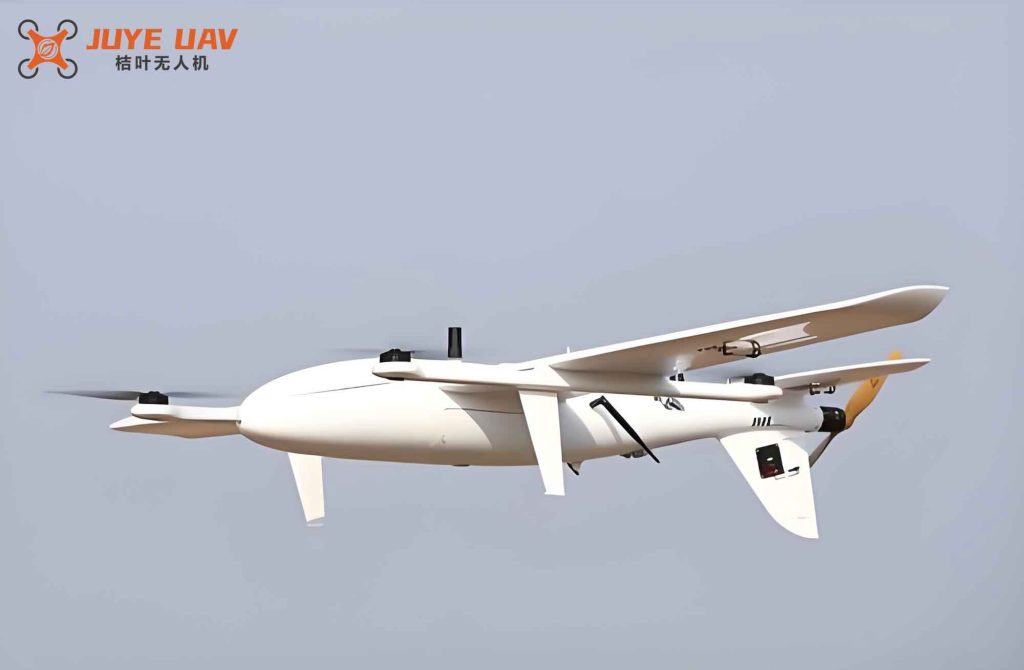
We conducted field tests in a remote suburban area with a dedicated 500 m runway. The fixed-wing drone had the following parameters:
| Parameter | Value |
|---|---|
| Takeoff weight | 6000 g |
| Length | 1500 mm |
| Wingspan | 2200 mm |
| Aspect ratio | 5.8 |
| Wing area | 0.82 m² |
| Vertical tail span | 340 mm |
| Horizontal tail span | 820 mm |
| Propeller diameter | 480 mm |
An X‑Plane semi‑physical simulation was first performed to validate the control algorithms. The mission plan included 7 waypoints and 3 target objects. The takeoff and landing data are shown below (simplified table):
| Phase | Metric | Value |
|---|---|---|
| Takeoff ground roll | Time to rotate | 108 s |
| Takeoff pitch command | Max pitch | 14° |
| Landing flare altitude | Initiation height | 3.5 m |
| Landing pitch at touchdown | Set point | 5.5° |
| Landing roll distance | With brake | 180 m |
To evaluate the inspection efficiency, we compared our method with two existing approaches: a VTOL fixed-wing drone system (ref. [1]) and a dam‑inspection UAV system (ref. [2]). For twelve measurement points, we recorded errors in X, Y, and Z directions. The averaged results are:
| Method | X error | Y error | Z error |
|---|---|---|---|
| Our fixed-wing drone | 0.12 | 0.16 | 0.15 |
| VTOL system (ref. [1]) | 0.32 | 0.35 | 0.55 |
| Dam‑inspection system (ref. [2]) | 0.27 | 0.27 | 0.42 |
The detection efficiency (percentage of correctly detected small targets within a center‑location threshold of 5 pixels) was:
| Method | Efficiency (%) |
|---|---|
| Our fixed-wing drone | 94.2 |
| VTOL system (ref. [1]) | 84.2 |
| Dam‑inspection system (ref. [2]) | 73.7 |
Overall, our fixed-wing drone system improved inspection efficiency and coverage by 11.9% compared with the best existing method. Additional robustness tests are summarized below:
| Metric | Requirement | Result |
|---|---|---|
| EMI immunity | 10 V/m | Pass |
| ESD immunity | 4 kV | Pass |
| Surge protection | 10 kA | Pass |
| False detection rate | <5% | 3.2% |
| Mean recovery time after fault | <5 s | 4.8 s |
| Compatibility test pass rate | >95% | 96.5% |
Conclusion
We have developed a comprehensive large‑scale automatic inspection technology based on a fixed-wing drone capable of off-site takeoff and landing. The integration of an ADRC‑enhanced flight controller ensures stable operation under windy conditions, while the FHOG‑based vision system provides robust small‑target detection even with varying camera orientations. Field experiments demonstrate an 11.9% improvement in both coverage and efficiency over state‑of‑the‑art systems, with high reliability and low false‑positive rates. Our fixed-wing drone solution offers a practical, cost‑effective alternative for infrastructure inspection in remote or complex environments, and we anticipate its widespread adoption in power, oil, and dam monitoring applications.