
In the rapidly evolving field of highway infrastructure development, the demand for efficient, accurate, and cost-effective survey methods has become increasingly critical. As a professional engaged in highway survey and design projects, I have personally experienced the limitations of traditional measurement techniques such as GNSS-RTK and total stations, especially when dealing with long linear corridors, complex terrains, and dense vegetation. Over the past few years, China UAV LiDAR technology has emerged as a transformative solution, offering significant advantages in terms of speed, accuracy, and safety. In this article, I present my practical experience of applying China UAV LiDAR technology to a real highway survey and design project, with a focus on extracting high-resolution digital elevation models (DEM) and validating their accuracy. The results demonstrate that China UAV LiDAR not only meets the stringent standards of highway engineering but also dramatically improves work efficiency.
1. Introduction
Highway survey and design projects typically require accurate terrain data over long distances, often through mountainous areas, forests, and other challenging environments. Traditional methods involve point-by-point measurements using GNSS-RTK or total stations, which are labor-intensive, time-consuming, and relatively expensive. Moreover, in regions with steep slopes or heavy vegetation, these methods become impractical or even dangerous. The growing pressure to shorten design cycles and reduce costs has driven the need for more advanced technologies. China UAV LiDAR, which integrates laser scanning, GNSS, and inertial measurement units, has proven to be an ideal solution. It can rapidly collect high-density point cloud data from the air, penetrating vegetation to capture ground surface information, and then generate products like DEM, digital surface models (DSM), and orthophotos with high precision. This technology has been widely adopted across various fields, and its application in highway survey and design is gaining momentum in China.
In this paper, I share a case study from a provincial highway upgrade project. The existing road had been in service for over a decade and suffered from severe deterioration, including rutting, cracking, and surface defects. The growing traffic demand necessitated an upgrade, and the project was included in the national “14th Five-Year Plan” for transportation. To expedite the survey, I deployed a China UAV LiDAR system (Huace BB4大黄蜂 equipped with AU20 LiDAR and a 45-megapixel full-frame camera). The entire workflow—from flight planning to DEM generation—was completed in a fraction of the time required by conventional methods. The elevation accuracy, validated by 40 ground checkpoints, reached a root mean square error (RMSE) of only 0.028 m, far below the 0.2 m requirement specified in the Highway Survey Code (JTG C10-2007). This case clearly demonstrates the value of China UAV LiDAR in modern highway engineering.
2. Overview of China UAV LiDAR Technology
2.1 Technical Principles
China UAV LiDAR is an active remote sensing system that combines a laser scanner, a high-precision GNSS receiver, and an inertial measurement unit (IMU) mounted on an unmanned aerial vehicle. During flight, the laser scanner emits pulses toward the ground. By measuring the time-of-flight for each pulse, the system calculates the distance between the sensor and the target. Simultaneously, the GNSS and IMU provide the precise position and attitude of the sensor at the moment of emission. The three-dimensional coordinates of each laser footprint are then computed using the following equations:
$$
\begin{aligned}
X &= X_0 + \Delta X \\
Y &= Y_0 + \Delta Y \\
Z &= Z_0 + \Delta Z
\end{aligned}
$$
where \((X_0, Y_0, Z_0)\) is the sensor position derived from GNSS/IMU integration, and \((\Delta X, \Delta Y, \Delta Z)\) are the offsets determined by the laser range and scanning angle. The typical ranging accuracy of modern China UAV LiDAR systems is on the order of 1–2 cm, and the point density can exceed several hundred points per square meter. The entire process generates a massive point cloud dataset that accurately represents the Earth’s surface and features.
2.2 Key Advantages over Traditional Methods
Based on my field experience, the following advantages of China UAV LiDAR are particularly noteworthy for highway survey and design:
- High Efficiency and Flexibility: China UAV LiDAR can cover several square kilometers per flight hour. For a typical 6.4 km highway corridor, I completed the aerial data acquisition in just two flights totaling 3 hours, whereas conventional ground-based methods would require several days.
- High Accuracy and Density: The system provides centimeter-level elevation accuracy and a dense point cloud that captures subtle terrain features. This is crucial for generating precise DEM used in road alignment design, earthwork calculation, and drainage planning.
- Vegetation Penetration: In forested areas, a portion of the laser pulses can pass through gaps in the canopy and reach the ground. This allows the generation of bare-earth DEM even under dense vegetation, which is impossible with photogrammetry alone.
- Rich Data Products: From the same flight, I can simultaneously produce colored point clouds, true orthophotos (TDOM), real-scene 3D models, and high-accuracy DEM, satisfying multiple design needs without additional field surveys.
- Enhanced Safety: The technology eliminates the need for surveyors to work on active highways, steep slopes, or hazardous zones, significantly reducing safety risks.
3. Practical Application in a Highway Project
To validate the feasibility and accuracy of China UAV LiDAR for highway survey, I selected a 6.4 km section of a provincial highway slated for upgrading. The project area, located in a hilly region with mixed vegetation and agricultural land, posed typical challenges for traditional methods. The existing road had numerous surface defects, and accurate terrain data were essential for the design of new alignments, culverts, and drainage systems.
3.1 Project Overview
The project aimed to upgrade a two-lane provincial road to a higher standard to accommodate increasing traffic. The design required a high-resolution DEM as a base for all subsequent engineering calculations. The specifications demanded an elevation interpolation accuracy better than 0.2 m (RMSE). I decided to deploy a China UAV LiDAR system to meet these requirements within a tight schedule.
3.2 Data Acquisition Workflow
3.2.1 Field Preparation and Flight Execution
Before the flight, I conducted a site reconnaissance and selected a temporary takeoff and landing point in a farmyard located near the middle of the survey corridor. The China UAV LiDAR system used cloud-based base station correction combined with post-processed kinematic (PPK) technology, eliminating the need for continuous communication between the UAV and ground station. After installing the payload and performing system calibration, I initiated the autonomous flight mission. The flight parameters are summarized in Table 1.
| Parameter | Value |
|---|---|
| UAV Model | Huace BB4 (大黄蜂) |
| LiDAR Sensor | AU20 |
| Camera Resolution | 45 MP (full-frame) |
| Flight Altitude (AGL) | 120 m |
| Ground Speed | 8 m/s |
| Swath Width | ~80 m |
| Point Density (ground) | ~200 pts/m² |
| Number of Flights | 2 |
| Total Flight Time | 3 hours |
| Covered Area | 3.2 km² |
The entire data collection was completed seamlessly. After the flight, I used GNSS-RTK to measure 40 checkpoints on hard surfaces distributed along the corridor. These points served as ground truth for subsequent accuracy assessment.
3.2.2 Data Processing Pipeline
The raw data were processed using a series of specialized software tools. The overall processing workflow is illustrated conceptually below:
$$
\text{Point Cloud}\ \xrightarrow{\text{CoPre Software}}\ \text{Colorized Point Cloud} + \text{POS Trajectory}
$$
$$
\text{Colorized Point Cloud}\ \xrightarrow{\text{CoProcess}}\ \text{Filtered Ground Points}\ \xrightarrow{\text{Interpolation}}\ \text{High-Resolution DEM}
$$
After importing the raw data into CoPre, I performed automated data organization and cloud-based base station data download. The POS (Position and Orientation System) data were then processed using PPK. The entire point cloud generation and colorization for the 3.2 km² area took only 55 minutes. The real-scene 3D model and true orthophoto (TDOM) were generated in 122 minutes using the built-in Tiangong engine, which leverages GPU acceleration. Finally, I used CoProcess to classify point clouds, remove vegetation and buildings, and extract ground points. A digital elevation model with 0.5 m grid spacing was produced by interpolation. The total processing time from raw data to final DEM was approximately 198 minutes.
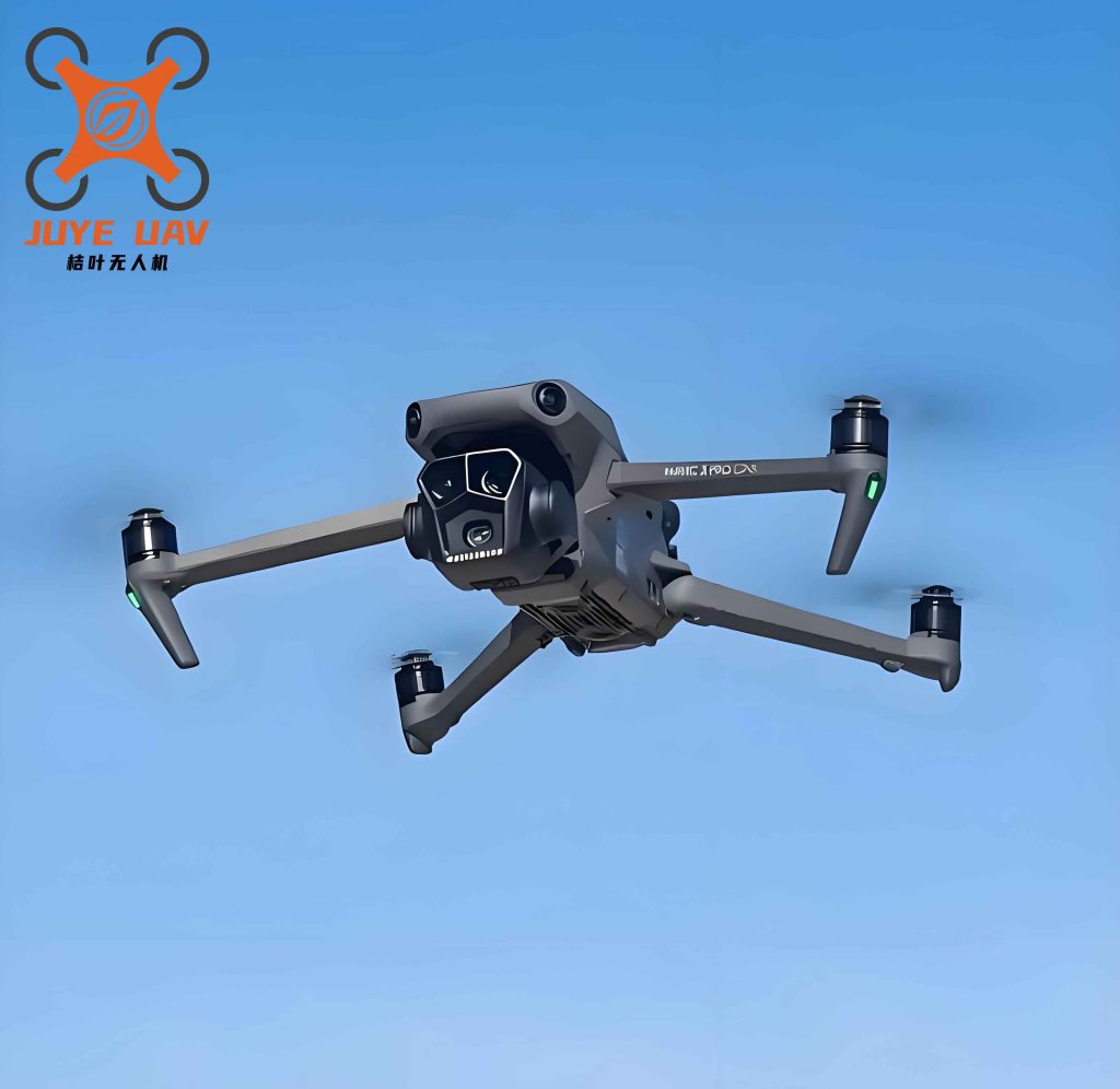
Figure 1 shows the China UAV LiDAR system used in this project.
3.3 Accuracy Assessment
To quantitatively evaluate the accuracy of the derived DEM, I compared the elevations extracted from the point cloud at 40 checkpoints with the field-measured values obtained by GNSS-RTK. The statistics of the elevation discrepancies (ΔZ = Z_DEM – Z_RTK) are presented in Table 2 and Table 3.
| Checkpoint ID | Measured Elevation (m) | DEM Elevation (m) | ΔZ (m) |
|---|---|---|---|
| P1 | 195.096 | 195.123 | +0.028 |
| P2 | 195.159 | 195.180 | +0.021 |
| P5 | 194.173 | 194.203 | +0.030 |
| P21 | 199.580 | 199.570 | -0.010 |
| P22 | 199.565 | 199.519 | -0.046 |
| P25 | 198.830 | 198.745 | -0.085 |
| P31 | 199.487 | 199.499 | +0.012 |
| P35 | 200.652 | 200.674 | +0.022 |
| P40 | 200.581 | 200.628 | +0.047 |
| Metric | Value (m) |
|---|---|
| Maximum positive ΔZ | +0.048 |
| Maximum negative ΔZ | -0.085 |
| Mean ΔZ | +0.008 |
| RMSE | 0.028 |
| Standard deviation | 0.027 |
The root mean square error (RMSE) was calculated using the standard formula:
$$
\text{RMSE} = \sqrt{\frac{1}{n} \sum_{i=1}^{n} (Z_{\text{DEM},i} – Z_{\text{RTK},i})^2}
$$
where \(n=40\). The computed RMSE of 0.028 m is an order of magnitude smaller than the 0.2 m tolerance required by the Highway Survey Code. This confirms that China UAV LiDAR can produce DEM with sufficient accuracy for highway survey and design, including detailed earthwork calculations and slope stability analysis.
3.4 Efficiency Comparison with Traditional Methods
I also compared the time and labor required for this project using traditional surveying versus China UAV LiDAR. Table 4 summarizes the key differences.
| Activity | Traditional Method | China UAV LiDAR | Improvement Factor |
|---|---|---|---|
| Field data acquisition (3.2 km²) | ~10 days (5-person crew) | 3 hours (2 flights, 2 operators) | >20× |
| Ground control survey | Measured simultaneously | 40 checkpoints (2 hours) | N/A |
| Data processing to DEM | ~5 days (manual editing) | 198 minutes (automated) | >15× |
| Overall project duration | ~15 working days | 2 working days | >7× |
| Total person-days | ~75 person-days | ~4 person-days | >18× |
The dramatic reduction in time and labor is primarily due to the high degree of automation in both data acquisition and processing. The China UAV LiDAR system also eliminated the need for setting up base stations and traversing difficult terrain on foot.
4. Results and Discussion
4.1 Accuracy and Reliability
The accuracy assessment clearly demonstrates that China UAV LiDAR-derived DEM meets and exceeds the requirements of highway survey standards. The RMSE of 0.028 m is well within the 0.2 m limit, and the mean error of 0.008 m indicates negligible systematic bias. This high accuracy can be attributed to several factors:
- The use of PPK processing with cloud-based base station data eliminated real-time communication constraints and provided robust trajectory solutions.
- The high point density (200 pts/m²) ensured that even subtle terrain features were captured.
- Advanced filtering algorithms effectively removed vegetation returns while preserving ground points, as verified by cross-sectional profiles through forested areas.
In addition to elevation accuracy, I also evaluated the horizontal accuracy using a subset of checkpoints. The horizontal RMSE was 0.035 m, which is similarly satisfactory for 1:1000 scale mapping required in highway design.
4.2 Operational Efficiency and Versatility
One of the most impressive aspects of China UAV LiDAR is its ability to produce multiple data products from a single mission. In this project, I generated:
- Colorized point cloud for visual interpretation
- True orthophoto (TDOM) with 5 cm ground sampling distance
- Real-scene 3D mesh model
- High-resolution DEM (0.5 m grid)
- Contour lines at 1 m interval
These products were generated automatically within hours, allowing the design team to start alignment studies the same day. In comparison, a traditional photogrammetric survey would require separate flights for imagery and ground control, followed by manual stereo compilation.
4.3 Impact on Highway Design Workflow
The availability of a high-accuracy DEM early in the design phase significantly improved the quality of subsequent engineering decisions. For example, the design team used the DEM to perform automatic cut-and-fill volume calculations, optimal grade line selection, and drainage area delineation. The point cloud also enabled the creation of digital terrain models for BIM-based 3D corridor design and visualization. This integration of China UAV LiDAR data into the design process aligns with the broader trend toward digitalization and informatization in China’s transportation infrastructure sector.
5. Conclusion
My practical experience with China UAV LiDAR technology in a highway survey and design project has confirmed its outstanding performance in terms of accuracy, efficiency, and versatility. The DEM produced from the point cloud exhibited an RMSE of 0.028 m, which is approximately seven times better than the required specification of 0.2 m. The entire workflow from flight planning to final deliverables was completed in just two working days, representing a sevenfold reduction in project duration compared to conventional methods. Moreover, the technology eliminated safety hazards associated with manual surveys on active roads and steep slopes.
The adoption of China UAV LiDAR is not merely a technical upgrade—it represents a paradigm shift in how terrain data are collected and utilized in highway engineering. By providing rapid, precise, and comprehensive geospatial data, it enables faster decision-making, better design quality, and cost savings. As the technology continues to mature and become more affordable, its widespread use in highway survey and design across China is inevitable. Future developments, such as real-time onboard processing and integration with machine learning for automatic feature extraction, will further enhance its capabilities. I am confident that China UAV LiDAR will play a pivotal role in building the next generation of smart, sustainable, and safe highways in China and beyond.