
The history of coordinated unmanned aerial vehicle (UAV) flight, or drone formation, is a narrative of evolving ambition and technological maturation. While the concept of using multiple drones in a cohesive unit dates back to early reconnaissance and target identification missions, the technological limitations of the early 20th century constrained operations to solitary vehicles. It was not until the 1960s, with projects like the U.S. deployment of “Firebee” drone formations in the Vietnam War, that the paradigm began to shift towards true collaborative autonomy. Today, drone formations are a cornerstone of modern military strategy, performing complex roles in joint operations across all domains. Beyond defense, the proliferation of advanced technologies—notably artificial intelligence, autonomous flight, and adaptive control—has unlocked unprecedented capabilities, pushing formation flight into the forefront of civilian and commercial applications, most spectacularly in the globally popular formation drone light show.
The advantages of formation flight over single-drone operations are multifaceted. A formation provides a vastly expanded sensor footprint and field of view, enabling faster, more precise surveillance and search patterns. The collaborative nature inherently enhances mission safety and robustness; drones within the formation can provide mutual support, ensuring mission continuity even if individual units encounter failures. This is particularly critical in time-sensitive scenarios like major disaster relief, where formations can rapidly deploy to provide real-time situational awareness and decision support. At the heart of these capabilities lies a fundamental challenge: precise relative localization. To maintain stable, collision-free geometries while executing complex maneuvers, each drone must have an accurate and reliable understanding of its position relative to its neighbors and the environment. Scholars have extensively categorized this formation control problem based on the agents’ perceptual and interactive capacities, leading to three primary formulations: position-based, displacement-based, and distance-based control, each with its own suite of solutions.
The technological foundation for solving these problems rests on two distinct philosophical approaches to localization: active and passive. The choice between them significantly impacts the formation’s performance, stealth, and applicability.
The Duality of Localization: Active vs. Passive Sensing
Active localization technology is the more direct approach. In this paradigm, drones within a formation determine their relative positions by actively emitting signals—such as radio waves, acoustic pulses, or laser light—and analyzing the reflected returns from other drones or fixed beacons. By measuring time-of-flight, time difference of arrival (TDOA), frequency shifts, or other signal characteristics, precise range and bearing information can be calculated. This method integrates seamlessly with onboard navigation systems (like GPS/INS) and communication links, forming a comprehensive, high-precision monitoring and control system. Its primary strengths are high accuracy and rapid response, enabling real-time tracking essential for dynamic formations. However, this strength is also its primary vulnerability. The necessity to actively radiate electromagnetic or acoustic energy makes the formation detectable, susceptible to electronic warfare tactics like jamming and spoofing, and ultimately reveals its presence and location.
In stark contrast, passive localization operates on the principle of silent observation. A passively localizing drone formation does not emit any signals of its own. Instead, each agent positions itself by listening to and processing signals emanating from the environment or from other members of the formation. These signals can be external, such as ambient radio frequency broadcasts, cellular tower signals, or signals of opportunity, or internal, such as communicated state information (e.g., GPS coordinates shared over a secure datalink). The core advantage is supreme stealth and resilience to interference; since the formation is not broadcasting, it is exceptionally difficult to detect, track, or jam. This makes passive localization ideal for covert surveillance, electronic intelligence (ELINT) missions, and operations in contested electromagnetic environments. Furthermore, it offers excellent cost-effectiveness and lower power consumption. The principal challenge, however, is that passive systems are inherently “observationally deficient”—they often lack direct range information, relying on complex angle-of-arrival (AOA) or time-difference processing, which can lead to geometric dilution of precision (GDOP), slower convergence, and potential filter divergence if not carefully managed.
The table below summarizes the key characteristics of both approaches, highlighting their suitability for different mission profiles, including the demanding requirements of a large-scale formation drone light show.
| Localization Type | Core Principle | Key Advantages | Primary Disadvantages | Typical Application Context |
|---|---|---|---|---|
| Active Localization | Emit signal and analyze reflection/response. | High precision, fast response, works in signal-devoid environments, enables direct ranging. | Easily detectable, susceptible to jamming/spoofing, emits energy. | Close-range precision inspection, indoor swarm navigation (with UWB), controlled test environments. |
| Passive Localization | Listen to ambient or peer signals without emission. | High stealth/low probability of intercept, strong anti-jamming capability, cost-effective, energy-efficient. | Observational deficiency (no direct range), potential for lower accuracy/filter divergence, dependent on external signal sources. | Covert military surveillance, electronic warfare, public spectacles like formation drone light show, GPS-denied navigation using signals of opportunity. |
Given the increasing emphasis on operational security, electromagnetic spectrum management, and the specific need for non-interference in crowded civilian airspace (e.g., during a formation drone light show), research into robust passive localization methods has intensified. The remainder of this article focuses on surveying the principal decentralized, passive localization and control methodologies that enable sophisticated UAV formation flight.
A Survey of Passive Formation Control Methodologies
Passive formation control is fundamentally a distributed estimation and consensus problem. Each drone, acting as an autonomous agent, must estimate the state of the formation (its own position and the relative positions of neighbors) using only information obtained passively or through limited, non-ranging communication. The control law must then drive the agents to achieve and maintain a desired geometric configuration. Mature and stable approaches can be broadly classified into the following categories.
1. Leader-Follower (Master-Slave) Architecture
This method imposes a hierarchical structure on the formation. One or more designated “leader” drones are responsible for trajectory planning and broadcasting high-level command signals (e.g., desired velocity, heading, or path waypoints). The “follower” drones receive these commands and implement control laws to maintain a pre-defined relative offset ($$ \Delta x_i, \Delta y_i, \Delta z_i $$) from their assigned leader. The kinematic model for a follower $$ i $$ tracking a leader $$ L $$ can be simplified as:
$$ \dot{p}_i = u_i $$
$$ u_i = K_p (p_L + r_{i}^{des} – p_i) + K_v (\dot{p}_L – \dot{p}_i) $$
where $$ p_i $$ and $$ p_L $$ are the positions of the follower and leader, $$ r_{i}^{des} $$ is the desired relative position vector, and $$ K_p, K_v $$ are control gains.
Advantages: The structure is conceptually simple, easy to implement, and reduces overall communication complexity as followers only need data from their leader.
Disadvantages: The formation’s integrity is critically dependent on the reliability of the leader(s). A leader failure can cause the entire sub-formation to collapse. Furthermore, errors in the leader’s state estimation propagate directly to all followers. This method is often seen in simpler formation drone light show setups where a ground control station acts as the absolute leader.
2. Virtual Structure Approach
In this method, the entire formation is treated as a single, rigid virtual body. A desired geometric shape (the virtual structure) is defined in a reference frame. Each drone is assigned to a specific control point on this structure. The control objective for each drone is to make its position $$ p_i $$ converge to and track its assigned point $$ p_i^{vs} $$ on the moving virtual structure. The dynamics involve controlling the translation, rotation, and possibly scaling of the virtual structure:
$$ p_i^{vs}(t) = R(\theta(t)) \cdot s(t) \cdot p_i^{vs}(0) + p_c(t) $$
where $$ p_c(t) $$ is the structure’s centroid, $$ R(\theta) $$ is a rotation matrix, and $$ s(t) $$ is a scaling factor. The drone’s control input is then:
$$ u_i = K (p_i^{vs}(t) – p_i) $$.
Advantages: Provides precise and rigid formation shape control, which is ideal for creating and holding complex static or slowly evolving patterns—a perfect fit for aerial displays in a formation drone light show where logos or text must be perfectly formed.
Disadvantages: It is a centralized concept in nature; calculating and communicating the transformed coordinates $$ p_i^{vs}(t) $$ to all drones requires a reliable, high-bandwidth communication network and significant central computation. It lacks flexibility for rapid, adaptive reconfiguration.
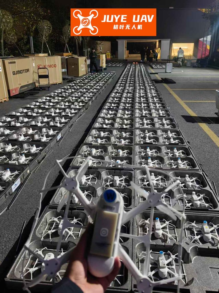
3. Behavior-Based (Bionic) Methods
Inspired by the emergent, coordinated behaviors of biological swarms (flocks of birds, schools of fish), this approach decomposes the formation control objective into a weighted sum of several elementary behaviors. Each drone independently calculates its control input based on a combination of these behaviors, using only local sensor and neighbor information. Common behaviors include:
- Separation: Avoid collisions with nearby drones. $$ u_{sep} = – \sum_{j \in N_i} \nabla V( \| p_i – p_j \| ) $$, where $$ V $$ is a repulsive potential function.
- Alignment: Match velocity with neighbors. $$ u_{align} = \frac{1}{|N_i|} \sum_{j \in N_i} (v_j – v_i) $$.
- Cohesion: Move towards the centroid of local neighbors. $$ u_{coh} = \frac{1}{|N_i|} \sum_{j \in N_i} (p_j – p_i) $$.
- Goal Attraction: Move towards a target location.
The total control is $$ u_i = w_{sep}u_{sep} + w_{align}u_{align} + w_{coh}u_{coh} + w_{goal}u_{goal} $$.
Advantages: Highly decentralized, robust to individual failures, and exhibits emergent adaptive properties well-suited for complex, dynamic environments like terrain following or obstacle-rich spaces.
Disadvantages: The final formation geometry is an emergent property, not explicitly guaranteed, making it difficult to achieve and maintain a specific, precise pattern. Tuning the behavior weights $$ w $$ is non-trivial and can lead to unstable group dynamics. This is less common in precision formation drone light show applications.
4. Graph-Theoretic and Consensus-Based Control
This is a rigorous mathematical framework where the formation is modeled as a dynamic graph $$ G = (V, E) $$. Drones are vertices ($$ V $$), and communication/sensing links are edges ($$ E $$). The adjacency matrix $$ A $$ and the Laplacian matrix $$ L $$ of the graph encode the interaction topology. Formation control is framed as a consensus or agreement problem. The core idea is that drones reach an agreement on a shared state (like relative position or velocity) through local interactions. A fundamental linear consensus protocol for velocity is:
$$ \dot{v}_i(t) = – \sum_{j \in N_i} a_{ij} ( (p_i(t) – p_j(t)) – d_{ij} ) $$
where $$ a_{ij} $$ are elements of the adjacency matrix, and $$ d_{ij} $$ is the desired relative displacement vector between drone $$ i $$ and $$ j $$. For distance-based control (a purely passive relative measurement scenario), the control law might aim to regulate the squared distance between agents to a desired value:
$$ u_i = \sum_{j \in N_i} ( \| p_i – p_j \|^2 – d_{ij}^2 ) (p_j – p_i) $$.
Advantages: Provides a strong theoretical foundation for analyzing stability, convergence, and robustness under different communication topologies (e.g., ring, star, all-to-all). It is inherently distributed and flexible.
Disadvantages: Implementation can be complex, and performance is highly sensitive to communication delays and the quality of the information exchanged. Ensuring global stability from local rules requires careful design of the graph topology and control gains.
5. The Modern Paradigm: Integrated Consensus Algorithms
Modern formation control for applications like formation drone light show often employs advanced, integrated consensus algorithms that combine elements from the above categories. These algorithms typically run in two layers: an estimation layer that uses passive sensing (vision-based tracking of neighboring LEDs, UWB TDOA listening) or communicated state information to build a local estimate of the formation’s geometry, and a control layer that uses a consensus protocol to minimize the error between the current and desired relative states. A typical formulation for a second-order agent (having position and velocity) is:
$$ \dot{p}_i = v_i $$
$$ \dot{v}_i = u_i $$
$$ u_i = – \sum_{j \in N_i} [ \alpha (p_i – p_j – d_{ij}) + \beta (v_i – v_j) ] + f_i^{nav} $$
where $$ \alpha, \beta > 0 $$ are control parameters, and $$ f_i^{nav} $$ is a navigation feedback term for following a global path. This ensures both position and velocity consensus across the formation.
The following table provides a consolidated comparison of these passive formation control methods, directly relevant to designing systems for reliable and spectacular formation drone light show performances.
| Formation Control Method | Core Principle | Key Advantages for Passive Localization | Key Challenges & Disadvantages | Suitability for Formation Drone Light Show |
|---|---|---|---|---|
| Leader-Follower | Hierarchical command following. | Low inter-drone communication needs; simple logic for followers. | Single point of failure (leader); error propagation; rigid structure. | Low to Medium. Suitable for simple, pre-choreographed sequences with a strong central controller. |
| Virtual Structure | Tracking a point on a rigid virtual body. | Guarantees precise geometric shape maintenance; excellent for static patterns. | Centralized computation/communication; poor adaptability; high bandwidth required. | High for static shapes, Low for dynamic transitions. Ideal for holding perfect logos or text. |
| Behavior-Based | Weighted sum of local steering behaviors. | Highly adaptive and robust; fully decentralized; good for obstacle avoidance. | Unpredictable emergent geometry; difficult to guarantee precise pattern; tuning is complex. | Low. The unpredictable nature is unsuitable for precise, artistic choreography. |
| Consensus (Graph Theory) | Reaching agreement on state via local interaction rules. | Strong theoretical guarantees; flexible topologies; distributed and scalable. | Sensitive to communication delays; implementation complexity; requires stable neighbor information. | Very High. The backbone of modern shows, enabling smooth, synchronized transitions and robustness to single drone loss. |
| Integrated Consensus | Combining estimation (passive/comm.) with consensus control. | Balances precision with robustness; can incorporate various sensor types; handles dynamic reformation. | Most complex to design and implement; requires significant onboard processing. | Highest. Enables complex, dynamic, and fault-tolerant formation drone light show performances. |
Conclusion and Future Trajectories
This overview has delineated the landscape of passive localization and control for UAV formations, tracing the evolution from simple hierarchical models to sophisticated, distributed consensus algorithms. The imperative for passive methods is clear: in an increasingly spectrum-congested and security-conscious world, the ability for a drone swarm to self-organize, navigate, and perform without emitting detectable signals is paramount. This is not only a military requirement but a civilian one, as evidenced by the stringent safety and interference regulations governing public events like a formation drone light show.
The core strength of passive localization—its stealth and low interference—is counterbalanced by its principal challenge: maintaining high-precision state estimation without direct, active ranging. Current research is vigorously addressing this through advanced sensor fusion (combining vision, inertial measurements, and signals of opportunity), machine learning-enhanced filtering algorithms to prevent divergence, and the development of ultra-wideband (UWB) systems that can operate in a listen-only, TDOA mode.
The future of formation flight lies in hybrid and adaptive systems. A promising direction is the context-aware fusion of active and passive modes. For instance, a formation might navigate covertly using passive RF geolocation, then briefly activate a low-probability-of-intercept, encrypted active ranging pulse (e.g., LiDAR or directed UWB) only when precision is critical for a specific maneuver, such as a tight reformation during a formation drone light show climax. Furthermore, the integration of artificial intelligence for predictive formation control, dynamic topology optimization, and resilient communication scheduling will push the boundaries of what is possible. As these technologies mature, we will witness not only more spectacular and reliable aerial displays but also the deployment of truly intelligent, stealthy, and robust drone swarms capable of undertaking the most complex tasks in our skies.