In recent years, drone light shows have emerged as a captivating spectacle, transforming night skies into dynamic canvases with synchronized fleets of unmanned aerial vehicles (UAVs). As an expert involved in radio monitoring and management, I have observed that the precision and safety of these performances hinge critically on advanced positioning technologies. Real-time kinematic (RTK) technology, with its centimeter-level accuracy, has become the backbone of modern drone light shows, enabling intricate formations and seamless maneuvers. This article delves into the core principles of RTK, its pivotal role in drone light shows, the multifaceted factors affecting its performance, and comprehensive safeguarding strategies from a radio frequency perspective. Through detailed analysis, tables, and formulas, I aim to provide an in-depth exploration that underscores the importance of RTK in elevating the quality and reliability of these aerial displays.
RTK technology is fundamentally based on the Global Navigation Satellite System (GNSS), which includes constellations such as GPS, GLONASS, BeiDou, and Galileo. These satellites continuously transmit signals containing time and positional data, which are received by ground-based and airborne equipment. In drone light shows, RTK operates through a two-station system: a fixed base station at a known location and mobile stations on each drone. The base station computes errors in satellite signals—such as ionospheric delays, tropospheric delays, and orbital inaccuracies—by comparing measured pseudo-ranges with its precise coordinates. These corrections are transmitted via wireless data links, typically using the RTCM (Radio Technical Commission for Maritime Services) protocol, to the drones’ RTK receivers. The mobile stations then apply these corrections to their own satellite measurements, achieving highly accurate real-time positioning. The fundamental pseudo-range measurement equation can be expressed as:
$$ \rho = r + c \cdot \delta t + \epsilon_{iono} + \epsilon_{tropo} + \epsilon_{orbit} + \epsilon_{noise} $$
where $\rho$ is the measured pseudo-range, $r$ is the true geometric distance, $c$ is the speed of light, $\delta t$ represents clock errors, and $\epsilon$ terms account for various error sources. RTK mitigates these errors by differential correction, reducing positioning uncertainty from meters to centimeters. This precision is quantified by the variance in position estimates, often modeled as:
$$ \sigma^2_{pos} = \sigma^2_{measurement} \cdot \text{DOP} $$
where $\sigma_{measurement}$ is the measurement noise and DOP (Dilution of Precision) reflects satellite geometry quality. For drone light shows, low DOP values are essential, as they directly impact the accuracy of drone formations.
The effectiveness of RTK in drone light shows depends on several technical factors, which I have categorized and summarized in the table below. These elements influence the overall system performance and must be carefully managed to ensure flawless performances.
| Factor Category | Specific Elements | Impact on RTK Precision | Mitigation Strategies |
|---|---|---|---|
| Satellite Geometry | Number of visible satellites, spatial distribution | Poor geometry (e.g., low satellite count or clustering) increases DOP, reducing accuracy. Optimal geometry enhances redundancy and reliability. | Schedule shows during periods of high satellite visibility; use multi-constellation GNSS receivers to improve coverage. |
| Base Station | Positional accuracy, stability, data link reliability | Errors in base station coordinates propagate to drones; unstable power or transmission disrupts corrections. | Use surveyed, fixed locations; implement redundant power and communication systems; employ network RTK for large areas. |
| Environmental Conditions | Terrain (e.g., mountains, forests), weather (e.g., rain, snow), electromagnetic interference | Signal blockage or attenuation degrades reception; precipitation increases signal delay; RF interference corrupts data. | Select open venues; monitor weather forecasts; conduct pre-show electromagnetic scans to identify and mitigate interference sources. |
| Equipment Performance | Receiver sensitivity, antenna quality, processing algorithms | Low-sensitivity receivers fail in weak signal areas; poor antenna design introduces multipath errors; outdated software increases latency. | Deploy high-grade RTK receivers with advanced tracking capabilities; use calibrated, high-gain antennas; regularly update firmware and algorithms. |
In drone light shows, RTK technology enables precise coordination among hundreds or thousands of drones, which is critical for creating complex aerial patterns. The relative positioning accuracy allows drones to maintain tight formations, with inter-drone distances often as small as a few meters. For instance, in a typical drone light show, the required positional tolerance might be within ±0.1 meters horizontally and vertically, as achieved by systems like DJI’s Phantom 4 RTK. This precision supports dynamic shape transitions, such as morphing from a geometric grid to a detailed logo, without collisions. The role of RTK extends beyond mere positioning; it facilitates real-time monitoring, where operators track each drone’s location on ground control stations, enabling immediate adjustments if deviations occur. This capability is vital for safety, as it prevents mid-air incidents and ensures the show’s continuity. Moreover, RTK data collected during rehearsals can be analyzed to optimize flight paths and enhance performance reliability. The integration of RTK with other sensors, like inertial measurement units (IMUs), further refines positioning through sensor fusion techniques, often modeled as:
$$ \hat{x}_{k} = \hat{x}_{k-1} + K_k (z_k – H \hat{x}_{k-1}) $$
where $\hat{x}$ is the estimated state vector, $K$ is the Kalman gain, $z$ is the measurement vector, and $H$ is the observation matrix. This fusion compensates for RTK signal outages, ensuring stable positioning even in challenging environments.
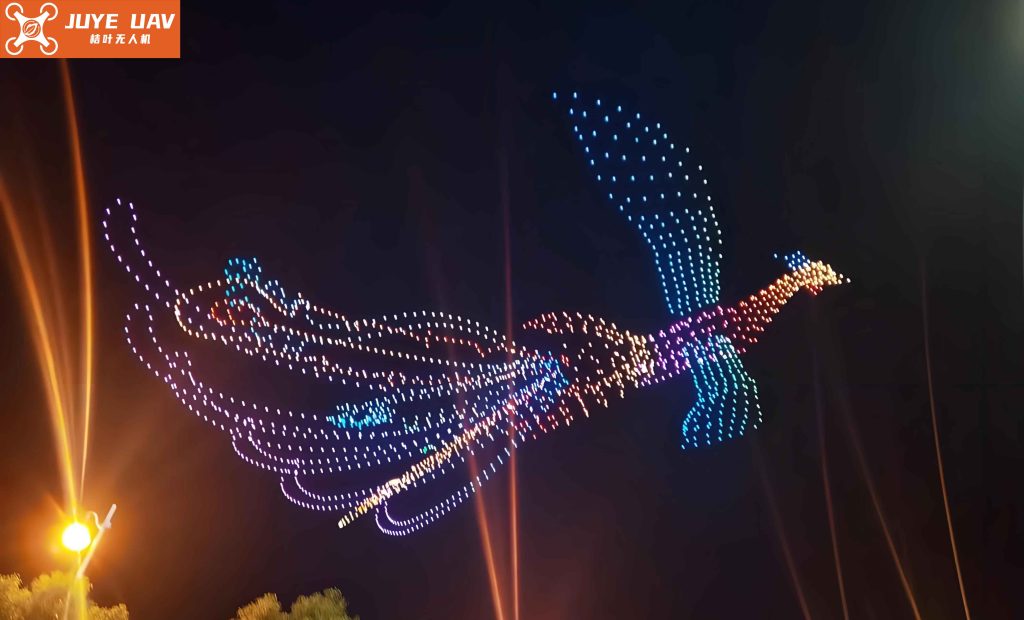
The application of RTK in drone light shows is exemplified by numerous large-scale performances worldwide. For example, a spectacular drone light show over a metropolitan area utilized RTK for millimeter-level positioning, allowing 500 drones to form intricate patterns like cascading stars and dynamic waves. Another instance involved a nighttime celebration where thousands of drones, equipped with LED lights, relied on RTK corrections to achieve synchronized maneuvers, creating vibrant animations in the sky. These successes highlight how RTK transforms artistic visions into reality, but they also underscore the need for robust safeguards against technical failures. As a radio frequency specialist, I emphasize that drone light shows operate in shared electromagnetic spectra, where interference from sources like communication towers or industrial equipment can disrupt RTK signals. Thus, proactive management is essential to protect these performances.
To safeguard RTK systems in drone light shows, a multi-faceted approach focused on electromagnetic environment management and equipment reliability is imperative. From a radio management perspective, I advocate for rigorous pre-show electromagnetic compatibility (EMC) assessments. This involves scanning the performance area for potential interferers—such as cellular base stations, radar systems, or power lines—using spectrum analyzers and directional antennas. The measured power levels of interfering signals can be evaluated with formulas like the signal-to-interference ratio (SIR):
$$ \text{SIR} = \frac{P_{signal}}{P_{interference}} $$
where $P_{signal}$ is the received RTK signal power and $P_{interference}$ is the interfering signal power. A low SIR indicates high vulnerability, necessitating mitigation actions like coordinating with local authorities to temporarily adjust transmitter powers or frequencies. Additionally, dedicated frequency bands for RTK data links should be allocated and protected. For example, in many regions, segments of the L-band are used for GNSS corrections; monitoring these bands for unauthorized emissions ensures clean transmission channels. The table below summarizes key safeguarding strategies and their implementation aspects, which I have developed based on field experiences.
| Strategy Domain | Specific Measures | Technical Implementation | Expected Outcome |
|---|---|---|---|
| Electromagnetic Environment Management | Pre-show spectrum monitoring, interference source identification, frequency coordination | Deploy mobile monitoring stations to capture RF activity; use geolocation techniques to pinpoint interferers; establish temporary exclusion zones for non-essential transmitters. | Reduced RF interference, ensuring stable RTK data links and minimizing positioning errors during the drone light show. |
| Equipment Reliability Enhancement | Standardized device testing, redundancy design, regular maintenance protocols | Conduct lab tests under simulated interference and harsh weather; implement dual receivers and antennas on critical drones; schedule firmware updates and hardware inspections pre-show. | Increased system resilience, lower failure rates, and enhanced safety for drone light show operations. |
| Operational Protocols | Contingency planning, real-time monitoring, data logging | Develop fallback plans (e.g., switch to inertial navigation if RTK fails); use ground control software with alert systems; archive RTK data for post-show analysis and optimization. | Improved response to anomalies, ensuring show continuity and providing insights for future drone light show improvements. |
From an equipment standpoint, ensuring the reliability of RTK components is equally crucial. Manufacturers should adhere to stringent quality standards, such as ISO certifications, and incorporate features like anti-jamming circuits and thermal stability in receivers. Testing protocols can involve subjecting devices to simulated high-interference environments, quantified by metrics like the jammer-to-signal ratio (JSR):
$$ \text{JSR} = \frac{J}{S} $$
where $J$ is the jamming signal power and $S$ is the desired signal power. Devices with low JSR tolerance should be rejected for use in drone light shows. Furthermore, regular maintenance—including antenna alignment checks and battery replacements—prevents degradations that could compromise performance. In my work, I have seen that drone light shows employing these safeguards experience fewer disruptions and higher audience satisfaction, underscoring the value of a proactive approach.
The integration of RTK technology into drone light shows represents a synergy of precision engineering and artistic expression. As the scale and complexity of these performances grow—with some involving over 10,000 drones—the demands on RTK systems will intensify. Future advancements may include the adoption of multi-frequency GNSS receivers to mitigate ionospheric errors more effectively, or the use of artificial intelligence to predict and compensate for signal disturbances. The positioning accuracy could be further refined through advanced algorithms, such as integer ambiguity resolution in carrier-phase measurements, expressed as:
$$ \nabla \Delta \Phi = \lambda^{-1} \cdot \nabla \Delta \rho + \nabla \Delta N + \epsilon $$
where $\nabla \Delta \Phi$ is the double-differenced carrier phase, $\lambda$ is the wavelength, $\nabla \Delta \rho$ is the double-differenced geometric range, $\nabla \Delta N$ is the integer ambiguity, and $\epsilon$ encompasses residuals. Resolving these ambiguities quickly and reliably is key to achieving centimeter-level accuracy in dynamic drone light show environments.
In conclusion, RTK technology is indispensable for the success of modern drone light shows, providing the positional fidelity required for breathtaking aerial choreography. However, its effectiveness is contingent on managing various technical and environmental factors. Through comprehensive electromagnetic environment management and robust equipment reliability strategies, stakeholders can mitigate risks and enhance performance stability. As a practitioner in radio monitoring, I believe that continued innovation in RTK systems, coupled with vigilant safeguarding practices, will drive the evolution of drone light shows toward greater safety, reliability, and spectacle. The fusion of technology and artistry in these displays not only entertains but also showcases the potential of precision navigation in unlocking new frontiers for aerial performances.