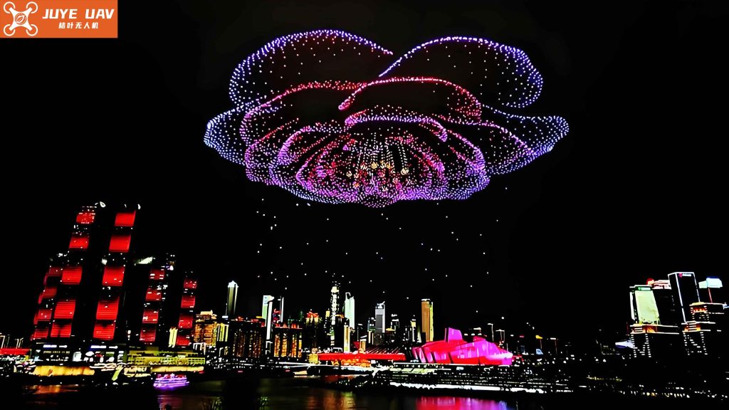
The integration of artificial intelligence (AI) into industrial applications necessitates a confluence of knowledge from multiple disciplines. Familiarizing students across various majors with AI technologies at an early stage is crucial for empowering them to infuse “AI thinking” into their respective fields. However, the abstract nature of many AI algorithms presents a significant pedagogical challenge. These concepts often become tangible only when demonstrated through concrete applications. Drone technology serves as an exemplary and vivid vessel for this purpose. Key aspects such as visual intelligence, intelligent swarm coordination, and autonomous planning in drones are successful real-world applications of deep learning and computer vision technologies. The challenge, therefore, was to create a learning module that allows students to bridge the gap between abstract theory and practical implementation, fostering an understanding of multi-agent systems through a compelling and accessible medium: the drone light show.
The primary obstacle in achieving this pedagogical goal was the prohibitive cost and logistical complexity of conducting physical drone swarm experiments. Operating a fleet of drones involves stringent airspace regulations, significant safety concerns, meticulous personnel management, and high financial costs for equipment and potential damage. Consequently, this critical area of multi-agent coordination was often relegated to theoretical lectures, which are inefficient and fail to engage students or provide experiential learning. To overcome this, I spearheaded the development of a comprehensive virtual simulation experiment. This platform is designed to guide students through the entire creative and technical pipeline of designing a drone light show. By engaging in formation design, flight path optimization, and lighting choreography, students gain hands-on experience with the AI project lifecycle, understand the principles of swarm behavior, and explore methods to mitigate collision risks—all within a safe, cost-effective, and scalable virtual environment.
The core objective of this simulation is twofold. First, it aims to demystify the fundamental principles behind drone swarm formation transformation. Students practice the operational workflow—from initial formation design and dynamic transformation sequencing to synchronized lighting control—using simulated versions of standard drone application programming interfaces (APIs). Completing a full drone light show project allows students from different academic backgrounds (e.g., computer science, design, engineering) to appreciate their unique roles in a collaborative AI project, thereby cultivating an interdisciplinary AI mindset. Second, the platform encourages exploration and innovation. Students are challenged to investigate optimal trajectory planning using AI algorithms and to develop risk-control strategies to minimize the probability of in-flight collisions. This process enhances their ability to solve complex, multi-faceted problems. Ultimately, the virtual simulation breaks the temporal and spatial constraints of physical labs, enabling intuitive, immersive, and self-paced learning about this fascinating application of distributed AI.
Architectural and Control Principles of a Real-World Drone Light Show
Before delving into the simulation architecture, it is essential to understand the underlying principles of an actual drone swarm performance. The transformation between intricate formations is executed through centralized control from a ground control station (GCS). The GCS pre-computes the precise position, lighting state, and flight trajectory for every drone at every millisecond. This grand plan is then realized by the onboard systems of each unmanned aerial vehicle (UAV). The key technological components enabling a safe and synchronized drone light show are outlined below:
| System Component | Primary Function | Key Technologies/Subsystems |
|---|---|---|
| Flight Control System | Maintains stable flight, executes maneuver commands. | Inertial Measurement Unit (IMU: accelerometers, gyroscopes), pressure sensor/barometer, PID controllers, electronic speed controllers (ESCs). |
| Precision Positioning System | Provides centimeter-level accurate real-time location. | Real-Time Kinematic (RTK) GPS, Ultra-Wideband (UWB) indoor systems, fusion algorithms. |
| Robust Communication System | Ensures reliable, low-latency command & telemetry data flow. | Time Division Multiple Access (TDMA) protocols, 4G/5G LTE, specialized RF links (e.g., LoRa). |
| Central Control Software | Orchestrates the entire swarm, handles path planning & safety. | Trajectory generation algorithms, collision checking, mission planning interfaces. |
The flight controller is the “brain” of the drone, processing data from various sensors to maintain stability. An accelerometer measures proper acceleration, a gyroscope measures angular velocity, and a barometer estimates altitude. These readings are fused via sensor fusion algorithms (like a Kalman filter) to provide a reliable state estimate. For a drone light show to maintain its shape, positioning accuracy far exceeding standard GPS (3-5 meters) is required. This is achieved using Real-Time Kinematic (RTK) technology, where a fixed base station on the ground provides correction signals to the drones, enabling centimeter-level precision.
Communication for hundreds of drones requires a highly organized protocol to avoid data collisions. A common method is a Time Division Multiple Access (TDMA) scheme, akin to a token-ring network logic. The central control station holds the “token” of communication time and allocates precise, non-overlapping time slots to each drone in the swarm for sending telemetry and receiving commands. This ensures deterministic, low-latency communication essential for tight synchronization in a dynamic drone light show.
Simulation Design Philosophy and Core Implementation
The virtual simulation is architected to replicate the core functional layers of a real drone light show system while abstracting away unnecessary hardware complexities. The goal is high-fidelity simulation of the control logic, physics, and visual outcome. The principle is to create a “software-in-the-loop” environment where authentic control code can be tested. The simulation framework is built around several key modules, as illustrated in the following functional block diagram translated into a descriptive table:
| Simulation Module | Real-World Counterpart | Implementation Technique | Fidelity Goal |
|---|---|---|---|
| Drone & Scene Modeling | Physical drones, performance venue. | 3D modeling (Blender/Maya), asset import into Unity/Unreal Engine. Physics-based rendering for lights. | >90% visual accuracy for drone model and lighting effects. |
| Physics & Dynamics Engine | Drone flight mechanics (thrust, drag, inertia). | Implementing a simplified 6-DOF rigid body model with PID control simulation within the game engine. | Accurate trajectory simulation under given control inputs. |
| Virtual Communication Layer | RF/LTE communication network. | Deterministic, simulated TDMA scheduler with configurable latency and packet loss. | Functional simulation of command flow, not bit-level protocol. |
| Emulated Control API | SDK/API provided by drone manufacturers. | Creating a Python/C++ library with identical function signatures to real APIs. | 100% code compatibility for basic flight and light commands. |
| Path Planning & Collision Checker | Central control station planning algorithms. | Integration of pathfinding (A*, RRT) and continuous collision detection libraries. | Accurate risk assessment for student-designed paths. |
The drone models are created from 3D scans or detailed CAD models of real programmable quadcopters, ensuring high visual fidelity. The lighting system simulates RGB LEDs through emissive materials and light particles in the 3D engine, creating visually stunning effects that mimic a real drone light show. The scene typically includes a realistic skybox, terrain, and virtual audience points to provide spatial context.
Critically, the simulation provides an emulated programming interface. This is the bridge between student code and the virtual world. Students write scripts using functions like `takeoff(height)`, `goto(x, y, z, speed)`, `set_led(r, g, b)`, and `land()`. These function calls are intercepted by the simulation engine, which then commands the corresponding virtual drone to execute the action using its internal physics model. This allows students to learn real-world programming paradigms for drone control without physical risk.
The Central Challenge: Formalizing Collision Risk and Path Optimization
The most intellectually engaging part of designing a drone light show is transforming one formation into another safely and efficiently. This is a classic multi-agent path planning (MAPP) problem. In the simulation, this is framed as an optimization challenge for students. The core problem can be formalized as follows:
Let a swarm consist of \( N \) drones. A formation transformation is defined by the starting positions \( \mathbf{S}_i \) and ending positions \( \mathbf{E}_i \) for each drone \( i \in [1, N] \). The task is to find a set of continuous trajectories \( \boldsymbol{\tau}_i(t) \) for a time period \( T \), such that:
$$ \boldsymbol{\tau}_i(0) = \mathbf{S}_i, \quad \boldsymbol{\tau}_i(T) = \mathbf{E}_i $$
and the trajectories minimize a combined cost function, typically dominated by the need to avoid collisions.
We model the collision risk probabilistically. The instantaneous collision probability between two drones \( i \) and \( j \) is assumed to follow a distribution based on their separation distance. A common simplified model uses a normal distribution centered on a minimum safe distance \( d_{safe} \). The closest distance between two drones during the entire maneuver is:
$$ d_{min}(i,j) = \min_{t \in [0,T]} \lVert \boldsymbol{\tau}_i(t) – \boldsymbol{\tau}_j(t) \rVert $$
The collision probability for the pair can be modeled as:
$$ P_{coll}(i,j) = \eta \cdot \exp\left( -\frac{(d_{min}(i,j) – d_{safe})^2}{2 \sigma^2} \right) $$
where \( \sigma \) controls the spread of the risk and \( \eta \) is a normalization factor. The system-level requirement is that the maximum pairwise probability must be below an extremely low threshold \( \epsilon \) (e.g., \( 10^{-9} \)):
$$ \max_{\forall i,j} P_{coll}(i,j) < \epsilon $$
Simultaneously, we wish to optimize for efficiency, often represented by the total flight distance or energy. A common objective is to minimize the maximum distance traveled by any single drone (the “makespan” of the flight):
$$ \text{Minimize: } J = \max_{\forall i} \left( \int_{0}^{T} \lVert \dot{\boldsymbol{\tau}}_i(t) \rVert \, dt \right) $$
Therefore, the complete optimization problem for the student is:
$$ \begin{aligned} & \underset{\boldsymbol{\tau}_1, \dots, \boldsymbol{\tau}_N}{\text{minimize}} & & J \\ & \text{subject to} & & \boldsymbol{\tau}_i(0) = \mathbf{S}_i, \; \boldsymbol{\tau}_i(T) = \mathbf{E}_i, \\ & & & \max_{\forall i,j} P_{coll}(i,j) < \epsilon. \\ \end{aligned} $$
To make this tractable in an educational setting, the simulation allows students to define trajectories as a series of waypoints connected by straight lines or simple curves. The simulation engine then performs discrete-time collision checking and calculates the performance metrics. Students are encouraged to experiment with different planning strategies:
- Geometric Patterns: Having drones follow radially symmetric paths outwards before converging.
- Priority-Based Staging: Moving drones in sequenced groups to de-clutter the airspace.
- Algorithmic Optimization: Implementing search algorithms like A* for each drone on a discretized space-time grid, or using evolutionary algorithms like Genetic Algorithms (GAs) to evolve waypoint parameters. A simple GA fitness function \( F \) might combine distance and collision penalty:
$$ F = \frac{1}{J + \alpha \cdot \sum_{i,j} \max(0, d_{safe} – d_{min}(i,j))^2 } $$
where \( \alpha \) is a large penalty weight.
The table below summarizes the key parameters a student can manipulate in the simulation’s optimization module:
| Parameter Category | Example Variables | Student’s Optimization Goal |
|---|---|---|
| Path Definition | Number of waypoints, their (x,y,z) coordinates, arrival time at each. | Find the shortest, smoothest path that meets endpoint constraints. |
| Speed Profile | Velocity between waypoints, acceleration limits. | Minimize time (T) while respecting drone dynamics. |
| Safety Margins | Minimum separation distance \( d_{safe} \), risk threshold \( \epsilon \). | Ensure simulated collision probability is effectively zero. |
| Algorithm Parameters | GA (population size, mutation rate), A* (heuristic weight). | Tune algorithms to find better solutions faster. |
Pedagogical Integration and Experimental Workflow
The virtual simulation is integrated into a project-based learning curriculum. The typical student workflow is structured into distinct phases, each fostering different skills and insights relevant to AI and systems engineering. The process mirrors the real-world development cycle for a commercial drone light show.
Phase 1: Conceptual Design & Formation Authoring. Using a graphical user interface within the simulator, students design their initial and final formations. They can place drones in 3D space, creating shapes, logos, or text. This phase engages spatial reasoning and artistic creativity. They also define the color and blink pattern for each drone’s lights at keyframes, planning the visual narrative of their show.
Phase 2: Trajectory Programming & Optimization. This is the core AI/technical phase. Students switch to a scripting environment. They may start with simple, manually defined linear paths for each drone using the emulated API. They then run the simulation and use the built-in analytics tools to visualize proximity hotspots and see collision warnings. To improve their design, they must then formulate the path planning as an optimization problem. They might write a script to implement a greedy assignment algorithm, a search-based planner, or integrate a GA library to optimize waypoints. The iterative process of coding, simulating, and analyzing results deepens their understanding of algorithmic trade-offs (optimality vs. computation time, centralization vs. decentralization).
Phase 3: Full-System Simulation & Validation. Once a satisfactory set of trajectories is generated, students execute the full, time-synchronized drone light show simulation. The platform provides multiple viewing perspectives (overhead, cinematic, drone-follow) and renders the lighting effects in real-time. A comprehensive report is generated, including:
- Total mission time and maximum/mean drone flight distance.
- A list of all separation minima between drone pairs.
- The calculated maximum collision probability.
- A visual timeline of distances and speeds.
This data allows for objective assessment of their solution’s safety and efficiency.
Phase 4: Extension and Experimentation. Advanced students can explore more complex scenarios: handling simulated communication dropouts (where a drone must execute a failsafe maneuver), incorporating dynamic obstacles, or experimenting with decentralized control strategies where drones react to local sensor data rather than following a pre-computed plan. This opens the door to discussions on swarm intelligence and robustness.
Technical Implementation and System Architecture
The simulation platform is built using a client-server architecture to support scalability and centralized management of student assignments and results. The server-side component, hosted on a cloud instance, handles user authentication, stores persistent data (formation designs, student code, result metrics), and runs the heavier path planning algorithms if needed. The client is a standalone application or WebGL-based interface that contains the real-time 3D rendering engine, the physics simulator, and the local API emulator.
Core Technologies:
- Game Engine: Unity 3D or Unreal Engine. These provide the robust framework for 3D rendering, physics simulation (via NVIDIA PhysX or similar), and real-time scripting in C# or C++.
- Physics Model: A simplified quadrotor model is implemented. The thrust from each motor is simulated, and the net force and torque are calculated to update the drone’s position and orientation using Newton-Euler equations. A simulated PID controller runs onboard each virtual drone to track its commanded trajectory.
$$
\begin{aligned}
\text{Forces: } & \mathbf{F} = m\mathbf{g} + \mathbf{T}_{net} \\
\text{Motion: } & m\ddot{\mathbf{r}} = \mathbf{F}, \quad I \dot{\boldsymbol{\omega}} + \boldsymbol{\omega} \times (I \boldsymbol{\omega}) = \boldsymbol{\tau}
\end{aligned}
$$
where \( \mathbf{T}_{net} \) is the total thrust vector and \( \boldsymbol{\tau} \) is the total torque. - API Emulation Layer: A wrapper library is created in Python (popular for education) and C++. When a student calls `drone.goto(x,y,z)`, the library packages this command and sends it via an internal message bus to the corresponding drone agent in the simulation, which then processes it through its control loop.
- Collision Detection: The engine uses continuous collision detection (CCD) for accuracy, checking for intersections between swept volumes along trajectories, not just static frames. This is computationally intensive but critical for trustworthy safety validation in a drone light show simulation.
| Function Name | Parameters | Description | Simulation Action |
|---|---|---|---|
connect() |
drone_id | Establish link to a virtual drone. | Initializes a software drone object in the scene. |
takeoff(altitude) |
target_altitude (m) | Command drone to take off and hover at altitude. | Activates physics model, executes PID control to reach z=altitude. |
goto(x, y, z, speed) |
target coordinates, speed (m/s) | Fly to an absolute position at given speed. | Generates a smooth trajectory segment and commands the drone to follow it. |
set_led(r, g, b, effect) |
RGB values (0-255), effect type. | Set the color and blink pattern of the drone’s LED. | Changes the material/particle emission properties of the 3D model. |
get_position() |
– | Query the current (x,y,z) position. | Returns the true coordinates from the physics engine. |
land() |
– | Command drone to land at its current location. | Initiates a descent sequence until ground contact. |
Educational Impact and Assessment
The deployment of this virtual simulation has transformed the teaching and learning of multi-agent systems. It moves education from passive absorption to active creation. Students are no longer just learning about collision avoidance algorithms; they are implementing them and immediately seeing the consequences—a mesmerizing drone light show or a catastrophic virtual crash.
Assessment is multifaceted, combining automated evaluation from the simulator with traditional project grading. The simulator provides objective metrics on each group’s final design: the success of the transformation, the minimum separation distance, the energy efficiency, and the overall visual smoothness. These quantitative measures are combined with a qualitative assessment of the students’ code quality, the creativity of their formation and light choreography, and their written report analyzing their design choices and optimization strategy. This approach evaluates not only the final product but also the engineering process, critical thinking, and collaboration—skills essential for modern AI and robotics professionals.
In conclusion, this virtual simulation platform for drone formation transformation effectively bridges a critical gap in AI and robotics education. By leveraging the inherent appeal and technical richness of a drone light show, it provides a safe, accessible, and deeply engaging sandbox for students to experiment with complex concepts in distributed AI, path planning, optimization, and systems integration. It demonstrates how virtual simulation can transcend physical limitations to deliver high-impact experiential learning, preparing a new generation of engineers and scientists to design and manage the intelligent multi-agent systems of the future.