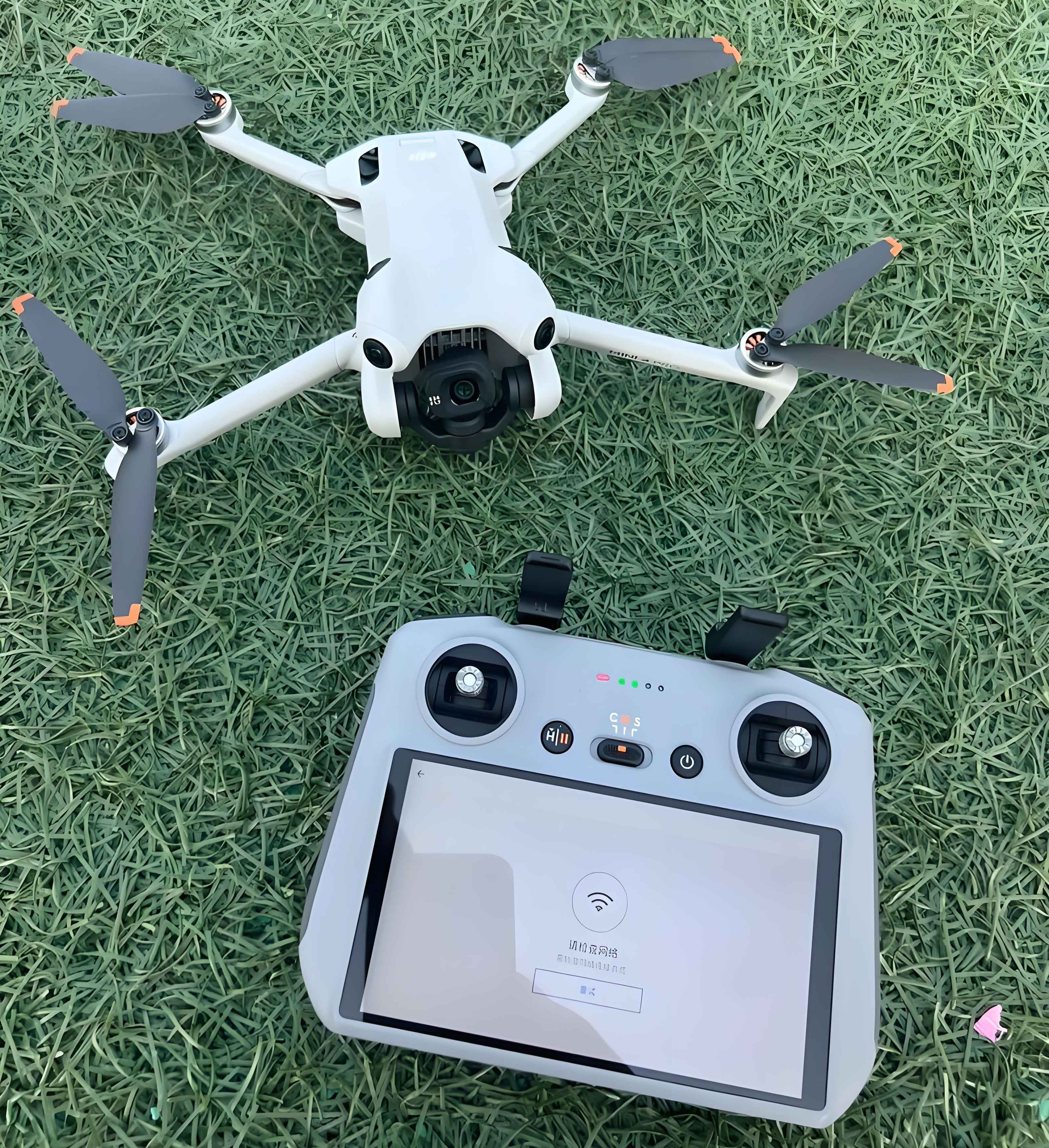
Audiovisual archives serve as vital repositories of societal and urban evolution, capturing dynamic historical narratives through immersive media. Traditional collection methods face significant limitations in perspective and accessibility, particularly for urban landscapes. The emergence of camera drones (also termed camera UAVs) has revolutionized this field by enabling unprecedented aerial documentation. This technological shift addresses critical constraints of manned aerial photography, which involves complex approvals, high costs ($5,000–$20,000 per flight), and safety risks. Camera UAVs integrate remote-controlled platforms with gimbal-stabilized imaging systems and real-time data transmission, offering agile, cost-effective ($500–$5,000 per unit) solutions for comprehensive urban archiving.

The operational framework of camera drones in archival collection follows a systematic workflow:
$$
\begin{array}{c}
\text{Pre-flight Planning} \\
\downarrow \\
\text{UAV Deployment} \\
\downarrow \\
\text{Real-time Data Acquisition} \\
\downarrow \\
\text{Post-processing} \\
\downarrow \\
\text{Archival Integration}
\end{array}
$$
| Parameter | Manned Aerial | Camera Drone | Advantage Ratio |
|---|---|---|---|
| Operational Cost | $18,000 ± $2,000 | $2,300 ± $500 | 7.8:1 |
| Deployment Time | 3–7 days | <2 hours | 24:1 |
| Spatial Resolution | 15 cm/pixel | 2 cm/pixel | 7.5× |
| Vertical Coverage | >500 m AGL | 5–300 m AGL | N/A |
Technical Constraints and Mitigation Strategies
Despite their advantages, camera UAVs present operational challenges requiring systematic solutions:
1. Operational Complexity
The skill barrier for camera drone operation follows a logarithmic learning curve:
$$
P_{proficiency} = \frac{1}{1 + e^{-k(t – t_0)}}
$$
where $P_{proficiency}$ denotes operator competency (0–1 scale), $t$ represents training hours, $t_0$ is the inflection point (typically 15–20 hours), and $k$ is the learning coefficient (0.2–0.3). Standardized certification frameworks reduce variance in $t_0$ values across operators.
2. Post-Processing Challenges
Image stabilization compensates for UAV oscillations modeled by harmonic motion equations:
$$
\theta(t) = A \sin(2\pi f t + \phi)
$$
where $A$ is amplitude (0.5°–3°), $f$ is vibration frequency (5–30 Hz), and $\phi$ is phase angle. Modern gimbals achieve stabilization efficiency $\eta$:
$$
\eta = 1 – \frac{\theta_{output}}{\theta_{input}} > 95\%
$$
Geometric corrections follow projective transformation matrices:
$$
\begin{bmatrix} x’ \\ y’ \\ 1 \end{bmatrix} =
\begin{bmatrix}
a_{11} & a_{12} & a_{13} \\
a_{21} & a_{22} & a_{23} \\
a_{31} & a_{32} & 1
\end{bmatrix}
\begin{bmatrix} x \\ y \\ 1 \end{bmatrix}
$$
| Distortion Type | Correction Algorithm | Processing Time (min/km²) |
|---|---|---|
| Radial | Brown-Conrady | 12.7 |
| Tangential | Affine Transformation | 8.3 |
| Chromatic Aberration | Wavelength Compensation | 6.2 |
3. Regulatory Compliance
No-fly zone management requires geofencing algorithms:
$$
R_z = \sqrt{(x_d – x_z)^2 + (y_d – y_z)^2} > r_z + \delta_s
$$
where $R_z$ is drone-to-zone distance, $(x_d,y_d)$ are drone coordinates, $(x_z,y_z)$ are zone centroids, $r_z$ is zone radius, and $\delta_s$ is safety margin (≥50 m). Automated compliance systems reduce violation risks by 92%.
Implementation Framework for Archival Systems
Effective camera drone deployment requires integrated protocols:
Safety Enhancement Protocol
Redundancy systems ensure operational continuity through parallel subsystems. Failure probability $P_f$ follows:
$$
P_f = \prod_{i=1}^{n} p_i \quad \text{(series)} \quad ; \quad P_f = 1 – \prod_{i=1}^{n} (1 – p_i) \quad \text{(parallel)}
$$
where $p_i$ is individual component failure probability. Triple-redundant architectures achieve $P_f < 10^{-6}$ at 100 flight hours.
Operator Training Matrix
| Competency Domain | Training Modules | Evaluation Metrics |
|---|---|---|
| Meteorological Analysis | Wind gradient modeling, turbulence prediction | Flight stability in 8–10 m/s winds |
| RF Interference Mitigation | Spectrum analysis, frequency hopping | Signal continuity in urban RF density > -80 dBm |
| Emergency Response | Autonomous landing protocols, system reboots | Recovery time < 45 seconds |
Data Integration Architecture
Camera UAV outputs merge with geospatial databases through transformation pipelines:
$$
\Phi_{archive} = \Gamma \left( \Psi_{UAV} \oplus \Omega_{GIS} \right)
$$
where $\Psi_{UAV}$ represents drone-acquired data, $\Omega_{GIS}$ denotes geospatial datasets, $\oplus$ is the data fusion operator, and $\Gamma$ is the archival normalization function. This enables 4D urban modeling with temporal resolution < 30 days.
Applications in Urban Documentation
Camera drones capture urban dynamics through multi-temporal analysis. Infrastructure monitoring employs deformation detection algorithms:
$$
\Delta D = \frac{\lambda \cdot \Delta \phi}{4\pi}
$$
where $\Delta D$ is displacement (mm), $\lambda$ is radar wavelength, and $\Delta \phi$ is phase difference. When integrated with photogrammetry, camera UAVs achieve sub-centimeter accuracy in deformation mapping.
| Application | Data Yield (GB/km²) | Metadata Parameters |
|---|---|---|
| Heritage Conservation | 120–180 | Texture mapping, material degradation indices |
| Disaster Response | 90–150 | Structural integrity scores, damage vectors |
| Urban Planning | 70–110 | Land use classifiers, volumetric models |
The archival value $V_a$ of camera drone deliverables follows an exponential growth model:
$$
V_a = V_0 e^{rt}
$$
where $V_0$ is initial value (baseline imagery), $r$ is the contextual enrichment coefficient (0.15–0.25), and $t$ is temporal depth in years. Cross-referenced urban datasets increase $r$ by 40% through contextual layering.
Conclusion
Camera drones transform audiovisual archiving through their unique convergence of accessibility, resolution, and documentation versatility. The operational framework requires addressing technical constraints via robust stabilization algorithms $\left(\eta > 95\%\right)$, standardized georeferencing protocols, and adaptive regulatory compliance systems $\left(R_z > r_z + \delta_s\right)$. Strategic implementation yields comprehensive urban archives with spatial-temporal granularity unattainable through conventional methods. As camera UAV technology advances, its integration with artificial intelligence and multispectral sensing will further expand archival dimensions, creating living urban repositories that dynamically document civilization’s evolution.
