
As urbanization accelerates and natural disasters occur more frequently, traditional firefighting and rescue techniques face numerous challenges, such as slow response times, chaotic fireground environments, high rescue difficulties, and significant risks to responders. In recent years, the gradual development of police drone technology has provided novel solutions, especially when empowered by emerging technologies like artificial intelligence, big data, cloud computing, and the Internet of Things. This empowerment showcases remarkable advantages in enhancing safety and efficiency. In this article, I explore the application scenarios and specific practices of intelligently empowered police drones in firefighting and rescue, aiming to offer valuable insights for reducing casualties among firefighters and improving the quality and effectiveness of operations.
Police drones, when integrated with smart technologies, revolutionize rescue missions. According to data from emergency management departments, from 2018 to 2023, 165 firefighters sacrificed their lives in various rescue tasks, with over 1,300 injured, highlighting the limitations of conventional methods that expose personnel to extreme dangers. The adoption of police drones, particularly through intelligent systems, transforms these operations by providing real-time data, autonomous capabilities, and coordinated efforts. This article delves into how police drones are applied in key scenarios and the technical implementations that drive their efficacy, supported by tables and mathematical models to summarize critical aspects.
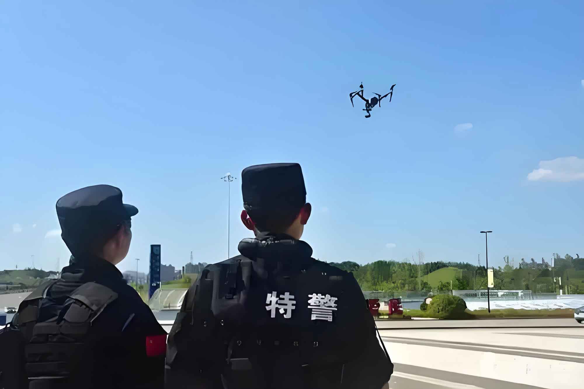
The core of intelligent empowerment lies in leveraging advanced algorithms and sensors to enhance police drone functionality. In firefighting, police drones serve as multi-role assets, from reconnaissance to active intervention. I will first outline the application scenarios, followed by an in-depth analysis of specific practices, incorporating formulas and tables to illustrate concepts. This structured approach ensures a comprehensive understanding of how police drones are reshaping rescue paradigms.
Application Scenarios of Intelligently Empowered Police Drones in Firefighting and Rescue
Police drones are deployed across various scenarios, each benefiting from smart technologies to address traditional limitations. The table below summarizes these primary application areas, emphasizing the roles of police drones in enhancing operational outcomes.
| Application Scenario | Key Functions | Technologies Involved | Impact on Safety and Efficiency |
|---|---|---|---|
| Fire Scene Reconnaissance and Monitoring | Real-time data collection, thermal imaging, gas sensing | AI, HD cameras, infrared sensors, IoT | Reduces human exposure; provides accurate situational awareness |
| Hazard Zone Detection and Early Warning | Radiation monitoring, temperature sensing, danger prediction | Gas sensors, AI analytics, cloud computing | Prevents accidents like flashovers; guides safe entry points |
| Supply Delivery and Personnel Rescue | Transport of extinguishing agents, equipment deployment | Medium-sized drones, robotic arms, automation | Speeds up response; minimizes risks in inaccessible areas |
| Coordinated Operations and Command Dispatch | Multi-drone collaboration, task allocation, data sharing | IoT, cluster algorithms, 5G/6G networks | Enhances teamwork; optimizes resource distribution |
In fire scene reconnaissance, police drones equipped with high-definition cameras and infrared thermal imagers can quickly reach the site, capturing comprehensive data. For instance, in structural fires, AI algorithms analyze this data to generate building information models and predict fire spread. This is represented mathematically by a fire propagation model, where the rate of spread \( R \) can be estimated using equations like the Rothermel model for wildland fires, adapted for urban settings: $$ R = \frac{I_r \cdot \xi}{(ρ_b \cdot ε \cdot Q_{ig})} $$ where \( I_r \) is the reaction intensity, \( \xi \) is the propagating flux ratio, \( ρ_b \) is the bulk density, \( ε \) is the effective heating number, and \( Q_{ig} \) is the heat of ignition. Police drones feed real-time parameters into such models, enabling dynamic updates.
For hazard zone detection, police drones act as mobile safety officers. In incidents like chemical plant explosions, they monitor toxic gas concentrations using sensors, with data transmitted via IoT to command centers. A Gaussian plume model can describe gas dispersion: $$ C(x,y,z) = \frac{Q}{2πuσ_yσ_z} \exp\left(-\frac{y^2}{2σ_y^2}\right) \left[ \exp\left(-\frac{(z-H)^2}{2σ_z^2}\right) + \exp\left(-\frac{(z+H)^2}{2σ_z^2}\right) \right] $$ where \( C \) is concentration, \( Q \) is emission rate, \( u \) is wind speed, \( σ_y \) and \( σ_z \) are dispersion parameters, and \( H \) is effective height. Police drones validate these predictions, offering early warnings to protect responders.
In supply delivery, medium-sized police drones with payloads of 25–150 kg carry fire suppressants directly to fire points. This bypasses logistical hurdles, such as limited access for aerial ladder trucks. The efficiency gain can be quantified by comparing traditional deployment time \( T_t \) to drone-based time \( T_d \): $$ ΔT = T_t – T_d = \frac{D}{v_t} – \frac{D}{v_d} – t_s $$ where \( D \) is distance, \( v_t \) and \( v_d \) are speeds of traditional methods and police drones, respectively, and \( t_s \) is setup time saved. Police drones reduce \( ΔT \) significantly, accelerating rescue efforts.
Coordinated operations involve multiple police drones working in unison. Through IoT and AI-driven cluster control, they share tasks—like one group scanning perimeters while another delivers supplies. This synergy enhances coverage and response precision. The table below details a typical multi-drone assignment matrix for a large-scale fire incident.
| Police Drone ID | Primary Task | Secondary Task | Data Shared | Collaboration Partners |
|---|---|---|---|---|
| PD-01 | High-altitude reconnaissance | Thermal mapping | Fire origin coordinates, spread vectors | PD-02, PD-03 |
| PD-02 | Low-altitude gas sensing | Temperature monitoring | Toxic gas levels, heat zones | PD-01, PD-04 |
| PD-03 | Supply transport | Communication relay | Payload status, drop locations | PD-01, ground robots |
| PD-04 | Search and rescue support | Obstacle detection | Navigation paths, hazard alerts | PD-02, wearable devices |
These scenarios underscore how police drones, when intelligently empowered, transform firefighting into a data-driven, safer endeavor. In the following sections, I delve into the specific practices that enable these applications, focusing on technical implementations with formulas and analyses.
Specific Practices of Intelligently Empowered Police Drones in Firefighting and Rescue
The effectiveness of police drones hinges on advanced practices that integrate smart technologies. I discuss four key areas: intelligent path planning, real-time data analysis, multi-drone协同作业 (collaborative作业), and remote control with automation. Each practice leverages mathematical models and algorithmic frameworks to optimize performance, with police drones at the core of execution.
Intelligent Path Planning
Intelligent path planning is a cornerstone technology for police drones, allowing them to navigate complex environments autonomously. Police drones use sensors like LiDAR and visual cameras to construct 3D maps, combined with AI algorithms such as A* or reinforcement learning to compute optimal routes. In urban fires, police drones must avoid obstacles while accounting for environmental factors like wind and heat. The path planning problem can be formulated as minimizing a cost function: $$ J(\mathbf{p}) = \int_{0}^{T} \left[ w_1 \cdot \|\mathbf{v}(t)\|^2 + w_2 \cdot \|\mathbf{a}(t)\|^2 + w_3 \cdot d(\mathbf{p}(t), \mathcal{O}) \right] dt $$ where \( \mathbf{p}(t) \) is the drone’s position over time \( T \), \( \mathbf{v}(t) \) and \( \mathbf{a}(t) \) are velocity and acceleration, \( d(\cdot) \) is distance to obstacles \( \mathcal{O} \), and \( w_1, w_2, w_3 \) are weights balancing speed, energy, and safety. Police drones solve this in real-time using onboard processors, ensuring rapid arrival at fire scenes.
For instance, in high-rise building fires, a police drone might plan a path to enter through a window, avoiding smoke plumes. Reinforcement learning enhances this by simulating scenarios: $$ Q(s,a) \leftarrow Q(s,a) + \alpha \left[ r + \gamma \max_{a’} Q(s’,a’) – Q(s,a) \right] $$ where \( Q(s,a) \) is the value of action \( a \) in state \( s \), \( \alpha \) is the learning rate, \( r \) is the reward (e.g., reaching the target quickly), and \( \gamma \) is the discount factor. Police drones trained this way adapt to dynamic conditions, improving path efficiency over time. The table below compares different path planning algorithms used in police drones.
| Algorithm | Key Principle | Advantages for Police Drones | Limitations |
|---|---|---|---|
| A* Search | Heuristic-based graph traversal | Fast computation for known maps; guarantees shortest path | Struggles with real-time updates in chaotic environments |
| RRT (Rapidly-exploring Random Tree) | Random sampling in configuration space | Handles high-dimensional spaces; suitable for cluttered areas | Paths may be suboptimal; requires tuning for smoothness |
| Deep Q-Network (DQN) | Reinforcement learning with neural networks | Adapts to unseen scenarios; learns from experience | High computational demand; needs extensive training data |
| Model Predictive Control (MPC) | Optimization over a receding horizon | Accounts for dynamics and constraints; robust to disturbances | Complex to implement; real-time solving requires powerful hardware |
Police drones employ a hybrid approach, often combining these algorithms. For example, A* might generate an initial path, while MPC adjusts it based on real-time sensor data from the police drone’s environment. This ensures that police drones can swiftly navigate to critical zones, reducing response times from minutes to seconds in some cases.
Real-Time Data Analysis
Police drones serve as mobile data hubs, collecting and analyzing information on-the-fly. Equipped with multispectral cameras, thermal imagers, and gas sensors, police drones capture temperature distributions, gas concentrations, and fire spread patterns. This data is transmitted via 5G networks to cloud platforms, where big data analytics and AI algorithms process it. In forest fires, police drones use thermal data to identify hotspots, integrating weather data to predict spread using models like the Fire Weather Index (FWI): $$ FWI = f(DMC, DC, ISI) $$ where DMC is the Duff Moisture Code, DC is the Drought Code, and ISI is the Initial Spread Index. Police drones provide real-time inputs for these indices, enabling accurate forecasts.
The technical architecture involves edge computing on the police drone and cloud computing for deep analysis. Edge devices preprocess data to extract features, reducing bandwidth usage, while the cloud runs complex simulations. For chemical fires, a police drone might measure toxic gas levels, with edge computing quickly identifying hazardous zones using thresholding: $$ \text{Hazard Flag} = \begin{cases} 1 & \text{if } C_{gas} > C_{threshold} \\ 0 & \text{otherwise} \end{cases} $$ where \( C_{gas} \) is the concentration sensed by the police drone. Data is then uploaded to generate 3D diffusion models, aiding evacuation planning.
A mathematical framework for real-time analysis can be expressed as a Bayesian inference problem, where police drones update beliefs about fire states: $$ P(S_t | O_{1:t}) \propto P(O_t | S_t) \int P(S_t | S_{t-1}) P(S_{t-1} | O_{1:t-1}) dS_{t-1} $$ Here, \( S_t \) is the fire state (e.g., intensity, location) at time \( t \), and \( O_{1:t} \) are observations from police drones. This allows continuous refinement of situational awareness. The table below summarizes sensor types and their data outputs in police drones.
| Sensor Type | Data Collected | Analysis Method | Application in Firefighting |
|---|---|---|---|
| Infrared Thermal Imager | Temperature gradients, hotspot locations | Heat map generation, anomaly detection | Identifying hidden fires behind walls or in debris |
| Gas Sensor (e.g., CO₂, CH₄) | Gas concentrations in ppm | Threshold comparison, trend analysis | Detecting explosive or toxic atmospheres for safety |
| HD Video Camera | Visual imagery, smoke patterns | Computer vision (e.g., object recognition) | Assessing structural integrity, locating victims |
| LiDAR | 3D point clouds, distance measurements | SLAM (Simultaneous Localization and Mapping) | Creating accurate maps of collapsed buildings |
Through such analysis, police drones enable informed decision-making, often predicting events like flashovers before they occur. This proactive capability stems from the intelligent empowerment of police drones, turning raw data into actionable insights.
Multi-Drone Collaborative作业
Multi-drone协同作业, or collaborative作业, involves police drones working in teams to accomplish complex tasks. Using IoT and distributed control algorithms, police drones share data and coordinate actions. In large-scale incidents, a swarm of police drones might divide responsibilities: some for surveillance, others for delivery, and a few for direct intervention. This is governed by a task allocation model, such as the Hungarian algorithm for optimal assignment: $$ \min \sum_{i=1}^{n} \sum_{j=1}^{m} c_{ij} x_{ij} \quad \text{subject to} \quad \sum_{j} x_{ij} = 1, \sum_{i} x_{ij} = 1, x_{ij} \in \{0,1\} $$ where \( c_{ij} \) is the cost of assigning police drone \( i \) to task \( j \), and \( x_{ij} \) is the decision variable. This ensures efficient use of police drone resources.
In practice, police drones communicate via wireless ad-hoc networks, forming a mesh topology. Each police drone has independent computing units, running consensus algorithms like Paxos to agree on shared states. For mountain forest fires, police drones autonomously partition侦查 regions, ensuring full coverage. The协同 can be modeled as a multi-agent system with shared objectives: $$ \max_{\mathbf{u}_1, \dots, \mathbf{u}_N} \sum_{k=1}^{N} R_k(\mathbf{s}, \mathbf{u}_k) $$ where \( \mathbf{u}_k \) is the action of police drone \( k \), \( \mathbf{s} \) is the global state, and \( R_k \) is the reward for that police drone. Police drones optimize this collectively, enhancing overall mission success.
The table below illustrates a协同 workflow for a police drone swarm in a fire scenario, highlighting how tasks interrelate.
| Phase | Police Drone Actions | Data Exchange | Outcome |
|---|---|---|---|
| Initial Deployment | PD-01 scans from altitude; PD-02 tests air quality | GPS coordinates, ambient temperature | Base map created; hazard zones identified |
| Active Monitoring | PD-03 delivers fire retardant; PD-04 guides ground teams | Payload status, navigation waypoints | Fire suppression initiated; rescue paths optimized |
| Dynamic Adjustment | All police drones adapt to wind shifts | Real-time weather updates, fire spread vectors | Mission parameters updated; risks mitigated |
| Withdrawal and Recap | Police drones return for charging; data uploaded to cloud | Battery levels, summarized reports | Resources conserved; after-action analysis enabled |
This协同 approach not only boosts efficiency but also creates redundancy—if one police drone fails, others can compensate. Police drones thus form a resilient network, crucial in volatile fire environments.
Remote Control and Automation
Remote control and automation empower police drones to operate with minimal human intervention, crucial for dangerous zones. Through 5G/6G networks and low-latency通信, operators can steer police drones from a distance, adjusting flight parameters based on real-time feeds. Moreover, automation enables police drones to perform tasks like autonomous takeoff, landing, and recharging. This is achieved via high-precision navigation systems, such as visual-inertial odometry (VIO) fused with GPS: $$ \hat{\mathbf{x}}_t = \mathbf{x}_{t-1} + \Delta \mathbf{x} \quad \text{with} \quad \Delta \mathbf{x} = \int_{t-1}^{t} (\mathbf{v} + \mathbf{w}_v) dt $$ where \( \hat{\mathbf{x}}_t \) is the estimated position, \( \mathbf{v} \) is velocity from VIO, and \( \mathbf{w}_v \) is noise. Police drones use this for stable hovering and precise movements.
AI decision algorithms drive full autonomy. For example, a police drone might identify a fire source using computer vision, then automatically deploy extinguishing agents. This can be framed as a control problem: $$ \mathbf{u}^* = \arg\min_{\mathbf{u}} \| \mathbf{y}_{des} – \mathbf{y}(\mathbf{u}) \|^2 + \lambda \| \mathbf{u} \|^2 $$ where \( \mathbf{u} \) is the control input (e.g., throttle, rotor speeds), \( \mathbf{y}_{des} \) is the desired state (e.g., fire extinguished), and \( \lambda \) is a regularization term. Police drones solve this online, ensuring accurate actions.
In terms of automation levels, police drones can be classified as shown in the table below, which outlines the spectrum from manual to fully autonomous operations.
| Automation Level | Description | Role of Police Drone | Example in Firefighting |
|---|---|---|---|
| Level 0: Manual | Human operator controls all aspects | Police drone as a remote camera; limited smart features | Basic reconnaissance in low-risk areas |
| Level 1: Assisted | Police drone assists with stability or obstacle avoidance | Police drone uses sensors to aid human control | Flying through smoky environments with auto-hover |
| Level 2: Partial Automation | Police drone handles specific tasks autonomously | Police drone plans paths but human oversees | Automated supply drops to predefined coordinates |
| Level 3: Conditional Automation | Police drone manages most operations, human intervenes if needed | Police drone conducts full missions in structured settings | 协同 surveillance in a controlled fire drill |
| Level 4: High Automation | Police drone operates independently in most scenarios | Police drone makes decisions based on AI, minimal human input | Autonomous fire containment in wilderness areas |
| Level 5: Full Automation | No human intervention required | Police drone self-sufficient from start to finish | Complete rescue mission in a collapsed building |
Police drones at higher automation levels rely on robust perception systems. For instance, using convolutional neural networks (CNNs) for fire detection: $$ f(\mathbf{I}) = \sigma(\mathbf{W} * \mathbf{I} + \mathbf{b}) $$ where \( \mathbf{I} \) is an image from the police drone’s camera, \( \mathbf{W} \) and \( \mathbf{b} \) are learned weights, \( * \) denotes convolution, and \( \sigma \) is an activation function. This enables police drones to recognize flames or smoke and act accordingly.
Remote control complements automation by allowing override in critical situations. With ultra-reliable low-latency communication (URLLC), police drones receive commands within milliseconds, ensuring responsive control. This hybrid approach maximizes the benefits of police drones, blending human intuition with machine precision.
Conclusion
The intelligent empowerment of police drones in firefighting and rescue operations marks a paradigm shift toward safer and more efficient responses. Through applications in reconnaissance, hazard detection, supply delivery, and协同作业, police drones mitigate risks to human responders while accelerating mission timelines. Practices like intelligent path planning, real-time data analysis, multi-drone collaboration, and automation are underpinned by mathematical models and advanced algorithms, as detailed in this article. Police drones, equipped with AI and IoT, transform raw data into strategic insights, enabling proactive decision-making.
Looking ahead, as technologies such as 6G, edge AI, and quantum computing evolve, police drones will become even more capable. Future developments may include police drones with enhanced swarm intelligence, capable of self-organizing in chaotic environments, or integrating with smart city infrastructures for seamless救援. The ongoing adoption of police drones by fire departments worldwide underscores their value. By continuing to innovate and integrate these smart systems, police drones will play an increasingly vital role in safeguarding communities, reducing casualties, and elevating the overall effectiveness of firefighting and rescue efforts. In essence, the journey of police drones from辅助 tools to intelligent partners exemplifies the transformative power of technology in public safety.