
In recent years, the proliferation of unmanned aerial vehicle (UAV) technology has catalyzed a significant transformation across public safety operations. Among these, the police drone has emerged as a pivotal technological asset for law enforcement agencies worldwide. A police drone system, typically comprising the aerial platform, mission payloads, data-link systems, and ground control stations, offers a unique combination of aerial perspective, rapid deployment, and operational flexibility. This capability set effectively addresses chronic challenges in policing, such as limited personnel resources, operational risks in hazardous environments, and the need for expansive situational awareness. Consequently, police drone units are being integrated into various departments, including special operations, criminal investigation, traffic control, and patrol services. However, the rapid adoption of this technology has outpaced the development of corresponding frameworks for standardized operation, robust technical specifications, and clear legal guidelines. This analysis, based on an extensive survey and expert interviews, examines the current application landscape, identifies critical performance gaps and systemic challenges, and proposes strategic countermeasures to optimize the role of police drones in contemporary law enforcement.
The foundational understanding presented here stems from a rigorous research methodology. A detailed questionnaire was developed through multiple rounds of consultation with seasoned police drone practitioners and was subsequently distributed to specialized units across multiple regions. The survey targeted departments with established police drone programs, operational for over three years and equipped with a variety of professional-grade systems. The questionnaire was structured to investigate five core dimensions: operational domains, technical performance requirements, legal frameworks, regulatory safeguards, and organizational development. From 75 distributed surveys, 65 valid responses were analyzed, providing a substantive data set. Follow-up interviews were conducted to enrich the quantitative data with qualitative insights, ensuring a comprehensive view of the police drone application ecosystem.
The survey data reveals two primary streams of police drone application: public order maintenance and criminal investigation. The results, summarized in Table 1, indicate that police drones are most consistently deployed for securing large-scale public events and protecting critical infrastructure. Applications in emergency response, wilderness patrol (e.g., forest fire monitoring), and hotspot area management also show high adoption rates. Conversely, uses in routine traffic law enforcement, river patrol, and specific contraband detection (e.g., illicit crop surveillance) are less prevalent, suggesting either technological limitations or lower operational priority in these areas.
| Application Category | Primary Domains | Adoption Rate (%) |
|---|---|---|
| Public Order Maintenance | Large-Scale Event Security | 97 |
| Critical Infrastructure & Site Protection | 86 | |
| Mass Incident Response | 77 | |
| Search & Rescue / Emergency Response | 75 | |
| Forestry & Mountain Patrol | 69 | |
| Traffic Management & Accident Response | < 50 | |
| Criminal Investigation | Major Criminal Case Investigation | 100 |
| Wilderness Gambling Operations | 77 | |
| Wilderness Drug-Related Operations | 62 |
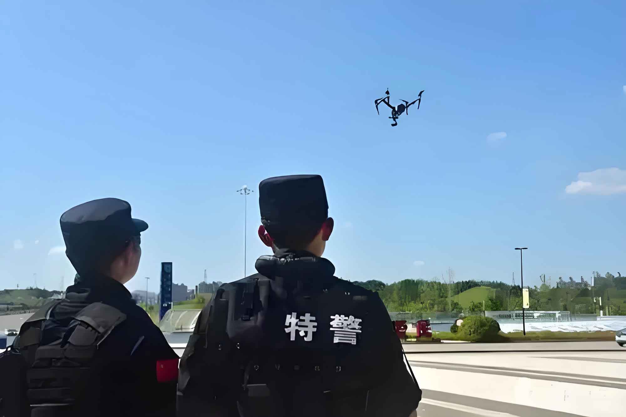
The operational effectiveness of a police drone is fundamentally constrained by its technical performance parameters. These requirements can be modeled as a function of mission type, environmental conditions, and payload. A generalized performance equation for a police drone mission can be expressed as:
$$ \text{Mission Success} = f(P_{\text{flight}}, P_{\text{sensor}}, P_{\text{comms}}, P_{\text{ai}}, E_{\text{env}}) $$
where:
$P_{\text{flight}}$ represents flight performance (endurance $t$, range $r$, payload capacity $m$, robustness to wind $w$).
$P_{\text{sensor}}$ denotes sensor suite capability (optical zoom $z$, thermal sensitivity $\Delta T$, resolution $R$).
$P_{\text{comms}}$ is communication link reliability (latency $\ell$, bandwidth $B$, encryption level $E$).
$P_{\text{ai}}$ encapsulates AI/automation features (object recognition accuracy $A_{rec}$, tracking stability $S_{tr}$).
$E_{\text{env}}$ accounts for environmental factors (weather, electromagnetic interference, terrain).
Current systems often fall short in optimizing this function. For public order maintenance, the core needs are persistent patrol and rapid response to incidents. The technical shortcomings are detailed in Table 2. A critical limitation is the lack of deep integration between the police drone‘s real-time sensor data and backend policing databases (e.g., for automatic license plate or facial recognition linked to watchlists). The vision for a smart police drone grid involves autonomous patrols that can detect anomalies—a stranded vehicle, an unauthorized gathering, a missing person—and push intelligent alerts to a command center or nearest patrol unit, significantly enhancing preventive policing. The concept of automated drone-in-a-box systems for first response is promising but hampered by long launch times and lack of universal standards.
| Operational Need | Technical Requirement | Current Performance Gap |
|---|---|---|
| Persistent Aerial Patrol | Long endurance ($t$), stable video downlink ($B$, $\ell$), automated flight, intelligent threat detection ($A_{rec}$). | Limited flight time, especially for multi-rotors. Basic object recognition; lacks real-time cross-referencing with police databases for automatic suspect/vehicle flagging. |
| Automated First Response | Rapid, remote deployment from automated stations, precise GPS navigation to coordinates, live feed to dispatchers & ground units. | Automated take-off/landing station technology is nascent and expensive. Systems lack interoperability. Deployment is not fast enough for critical minutes immediately post-emergency call. |
In the realm of criminal investigation, the demands on the police drone are more acute and varied. The performance gaps here are even more pronounced, as shown in Table 3. Nighttime operations remain a significant challenge; while thermal imaging is available, its resolution and ability to discern details crucial for identification are often insufficient. The potential for coordinated multi-drone operations—using fixed-wing drones for wide-area search and multi-rotors for close inspection—is largely untapped due to a lack of mature command-and-control software. Perhaps the most sensitive area is the use of police drones for tactical interventions. While drones can be equipped with non-lethal or, in extreme scenarios, lethal payloads, the technology for precision targeting from a mobile aerial platform is underdeveloped. Most current solutions offer only area-effect or very short-range, unaimed deployment, raising serious concerns about collateral effects and proportionality in complex, dynamic environments like urban settings.
| Operational Need | Technical Requirement | Current Performance Gap |
|---|---|---|
| Covert Surveillance & Reconnaissance | Low acoustic signature, all-weather capability, long-range optics ($z$), encrypted low-latency link ($\ell$, $E$). | Limited performance in rain/snow/fog. Acoustic footprint is significant for multi-rotors. Video transmission in remote, signal-poor areas is unreliable. |
| Wide-Area Search & Pursuit | High endurance ($t$), multi-spectral sensors (thermal $\Delta T$, night-vision), AI-powered tracking ($S_{tr}$), multi-agent coordination. | Single-drine operations are the norm. AI tracking loses target in cluttered environments. No effective swarm search protocols are operationally fielded. |
| Tactical Intervention Support | Stable low-altitude flight in GPS/comm-denied environments, precise targeting systems for less-lethal payloads, real-time video feed to tactical teams. | Payload delivery systems (nets, irritants) lack precision aiming. Urban electromagnetic interference disrupts control links at low altitude. Clear rules of engagement and liability frameworks are absent. |
| Forensic Scene Documentation | High-resolution mapping, rapid orthomosaic & 3D model generation, evidence marking from aerial imagery. | Photogrammetry software processing is too slow for real-time decision-making during an active incident. Low-light scene capture is poor. |
Beyond hardware, systemic and regulatory hurdles profoundly constrain police drone efficacy. Airspace management is a primary point of friction. The ad-hoc nature of flight authorization, often involving separate military, civil aviation, and internal police bureaucracies, creates delays incompatible with the urgency of police work. This frequently leads to informal, unregulated flights, creating safety risks and potential legal vulnerabilities. The lack of standardized visual identification—consistent high-visibility livery and markings for police drones—further complicates public perception and accountability.
The legal landscape for police drone operations is ambiguous. While general guidelines for administration and pilot licensing exist, there is a critical lack of granular legal statutes governing specific use cases. Key unresolved questions include: Under what precise legal authority can a police drone deploy force (e.g., net guns, tear gas)? How is privacy balanced during broad-area surveillance? Who bears liability—the operator, the commander, or the agency—in the event of a crash causing property damage or injury? The absence of clear answers fosters a culture of risk aversion among operators, stifling innovative but legally untested applications.
Organizational infrastructure for police drone units is often precarious. Many units exist as ad-hoc teams within larger departments like SWAT, without dedicated budgets, career progression pathways for pilots/technicians, or standardized advanced training programs. Funding is frequently project-based, leading to one-time purchases of equipment that quickly becomes obsolete, with no sustainable budget for maintenance, software updates, or fleet renewal. This undermines the long-term operational readiness and development of institutional expertise.
To harness the full potential of police drones, a multi-faceted strategy is required. First, a stable, demand-driven innovation pipeline must be established. Law enforcement agencies must move beyond being mere customers and become active partners in the research and development cycle. By formally collaborating with UAV manufacturers and software developers, agencies can communicate precise operational pain points—such as the need for longer endurance, better low-light sensors, or AI algorithms trained on specific forensic patterns—guiding the industry toward creating truly fit-for-purpose police drone solutions. The integration frontier lies in creating middleware that seamlessly feeds police drone data streams into existing Computer-Aided Dispatch (CAD) and Real-Time Crime Center systems, transforming the drone from an isolated tool into a node in a networked intelligence ecosystem.
Second, regulatory and legal frameworks require urgent clarification and strengthening. Nationally, legislation must be updated to explicitly define the status of police drones as law enforcement platforms, delineating permissible uses, privacy safeguards, and liability structures. Operationally, unified airspace management platforms, co-managed by aviation and public safety authorities, are essential to streamline flight approvals for authorized missions while effectively monitoring and interdicting unauthorized drones. Internally, police agencies must develop and enforce strict Standard Operating Procedures (SOPs) covering every aspect of police drone use, from pre-flight checklists and data handling protocols to rules for escalation of force, ensuring accountability and professionalism.
Finally, investment in the human and organizational capital behind the technology is paramount. Police drone operations should be recognized as a distinct technical discipline within law enforcement. This entails creating dedicated units with proper staffing, clear command structures, and career ladders that attract and retain talent. Training must evolve from basic pilot certification to include advanced modules on tactical employment, legal considerations, data analysis, and maintenance. A sustainable funding model, viewing the police drone program as critical infrastructure requiring periodic refreshment, is necessary to avoid technological stagnation.
In conclusion, the police drone represents a transformative tool for modern law enforcement, offering unprecedented capabilities in surveillance, response, and situational awareness. Its current application, while broad, is hampered by a confluence of technical limitations, regulatory ambiguities, and organizational growing pains. The path forward requires a concerted effort to bridge the gap between technological possibility and operational reality. By fostering strategic industry partnerships, advocating for clear and sensible regulations, and building professional, well-resourced drone units, law enforcement agencies can ensure that the police drone evolves from a novel gadget into a cornerstone of effective, efficient, and accountable public safety in the 21st century. The ultimate measure of success will be a police drone ecosystem that is not only powerful and intelligent but also fully integrated, legally sound, and publicly trusted.