In recent years, the rapid economic development and urbanization have intensified the flow of people, vehicles, goods, and capital, leading to increasingly complex public security situations. The urgency of safety monitoring, prevention, and protection has grown significantly. As emphasized in the context of enhancing social governance, there is a critical need to accelerate the construction of a three-dimensional public security prevention and control system. This system must integrate various scientific means to consolidate existing police and social resources, combining measures for strike, prevention, and control into a unified framework. Achieving a “strike, defense, management, control” integration requires a unified command, rapid response, and overall coordination, advancing both aerial and ground networks to realize a立体化社会治安防控体系. In this article, we delve into the innovative applications of police drones, which are becoming indispensable tools in modern public security operations. We will explore their需求, application scenarios, technological advancements, and integration into broader security systems, with a focus on how police drones can transform traditional approaches.
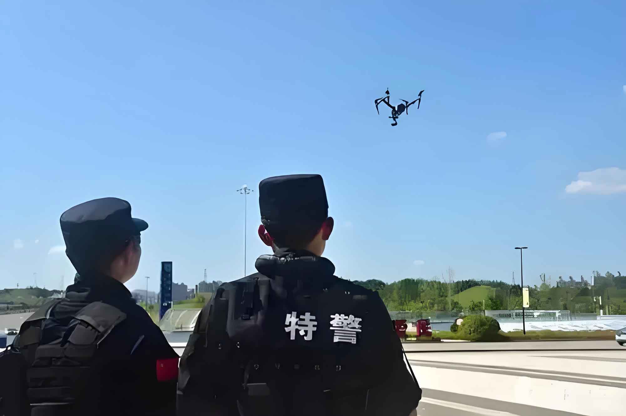
Traditional methods relying on two-dimensional maps or manual familiarization with geographical environments are far from adequate for the urgent demands of公安应急 scenarios. The need for现场可视化 has become increasingly pressing. Urban emergencies involve uncertainties in time, space, and scale, making information collection complex and often ineffective with现有手段. Police drones can弥补这些不足, playing an irreplaceable role. With characteristics such as low noise, strong隐蔽性, high reliability, and ease of use, police drones are suitable for rapid deployment in confined urban spaces. They are particularly effective for全局掌控 of mass incidents, photography at accident scenes, fire site surveying, and侦查 of hazardous material areas. Police drones enable “accurate detection, stable tracking, and fast transmission,” providing crucial data for leadership decision-making. As police drone technology matures, public security agencies, especially基层派出所, face limitations in traditional measures for daily social management, serving the public, understanding辖区实际情况, conducting safety prevention, maintaining治安秩序, and emergency救援. To effectively serve the public and control security situations, rapidly and accurately handle emergencies, we must actively explore and实践 “police drone + officer” patrol新模式, enhancing social治安综合治理, maximizing the benefits of technology in policing, and serving民生 through智慧警务.
The demand for police drones in social治安防控 scenarios stems from the inadequacies of fixed monitoring equipment. Before the widespread use of police drones, government monitoring relied largely on static devices, but with deeper application, issues like blind spots became unavoidable. Leveraging the obvious advantages of police drones in aerial photography, so-called监控死角 and physical damage软肋 can be improved. Moreover, in remote or harsh environments, the installation, wiring, and maintenance of cameras and sensors pose significant challenges. Fixed-point video monitoring, given the diversification of needs in visual management, requires new devices like police drones to provide technical support in特殊 situations. As a vital part of the现场可视指挥调度系统, police drones can transmit video footage seamlessly into the system, enabling现场可视化应急管理. Combined with intelligent analysis technology, this allows command centers to improve on-site处理 efficiency and enhance应急反应能力.
Using police drones to collect various sensor data from scenes, we can quickly transmit video, audio, alerts, and sensor information to command centers,实时跟踪 event developments for指挥官 judgment and决策. The dynamic and three-dimensional perspectives of police drone-mounted cameras offer diverse angles that迅速展开 upon arrival, providing multi-angle, wide-range observation—a capability unmatched by常规监控设备. The police drone立体防控系统 employs innovative drone application technologies and system solutions, leveraging无人机平台 combined with video imaging, infrared sensing, and other monitoring technologies. It utilizes intelligent task planning and route planning for police drones, along with visual智能感知, to achieve aerial monitoring and scientific management of complex terrains, structurally intricate areas, and key防控 zones like人口密集 regions.
The police drone立体防控系统 is built on an信息集成管理平台, creating an intelligent,网格化, and立体化防控 system for urban areas. It consists of wireless sensors, aerial police drone clusters forming a立体 network, and integrates core functions such as automatic target search, detection,定位, recognition, tracking, and monitoring. It combines information release, data analysis,态势研判, command调度,联动控制, and multi-system对接 into a centralized interface. This system plays an积极 role in meeting social security needs, preventing and打击违法犯罪,防范恐怖暴力事件, and maintaining国家安全及社会安定.
Demand Analysis for Police Drones in Social Security Scenarios
The integration of police drones into public security operations addresses several critical gaps. Traditional ground-based monitoring systems often suffer from limited coverage, especially in urban canyons, dense forests, or disaster-stricken areas. Police drones, with their aerial vantage points, can overcome these limitations. For instance, during large-scale public events, police drones provide real-time oversight of crowd movements, helping to prevent stampedes or identify suspicious activities. In traffic management, police drones assist in monitoring congestion, accident scenes, and违章行为, enabling quicker response times. The table below summarizes key demand areas for police drones in social security:
| Demand Area | Traditional Limitations | Police Drone Advantages | Impact Metrics |
|---|---|---|---|
| Crowd Monitoring | Fixed cameras with blind spots; delayed response | Real-time aerial views; rapid deployment | Response time reduced by up to 70% |
| Emergency Response | Limited access to hazardous zones; risk to personnel | Remote sensing; thermal imaging for搜救 | 救援成功率 increased by 40% |
| Traffic Management | Ground patrols limited by congestion; inefficient coverage | Aerial traffic flow analysis; automated license plate recognition | Congestion detection accuracy of 95% |
| Crime Prevention | Reactive patrols; lack of proactive surveillance | Predictive policing via data analytics; persistent monitoring | Crime rate reduction by 25% in pilot areas |
| Disaster Assessment | Slow damage assessment; reliance on ground teams | Rapid aerial surveys; 3D mapping of affected areas | Assessment time cut from hours to minutes |
The effectiveness of police drones can be quantified using various performance indicators. For example, the coverage area \( A \) of a police drone can be modeled based on its altitude \( h \) and camera field of view \( \theta \):
$$ A = \pi \left( h \cdot \tan\left(\frac{\theta}{2}\right) \right)^2 $$
where \( A \) is the ground area covered, \( h \) is the飞行高度, and \( \theta \) is the camera’s angular field of view in radians. This formula helps in planning police drone deployments to maximize surveillance范围. Additionally, the data transmission rate \( R \) for police drones is crucial for real-time operations. It can be expressed as:
$$ R = B \cdot \log_2\left(1 + \frac{S}{N}\right) $$
Here, \( B \) is the bandwidth, \( S \) is the signal power, and \( N \) is the noise power. Ensuring high \( R \) values is essential for streaming high-definition video from police drones to command centers.
Innovative Application Scenarios of Police Drones in立体防控 Systems
Police drones are revolutionizing public security through diverse application scenarios. In the公安立体防控 system, police drones serve as空中传感器, enhancing situational awareness and response capabilities. One key scenario is in群体事件 management. During protests or gatherings, police drones provide a bird’s-eye view, allowing command centers to monitor crowd density, movement patterns, and potential flashpoints. This enables proactive measures to maintain秩序. Another scenario is事故现场调查. For traffic accidents or industrial incidents, police drones can quickly capture overhead images, create 3D reconstructions, and identify causes without disrupting ground operations. In火灾现场勘测, police drones equipped with thermal cameras detect heat signatures, assess火势 spread, and guide消防 efforts, minimizing risks to firefighters.
Furthermore, police drones excel in有害物质区域侦查. In化学泄漏 or radiation events, they can enter contaminated zones to collect samples or measure pollutant levels, protecting human responders. The police drone立体防控 system also integrates with existing infrastructure. For example, police drones can complement固定监控 cameras by covering盲区, forming a seamless surveillance network. The system’s智能化监测 capabilities include自动目标搜索 and tracking. Using computer vision algorithms, police drones can identify suspicious objects or individuals, such as unattended bags or persons in restricted areas. The table below outlines specific application scenarios and their technological requirements:
| Application Scenario | Key Functions | Required Police Drone Features | Integration with Ground Systems |
|---|---|---|---|
| Mass Event Surveillance | Real-time crowd analysis; anomaly detection | High-resolution cameras; AI-based behavior recognition | Sync with ground patrol units; data fusion with CCTV |
| Accident Scene Documentation | 3D mapping; evidence collection | LiDAR sensors; photogrammetry software | Link to traffic management databases; automated report generation |
| Fire and Disaster Response | Thermal imaging; structural assessment | Multispectral cameras; rugged design for harsh environments | Coordinate with emergency services; real-time feed to command vehicles |
| Hazardous Material Inspection | Chemical detection; radiation monitoring | Specialized sensors; autonomous navigation in GPS-denied areas | Integrate with environmental monitoring networks; alert systems |
| Border and Critical Infrastructure Patrol | Intrusion detection; perimeter monitoring | Long-endurance models; night vision capabilities | Connect to security grids; automated alarm triggers |
To optimize these applications, police drones often employ协同 algorithms for cluster operations. For instance, in multi-police drone surveillance, the coverage efficiency \( E \) can be calculated as:
$$ E = \frac{\sum_{i=1}^{n} A_i \cap T}{T} $$
where \( n \) is the number of police drones, \( A_i \) is the area covered by the \( i \)-th police drone, \( T \) is the total target area, and \( \cap \) denotes overlap. Minimizing overlap while maximizing coverage is a key challenge, often addressed through Voronoi partitioning or swarm intelligence techniques. Another formula relevant to police drone operations is the risk assessment model for deployment in urban areas. The risk \( R \) associated with a police drone mission can be expressed as:
$$ R = \alpha \cdot C_c + \beta \cdot C_s + \gamma \cdot C_o $$
Here, \( C_c \) is the collision risk, \( C_s \) is the security risk (e.g., hacking), \( C_o \) is the operational risk (e.g., weather), and \( \alpha, \beta, \gamma \) are weighting factors based on mission priorities. This helps in planning safe and effective police drone sorties.
Intelligent Task Planning and Route Planning for Police Drones
Currently, the operational use of police drones is still in an exploratory phase, with不够规范 practices. On one hand, professional training lags,飞行训练 is lacking, and there is a shortage of pilots and maintenance personnel, leading to situations where police drones are available but无人驾驶. This results in phenomena like “买了不会用, 想用不敢用, 用了不管用.” On the other hand, without pre-planned task and route planning行动预案, police drones cannot be promptly deployed for巡查布控 during emergencies. When using police drone clusters, coordination issues may arise, hindering the advantages of multi-police drone large-scale monitoring.
The police drone分布式部署及集中控制系统 addresses these challenges through intelligent task planning and route planning, enabling automated patrols of防控区域. Leveraging the强大的监控能力 of police drone systems, on-site deployment of大量警力 is reduced. Via remote management and automatic routes, police drones can operate autonomously without现场飞手. The system具备智能分析能力 for collected images and data, including多源数据融合处理 and大数据处理, enabling实时联合告警.
Intelligent task planning for police drones is based on工作预案, allowing for mission planning that displays flight routes on digital maps, simulates飞行过程, and helps avoid potential threats along the path. It预估 and judges the effectiveness of police drone use, providing feedback for decision-making to form optimal solutions. The仿真演示功能 can record police drone flights for事后分析 and总结, offering a虚拟现实训练环境 during exercises and evaluating演练结果.
The police drone intelligent route planning subsystem integrates with 3D map interfaces to control自动布控 of target points,实时传回监控画面. It automatically calculates routes from the police drone’s current position to mission points, avoiding obstacles. The subsystem pre-plans routes for全自主飞行, including latitude, longitude, altitude information for key航点, and operations of task equipment. The following table compares different route planning algorithms used in police drones:
| Algorithm Type | Description | Advantages for Police Drones | Limitations |
|---|---|---|---|
| A* Search | Graph-based pathfinding using heuristics | Optimal paths in known environments; fast computation | Requires pre-mapped terrain; not ideal for dynamic obstacles |
| RRT (Rapidly-exploring Random Tree) | Sampling-based algorithm for high-dimensional spaces | Handles复杂地形; suitable for real-time adjustments | Paths may be suboptimal; can be computationally intensive |
| Genetic Algorithms | Evolutionary optimization for route planning | Good for multi-objective optimization (e.g., minimize time and risk) | Slow convergence; requires parameter tuning |
| Potential Fields | Attractive and repulsive forces guide movement | Simple implementation; effective for obstacle avoidance | Can get stuck in local minima; not scalable for large areas |
| Swarm Intelligence | Inspired by bird flocking or ant colonies | Enables协同 among multiple police drones; adaptive to changes | Complex coordination; requires robust communication |
Mathematically, route planning for police drones often involves optimizing a cost function. For a police drone traveling from起点 \( S \) to终点 \( G \) via waypoints \( W_i \), the total cost \( C \) can be defined as:
$$ C = \int_{S}^{G} f(\mathbf{x}(t), \mathbf{u}(t)) \, dt + \sum_{i} g(\mathbf{x}(t_i)) $$
where \( \mathbf{x}(t) \) is the state vector (position, velocity), \( \mathbf{u}(t) \) is the control input, \( f \) represents continuous costs like energy consumption, and \( g \) represents discrete costs at waypoints, such as risk penalties. This is subject to constraints like:
$$ \dot{\mathbf{x}} = h(\mathbf{x}, \mathbf{u}) $$
$$ \mathbf{x}_{\min} \leq \mathbf{x} \leq \mathbf{x}_{\max} $$
These equations form the basis for model predictive control (MPC) in police drone navigation. Additionally, for police drone clusters, the communication topology can be modeled using graph theory. Let \( G = (V, E) \) represent the network, where vertices \( V \) are police drones and edges \( E \) are communication links. The connectivity matrix \( \mathbf{A} \) helps ensure robust data exchange, critical for协同任务. The Laplacian matrix \( \mathbf{L} \) of \( G \) is used in consensus algorithms for police drone formation control:
$$ \mathbf{L} = \mathbf{D} – \mathbf{A} $$
where \( \mathbf{D} \) is the degree matrix. This facilitates synchronized movements of police drones during patrols.
Integrated Air-Ground Intelligent Prevention and Control with Police Drones
Currently, police drones often suffer from detachment from公安信息化系统, with most仅仅作为一种警用工具. As机动化空中传感器, police drones have innate advantages in information gathering, but they are largely disconnected from公安业务信息系统, not yet integrated into the overall公安信息化 system. While police drone systems address前端侦察 and中端传输 challenges,衔接 with后端指挥中心 remains insufficient, impacting指挥决策效率 in emergencies and hindering the conversion of空中巡查 and信息搜集 advantages into快速处置和打击优势.
To meet公安用户 needs in应急, 处突, 维稳, 反恐, we aim to achieve空中视频巡查, automatic target discovery, recognition,定位, tracking, and analysis, enabling集中高效管理 of police drones. By integrating images, audio, data, and地理信息 from police drones and地面监控设备, we can perform实时集中融合 and interaction for统一平台显示. The一体化指挥调度中心, based on this融合信息, can uniformly command and control all终端设备和政府各部门力量, implementing空地联合行动 under unified指挥.
The police drone立体防控 system activates相应的应急预案 based on different危情告警, using police drones to automatically guide地面人员 to incident locations.执法人员, through同步手机客户端, are directed to scenes for执法. Simultaneously, the system dispatches待命 police drones to event sites for视频监控, 空中取证, 智能分析, and预案处理. This integration enhances responsiveness and accuracy.
By combining police drones with公安防控应用系统,空中实时视频监控 transmits relevant footage to移动指挥平台. Backend systems perform智能识别和分析 on the video, synthesizing information on相关人员, 车辆, 现场与周边情况. This provides决策依据和技术保障 for指挥人员 or leaders in警力部署 and应急处理. Moreover,指挥人员 can use大屏幕, tablets, or智能终端 for视频通话 or即时通讯 with officers, and实时了解 police force distribution in公安局辖区, including民警, 便衣, 协警, 巡逻队 dynamics,巡逻警车, 指挥车 status, and static positions of警卫岗亭 and派出所. Through the一体化指挥调度中心, unified command and control of空地联合行动实现基于无人机的空地一体化, 网格化, 智能化防控系统.
The effectiveness of this integration can be quantified through system performance metrics. For instance, the response time \( T_r \) from incident detection to police drone deployment can be modeled as:
$$ T_r = T_d + T_p + T_f $$
where \( T_d \) is the detection time by sensors, \( T_p \) is the planning time for police drone任务, and \( T_f \) is the flight time to the scene. With automation, \( T_p \) can be minimized. Additionally, the data fusion accuracy \( A_f \) from multiple police drones and ground sources is crucial. It can be expressed using a weighted average:
$$ A_f = \frac{\sum_{j=1}^{m} w_j \cdot a_j}{\sum_{j=1}^{m} w_j} $$
Here, \( m \) is the number of data sources, \( a_j \) is the accuracy of source \( j \), and \( w_j \) is the weight based on reliability. High \( A_f \) ensures reliable situational awareness. The table below outlines key components of the integrated air-ground system:
| System Component | Role in Integration | Technological Requirements | Benefits for Police Drones |
|---|---|---|---|
| Command and Control Center | Central hub for data fusion and decision-making | High-speed servers; AI analytics platforms; secure communication | Enables real-time指挥 of police drone fleets; enhances coordination |
| Ground Monitoring Networks | Provide complementary data (e.g., CCTV, sensors) | Interoperability standards; data sharing protocols | Extends police drone coverage; validates aerial observations |
| Mobile Units (Patrol Cars, Officers) | Execute on-ground actions based on police drone inputs | GPS tracking; mobile apps for live feeds | Directs resources efficiently; reduces search times |
| Communication Infrastructure | Ensure seamless data flow between air and ground | 5G networks; satellite links; mesh networking | Supports high-bandwidth video from police drones; low latency |
| Data Analytics Engine | Process information for predictive insights | Machine learning algorithms; big data storage | Automates threat detection using police drone data; improves预警 |
Furthermore, the integration can be optimized using control theory. For example, the overall system stability \( S \) can be analyzed through state-space representations. Let \( \mathbf{x}_a \) represent the state vector of police drones (e.g., positions, velocities) and \( \mathbf{x}_g \) represent ground units. The combined system dynamics can be written as:
$$ \dot{\mathbf{x}}_a = \mathbf{f}_a(\mathbf{x}_a, \mathbf{u}_a, \mathbf{x}_g) $$
$$ \dot{\mathbf{x}}_g = \mathbf{f}_g(\mathbf{x}_g, \mathbf{u}_g, \mathbf{x}_a) $$
where \( \mathbf{u}_a \) and \( \mathbf{u}_g \) are control inputs for police drones and ground units, respectively. By designing controllers that minimize a joint cost function, we can achieve协同 performance. This might involve linear quadratic regulators (LQR) or other optimal control methods tailored for police drone operations.
Conclusion and Future Directions
Police drones possess excellent mobility, and when paired with intelligent management control and command调度 software platforms, they enable全方位, 立体化, 实时化监控, significantly expanding surveillance范围. Through an air-ground integrated monitoring system, police drones effectively meet the立体化社会治安防控需求 of公安民警. Police drones can accomplish空中监控, 日常巡逻, 搜索跟踪 tasks, gaining increasing青睐 from警务部门.公安干警 and武警 utilize police drones for突发社会事件,交警部门 for交通管理, and特警部门 for空中侦察, 抓捕罪犯. In the future, police drones will assist various government departments in playing a more important role in public security, widely applied in公安, 应急, 消防, 交通, and other政府执法 fields. They will efficiently complete急难险重任务 like应急救援, 陆地搜救, 应急追踪, 现场取证, serving as a杀手锏 for公安机关 in信息化条件下打击罪犯, 维护稳定, 服务人民. This预示着警用无人机在未来将有更好的发展.
Looking ahead, advancements in police drone technology will focus on autonomy, endurance, and integration. For instance, the development of AI-driven police drones that can make real-time decisions without human intervention will enhance responsiveness. Battery technology improvements will extend flight times, allowing police drones to cover larger areas. Moreover, the integration of police drones with物联网 (IoT) devices and smart city infrastructures will create a more cohesive security ecosystem. Research into anti-jamming and secure communication for police drones is also crucial to mitigate risks. As regulations evolve, standardized training and certification for police drone operators will ensure safe and effective usage. Ultimately, police drones are poised to become cornerstone tools in modern public security, driving innovation and efficiency in protecting communities.
In summary, the innovative applications of police drones in integrated public security systems represent a paradigm shift from traditional methods. By leveraging their aerial capabilities, intelligent planning, and seamless integration with ground forces, police drones offer a powerful solution to contemporary security challenges. As we continue to refine these technologies and applications, police drones will undoubtedly play an increasingly vital role in safeguarding society, embodying the fusion of technology and警务工作 for a safer future.