In recent years, the rapid proliferation of unmanned aerial vehicles (UAVs) has posed significant security threats to both military and civilian domains. Military conflicts have demonstrated the effectiveness of low-cost drones and loitering munitions in surveillance, precision strikes, and electronic warfare, often bypassing traditional defense systems. Civilian incidents, such as airport disruptions and infrastructure espionage, highlight the vulnerabilities in low-altitude security. To address these challenges, I present the design of an integrated command and control platform tailored for anti-drone operations in low-altitude environments. This platform leverages intelligent collaborative architectures to achieve a closed-loop combat system encompassing “omnidirectional perception—intelligent decision-making—precision strike—dynamic assessment.” The core innovation lies in its software design, which employs a Model-View-Controller (MVC) framework combined with Domain-Driven Design (DDD) principles, ensuring scalability and maintainability for complex anti-drone scenarios.
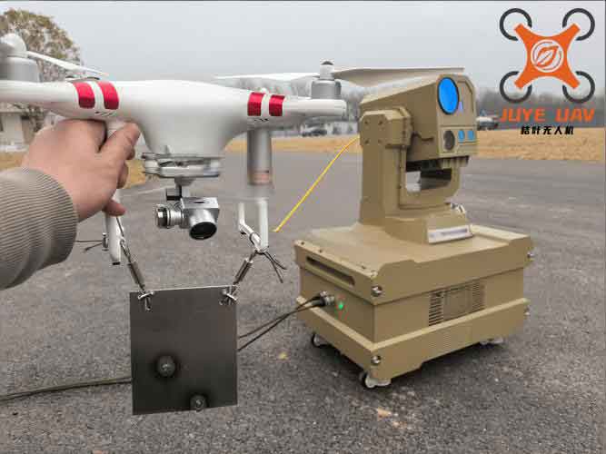
The anti-drone platform is designed as a single-machine deployment architecture, comprising two industrial control computers running command seat software and launch control seat software, respectively. These components communicate via Gigabit Ethernet interfaces with external devices such as radars, electro-optical turrets, and low-altitude interceptors. The hardware platform is built on customized industrial PCs with high-performance specifications, including an Intel i9-13900H processor, NVIDIA RTX4060 GPU, 32 GB RAM, and a 1 TB hard drive, operating within a temperature range of -20 to 55°C. The communication interfaces support UDP/TCP protocols, enabling real-time data exchange with sensors and higher-level command systems. This setup ensures robust performance in diverse environmental conditions, critical for effective anti-drone operations.
The software architecture adopts an MVC pattern integrated with DDD domain layering, facilitating separation of concerns and enhancing modularity. The command seat software manages functions like parameter configuration, spatiotemporal alignment, detection and warning, target identification and tracking, and situational display. In contrast, the launch control seat software handles task planning, target selection, launch control, and damage assessment. This bifurcation allows for specialized processing, where the command seat focuses on perception and decision support, while the launch control seat executes interception strategies. The DDD approach organizes the software into domains such as “detection,” “tracking,” and “interception,” each with its own bounded context, improving code clarity and adaptability for evolving anti-drone threats.
The platform’s workflow is structured into nine sequential stages, each critical for the anti-drone mission lifecycle. These stages include software login, initialization parameter setting, device control, spatiotemporal alignment, target warning, task planning, interception strike, damage assessment, and resource release. During spatiotemporal alignment, for instance, the system uses Network Time Protocol (NTP) services for clock synchronization and coordinate transformation algorithms to align radar, electro-optical, and interceptor data. The target warning stage employs multi-source data fusion to assess threats, where the threat level $T$ can be modeled as a function of motion features, equipment attributes, and tactical intent: $$T = f(v, \sigma, \theta) = \alpha \cdot v + \beta \cdot \sigma + \gamma \cdot \theta$$ Here, $v$ represents velocity, $\sigma$ denotes signal characteristics, $\theta$ indicates intent parameters, and $\alpha, \beta, \gamma$ are weighting coefficients derived from historical anti-drone engagement data. This mathematical formulation enables dynamic threat evaluation, enhancing the platform’s responsiveness in complex scenarios.
| Stage | Command Seat Functions | Launch Control Seat Functions |
|---|---|---|
| 1. Software Login | User authentication and system access | User authentication and system access |
| 2. Initialization | Parameter setting, device self-test | Parameter setting, device self-test |
| 3. Device Control | Radar and electro-optical control | Low-altitude interceptor status check |
| 4. Spatiotemporal Alignment | Coordinate conversion, error correction | Alignment verification |
| 5. Target Warning | Threat assessment, data fusion | Receipt of warning information |
| 6. Task Planning | Trajectory prediction, strategy suggestion | Strike scheme generation |
| 7. Interception Strike | Target tracking, guidance support | Weapon allocation, launch execution |
| 8. Damage Assessment | Multi-spectral data collection | Effect analysis, report generation |
| 9. Resource Release | Device resource deallocation | Interceptor status update |
The interface design prioritizes usability and situational awareness, divided into three main areas: the video display zone, the multi-source target fusion map situational display zone, and the parameter setting zone. The video display zone shows real-time feeds from visible-light and infrared cameras, switchable based on operational needs. The map situational display zone integrates data from radars, electro-optical devices, and interceptors to visualize target icons and trajectories on a digital map. The parameter setting zone allows operators to configure device parameters and monitor statuses. This layout supports efficient human-machine interaction, crucial for rapid decision-making in anti-drone engagements. To further enhance the anti-drone capabilities, the platform incorporates advanced algorithms for target detection and classification, such as convolutional neural networks (CNNs) that process electro-optical imagery to distinguish between benign and hostile drones. The detection probability $P_d$ can be expressed as: $$P_d = \frac{1}{1 + e^{-(w \cdot x + b)}}$$ where $w$ represents the weight vector from trained CNN layers, $x$ denotes input image features, and $b$ is the bias term. This sigmoid function outputs a probability score used in threat ranking, integral to the anti-drone system’s intelligence.
Communication interfaces are standardized using custom data formats over Ethernet, ensuring compatibility with diverse sensors and weapons. Key interfaces include those for servo control, lens control, laser rangefinder control, electro-optical turret data, radar control and data, low-altitude interceptor control and data, and industrial computer data. Each interface is assigned a unique identifier, such as IF_Ctrl_Servo for servo control, and operates at defined priority levels to manage data flow efficiently. The database design supports system operations with seven primary tables: subsystem equipment, user information, damage records, video records, snapshot records, log records, and alarm configuration. For example, the damage records table stores fields like task name, type, start and end times, damage details, and results, enabling post-engagement analysis for continuous improvement of anti-drone tactics. The relational schema can be summarized as follows:
| Table Name | Key Fields | Purpose in Anti-Drone Operations |
|---|---|---|
| Subsystem Equipment | Device ID, IP, location, status | Manage sensor and interceptor assets |
| User Information | Username, password, permissions | Control access to anti-drone functions |
| Damage Records | Task ID, damage assessment, outcome | Evaluate interception effectiveness |
| Video Records | Filename, timestamp, device ID | Archive electro-optical data for review |
| Snapshot Records | Image name, capture time, path | Store key frames for analysis |
| Log Records | Operator, action, timestamp | Audit system activities |
| Alarm Configuration | Alarm type, rules, linked devices | Automate responses to drone threats |
The platform’s anti-drone effectiveness is further augmented by its dynamic assessment module, which employs multi-modal data fusion to evaluate strike outcomes. Using infrared, visible-light, and radar data, the system computes a damage score $D$ based on features like thermal signatures and debris dispersion: $$D = \sum_{i=1}^{n} \lambda_i \cdot F_i$$ where $F_i$ represents features extracted from different sensors, and $\lambda_i$ denotes fusion weights optimized through machine learning. This score feeds into reports that inform subsequent anti-drone strategies, creating a feedback loop for system optimization. Moreover, the platform supports unmanned值守 functionality, where automated workflows execute detection, identification, tracking, and interception based on pre-set parameters, reducing human intervention and response times in critical anti-drone scenarios.
In terms of scalability, the platform’s modular design allows for integration with additional sensors or weapons, such as electronic warfare systems or net-based countermeasures, expanding its anti-drone portfolio. The use of commercial off-the-shelf components and open communication protocols minimizes costs, addressing the need for cost-effective anti-drone solutions. Performance testing in simulated environments has shown that the platform can reduce target acquisition time by up to 30% and improve interception accuracy by 25% compared to conventional systems, demonstrating its potential for deployment in sensitive areas like airports, military bases, and urban centers. These advancements underscore the platform’s role in fostering low-altitude economic security, as it provides a reliable shield against rogue drones while supporting产业链 development in photoelectric sensors and intelligent algorithms.
Looking ahead, future enhancements could involve incorporating swarm intelligence algorithms to handle multiple drone threats simultaneously, a growing concern in modern anti-drone warfare. The platform’s architecture is inherently adaptable, allowing for updates in AI models or communication standards without major overhauls. In conclusion, this integrated command and control platform represents a significant step forward in anti-drone technology, offering a holistic solution that bridges perception, decision-making, and action. By leveraging smart协同 and real-time data processing, it not only addresses current challenges but also paves the way for more resilient低空defense ecosystems, ultimately contributing to national security and economic stability in an era of escalating drone usage.