As an aerospace engineer deeply involved in unmanned systems, I have witnessed the rapid evolution of Vertical Take-Off and Landing Unmanned Aerial Vehicles (VTOL UAVs) and their transformative impact across industries. From geophysical surveys to military logistics, VTOL UAV technology is pushing boundaries, enabling operations in previously inaccessible environments. In this article, I will delve into recent advancements, focusing on integrated aerogeophysical systems, space technology trials, and innovative VTOL UAV designs, all while emphasizing the critical role of VTOL UAV platforms. Throughout, I will use tables and formulas to summarize key data and performance metrics, providing a comprehensive overview of this dynamic field.
The development of VTOL UAV-based systems has revolutionized aerial survey methodologies. For instance, projects integrating electromagnetic, magnetic, and radiometric sensors onto UAV platforms have achieved significant milestones. One notable system, the UGRS-5 UAV aerogeophysical survey system, exemplifies this progress. It combines remote control capabilities with high-precision sensors, allowing for extensive data collection over challenging terrains. The core advantage of VTOL UAVs here is their ability to operate without runways, making them ideal for remote or rugged areas. The system’s performance can be summarized using the following formula for survey efficiency:
$$E = \frac{A \times R}{T}$$
where \(E\) is the survey efficiency in km² per hour, \(A\) is the area coverage rate, \(R\) is the sensor resolution, and \(T\) is the time per mission. For VTOL UAVs, \(A\) is enhanced due to vertical launch and recovery, reducing downtime.
To illustrate the components of such integrated systems, consider the table below outlining key elements of a typical VTOL UAV-based aerogeophysical station:
| Component | Function | VTOL UAV Integration Benefit |
|---|---|---|
| Remote Control System | Enables real-time monitoring and flight path adjustment | Allows precise navigation in complex environments without ground infrastructure |
| Magnetometer | Measures magnetic field variations for geological mapping | VTOL UAV stability enhances data accuracy during hover and low-speed flights |
| Radiometric Sensor | Detects natural radioactivity for mineral exploration | VTOL UAVs can fly at low altitudes, improving sensor sensitivity and resolution |
| Data Link | Transmits survey data to ground stations | Integrated with VTOL UAV communication systems for seamless operation |
These systems have undergone rigorous testing, including production trials covering over 13,000 line-kilometers, demonstrating the reliability of VTOL UAV platforms. The data quality often exceeds traditional methods, as VTOL UAVs minimize vibrations and maintain consistent altitudes. Another formula relevant here is the signal-to-noise ratio (SNR) for sensors on VTOL UAVs:
$$SNR = \frac{S_{signal}}{S_{noise}} = \frac{k \cdot P_{sensor}}{V_{vibration} + E_{environment}}$$
where \(k\) is a calibration constant, \(P_{sensor}\) is the sensor power, \(V_{vibration}\) is vibration noise (reduced in VTOL UAVs due to balanced rotors), and \(E_{environment}\) is environmental interference.
Beyond Earth-based surveys, VTOL UAV technology intersects with space exploration. For example, inflatable space capsule structures have been tested using hydrostatic pressure methods, which share similarities with VTOL UAV durability assessments. These trials validate structural integrity under extreme conditions, akin to how VTOL UAVs must withstand varied operational stresses. The pressure test formula can be expressed as:
$$P_{test} = \frac{F_{load}}{A_{surface}}$$
where \(P_{test}\) is the applied pressure, \(F_{load}\) is the force, and \(A_{surface}\) is the surface area. Such engineering principles are crucial for VTOL UAV design, ensuring they can handle payloads during vertical ascents and descents.
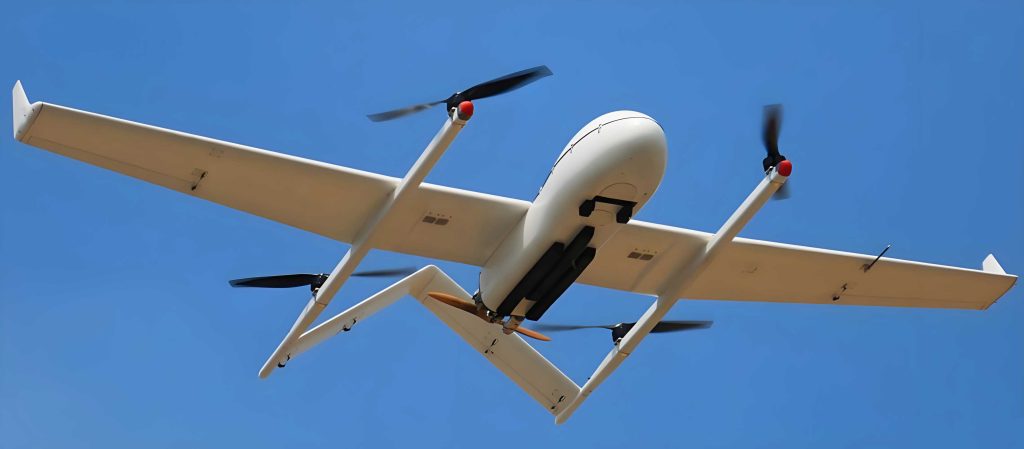
Turning to a standout example, the Israeli “Cormorant” VTOL UAV represents a leap in unmanned logistics. This compact, single-engine VTOL UAV is designed for tactical support, capable of transporting up to 500 kg of cargo over a 50 km radius. Its internal lift rotor system enables access to treacherous terrains where helicopters cannot operate, showcasing the versatility of VTOL UAV designs. During testing, the VTOL UAV achieved speeds of 55.6 km/h, with plans to reach 180 km/h, highlighting performance scalability. The logistics efficiency of such VTOL UAVs can be modeled as:
$$L_{eff} = \frac{M_{payload} \times D_{range}}{T_{flight} + T_{turnaround}}$$
where \(L_{eff}\) is logistics efficiency in kg·km per hour, \(M_{payload}\) is the cargo mass, \(D_{range}\) is the operational range, \(T_{flight}\) is flight time, and \(T_{turnaround}\) is the turnaround time (minimized by VTOL capabilities). For a fleet of 10 VTOL UAVs like the Cormorant, daily transport capacity can approach 6,000 kg, sufficient to supply hundreds of personnel. The following table compares key parameters of the Cormorant VTOL UAV with conventional UAVs:
| Parameter | Cormorant VTOL UAV | Standard Fixed-Wing UAV | Standard Helicopter UAV |
|---|---|---|---|
| Take-Off/Landing | Vertical (no runway needed) | Requires runway or launcher | Vertical but larger footprint |
| Max Payload | 500 kg | Varies, often lower for similar size | Higher but less efficient |
| Operational Range | 50 km (expandable) | Longer, but limited by launch sites | Shorter due to energy consumption |
| Speed | 55.6–180 km/h | Higher speeds common | Moderate speeds |
| Terrain Accessibility | Excellent (hovers in confined spaces) | Poor for rough terrain | Good but noisy and detectable |
The Cormorant VTOL UAV adheres to the Missile Technology Control Regime (MTCR) Category I standards, underscoring its advanced capabilities. Its powerplant, a Turbomeca Arriel turbine, delivers up to 734 kW in production models, enabling robust performance. The thrust-to-weight ratio, a critical metric for VTOL UAVs, is given by:
$$TWR = \frac{T}{W} = \frac{T_{engine}}{M_{UAV} \cdot g}$$
where \(TWR\) is the thrust-to-weight ratio, \(T\) is thrust, \(W\) is weight, \(M_{UAV}\) is the mass of the VTOL UAV, and \(g\) is gravitational acceleration. For efficient VTOL operations, \(TWR\) should exceed 1.5, allowing for agile maneuvers and heavy payloads.
In aerogeophysical applications, VTOL UAVs like those in the UGRS-5 system have filled gaps in national survey equipment, promoting domestic technological growth. The remote monitoring software integrates real-time data analytics, with algorithms that optimize flight paths based on sensor feedback. For instance, the path planning efficiency can be expressed as:
$$P_{opt} = \min \sum_{i=1}^{n} \left( \frac{d_i}{v_i} + c_i \right)$$
where \(P_{opt}\) is the optimal path cost, \(d_i\) is distance per segment, \(v_i\) is velocity (adjustable in VTOL UAVs for detailed surveys), and \(c_i\) is correction factor for obstacles. This flexibility is key for mapping mineral deposits or environmental monitoring.
Moreover, the fusion of multiple sensors on a single VTOL UAV platform enhances data correlation. For magnetic and radiometric surveys, the combined data yield insights into subsurface structures. A formula for integrated data accuracy is:
$$A_{integrated} = \sqrt{ \left( \frac{1}{N} \sum_{i=1}^{N} (A_{mag}^2 + A_{rad}^2) \right) }$$
where \(A_{integrated}\) is the overall accuracy, \(N\) is the number of data points, \(A_{mag}\) is magnetic accuracy, and \(A_{rad}\) is radiometric accuracy. VTOL UAVs provide stable platforms that minimize errors, pushing \(A_{integrated}\) to higher values.
The economic impact of VTOL UAVs is also significant. By reducing the need for manned aircraft or ground teams, they lower operational costs. A cost-benefit analysis can be tabulated as follows:
| Factor | VTOL UAV-Based Survey | Traditional Manned Survey |
|---|---|---|
| Initial Investment | High (due to advanced technology) | Lower (but recurring costs higher) |
| Operational Cost per Hour | $200–$500 (including maintenance) | $1,000–$3,000 (fuel, crew, etc.) |
| Data Collection Rate | Moderate but precise | Faster but less detailed |
| Safety | High (no crew risk) | Moderate (human operators at risk) |
| Environmental Impact | Low (electric or efficient engines) | Higher (larger carbon footprint) |
These advantages make VTOL UAVs indispensable for modern aerospace projects. In space technology trials, such as the inflatable capsule tests, the methodologies parallel VTOL UAV stress tests—both require lightweight, durable materials that can withstand pressure differentials. The formula for material stress in VTOL UAV rotors is similar:
$$\sigma = \frac{F}{A} \leq \sigma_{yield}$$
where \(\sigma\) is stress, \(F\) is force, \(A\) is cross-sectional area, and \(\sigma_{yield}\) is the material’s yield strength. Advances in composites, driven by VTOL UAV demands, benefit broader aerospace applications.
Looking ahead, the future of VTOL UAVs involves autonomy and swarm technology. Autonomous navigation systems, like those tested on the Cormorant VTOL UAV, use sensor fusion algorithms to improve reliability. The control logic can be modeled with differential equations:
$$\frac{d\vec{x}}{dt} = f(\vec{x}, \vec{u}), \quad \vec{u} = K(\vec{x}_{desired} – \vec{x})$$
where \(\vec{x}\) is the state vector (position, velocity), \(\vec{u}\) is the control input, and \(K\) is a gain matrix optimized for VTOL dynamics. Such systems enable VTOL UAVs to operate in GPS-denied environments, crucial for military or disaster response.
In conclusion, VTOL UAVs are at the forefront of aerospace innovation, bridging gaps in survey accuracy, logistics efficiency, and operational safety. From the rugged terrains mapped by aerogeophysical systems to the tactical supply chains supported by vehicles like the Cormorant, VTOL UAV technology continues to evolve. As we develop more integrated sensors, stronger materials, and smarter algorithms, the potential of VTOL UAVs will only expand, solidifying their role as pivotal tools in both civilian and defense sectors. The ongoing research and testing, exemplified by the projects discussed, underscore a commitment to advancing VTOL UAV capabilities—a journey I am proud to contribute to as we soar into new frontiers.