The integration of vertical take-off and landing (VTOL) capabilities with fixed-wing airframes represents a significant evolution in unmanned aerial vehicle (UAV) technology. This hybrid configuration, commonly referred to as a VTOL UAV or VTOL Fixed-Wing UAV, merges the distinct advantages of its predecessors: the high cruise speed, long endurance, and efficient forward flight of fixed-wing platforms with the multi-rotor’s hallmark ability for vertical take-off/landing and precise hovering. This synergy liberates operations from the constraints of runways or catapult launchers, enabling deployment in complex or confined environments while maintaining superior area coverage efficiency. Consequently, VTOL UAV systems are rapidly securing a vital role across numerous industries, including surveying, mapping, precision agriculture, and infrastructure inspection. The following discourse details the independent development of one such VTOL UAV system and presents a rigorous performance and accuracy assessment conducted through a real-world application: volumetric inventory of coal stockpiles at a port facility.
The core philosophy behind this VTOL UAV development was to create a robust, cost-effective, and highly stable platform suitable for professional aerial surveying tasks. The system architecture is built around three primary components: the aerial vehicle (flight platform), the mission payload, and the ground control station (GCS). Stability, reliability, and data quality were paramount considerations throughout the design and integration process.
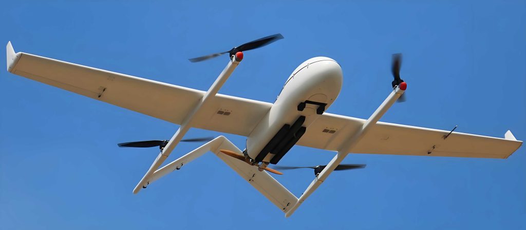
The flight platform employs a “4+1” lift-plus-cruise configuration, a subclass of powered-lift VTOL UAV designs. This configuration features four vertical lift rotors mounted on a fixed-wing airframe, paired with a separate, single rear-mounted propeller for forward thrust. This decoupling of lift and cruise systems offers significant advantages in terms of mechanical simplicity, control stability during transition phases, and operational reliability. The airframe itself utilizes a molded foam fuselage for light weight and durability, reinforced with carbon fiber spars in the wings to handle a maximum take-off weight of approximately 8 kg. This design provides ample internal space for avionics and payloads. The avionics suite is centered on the Pixhawk 2 open-source autopilot system. This advanced flight controller features a dual-processor design (STM32F437 + STM32F100) for enhanced reliability and incorporates a triple-redundant Inertial Measurement Unit (IMU). The IMU setup, complete with vibration damping and temperature regulation, ensures exceptional attitude and navigation stability. The system is fully compatible with Real-Time Kinematic (RTK) GPS, enabling centimeter-level positioning accuracy for geotagging acquired imagery.
Power is supplied by a high-capacity 22.2V Lithium-Polymer (LiPo) battery, selected for its favorable energy-to-weight ratio. Key parameters of the power system are summarized below:
| Parameter | Specification |
|---|---|
| Cell Type | Li-Polymer Power Cell |
| Voltage | 22.2 V |
| Capacity | 16,000 mAh |
| Approx. Weight | 1,915 g |
For high-resolution mapping, a Sony A7R2 mirrorless camera was integrated as the primary sensor. This payload was chosen for its high pixel count (42.4 megapixels), compact size, and built-in 5-axis image stabilization—a critical feature for mitigating motion blur during UAV flight. The camera was mounted in a vibration-isolated nadir position within the fuselage and electronically triggered by the flight controller at predetermined survey points. With a 35mm lens and a flight height of 140 meters, this configuration yields a ground sampling distance (GSD) of approximately 1.72 cm/pixel, suitable for detailed topographic modeling. The sensor specifications are critical for the VTOL UAV’s mission performance.
| Parameter | Specification |
|---|---|
| Effective Pixels | 42.4 Megapixels |
| Image Resolution | 7,952 x 4,472 pixels |
| Lens Focal Length | 35 mm |
| Stabilization | 5-axis Optical Image Stabilization |
The ground segment consists of a portable computer running mission planning and control software, linked to the VTOL UAV via a long-range digital telemetry radio (XROCK V3, range >2 km). The GCS software allows for complete mission planning (flight altitude, speed, overlap, area coverage), provides real-time telemetry monitoring (altitude, speed, battery status, GPS health), and enables manual override via a companion radio controller if required.
To evaluate the operational performance and data accuracy of this VTOL UAV system, a field test was designed around a stockpile inventory project at a bulk cargo port. The objective was to calculate the volume of several large coal piles. To establish a high-accuracy ground truth for comparison, the site was first scanned using a RIEGL VZ-1000 terrestrial laser scanner (TLS). This instrument provides millimeter-to-centimeter level point cloud accuracy, making it an excellent reference. The TLS parameters are listed for context:
| Performance Metric | Parameter |
|---|---|
| Scanning Range | 2.5 m to 1,400 m |
| Scanning Speed | 300,000 points/second |
| Scanning Accuracy | 5 mm at 100 m |
Following the TLS survey, the VTOL UAV was deployed. The mission was planned with an altitude of 140 m above take-off point, a forward overlap of 70%, and a side overlap of 60%. Flight conditions were recorded as partly cloudy with a northeast wind at approximately 4.6 m/s (Beaufort scale 3). The UAV executed a fully autonomous grid pattern, capturing 357 images during the single flight.
The first performance metric analyzed was the stability of the flight altitude. Maintaining a consistent altitude is crucial for ensuring a uniform GSD across the project area. The UAV’s altitude is derived from a barometric pressure sensor, where pressure (P) and temperature are used to compute height (h) relative to a reference pressure at sea level (P0). The relationship can be expressed by the barometric formula:
$$ h = 44300 \times \left(1 – \left(\frac{P}{P_0}\right)^{1/5.255}\right) $$
The theoretical flying height above ground (AGL) is the sum of the take-off point’s elevation ($$ h_{base} $$) and the planned mission altitude ($$ A_{planned} $$): $$ h_{theoretical} = h_{base} + A_{planned} $$. For this mission, $$ h_{theoretical} = 170.86 \text{ m} $$. The actual altitude for each captured image, $$ h_{i} $$, was extracted from the vehicle’s logged POS data.
The Root Mean Square Error (RMSE) of the flight altitude and its relative error were calculated to quantify stability:
$$ RMSE_h = \sqrt{ \frac{\sum_{i=1}^{n} ( h_{theoretical} – h_{i} )^2 }{n} } $$
$$ \text{Relative Error}_h = \frac{RMSE_h}{A_{planned}} \times 100\% $$
Analysis showed the altitude fluctuated around the set point, with the largest deviations occurring during turns between flight lines. The maximum positive deviation was +3.91 m, and the maximum negative deviation was -3.60 m. The calculated $$ RMSE_h $$ was ±1.61 m, resulting in a relative error of 1.1% for the 140 m planned altitude. This demonstrates that the VTOL UAV maintained highly stable flight performance even in moderate wind conditions, a key attribute for reliable data acquisition.
The second and primary evaluation focused on the geometric accuracy of the photogrammetric outputs. The 357 images were processed independently using three industry-standard software packages: PIX4Dmapper, Agisoft Metashape, and ContextCapture (Smart3D). Each pipeline involved standard steps: image alignment (Structure from Motion), dense point cloud generation, mesh reconstruction, and georeferencing using ground control points. All three packages successfully generated high-resolution, textured 3D models of the coal yard.
To assess volumetric accuracy, three distinct coal piles were selected, representing different base terrain types: a pile on a flat surface (Pile F), a pile on a sloped surface (Pile S), and a pile on an irregular, obstructed surface near a tree line (Pile I). The volume of each pile was calculated from the TLS point cloud (considered the reference truth) and from the three UAV-derived 3D models. Crucially, identical reference plane definitions were used for each pile across all datasets to ensure a fair comparison.
The volumetric results and the relative error for each software package are presented below:
| Data Source | Pile F Volume (m³) | Relative Error | Pile S Volume (m³) | Relative Error | Pile I Volume (m³) | Relative Error |
|---|---|---|---|---|---|---|
| TLS (Reference) | 8,774.11 | – | 982.28 | – | 18,736.46 | – |
| PIX4Dmapper | 8,616.49 | 1.80% | 962.72 | 1.99% | 18,030.35 | 3.77% |
| Agisoft Metashape | 8,823.94 | 0.57% | 955.38 | 2.74% | 18,372.21 | 1.94% |
| ContextCapture | 8,733.89 | 0.46% | 1,003.64 | 2.17% | 18,183.69 | 2.95% |
The results conclusively validate the performance of the developed VTOL UAV system. The maximum relative volume error across all terrain types and processing software was 3.77%, with most errors well below 3%. As expected, the best accuracy (errors < 1%) was achieved for the pile on a flat, unobstructed base (Pile F). The slightly higher errors for piles on sloped and irregular terrain (Pile S and Pile I) are attributed to challenges in precisely defining the base reference plane and potential data gaps due to occlusion. Nevertheless, all errors fall within typical tolerance limits for bulk material inventory, which often range from 1% to 5%.
This case study demonstrates the significant practical advantages of using a VTOL UAV for such applications. Compared to the terrestrial laser scanning method, which requires multiple scanner setups and is labor-intensive for large areas, the VTOL UAV covered the entire site in a single, rapid automated flight. The system offers superior efficiency, lower operational costs, and greater accessibility for large or hazardous stockpiles. The inherent flexibility of VTOL operation allows for deployment without specialized launch/recovery infrastructure, directly at the survey site.
In conclusion, the independently developed VTOL UAV system proves to be a highly capable and reliable platform for aerial surveying and volumetric analysis. The system demonstrated excellent flight stability under operational wind conditions, maintaining a consistent altitude with an RMSE of 1.1%. The photogrammetric outputs generated from the UAV imagery achieved a volumetric accuracy sufficient for industrial inventory purposes, with a maximum error of less than 4% when benchmarked against high-precision TLS data. The fusion of vertical take-off convenience with fixed-wing endurance and stability makes this class of VTOL UAV an indispensable tool. Future development will focus on integrating additional sensors (e.g., multispectral, LiDAR) and enhancing flight planning algorithms for even more complex environments, further solidifying the role of VTOL UAV technology in geospatial data acquisition.