The field of geomatics and land surveying has undergone a revolutionary transformation with the advent of Unmanned Aerial Vehicle (UAV) technology. Among the various platforms available, rotary-wing DJI drone systems, particularly the Phantom series, have become ubiquitous due to their operational flexibility, cost-effectiveness, and increasingly sophisticated onboard sensors. This article delves into the practical application and technical workflow of using a high-precision DJI drone, specifically the Phantom 4 RTK model, for large-scale topographic mapping. Based on a first-person perspective from a professional surveying project, I will detail the entire process from mission planning and data acquisition to advanced processing and accuracy assessment, highlighting how this integrated technology stack delivers results that meet stringent national standards for 1:500 scale maps.
The core advantage of using a DJI drone like the Phantom 4 RTK lies in its integrated Real-Time Kinematic (RTK) positioning module. Traditional photogrammetry relies heavily on a dense network of pre-surveyed Ground Control Points (GCPs) to achieve high absolute accuracy. This is a time-consuming and often logistically challenging phase of fieldwork. The RTK-enabled DJI drone addresses this by receiving correction signals from a base station or a network RTK service (e.g., CORS), providing each captured image with centimeter-level positioning data directly from the satellite constellation. This significantly reduces, and in some cases minimizes, the dependency on GCPs, shifting the workload from arduous field surveys to efficient computer-based processing.
System Components and Technical Specifications
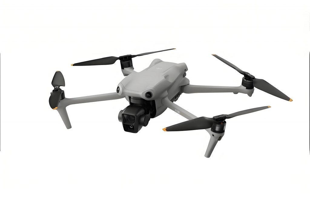
The Phantom 4 RTK is a lightweight, quadcopter-style DJI drone engineered for survey-grade data collection. Its key specifications relevant to topographic mapping are summarized below:
| Component/Parameter | Specification | Significance for Topographic Mapping |
|---|---|---|
| Sensor | 1-inch 20MP CMOS | High-resolution imagery for detailed feature extraction and dense point cloud generation. |
| Positioning System | Integrated GNSS (GPS+GLONASS+BeiDou) RTK Module | Provides image center coordinates with ~1-3 cm horizontal and ~2-5 cm vertical accuracy. |
| Maximum Flight Time | ~30 minutes | Dictates the maximum coverage per single flight, requiring careful mission planning for larger areas. |
| Obstacle Sensing | Multi-directional | Enhances operational safety in complex environments with buildings or vegetation. |
| Communication | OcuSync transmission system | Provides stable, long-range connectivity for live view and flight control. |
While the in-flight RTK positioning is powerful, the most accurate results are achieved through Post-Processed Kinematics (PPK). In this workflow, the raw satellite observation data from both the DJI drone and a static base station are recorded during the flight. After the mission, specialized software (e.g., UAV-PPK) processes these data sets together, yielding a more robust and precise trajectory for the camera positions. The position of a camera at exposure time, $i$, can be refined from the RTK solution $\mathbf{P}_{RTK,i}$ to the PPK solution $\mathbf{P}_{PPK,i}$ by solving for phase ambiguities and applying more sophisticated error models:
$$\mathbf{P}_{PPK,i} = \mathbf{P}_{RTK,i} + \delta\mathbf{P}_{orb} + \delta\mathbf{P}_{atm} + \delta\mathbf{P}_{multipath}$$
where $\delta\mathbf{P}_{orb}$, $\delta\mathbf{P}_{atm}$, and $\delta\mathbf{P}_{multipath}$ represent corrections for satellite orbit errors, atmospheric delays, and signal multipath effects, respectively. This PPK-corrected trajectory is the critical input for the next stage: photogrammetric processing.
Case Study: Workflow for 1:500 Topographic Mapping
The project involved creating a highly accurate 1:500 scale topographic map of a peri-urban area characterized by moderate terrain relief, dense residential buildings, and road networks. The workflow can be broken down into four main stages.
1. Mission Planning and Field Data Acquisition
Using the dedicated ground station software, a flight plan was designed. Key parameters were set according to the desired ground sampling distance (GSD), which determines the level of detail. The GSD is calculated as:
$$GSD = \frac{H \times s}{f}$$
where $H$ is the flight altitude above ground, $s$ is the sensor pixel size, and $f$ is the focal length. For a target GSD of ~2-3 cm (suitable for 1:500 mapping), the flight altitude was set to approximately 120 meters. Overlap rates of 80% (frontal) and 70% (side) were configured to ensure robust stereoscopic coverage and successful 3D model generation. Although the DJI drone‘s PPK capability reduces the need for GCPs, a sparse network of 7 checkpoints was established across the project area. These points, surveyed with a high-precision GNSS receiver, serve solely for independent accuracy validation, not for direct model orientation.
2. Data Processing and 3D Reconstruction
The collected images and GNSS logs were processed. First, the PPK software computed the refined camera positions. These coordinates, along with the images, were imported into a photogrammetry suite (e.g., ContextCapture, Pix4D, or Metashape). The software performs aerial triangulation (AT) or Structure from Motion (SfM) to solve for the interior and exterior orientation parameters of all cameras simultaneously, creating a sparse point cloud. The mathematical model for collinearity, fundamental to this process, is given by:
$$
\begin{bmatrix}
x \\
y \\
-f
\end{bmatrix}
= \lambda R \begin{bmatrix}
X – X_0 \\
Y – Y_0 \\
Z – Z_0
\end{bmatrix}
$$
where $(x, y)$ are the image coordinates of a point, $f$ is the focal length, $\lambda$ is a scale factor, $R$ is the rotation matrix from object to image space, $(X, Y, Z)$ are the object space coordinates of the point, and $(X_0, Y_0, Z_0)$ are the coordinates of the camera perspective center (from PPK).
Following AT, a dense point cloud is generated through multi-view stereo matching. This dense cloud is then used to create the primary deliverables:
- Digital Surface Model (DSM): A raster representing the elevation of the topmost surface, including buildings and trees.
- Digital Terrain Model (DTM): A raster representing the bare-earth elevation, obtained by filtering out non-ground points from the DSM.
- True Orthophoto Mosaic: A geometrically corrected, seamless image map where displacement due to terrain and camera tilt is removed.
- 3D Textured Mesh: A triangulated surface model with photo-realistic textures, ideal for visualization and 3D digitizing.
3. 3D Feature Compilation (Stereo Digitization)
The 3D textured mesh and the orthophoto were loaded into a digital stereo plotting environment within a Geographic Information System (GIS) or dedicated survey software. Using stereoscopic viewing (with glasses or a screen split-view) or directly from the 3D mesh, topographic features were digitized in three dimensions. Contours were automatically generated from the DTM and then carefully edited to ensure proper representation of terrain forms and adherence to cartographic standards.
4. Accuracy Assessment
The final and most critical step was to quantify the accuracy of the photogrammetrically derived products. The independently surveyed checkpoints (not used in processing) provided the reference truth. The errors were calculated by comparing the coordinates extracted from the DTM and orthophoto at the checkpoint locations against the surveyed coordinates. The standard accuracy metrics are Root Mean Square Error (RMSE):
$$RMSE = \sqrt{\frac{\sum_{i=1}^{n}(x_{i, measured} – x_{i, reference})^2}{n}}$$
where $x_i$ can represent Easting, Northing, or Elevation. For a 1:500 scale map, common accuracy standards require RMSE values better than certain thresholds (e.g., ≤ 0.25m for planimetry and ≤ 0.20m for elevation in open terrain). The results from our project, leveraging the DJI drone PPK workflow, are summarized below:
| Checkpoint ID | ΔEasting (m) | ΔNorthing (m) | ΔElevation (m) | Horizontal Error (m) |
|---|---|---|---|---|
| CP01 | 0.012 | -0.018 | 0.025 | 0.021 |
| CP02 | -0.025 | 0.031 | -0.032 | 0.040 |
| CP03 | 0.018 | 0.015 | 0.019 | 0.023 |
| CP04 | -0.031 | -0.022 | -0.041 | 0.038 |
| CP05 | 0.005 | -0.028 | 0.015 | 0.028 |
| CP06 | 0.022 | 0.019 | -0.022 | 0.029 |
| CP07 | -0.015 | 0.025 | 0.028 | 0.029 |
| RMSE | 0.021 m | 0.024 m | 0.027 m | 0.030 m |
The calculated RMSE values for both horizontal (0.030 m) and vertical (0.027 m) components were well within the acceptable tolerances for 1:500 scale topographic mapping, validating the efficacy of the DJI drone-based approach.
Advantages and Practical Considerations
The integration of a PPK-capable DJI drone into a topographic surveying workflow offers compelling advantages:
- Operational Efficiency: Dramatic reduction in field time for GCP establishment. Large areas can be covered rapidly in a single automated flight.
- Safety: The ability to map hazardous or inaccessible areas (steep slopes, unstable terrain, water bodies) without putting surveyors at risk.
- Data Richness: The primary output is not just a map but a comprehensive, high-resolution 3D geospatial dataset (point cloud, mesh, DSM, DTM, orthophoto) that can be repurposed for volume calculations, change detection, 3D modeling, and more.
- Cost-Effectiveness: Lower operational costs compared to traditional manned aircraft surveys or extensive ground-based topographic methods.
However, practitioners must be aware of limitations. The physical endurance of a DJI drone like the Phantom 4 RTK limits single-sortie coverage. Wind can severely impact flight stability and image quality. Furthermore, photogrammetry struggles with vegetated areas; the DSM represents the top of the canopy, not the ground, requiring additional techniques like LiDAR for ground points in dense forests. The PPK processing chain, while powerful, adds a step that requires expertise and appropriate software.
Conclusion and Future Outlook
The application of the Phantom 4 RTK DJI drone, coupled with PPK post-processing and modern photogrammetric software, presents a mature, reliable, and highly accurate solution for large-scale topographic mapping. The workflow successfully bridges the gap between rapid data acquisition and survey-grade precision, fulfilling the stringent requirements for producing standard 1:500 scale maps. As evidenced by the quantitative accuracy assessment, the horizontal and vertical errors achieved are consistently within centimeter-level tolerances.
Looking forward, the evolution of DJI drone technology continues. Newer platforms offer longer endurance, improved sensors (including multispectral and thermal cameras), and more integrated processing solutions. The convergence of UAV-based photogrammetry with other sensors, such as lightweight LiDAR scanners, is already creating even more powerful hybrid systems capable of penetrating vegetation. For surveyors, engineers, and geospatial professionals, mastering this DJI drone-enabled workflow is no longer just an advantage but a fundamental competency for efficient and precise topographic data acquisition in the 21st century. The democratization of high-accuracy mapping through accessible platforms like this is fundamentally reshaping how we measure, model, and manage our physical world.