
From my perspective as a researcher and practitioner in the field, the integration of low-altitude unmanned aerial vehicle (UAV) technology into video production represents not merely a technological upgrade but a fundamental paradigm shift in visual storytelling. This fusion has transcended the drone’s initial role as a simple aerial camera platform, evolving it into a dynamic, intelligent narrative agent capable of reshaping spatial perception and production workflows. The rapid growth of the low-altitude economy underscores this transformation, signaling a move from specialized tool to ubiquitous creative medium. My analysis focuses on deconstructing the technical pillars enabling this shift, examining the integrated production pipeline it creates, and confronting the significant challenges—particularly in standardized drone training—that must be overcome to realize its full potential.
Core Technical Characteristics and Integrative Pathways
The unique value proposition of low-altitude drones stems from a convergence of distinct technical attributes, which I categorize into three primary dimensions: perspective, mobility, and hardware intelligence. Unlike traditional ground-based or crewed aerial platforms, drones operate in a niche airspace that unlocks novel compositional and narrative possibilities.
1.1 Dimensionality of the Low-Altitude Perspective
The low-altitude perspective fundamentally redefines spatial narrative. It operates within a “mesoscale” band—high enough to reveal overarching patterns and relationships invisible from the ground, yet low enough to retain intimate textual detail and a palpable sense of speed and proximity. This creates a powerful cinematic tool for “spatial montage,” where a single continuous shot can transition from a grand establishing view to a tight, detail-oriented focus, guiding the viewer’s perception through a scene. The kinetic energy is inversely related to altitude; proximity to subjects generates high-velocity dynamism, while higher elevations offer stately, omniscient observation. This capability allows directors to manipulate both space and time perception within a frame.
1.2 Dynamic Mobility and Intelligent Flight
Dynamic shooting capabilities are powered by advanced flight controllers and computer vision algorithms. Key automated flight modes have become essential creative tools:
- Intelligent Follow: Utilizes deep learning models trained on massive datasets to recognize and track subjects (e.g., via head-shoulder models), predicting trajectory even with occlusions or rapid movement.
- Orbit and POI (Point of Interest): Automatically circles a subject, maintaining perfect framing to create dramatic, three-dimensional reveals. This is governed by algorithms that calculate tangential velocity and camera gimbal yaw.
- Waypoint Navigation & Complex Pathing: Allows pre-programming of intricate flight paths, speeds, and camera angles, enabling precise repeatable moves for complex sequences or visual effects work.
The efficacy of these modes hinges on robust path-planning algorithms. For dynamic environments, algorithms based on Reinforcement Learning (RL) are increasingly vital. An RL agent learns an optimal policy $\pi^*$ by maximizing the expected cumulative reward $R_t$:
$$
\pi^* = \arg\max_{\pi} \mathbb{E}\left[ \sum_{k=0}^{\infty} \gamma^k R_{t+k+1} | S_t=s, A_t=a \right]
$$
where $\gamma$ is a discount factor. This allows drones to adaptively navigate around unexpected obstacles while executing a creative shot, a significant leap over static pre-planned paths.
1.3 Hardware Evolution: Lightweighting and Connectivity
The physical platform itself has undergone revolutionary change. Lightweight composite materials like carbon fiber have drastically reduced weight while increasing durability, directly translating to longer flight times and greater payload capacity. This enables the carrying of high-end cinema cameras, LiDAR scanners, or multispectral sensors. Simultaneously, transmission technology has leaped forward. Modern systems employ adaptive frequency hopping (2.4/5.8 GHz, DFS) and protocols like SRT for robust, low-latency HD video feeds over distances of several kilometers. The impending integration with 5G-A and 6G networks promises near-instantaneous cloud uploading, enabling real-time remote production workflows.
1.4 Fusion with Immersive and Real-Time Technologies
The true innovation unfolds when drone technology converges with other digital media frontiers. The combination with Virtual Reality (VR) is transformative. Drones equipped with 360° cameras can capture spherical video from dynamic aerial paths, creating immersive experiences that place the viewer *inside* the flight. The production pipeline for such VR content involves synchronized data capture, transmission, stitching, and distribution to head-mounted displays. A simplified workflow is summarized below:
| Stage | Process | Key Technology |
|---|---|---|
| 1. Capture | UAV with 360° cam executes flight path | High-res spherical sensors, stable gimbal |
| 2. Transmission | Live video feed sent to ground station/cloud | Low-latency HD图传, 5G |
| 3. Processing | Stitching, color grading, spatial audio syncing | Real-time stitching engines, cloud compute |
| 4. Distribution | Stream to VR headsets for live or on-demand viewing | VR platforms, adaptive bitrate streaming |
Furthermore, real-time processing powered by edge and cloud computing is revolutionizing live production. Video streams can now be processed for object recognition, automatic cropping for multiple aspect ratios, or even real-time compositing with AR graphics, turning drones into live broadcasting units for news and sports.
The Intelligent Production Pipeline: From Capture to Edit
The integration of drones necessitates a re-engineered video production pipeline, heavily augmented by artificial intelligence at every stage to manage the vast data generated and unlock new creative efficiencies.
2.1 Pre-Production and Path Planning Algorithms
Sophisticated planning is crucial for efficient and safe filming. Path planning algorithms must balance creative intent (camera motion, framing) with physical constraints (battery, obstacles, regulations). These algorithms can be classified as shown below, with hybrid approaches often used in practice:
| Algorithm Class | Description | Typical Use Case | Example Algorithms |
|---|---|---|---|
| Classical (Geometric) | Requires a pre-known or mapped environment. Plans globally optimal paths. | Structured inspections, repeatable cinematic shots in known locales. | A*, Voronoi diagrams, Probabilistic Roadmaps (PRM) |
| Reactive (Local) | Responds to real-time sensor data (e.g., obstacle distance). Plans locally. | Following moving subjects in dynamic, unknown environments. | Artificial Potential Fields (APF), Dynamic Window Approach |
| Bio-Inspired & Optimization | Uses metaheuristics to find good solutions in complex search spaces. | Planning efficient coverage paths over large, complex areas (e.g., for mapping). | Genetic Algorithm (GA), Particle Swarm Optimization (PSO) |
| Learning-Based | Learns optimal policies from interaction with the environment. | Extremely dynamic and unpredictable environments where explicit modeling is impossible. | Reinforcement Learning (RL), Deep Q-Networks (DQN) |
The cost function $J$ for an optimal path often combines multiple factors:
$$
J(\mathbf{p}) = \lambda_t \cdot T(\mathbf{p}) + \lambda_e \cdot E(\mathbf{p}) + \lambda_r \cdot R(\mathbf{p}) + \lambda_c \cdot C(\mathbf{p})
$$
where $\mathbf{p}$ is the path, $T$ is time, $E$ is energy consumption, $R$ is risk (e.g., proximity to obstacles), and $C$ is a cinematic quality score. The weights $\lambda$ are adjusted based on mission priority.
2.2 In-Capture and Post-Capture: Keyframe Selection & AI Editing
A single flight can generate hours of 4K/8K footage. Intelligent keyframe selection is critical for efficient processing. Instead of manually scrubbing, algorithms analyze the video stream to extract representative frames. A common method uses feature-based similarity. Let $F_i$ and $F_j$ be feature descriptors (e.g., from a CNN or improved SIFT) for frames $i$ and $j$. The dissimilarity $d(i,j)$ can be measured using a metric like the Bhattacharyya distance for histograms:
$$
d(i,j) = -\ln \sum_{k} \sqrt{F_i(k) \cdot F_j(k)}
$$
A new keyframe is selected when $d(i,j) > \tau$, where $\tau$ is a similarity threshold, ensuring only distinct frames are retained for stitching or editing.
AI-assisted editing represents the next frontier. Systems can now automatically:
- Log Footage: Identify scenes, objects (cars, people, buildings), and shot types (aerial, close-up, orbit).
- Assemble Rough Cuts: Follow learned narrative structures (e.g., establishing shot -> action sequence -> conclusion) or match footage to a selected music track’s beat and mood.
- Apply Corrections: Perform color grading consistency across varying light conditions and stabilize shaky footage.
This transforms the editor’s role from one of manual searching and assembly to that of a creative director guiding an AI collaborator.
Application-Specific Workflows and Efficacy
The practical impact of drone technology is best illustrated through its application in specific domains, each with unique requirements and value propositions.
| Application Domain | Primary Value | Key Technical Requirements | Exemplar Workflow / Outcome |
|---|---|---|---|
| News & Emergency Reporting | Rapid situational awareness, safe access to hazardous zones, compelling visuals. | Fast deployment, live HD transmission, long-range capability, durability. | Drones provide the first live aerial overview of a disaster site. 5G-linked drones stream real-time footage to the newsroom, where graphics are overlaid. GIS data from drone maps aids rescue planning. |
| Ecological & Documentary Filmmaking | Non-invasive observation of wildlife, capturing grand landscapes, revealing hidden patterns. | Quiet operation (low-noise propellers), long endurance, thermal/ multispectral imaging, precise slow movement. | Using pre-programmed waypoints, a drone silently captures the seasonal change in a forest canopy over weeks. A tracking shot follows a river from source to delta in one seamless “hyper-lapse” assisted by AI keyframe smoothing. |
| Cinema & High-End Commercials | Creating impossible camera moves, reducing cost vs. helicopters, increasing shot versatility. | Cinema-grade camera payloads (e.g., RED, ARRI), ultra-precise flight control for repeatable moves, ability to sync with ground units. | For a car chase sequence, a drone performs a high-speed “follow-race” mode, maintaining focus on the vehicle while dodging virtual obstacles defined in its path plan. The shot is achieved in hours, not days. |
| Industrial Inspection & Mapping | Accessing dangerous or inaccessible structures, creating accurate digital twins, automated analysis. | RTK GPS for cm-level accuracy, LiDAR or photogrammetry payloads, automated flight planning software, AI defect detection. | A drone autonomously flies a 3D grid pattern over a solar farm. Software stitches images into an orthomosaic and uses AI to highlight panels with suboptimal thermal signatures, generating an automated report. |
Persistent Challenges and the Critical Role of Standardized Training
Despite the remarkable progress, significant hurdles impede ubiquitous and safe adoption. These challenges are technical, regulatory, and human-centric.
3.1 Technical and Regulatory Hurdles
Network Integration & Real-Time Processing: Seamless, low-latency communication in complex urban or remote environments remains a challenge. While 5G-A helps, a true “air-ground-integrated network” requires solving interoperability between heterogeneous networks (cellular, satellite, ad-hoc drone swarms), leading to protocol conversion delays and data bottlenecks.
Data Security & Privacy: The regulatory landscape is fragmented. Compliance with varying national laws regarding airspace, geofencing, and data privacy (especially concerning facial recognition or property imaging) creates a complex web for operators. Clear, internationally harmonized technical standards for privacy-by-design (e.g., real-time onboard pixelation of faces) are needed.
3.2 The Paramount Challenge: Operational Expertise and Drone Training
The most critical bottleneck is the human factor. Operating a drone for professional video is not merely about flying; it involves cinematography, airspace law, data management, and maintenance. The current state of drone training is often inadequate, characterized by:
- High Cost: Comprehensive professional certification can cost thousands of dollars, a barrier to entry.
- Curriculum Lag: Many training programs focus on basic flight for obsolete models, failing to cover advanced topics like RTK surveying, LiDAR operation, cloud data workflows, or flight planning for complex cinematography.
- Lack of Standardization: While licenses exist (e.g., FAA Part 107, EU A1/A3), the specific skills for cinematic or industrial work are not uniformly defined or assessed.
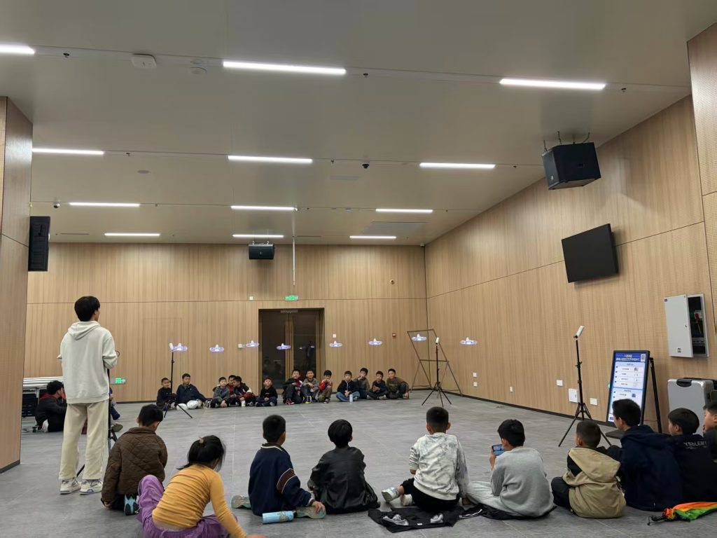
A structured, tiered drone training framework is essential to bridge the skills gap. This framework must extend beyond piloting to encompass the full production lifecycle.
| Training Tier | Target Skills & Knowledge | Curriculum Components | Outcome |
|---|---|---|---|
| Tier 1: Certified Remote Pilot | Safe flight, regulations, airspace, basic maintenance. | Flight physics, National Airspace System, weather, emergency procedures, Part 107 exam prep. | Legal authorization for commercial VLOS flight. |
| Tier 2: Aerial Imaging Technician | Camera operation, composition, basic shot execution, data handling. | Photography/videography fundamentals, gimbal operation, exposure control, file formats, basic editing. | Ability to capture quality aerial footage to a director’s specification. |
| Tier 3: Advanced Mission Specialist | Complex mission planning, specialized payloads, data processing. | Advanced path planning software (e.g., UgCS, DJI Terra), LiDAR/thermal operation, photogrammetry, RTK/GNSS principles, introductory GIS. | Ability to autonomously conduct mapping, inspection, or complex cinematic sequences. |
| Tier 4: Drone Workflow Integrator | Integration into broader media or IT systems, real-time production, team management. | Live video streaming protocols (SRT, RTMP), cloud processing APIs, fleet management software, multi-drone coordination basics, project budgeting. | Ability to design and lead a drone-based production or data acquisition project from concept to delivery. |
Investing in such comprehensive drone training is not an expense but a prerequisite for sustainable industry growth, ensuring safety, quality, and innovation.
Future Trajectories and Concluding Synthesis
The trajectory of low-altitude drone technology points toward deeper autonomy, richer data fusion, and more intuitive human-machine collaboration. Key frontiers include:
- 6G and AI-Native Drones: Future networks will offer integrated sensing and communication, allowing drones to perceive the radio environment itself, leading to ultra-reliable links. Onboard AI will enable real-time scene understanding for fully autonomous, context-aware filming.
- Swarm Cinematography: Coordinated fleets of drones will act as distributed camera arrays, capturing a single event from multiple synchronized angles simultaneously, or forming dynamic physical structures for light and shadow play.
- Ethical and Aesthetic Evolution: As the technology becomes more powerful, the industry must proactively establish ethical guidelines for its use in surveillance and public spaces. Aesthetically, the challenge will be to use these powerful tools to serve story and emotion, avoiding vacuous technical spectacle.
In conclusion, the integration of low-altitude UAV technology into video production is a multidimensional evolution. It has democratized aerial perspectives, industrialized visual data acquisition, and begun to reshape narrative form through real-time processing and immersion. However, its long-term success is inextricably linked to resolving the human capital challenge. Systematic, advanced drone training is the crucial catalyst needed to transform operational operators into creative technologists. By mastering not only the stick-and-rudder skills but also the language of data, networks, and narrative, the next generation of practitioners will fully harness this synergy, solidifying the drone’s role not just as a tool in the kit, but as a foundational pillar of modern visual communication.