
As a practitioner deeply involved in modern geomatics for mineral resource development, I have witnessed a paradigm shift in how we approach the critical task of surveying and mapping in metal mining environments. The traditional methodologies, heavily reliant on ground crews or manned aircraft, often present significant challenges in terms of efficiency, cost, safety, and data comprehensiveness when applied to the vast, complex, and dynamically changing landscapes of metal mines. In my experience, the integration of Unmanned Aerial Vehicle (UAV) remote sensing technology has emerged not merely as an alternative tool but as a foundational component of a modern, data-driven mining operation. This article delves into the technical framework, multifaceted value, inherent challenges, and strategic implementation of drone-based remote sensing, with a particular emphasis on the indispensable role of structured drone training for ensuring project success and sustainability.
The operational context of a metal mine—spanning exploration pits, active open-cast or underground portals, haul roads, waste dumps, tailings storage facilities, and surrounding environmental buffers—demands frequent, high-accuracy spatial data acquisition. This data is vital for volumetric calculations, stability monitoring, planning, compliance, and environmental stewardship. Drone technology answers this demand by offering a platform that is highly flexible, rapidly deployable, and capable of carrying an array of sophisticated sensors. The core system comprises the UAV platform itself (multi-rotor for detailed, confined areas or fixed-wing for broader coverage), the sensor payload, the ground control station, and the data processing software suite. Successful deployment hinges on understanding each component’s interaction. For instance, the choice between a multi-spectral and an RGB sensor depends entirely on whether the task is vegetation stress analysis for environmental monitoring or high-detail 3D reconstruction for stockpile measurement.
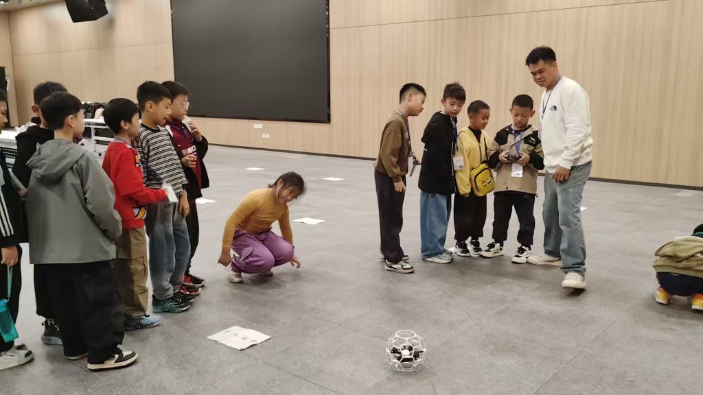
Crucially, the human operator linking these components is the most critical element. This is where comprehensive drone training transitions from a recommendation to an operational necessity, ensuring that mission planning, safe flight operations in challenging environments, and preliminary data handling are executed with proficiency.
| System Component | Key Considerations for Mine Surveying | Typical Options |
|---|---|---|
| UAV Platform | Endurance, Payload Capacity, Stability in Wind, VTOL Capability | Multi-rotor (e.g., Quadcopter, Hexacopter), Fixed-wing, Hybrid VTOL |
| Positioning System | Real-time Kinematic (RTK) / Post-Processed Kinematic (PPK) GNSS for cm-level accuracy | Integrated RTK, PPK with Base Station |
| Sensor Payload | Resolution, Ground Sample Distance (GSD), Spectral Bands, Global Shutter | RGB Camera, Multi-spectral Sensor, Thermal Camera, LiDAR |
| Data Processing Software | Automation, Point Cloud Generation, Orthomosaic & DSM/DTM Export, Analysis Tools | Pix4D, Agisoft Metashape, Bentley ContextCapture, DJI Terra |
The workflow, from mission conception to deliverable, follows a structured pipeline. It begins with meticulous planning using specialized software to define the flight area, altitude, overlap (front and side), and ground control point (GCP) network. The flight is then executed autonomously by the drone following the planned grid. The captured imagery, geotagged with high-precision coordinates, is processed via Structure-from-Motion (SfM) photogrammetric algorithms. These algorithms solve for camera positions and generate dense point clouds, which are then used to produce orthorectified mosaics (true orthophotos), digital surface models (DSMs), digital terrain models (DTMs), and highly detailed 3D textured meshes. The accuracy of these outputs is fundamentally tied to the quality of the GNSS data and the distribution of GCPs, which are surveyed in using traditional total stations or GNSS receivers. The relationship between flight altitude (H), sensor focal length (f), sensor pixel size (p), and the resulting Ground Sample Distance (GSD)—the distance between pixel centers on the ground—is fundamental:
$$ GSD = \frac{H \times p}{f} $$
This formula is central to mission planning, as it allows surveyors to determine the flight parameters needed to achieve a specified spatial resolution. For example, to achieve a 2 cm GSD for a detailed pit wall analysis, one would calculate the required altitude based on their specific camera’s parameters. Mastery of such planning concepts is a core outcome of effective drone training.
Multifaceted Value Proposition in the Mining Cycle
The adoption of drone remote sensing delivers transformative value across the entire mining lifecycle, which justifies the investment in both technology and personnel drone training.
1. Unmatched Operational Efficiency and Frequency: Drones can survey hundreds of hectares in a single flight, capturing data that would take a ground crew days or weeks to collect. This enables frequent monitoring—weekly, daily, or even after significant weather events—providing managers with near-real-time insights into material movement, progress against plan, and emerging geotechnical hazards. The speed of data acquisition directly translates to faster decision-making.
2. Significant Reduction in Lifecycle Costs: While the initial capital outlay for a professional drone system is notable, the total cost of ownership is dramatically lower than recurring manned aerial surveys or extensive ground-based topographic campaigns. The reduction in personnel exposure to hazardous areas (high walls, unstable slopes, tailings ponds) also lowers insurance liabilities and risk costs. Furthermore, accurate volumetric measurements prevent costly over- or under-estimation of ore and waste.
3. Enhanced Safety and Access: This is arguably the most critical benefit. Drones eliminate the need for personnel to physically access dangerous or inaccessible areas. Surveying steep highwalls, scanning roof conditions in open pits, or inspecting the integrity of a tailings dam crest can all be conducted from a safe distance. This aligns perfectly with the fundamental safety principles of the mining industry.
4. Superior Data Resolution and Integrability: Drone-derived products offer centimeter-level accuracy and visual clarity that satellite imagery cannot match and is more cost-effective than airborne LiDAR for many applications. The dense 3D point clouds and models integrate seamlessly with other mine planning software (like Vulcan, Deswik, or Surpac) for design, reconciliation, and simulation, creating a single source of truth for the mine’s physical state.
| Application Phase | Key Drone Deliverables | Primary Value Generated |
|---|---|---|
| Exploration & Development | High-resolution topographic base maps, Geological mapping support | Accurate terrain models for drill planning, Reduced field time in rough terrain |
| Active Mining | Daily/Weekly progress surveys, Volumetric calculations of stockpiles and cuts, Haul road condition monitoring | Real-time production tracking, Accurate tonnage reporting, Optimized logistics and maintenance |
| Geotechnical & Stability Monitoring | High-accuracy DSMs/DTMs, Change detection analysis, Crack and displacement mapping | Progressive hazard identification, Slope stability analysis, Early warning of potential failures |
| Environmental Management | Erosion and rehabilitation tracking, Watercourse monitoring, Vegetation health indices (via multispectral) | Compliance reporting, Closure planning, Demonstration of environmental stewardship |
| Tailings Management | Beach elevation surveys, Freeboard monitoring, Dam structure inspections | Critical safety monitoring, Regulatory compliance, Water balance calculations |
Inherent Challenges and Technical Limitations
Despite its advantages, the implementation of drone surveying in a mining context is not without significant challenges. Acknowledging and strategically addressing these is key to reliable operations.
1. Environmental and Operational Constraints: Mining sites are notoriously harsh environments. High winds, dust, precipitation, and extreme temperatures can ground flights or damage equipment. Electromagnetic interference from large machinery can disrupt control and GNSS signals. Flying in deep pits or near highwalls presents challenges for maintaining a clear GNSS signal and safe line-of-sight for the pilot. These factors demand robust equipment, contingency planning, and pilots whose drone training has included scenario-based learning for adverse conditions.
2. Technical Complexity and Data Fidelity: The “black box” nature of photogrammetric processing can sometimes mask errors. The accuracy of final products is highly dependent on the quality of the ground control network and the performance of the onboard RTK/PPK system. Errors can propagate from poor GCP measurement, incorrect camera calibration, or insufficient image overlap. The inherent positional error of a drone using a standard GNSS receiver without RTK/PPK can be modeled as a combination of factors:
$$ \sigma_{total} = \sqrt{\sigma_{ephemeris}^2 + \sigma_{ionosphere}^2 + \sigma_{troposphere}^2 + \sigma_{multipath}^2 + \sigma_{receiver}^2 } $$
Where $\sigma_{ephemeris}$ is satellite orbit error, $\sigma_{ionosphere}$ and $\sigma_{troposphere}$ are atmospheric delays, $\sigma_{multipath}$ is signal reflection error, and $\sigma_{receiver}$ is internal noise. RTK/PPK techniques significantly mitigate these errors by using a fixed base station to provide corrections, but understanding this error budget is essential. Furthermore, processing large datasets (thousands of images) requires substantial computational resources and time.
3. Regulatory Compliance and Airspace Awareness: Operating drones in mining areas, which may be near airports, helipads, or other restricted airspace, requires strict adherence to national and local aviation regulations. Securing operational approvals, maintaining logs, and ensuring pilots are licensed are non-negotiable aspects that must be integrated into the organizational workflow and drone training programs.
Strategic Framework for Successful Implementation
To harness the full potential of drone technology while mitigating its challenges, a strategic, holistic approach is required. This goes beyond simply purchasing a drone.
1. Develop a Purpose-Driven Technology and Workflow Plan: The starting point is a clear definition of operational needs. Is the primary goal volumetric tracking, high-wall monitoring, or environmental compliance? The answers will dictate the sensor choice (RGB vs. LiDAR), platform endurance needs, and required processing software. A standardized workflow—from flight planning and GCP deployment to data processing, quality control, and delivery to the engineering team—must be established and documented.
2. Invest in Comprehensive and Continuous Drone Training: This is the cornerstone of success. Drone training must be multifaceted, covering:
- Regulatory & Safety: Certification for pilots (e.g., FAA Part 107, or local equivalent), airspace rules, site-specific risk assessments, and emergency procedures.
- Technical Flight Operations: Advanced piloting skills for challenging environments, mission planning software proficiency, maintenance, and pre-flight checklists.
- Geomatics Fundamentals: Understanding of photogrammetry principles, coordinate systems, GNSS/GCP accuracy concepts, and basic surveying.
- Data Processing & Analysis: Hands-on software training to generate and critically evaluate outputs like point clouds, DTMs, and orthomosaics.
Effective drone training transforms operators into knowledgeable survey technicians who understand the ‘why’ behind the ‘what,’ enabling them to troubleshoot issues and optimize data quality.
| Training Module | Core Learning Objectives | Impact on Project Outcomes |
|---|---|---|
| Pilot Certification & Safety | Legal compliance, airspace navigation, risk mitigation, emergency protocols. | Ensures safe, legal operations; minimizes downtime and liability. |
| Advanced Mission Planning | Optimizing flight parameters for accuracy and efficiency; planning in complex topography. | Maximizes data quality and coverage while conserving battery life. |
| GNSS & Ground Control | Establishing and surveying GCP networks; RTK/PPK workflows. | Directly determines the absolute accuracy of all final deliverables. |
| Data Processing & QC | Software proficiency, error detection in point clouds, export for engineering tools. | Guarantees reliable, usable data for decision-making; identifies need for re-flights. |
| Maintenance & Troubleshooting | Basic repair, sensor calibration, diagnosing common flight and data issues. | Reduces equipment failure rates and ensures consistent data collection. |
3. Implement Rigorous Data Management and Validation Protocols: Drone projects generate vast amounts of raw and processed data. A centralized, well-organized storage and backup system is crucial. More importantly, a standard operating procedure for data validation must be in place. This involves periodic checks against independently surveyed check points (not used as GCPs) to quantify accuracy using statistical measures like Root Mean Square Error (RMSE):
$$ RMSE = \sqrt{\frac{\sum_{i=1}^{n}(Z_{drone,i} – Z_{survey,i})^2}{n}} $$
where $Z_{drone,i}$ and $Z_{survey,i}$ are the elevation values from the drone model and ground survey at point $i$, respectively. Regular validation builds confidence in the data and ensures it meets the tolerances required for engineering purposes.
4. Foster Integration with Legacy Systems and Cross-Departmental Collaboration: The ultimate value of drone data is realized when it is easily consumed by other departments. The survey/geomatics team must work closely with geology, planning, geotechnical engineering, and environmental departments to understand their specific data needs and deliver formats that integrate directly into their software ecosystems (e.g., .dxf, .shp, .las, or direct plugin formats). This breaks down data silos and creates a collaborative, model-centric mining operation.
In conclusion, the application of drone remote sensing in metal mine surveying represents a technological leap that directly addresses the industry’s core needs for safety, efficiency, and precision. However, its success is not automatic. It requires a strategic investment in the right technology, the development of robust and standardized workflows, and, most critically, a committed investment in continuous, high-quality drone training for personnel. When these elements align, drone technology ceases to be just a surveying tool and becomes a central nervous system for the mine, providing the accurate, timely, and actionable spatial intelligence required for responsible and profitable mining in the 21st century. The journey from raw imagery to strategic insight is complex, but with a solid foundation built on knowledge and process, the benefits are unequivocal and transformative.