From my vantage point on the ground, clad in heavy turnout gear with the roar of flames and the cacophony of sirens in the background, the operational landscape has grown exponentially more complex. The proliferation of high-rise towers, vast warehouses, and intricate subterranean networks presents a formidable, three-dimensional puzzle for my team. Gaining rapid, accurate situational awareness in these environments is not just a tactical advantage—it is a matter of life and death, for both potential victims and for us, the responders. In this challenging new era, the integration of the fire UAV has fundamentally transformed our approach, becoming an indispensable extension of our senses and a critical force multiplier on the modern fireground.
At its core, the modern fire UAV is a sophisticated low-altitude aerial platform, remotely piloted or operating via pre-programmed autonomous routines. We, as ground operators, command these systems from portable control units, dictating their flight path, altitude, and payload functions. The true power lies in the real-time data link; high-definition video, thermal imaging, and sensor data are streamed seamlessly back to our command vehicles and mobile devices. This capability allows me to see what was previously inaccessible or far too dangerous to approach. The evolution of this technology has been rapid, transitioning from a novel reconnaissance tool to a multi-role asset central to our incident action plan.
The operational advantages of deploying a fire UAV are immediately apparent. Foremost is enhanced safety. Sending an unmanned platform into a volatile, toxin-filled, or structurally compromised environment keeps firefighters out of harm’s way for the initial, most uncertain phase of assessment. Their operational resilience in harsh conditions—extreme heat plumes, dense smoke, or high winds—provides a layer of risk mitigation that was previously unattainable. Furthermore, modern systems are designed for intuitive operation, requiring a manageable training curve for certified personnel to achieve proficiency. Their compact size and agility allow them to navigate tight urban canyons, weave through structural skeletons, or hover steadily in turbulent thermal columns. Finally, advanced onboard intelligence enables obstacle avoidance and automated flight patterns, ensuring stable data collection even when the operator’s focus is divided between the screen and the dynamic ground operation.
The primary missions of the fire UAV can be systematically broken down into several key functional domains, each contributing to a more informed and effective response.
1. Rapid Situational Awareness and Reconnaissance
The first ten minutes of an incident are often the most critical. Before committing interior teams, we must understand what we are facing. A fire UAV can be airborne in moments, providing an immediate overhead view. It answers fundamental questions: What is the seat of the fire? How is it spreading? Are there visible victims or access points? This bird’s-eye perspective is invaluable for making initial size-up and resource deployment decisions.
Beyond visual spectrum imaging, the true revolution comes from multi-spectral sensing. By equipping the fire UAV with thermal imaging cameras (TICs), we can “see” through smoke, identifying hot spots, hidden fire extension within void spaces, and the heat signatures of trapped individuals. The thermal data provides a quantitative measure of thermal flux, crucial for predicting flashover conditions or structural collapse. The intensity of thermal radiation detected by the UAV’s sensor at a distance \( d \) from a heat source can be modeled by an inverse-square law approximation:
$$
I_{UAV} \approx \frac{P_{source}}{4 \pi d^2} \cdot \tau_{atmosphere}
$$
where \( I_{UAV} \) is the irradiance at the sensor, \( P_{source} \) is the radiative power of the fire, and \( \tau_{atmosphere} \) is the atmospheric transmittance, heavily dependent on smoke density. This data allows us to map thermal gradients across the incident scene.
| Sensor Type | Primary Function | Data Output for Command |
|---|---|---|
| Visual RGB Camera | Real-time video, daytime recon, damage assessment | Layout, fire behavior, ingress/egress routes, visible hazards |
| Thermal Imaging Camera (TIC) | Heat signature detection, see-through smoke, victim location | Heat maps, fire spread behind walls/ceilings, personnel tracking |
| Gas Sensor Package | Detection of toxic/combustible gases (CO, H2S, VOCs, LEL) | Hazard zone mapping, air quality monitoring for crew safety |
| LiDAR / Photogrammetry | 3D mapping and modeling of structures and terrain | Volumetric analysis, pre-plan integration, collapse zone calculation |
2. Command, Control, and Dynamic Resource Management
The live feed from the fire UAV acts as a shared situational awareness tool for the entire command structure. As an incident commander, I no longer have to rely solely on fragmented radio reports from sector officers. I have a unified, real-time visual of the entire operational theater on my tablet. This enables dynamic and precise resource allocation. I can see if a lateral spread is threatening Exposure D, if roof ventilation is progressing, or if a handline is effectively darkening down a specific sector.
This capability is transformative for large-scale or complex incidents. In a major industrial fire involving multiple tanks or process units, a fire UAV can safely monitor for signs of boiling liquid expanding vapor explosions (BLEVE) or dire impingement, guiding the positioning of master stream appliances and the retreat of crews. The data feed can be piped directly to the emergency operations center, providing strategic leaders with an unfiltered view of the battlefield. This shared visual context drastically improves the quality and timeliness of strategic decisions, aligning all operational sectors with the overarching incident action plan.
3. Search and Rescue (SAR) and Victim Localization
Time is the enemy in search operations. The fire UAV expedites the search process over large, obscured, or treacherous areas. In wildfire scenarios, UAVs can scan escape routes and potential safety zones. In urban search and rescue (USAR) following a collapse, equipped with thermal and visual cameras, they can peer into rubble piles from angles inaccessible to ground teams and canines. The mathematical principle for optimizing a grid search pattern with a fire UAV having a sensor swath width \( W \) can be expressed to ensure coverage:
$$
\text{Search Efficiency} (E) = \frac{v \cdot W \cdot t}{A_{search}}
$$
where \( v \) is the UAV’s ground speed, \( t \) is the available search time, and \( A_{search} \) is the total area to be covered. Maximizing \( E \) involves optimizing altitude (which affects \( W \)) and flight path planning.
Furthermore, some advanced fire UAV platforms are being tested as direct communication relays or light sources. A UAV can hover above a night-time operation, providing powerful, adjustable scene lighting, or act as a temporary communications node to boost radio signals in areas with poor coverage, ensuring continuous contact with interior teams.
4. Pre- and Post-Incident Modeling: The Digital Fireground
Perhaps one of the most profound applications is the creation of accurate 3D models. Using photogrammetry (stitching hundreds of overlapping high-res photos) or LiDAR scanning, a fire UAV can generate a precise digital twin of a structure or incident scene. This has two powerful applications:
Pre-Fire Planning: We can fly fire UAV over high-risk target hazards—chemical plants, large stadiums, historical complexes—and create detailed 3D models. These models are integrated into our pre-incident plans, allowing for virtual walkthroughs, identification of key fire protection systems, and planning of tactical approaches long before an alarm sounds.
Active Incident Management and Post-Fire Analysis: During a fire, a rapid model can show structural deformations over time. After a fire, a forensic model provides an immutable record for investigation, determining origin and cause, and for planning salvage and overhaul operations. The photogrammetric process relies on solving the collinearity equations for thousands of points:
$$
x – x_0 = -f \frac{m_{11}(X – X_0) + m_{12}(Y – Y_0) + m_{13}(Z – Z_0)}{m_{31}(X – X_0) + m_{32}(Y – Y_0) + m_{33}(Z – Z_0)}
$$
$$
y – y_0 = -f \frac{m_{21}(X – X_0) + m_{22}(Y – Y_0) + m_{23}(Z – Z_0)}{m_{31}(X – X_0) + m_{32}(Y – Y_0) + m_{33}(Z – Z_0)}
$$
where \((x, y)\) are image coordinates, \((X, Y, Z)\) are object space coordinates, \(f\) is focal length, and \(m_{ij}\) are elements of the rotation matrix. This allows for the precise reconstruction of the scene.
| Modeling Phase | UAV Role | Outcome & Use Case |
|---|---|---|
| Pre-Incident | Data collection of high-value/high-risk structures | Interactive 3D pre-plans; virtual training environments; hydrant & access planning |
| Active Incident | Periodic mapping during prolonged operations | Monitoring structural integrity change; tracking fire spread progress in wildland-urban interface (WUI) |
| Post-Incident | Comprehensive scan of the aftermath | Forensic analysis for cause & origin; damage assessment for insurance; after-action review training |
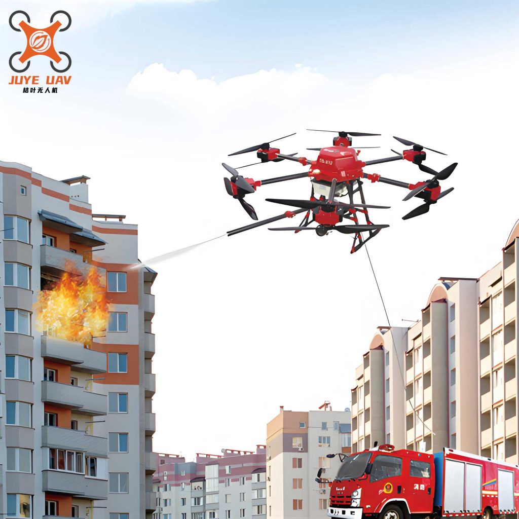
5. Direct Intervention and Suppression Support
While reconnaissance remains the primary role, the concept of a fire UAV as an active suppression agent is advancing rapidly. These are specialized, heavy-lift UAVs designed for direct payload delivery.
- Class A/B Payload Delivery: They can carry and discharge water, foam concentrate, or dry chemical agents. This is particularly useful for targeting hard-to-reach Class A fires in attics or upper floors of lightweight construction, or for applying foam on Class B spills without putting personnel in the vapor cloud danger zone.
- Explosive Breaching/Access Creation: In rare, controlled circumstances, UAVs can be used to safely deliver small explosive charges for tactical ventilation (e.g., to create a roof vent) or breaching in USAR scenarios.
- Ignition in Wildfire: In prescribed burning or wildfire backfiring operations, UAVs can accurately drop incendiary spheres (ping-pong ball-like devices) to safely establish control lines.
The effectiveness of a suppression fire UAV depends on its payload capacity \( m_{payload} \) and discharge rate. The theoretical extinguishing agent requirement can be related to the fire’s heat release rate (HRR):
$$
V_{agent} \propto \frac{\dot{Q}}{h_{eff}}
$$
where \( \dot{Q} \) is the fire’s HRR and \( h_{eff} \) is the effective heat absorption per unit volume of the agent. The UAV’s operational time is then limited by:
$$
t_{op} = \frac{m_{agent}}{ \dot{m}_{discharge} }
$$
where \( \dot{m}_{discharge} \) is the mass flow rate of the agent.
Optimizing the Tool: Performance, Protocol, and Integration
To fully harness the potential of the fire UAV, we must focus on continuous improvement in three areas: platform capabilities, standardized protocols, and holistic integration into the fire service ecosystem.
Platform Enhancement: The frontline fire UAV must be ruggedized. This includes developing and applying advanced thermal barrier coatings and using materials like carbon-fiber composites or refractory metals for critical components to protect avionics from intense radiant heat. Modular payload systems are essential, allowing us to swap sensors (gas, thermal, zoom) between flights based on incident needs. Perhaps most critically, we need longer endurance. This involves improvements in battery energy density and exploring hybrid-electric or fuel-cell systems for extended operations. The fundamental limitation is expressed by the endurance equation for electric multirotors:
$$
E = \frac{C_{battery} \cdot V_{nominal} \cdot \eta_{total}}{P_{avg}}
$$
where \( E \) is endurance, \( C_{battery} \) is battery capacity, \( V_{nominal} \) is voltage, \( \eta_{total} \) is total system efficiency, and \( P_{avg} \) is average power draw. Advancements aim to maximize the numerator and minimize the denominator.
Standardized Operational Protocols: We cannot rely on ad-hoc procedures. Clear, incident-type-specific workflows must be established and drilled. For a high-rise fire, the protocol might be:
1. Immediate launch of the fire UAV for a 360-degree size-up, focusing on wind direction, visible fire/smoke on multiple facades, and potential victim signals.
2. Thermal scan of the fire floor and the floors immediately above to identify extension via windows and curtain walls.
3. Provision of a persistent aerial watch on the fire building to monitor changing conditions and guide rooftop operations.
4. Post-control, external scanning for hidden fire in soffits and cladding systems.
Such protocols ensure that the fire UAV is used systematically to gather the most critical information in the correct sequence.
System Integration and Future Vision: The fire UAV should not be a data silo. Its feed must integrate directly with Computer-Aided Dispatch (CAD), mobile data terminals in apparatus, and incident command software. Looking ahead, the future lies in swarm technology—coordinated fleets of heterogeneous fire UAVs. One could be a dedicated mapping drone, another a gas sniffer, and a third a thermal spotter, all operating in concert and sharing data to build a comprehensive, real-time Common Operational Picture (COP).
| Optimization Area | Current Challenge | Development Path & Desired Capability |
|---|---|---|
| Robustness | Electronic failure in high heat/humidity; propeller damage | Active cooling systems; certified ingress protection (IP); redundant flight controllers |
| Sensing | Single sensor per flight; limited data fusion | Multi-sensor gimbals; real-time AI-based analysis of combined visual/thermal/gas data |
| Communications | Signal loss in dense urban or subterranean environments | Mesh networking between UAVs and ground units; satellite communication back-up |
| Autonomy | Primarily manual piloting or simple waypoint following | AI-powered autonomous inspection routines; automatic tracking of heat plumes or personnel |
| Logistics | Limited flight time; lengthy battery charging/swap | Rapid charging systems (e.g., 10-min to 80%); automated battery swap stations on apparatus |
Conclusion: A Permanent and Evolving Partner
The integration of the fire UAV into our daily operations is no longer an experiment; it is a proven and essential component of modern firefighting and technical rescue. It has irrevocably changed the risk calculus, allowing us to gather vital intelligence without blindly committing personnel. It has compressed the decision-making cycle, providing commanders with a god’s-eye view of the chaos. It has increased our effectiveness in searches and expanded our capabilities in mapping and direct intervention. As the technology continues to evolve—becoming more robust, more intelligent, and more integrated—the fire UAV will solidify its role as a trusted partner, ensuring that we are not just reacting to disasters, but managing them with unprecedented precision, awareness, and ultimately, greater safety for all involved.
The operational radius \( R_{op} \) of a fire UAV program, considering response time and loiter time, can be conceptualized as:
$$
R_{op} = v_{response} \cdot t_{setup} + \frac{E}{2} \cdot v_{cruise}
$$
where \( v_{response} \) is the vehicle travel speed to the scene, \( t_{setup} \) is the time from arrival to launch, \( E \) is the UAV’s airborne endurance, and \( v_{cruise} \) is its cruising speed. Our constant endeavor is to minimize \( t_{setup} \) and maximize \( E \), thereby expanding the effective area where this powerful tool can be deployed to protect lives and property.