
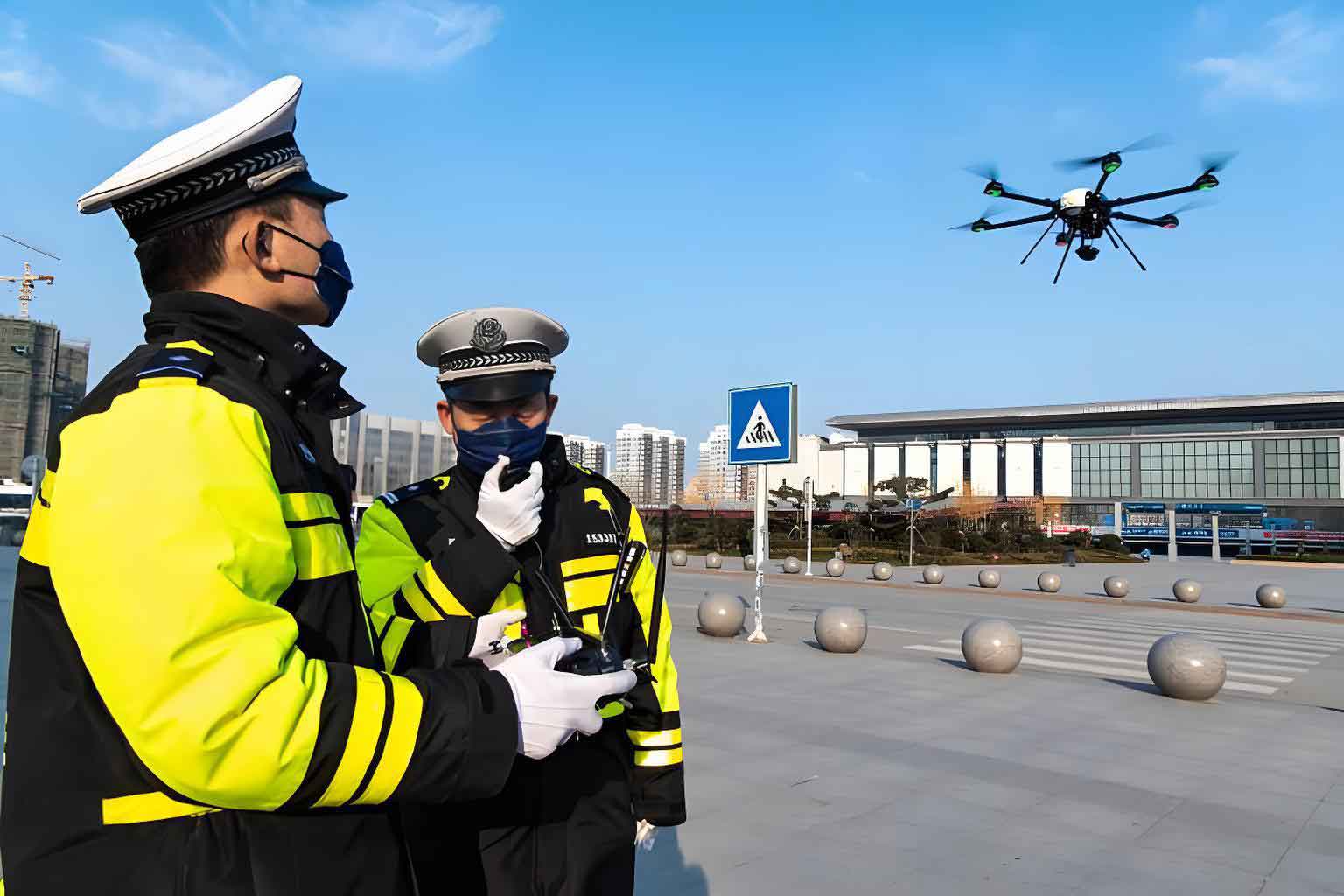
The integration of Unmanned Aerial Vehicle (UAV) technology into law enforcement, particularly within investigative domains, represents a paradigm shift in operational methodology. As a system operator and analyst, I have witnessed firsthand the transformation from purely ground-based, manpower-intensive procedures to a more integrated, technology-driven approach. Police UAVs, defined as remotely piloted or autonomously operated aircraft systems deployed for law enforcement purposes, serve as force multipliers. They extend the senses and reach of investigative teams, offering unprecedented capabilities in situational awareness, evidence collection, and tactical support. This evolution is not merely additive but fundamentally reconstructive, demanding new protocols, specialized skills, and a robust legal-ethical framework to govern their application.
The core value proposition of a police UAV in investigations lies in its platform versatility. Unlike manned aircraft, these systems can be deployed rapidly, operate in hazardous environments without risking officer safety, and provide a persistent or on-demand aerial perspective. Their utility is amplified by modular payload systems, allowing a single airframe to serve multiple functions—from high-resolution photography and thermal imaging to loudspeaker deployment or specific signal detection. The primary categories include multi-rotor UAVs (e.g., quadcopters), favored for vertical take-off/landing and stable hovering; fixed-wing UAVs, offering greater endurance and range for large-area searches; and hybrid vertical take-off and landing (VTOL) models that combine these advantages. The strategic selection of the platform is the first critical step in any UAV-assisted investigation, dictated by the specific operational parameters of the case.
Operational Applications: Enhancing Traditional Investigative Pillars
The deployment of police UAVs directly enhances three foundational pillars of investigation: crime scene management, evidence location and documentation, and suspect apprehension.
1. Crime Scene Assessment and 3D Reconstruction
Upon securing a scene, the primary challenge is to comprehensively document its spatial relationships and contextual details before any alteration occurs. Traditional methods involve ground photography, manual sketching, and measurements, which can be time-consuming and may miss macro-level patterns. A police UAV addresses this by conducting an automated aerial survey. Using photogrammetry software, hundreds of overlapping high-resolution images captured from the UAV are processed to generate highly accurate orthomosaic maps, digital elevation models, and fully navigable 3D models.
These digital assets are invaluable. The 3D model, for instance, allows investigators, prosecutors, and jurors to virtually “walk through” a frozen moment of the scene from any angle, long after the physical location has been released. This is crucial for complex scenes such as traffic accidents, homicides in rugged terrain, or large-scale environmental crimes. The spatial data can be used to calculate trajectories, lines of sight, and distances with precision. The efficiency gain is quantifiable. Where a ground team might spend hours mapping a large outdoor scene, a police UAV can capture the necessary data in minutes, freeing personnel for other critical tasks like witness interviews or evidence collection.
2. Evidence Detection and Forensic Intelligence Gathering
Beyond initial documentation, police UAVs excel at locating evidence that is difficult or dangerous for ground teams to find. Equipped with multispectral or thermal imaging sensors, a UAV can detect anomalies invisible to the naked eye. For example, disturbed soil in a clandestine grave may retain a different temperature signature than its surroundings. Similarly, a suspect attempting to hide in dense foliage at night will emit a clear thermal signature. This capability transforms searches from random, labor-intensive sweeps into targeted, data-informed operations.
The mathematical principle behind thermal detection is based on Planck’s Law, where every object emits infrared radiation as a function of its temperature. A thermal camera on a police UAV measures this radiation, creating a “heat map” of the scene. Differences in emissivity (ε) and temperature (T) allow the system to distinguish between a human body, an animal, a recently used vehicle engine, and ambient vegetation. The effectiveness can be modeled by considering the sensor’s Instantaneous Field of View (IFOV), altitude, and the contrast between the target and background.
$$ \text{Detection Capability} \propto \frac{\text{Sensor Resolution}}{\text{Altitude}} \times \Delta T \times \epsilon_{\text{target}} $$
Where ΔT is the temperature difference between target and background.
Furthermore, UAVs can be equipped with sensors for specific forensic tasks, such as LiDAR for penetrating vegetative cover to map ground topography or specialized sniffers for detecting chemical or radiological agents. This turns the police UAV into a mobile, airborne forensics platform.
3. Tactical Support and Apprehension Operations
In dynamic situations involving barricaded subjects, fugitive searches, or large-scale public order monitoring, real-time aerial intelligence is a game-changer. A police UAV provides a safe, elevated vantage point for command staff, allowing them to monitor suspect movement, assess the layout of a building or complex, and deploy resources more effectively without exposing officers to direct fire or other threats.
For tracking a fleeing suspect, especially in challenging environments like forests or industrial zones, a UAV with a stabilized zoom camera and thermal capability can maintain visual contact where ground units might lose it. This persistent “eye in the sky” enables the containment perimeter to be adjusted dynamically and guides tactical teams to the suspect’s exact location. The operational advantage is clear: it increases officer safety, enhances the probability of a peaceful resolution, and reduces the risk of collateral damage.
Current Challenges and Systemic Constraints
Despite their transformative potential, the integration of police UAVs into mainstream investigative workflows faces significant hurdles. These challenges span technical, organizational, and legal domains.
| Challenge Domain | Specific Issues | Operational Impact |
|---|---|---|
| Technical Limitations | Short flight endurance (typically 20-45 min); Limited payload capacity; Vulnerability to weather (wind, rain); Signal interference/jamming risks. | Restricts scope of continuous surveillance or large-area searches; Limits sensor options; Causes mission cancellations or loss of aircraft; Creates security and safety vulnerabilities. |
| Organizational & Training | High initial acquisition and maintenance costs; Lack of standardized training and certification; Insufficient dedicated personnel (pilots, analysts); Inter-departmental coordination hurdles. | Leads to unequal resource distribution between agencies; Results in inconsistent operational standards and safety risks; Causes burnout and underutilization of assets; Hinders large-scale, multi-agency operations. |
| Legal & Regulatory | Evolving and complex airspace regulations (e.g., FAA Part 107, LAANC); Ambiguous privacy laws regarding aerial surveillance; Lack of clear precedent for digital evidence admissibility; Cybersecurity threats to data links and stored footage. | Delays rapid response due to authorization needs; Risks evidence suppression or public backlash; Creates uncertainty in prosecution; Compromises operational integrity and data confidentiality. |
| Public Perception & Ethics | Concerns over “mass surveillance” and erosion of privacy; Noise pollution; Potential for accidents causing injury or damage. | Erodes community trust and legitimacy; Leads to complaints and restrictive local ordinances; Creates liability and public relations issues. |
From an operational standpoint, the endurance bottleneck is perhaps the most pressing technical issue. The mission time \( T_{\text{mission}} \) for a police UAV is a function of its battery energy capacity \( E_{\text{batt}} \), the power draw of its propulsion system \( P_{\text{prop}} \), and the power required by its mission payload \( P_{\text{payload}} \):
$$ T_{\text{mission}} = \frac{E_{\text{batt}}}{P_{\text{prop}} + P_{\text{payload}}} $$
This equation highlights the trade-off: adding a heavier, more capable sensor (increasing \( P_{\text{payload}} \)) directly reduces flight time. Advancements in battery technology (increasing \( E_{\text{batt}} \)) and more efficient motors and aerodynamics (decreasing \( P_{\text{prop}} \)) are critical for the next leap in police UAV utility.
Strategic Pathways for Optimization and Integration
To fully realize the potential of police UAVs in investigative work, a multi-faceted strategy addressing the aforementioned challenges is required. This strategy must be proactive, collaborative, and principle-based.
1. Advancing Technology and Interoperability
Investment in research and development is paramount. Priorities should include hybrid power systems (e.g., hydrogen fuel cells) for extended endurance, lightweight composite materials, and advanced sense-and-avoid systems for safer operations in complex airspace. Furthermore, developing standardized data protocols is essential. A police UAV should not be a data silo; its video stream, telemetry, and sensor outputs must integrate seamlessly with existing Real-Time Crime Centers (RTCCs), computer-aided dispatch (CAD) systems, and digital evidence management systems (DEMS). The concept of a “common operating picture” relies on this interoperability.
2. Building Institutional Capacity and Standardization
A police UAV is only as effective as its pilot and the analyst interpreting its data. Agencies must move beyond ad-hoc training and establish dedicated UAV units with clear career progression paths. This involves:
- Standardized Certification: Mandating nationally or regionally recognized pilot certifications that go beyond basic flight skills to include legal authorities, emergency procedures, and forensic data capture protocols.
- Tactical Training: Regular exercises integrating UAV operators with SWAT, K-9, and investigative teams to build seamless operational cohesion.
- Data Analysis Specialization: Training analysts specifically in interpreting UAV-gathered data (e.g., photogrammetry, thermal analysis, change detection over time).
3. Developing a Robust Legal and Ethical Framework
Clear, publicly accessible policies are the foundation of legitimate use. These policies must balance investigative efficacy with constitutional protections. Key elements include:
- Privacy-Preserving Protocols: Establishing clear guidelines for when a police UAV may conduct surveillance. This could involve a tiered system based on duration and intimacy of observation, often requiring heightened justification or a warrant for sustained, targeted surveillance of private spaces, even from the air.
- Transparency and Accountability: Mandating logging of all police UAV flights, including purpose, operator, and area of operation. Implementing strict data retention and purge schedules for non-evidentiary footage.
- Community Engagement: Proactively educating the public on the benefits and limitations of police UAVs, their governed use, and the complaint process. This builds trust and demystifies the technology.
The legal standard for evidence collection remains critical. The process of capturing, handling, and authenticating UAV-derived evidence (like a 3D model or thermal video) must follow a verifiable chain of custody. This is represented as a function of integrity-preserving steps:
$$ \text{Evidence Admissibility} = f(\text{Proper Authorization}, \text{Sensor Calibration}, \text{Secure Data Link}, \text{Hashing at Acquisition}, \text{Auditable Chain-of-Custody}) $$
Failure at any step jeopardizes the entire investigative effort.
Conclusion: Towards a Manned-Unmanned Teaming Future
The trajectory for police UAVs in investigative work points toward deeper integration and autonomy. We are moving from using drones as simple remote cameras to employing them as intelligent nodes in a broader sensor network. Future developments may include swarming tactics for searching vast areas, automated anomaly detection algorithms that flag suspicious activity in real-time, and persistent UAVs that can loiter for days providing overwatch for critical infrastructure.
The ultimate goal is not to replace the investigator but to empower them. The future investigative team will consist of officers on the ground working in concert with autonomous and remotely piloted systems in the air, all connected by a secure data fabric. The human provides context, judgment, and legal authority; the police UAV provides scale, perspective, and persistent sensing. By systematically addressing the technical, organizational, and ethical challenges today, law enforcement agencies can ensure that this powerful tool is used effectively, responsibly, and in a manner that enhances both public safety and the public trust.