As a professional engaged in the field of airfield recovery and security, I have witnessed firsthand the critical and hazardous nature of unexploded ordnance (UXO) clearance on runways and taxiways following an attack. The primary mission is to rapidly restore flight operations by locating and neutralizing any munitions that failed to detonate, whether on the surface or buried. However, the prevailing methodologies, which heavily rely on personnel approaching potentially volatile explosives, present unacceptable risks and operational limitations. The advancement of unmanned systems offers a paradigm-shifting solution. This analysis explores the integration of military drone technology into airport UXO disposal protocols, examining its evolution, potential applications, and the transformative impact it promises for airfield security.
The traditional UXO clearance cycle involves several high-risk phases: initial damage assessment of the airfield surface, visual and instrumental detection of subsurface threats, placement of counter-charges or specialized disposal tools, and finally, controlled detonation and subsequent repair. Each step requires personnel to operate within the lethal radius of unstable munitions. Sub-munitions from area denial weapons, in particular, pose a severe challenge due to their quantity, varied fuzing mechanisms, and dispersal pattern. This operational model is not only dangerous but can be time-consuming, creating a bottleneck in the crucial timeline to reopen an airbase. The need for a standoff, rapid, and precise capability is paramount. The military drone, or Unmanned Aerial Vehicle (UAV), has matured from a niche reconnaissance asset to a multifaceted platform capable of performing complex missions across all domains of warfare. Its core attributes—being unmanned, re-usable, configurable, and capable of operating in contaminated or high-threat environments—make it an ideal candidate to revolutionize airport explosive ordnance disposal (EOD).
Historical Progression and Modern Capabilities of Military Drones
The concept of unmanned flight for military purposes is not new, but its acceleration over the past three decades has been exponential. Early systems like the US Firebee provided valuable but limited intelligence. Today, military drones constitute a diversified ecosystem, categorized broadly by altitude, endurance, size, and role. The driving trends focus on enhancing autonomy, survivability, persistence, and multi-role functionality.
The following table summarizes key developmental vectors in modern military drone technology:
| Development Vector | Primary Objective | Exemplar Systems | Relevance to EOD/Logistics |
|---|---|---|---|
| Unmanned Loyal Wingman | Collaborate with manned aircraft; perform high-risk missions; enhance survivability of fleet. | US Skyborg, AU-ATS, UK LANCA | Concept extends to manned-unmanned teaming for base defense and damage assessment. |
| Integrated Intelligence, Surveillance, Reconnaissance & Strike (ISR-S) | Combine target acquisition, tracking, and kinetic engagement in a single persistent platform. | US MQ-9 Reaper, Chinese Wing Loong II & CH-5 | Directly applicable for immediate threat neutralization if armed; persistent surveillance for post-strike assessment. |
| High-Altitude, Long-Endurance (HALE) | Provide wide-area, persistent surveillance and communications relay. | US RQ-4 Global Hawk, Chinese CH-4 | Critical for pre- and post-attack wide-area assessment of airfield and surrounding terrain. |
| Aerial Refueling (UAV) | Automate aerial refueling to extend range and endurance of manned and unmanned platforms. | US MQ-25 Stingray | |
| Miniature & Tactical UAVs | Provide platoon/company-level immediate situational awareness in complex environments. | US InstantEye, Russian Zala 421-08 | Ideal for close-range, detailed inspection of runway surfaces, craters, and debris fields. |
This evolution is underpinned by breakthroughs in microelectronics, secure data-links, lightweight composite materials, and, most importantly, artificial intelligence (AI) and machine learning (ML). Modern military drones are transitioning from remotely piloted vehicles to increasingly autonomous systems capable of complex decision-making within defined parameters. This autonomy is crucial for applications in chaotic post-attack environments where communication links may be degraded.
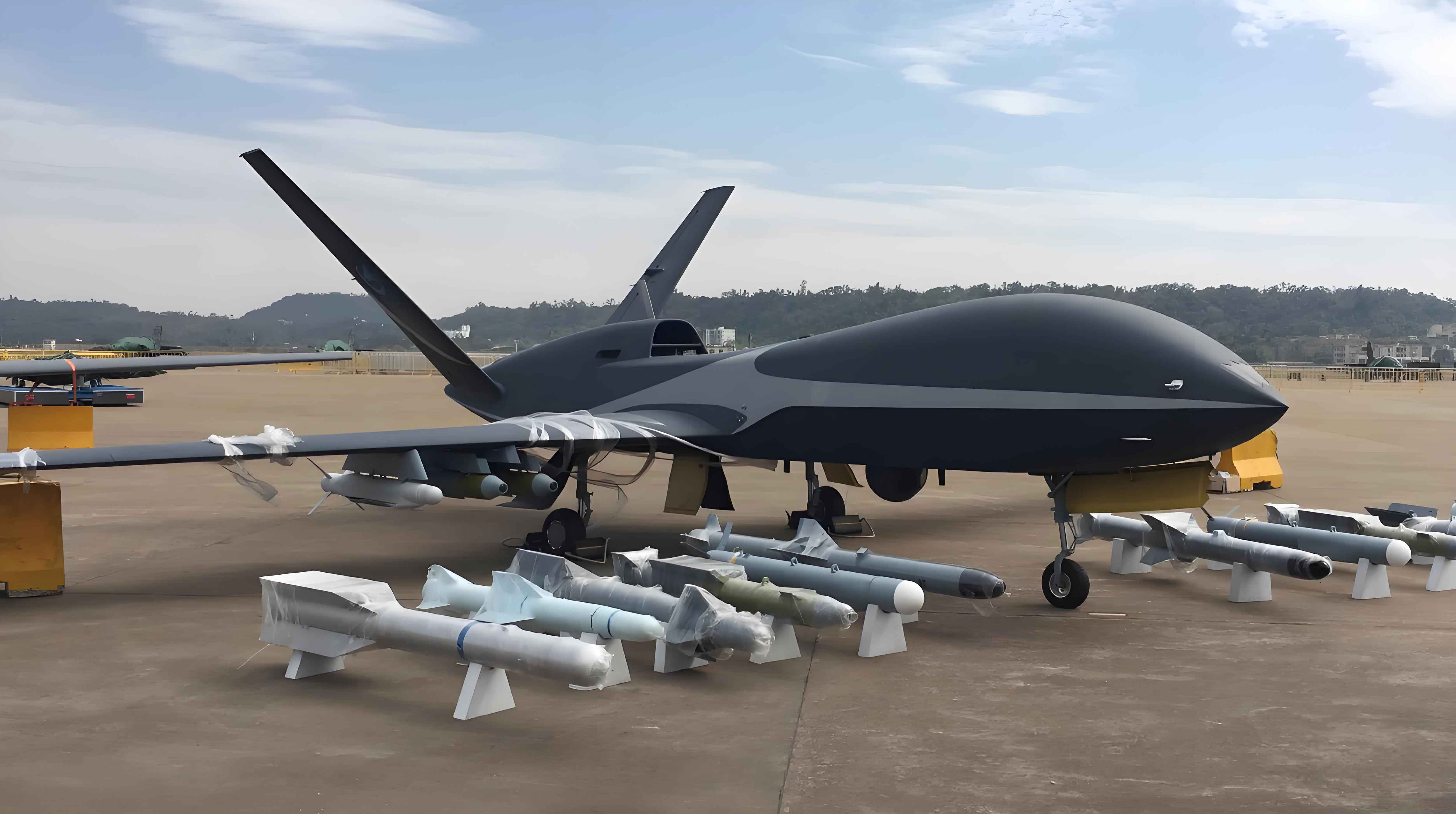
The image above encapsulates the modern reality of military drone operations. While often associated with strike missions, the same technological base—robust airframes, advanced sensors, precision navigation, and secure communications—can be repurposed for the lifesaving mission of UXO disposal. The “hunter” can become the “saver,” leveraging its ability to loiter, stare, and interact with the environment without risking a human life.
Deconstructing the Airport UXO Clearance Problem
To appreciate the value proposition of military drones, one must first understand the intricacies and vulnerabilities of the traditional clearance process. The workflow is linear and human-centric:
- Initial Surface Reconnaissance: EOD teams must visually scan the vast area of runways, taxiways, and aprons to identify surface or partially buried UXO and assess general damage. This is conducted on foot or from lightly armored vehicles, exposing personnel to potential blast, fragmentation, and secondary explosion hazards from disturbed munitions.
- Subsurface Detection and Localization: For suspected buried ordnance, teams use sequentially more precise instruments. Initial broad-area screening might use electromagnetic induction (EMI) or magnetometer arrays. Suspect locations are then investigated with precise tools like cesium-vapor magnetometers. The accuracy of the final coordinates $ (x, y, z) $ is critical and is affected by sensor noise, operator skill, and soil conditions. A localization error $ \delta $ can render a disposal attempt ineffective or dangerous.
$$ P_{detect} = f(S_{sensor}, N_{env}, D_{depth}, O_{skill}) $$
Where $ P_{detect} $ is the probability of correct detection and localization, $ S_{sensor} $ is sensor sensitivity, $ N_{env} $ is environmental noise, $ D_{depth} $ is burial depth, and $ O_{skill} $ is operator proficiency. - Disposal Action: Depending on the UXO type, disposal may involve:
- Surface UXO: Placing a shaped charge or linear cutting charge via a robotic manipulator or, in high-risk cases, by hand. For multiple small sub-munitions, constructing a protective blast wall and using bulk explosives for simultaneous disposal.
- Buried UXO: Using a borehole drill or a specialized “down-blast” explosive charge placed precisely above the located munition.
In all cases, personnel must approach the epicenter of danger to emplace equipment.
- Verification and Clearance: After detonation, the area must be re-checked to confirm successful neutralization and to scan for any previously missed items.
The core limitations are stark:
1. High Personnel Risk: Every phase requires proximity to hazards.
2. Time-Consuming Processes: Manual scanning and precise localization are slow.
3. Scalability Challenges: Clearing hundreds of sub-munitions with traditional methods is impractical under tactical time constraints.
4. Data Fragmentation: Assessment data is often qualitative and not integrated into a unified digital model of the airfield’s status.
A Conceptual Framework for Drone-Enabled Airport EOD
The integration of military drone technology proposes a networked, layered approach to transform each vulnerable phase of the clearance cycle. This is not merely about replacing a human with a drone in a single task, but about re-engineering the entire operational loop for speed, safety, and data fidelity.
1. Persistent Overwatch and Battle Damage Assessment (BDA) Drones
High-altitude, long-endurance (HALE) or medium-altitude, long-endurance (MALE) military drones can provide continuous surveillance of an airfield before, during, and after an attack. Equipped with high-resolution electro-optical/infrared (EO/IR) sensors and Synthetic Aperture Radar (SAR), they can track incoming munitions, record impact points, and generate an initial damage map. AI-powered image analysis can flag potential UXO sites based on impact craters, debris patterns, and visual signatures of munitions. This provides command with a near-real-time Common Operational Picture (COP), prioritizing areas for focused clearance. The probability of initial detection from altitude $ H $ can be modeled as a function of sensor ground sample distance (GSD) and coverage rate $ R $:
$$ P_{initial}(t) = 1 – e^{-\lambda R t} $$
where $ \lambda $ is the mean rate of detectable feature occurrence per unit area, and $ t $ is the surveillance time.
2. Close-Range勘察 and Detection Drone Swarms
Following the BDA, a swarm or team of smaller, agile tactical military drones would be deployed for detailed inspection. These platforms, potentially vertical take-off and landing (VTOL) for hover capability, would carry a multi-sensor payload:
- LiDAR (Light Detection and Ranging): To create a millimeter-accurate 3D point cloud of the runway surface, precisely mapping craters and surface deformations that may indicate buried objects.
- Multi/Hyperspectral Imaging: To detect chemical residues from explosives or disturbed soil, offering another cue for UXO location.
- Lightweight EMI/Magnetometer Arrays: Mounted on drones or suspended as “towed birds,” these can perform rapid aerial geophysical surveys. While less sensitive than ground-based systems, they can efficiently screen large areas to identify anomalous regions for follow-up. The magnetic anomaly $ \Delta B $ detected by an airborne sensor from a dipole source (UXO) at a distance $ r $ is approximated by:
$$ \Delta B \propto \frac{M}{r^3} $$
where $ M $ is the magnetic moment of the object. Drone altitude $ r $ thus critically affects signal strength.
This multi-modal data fusion, processed onboard or at a ground control station, generates a unified, coordinate-registered “UXO hazard map.”
| Sensor Type | Physical Principle | Primary Data Output | Advantages for Drone Use | Limitations |
|---|---|---|---|---|
| EO/IR Camera | Visible/Infrared Light | 2D Imagery, Video | High resolution, object identification, low cost. | Surface only, affected by weather/light. |
| LiDAR | Laser Pulse Time-of-Flight | 3D Topographic Point Cloud | Precise surface mapping, works day/night. | Cannot penetrate ground. |
| Hyperspectral Imager | Spectral Reflectance | Spectral Signatures per Pixel | Material identification (e.g., explosives residue). | Complex data processing, lower spatial resolution. |
| Airborne Magnetometer | Magnetic Field Disturbance | Total Field or Gradient Maps | Detects ferrous objects at depth, rapid area coverage. | Susceptible to cultural noise, lower resolution than ground survey. |
3. Dedicated Disposal and Neutralization Military Drones
This is the most revolutionary application. A specialized disposal military drone would be designed to carry and precisely emplace neutralization charges. It would navigate autonomously to the coordinates provided by the detection swarm. Key features would include:
- Precision Hover and Landing Capability: VTOL or highly stable multi-rotor design.
- Robotic Manipulator Arm: Equipped with a gripper or specialized tool to handle standardized counter-charge packages (e.g., shaped charges, soft-recovery kits).
- Onboard Fuzing Mechanism: The drone could arm and initiate the charge after safe retreat, or it could place a radio-controlled charge for later initiation by EOD teams from a safe bunker.
- Counter-Submunition Payloads: For dealing with area denial munitions, a drone could be equipped with a dispenser for small neutralizing agents (e.g., liquid explosives, thermite-based disruptors) that could be dropped or placed onto multiple sub-munitions in a single sortie.
The mission success probability $ P_{success} $ for a disposal drone can be framed as:
$$ P_{success} = P_{nav} \cdot P_{empl} \cdot P_{func} $$
where $ P_{nav} $ is the probability of accurate navigation to the target coordinate, $ P_{empl} $ is the probability of successful charge emplacement, and $ P_{func} $ is the probability of charge functioning as designed. Automated drone systems aim to drive $ P_{nav} $ and $ P_{empl} $ close to 1.
4. Verification and Digital Twin Generation
Post-detonation, the勘察 drones would re-survey the site. By comparing pre- and post-disposal LiDAR and magnetic data, the system can algorithmically verify the removal of the anomaly and update the hazard map. Over time, all this data contributes to a dynamic “Digital Twin” of the airfield’s damage state, invaluable for commanders making resource allocation decisions and for documenting clearance for flight operations.
System Integration and Operational Concept
The true power of this concept lies in the integration of these drone capabilities into a cohesive system-of-systems. An Airfield EOD Drone Network (AEDN) would function as follows:
- Alert Phase: A HALE military drone on persistent station detects an inbound strike and tracks impacts.
- Assessment Phase: The HALE drone transmits BDA. A ground control station tasks a swarm of勘察 drones to the affected grid. Swarm algorithms optimize coverage paths.
$$ \text{Minimize: } T_{total} = \sum_{i=1}^{n} \int_{Path_i} \frac{ds}{v(s)} $$
$$ \text{Subject to: } \bigcup_{i=1}^{n} Coverage(Path_i) = A_{target} $$
where $ T_{total} $ is total mission time, $ n $ is the number of drones, and $ A_{target} $ is the target area. - Localization Phase:勘察 drones fuse sensor data to create the hazard map, classifying threats by type and priority (e.g., large penetrating bomb vs. small sub-munition).
- Neutralization Phase: The control station dispatches appropriate disposal military drones. For a large bomb, a single drone places a shaped charge. For a cluster of sub-munitions, a “mothership” drone deploys several smaller kamikaze or emplacer drones.
- Verification & Clearance Phase:勘察 swarm re-scans. The digital twin is updated. If clear, the area is marked as safe for repair crews.
This cycle drastically reduces the “boots on the ground” time in the hot zone, compresses the timeline, and creates a comprehensive data record.
Challenges and Future Research Vectors
While the potential is immense, several challenges must be addressed to operationalize military drones for airport EOD:
| Challenge Category | Specific Issues | Potential Research Directions |
|---|---|---|
| Technical | Payload-weight constraints for sensors and manipulators. EMI from drone motors interfering with sensitive magnetometers. Precision emplacement in windy conditions. Limited endurance of VTOL platforms. | Development of ultra-lightweight composite manipulators. Advanced sensor shielding and noise-cancellation algorithms. Hybrid VTOL-fixed-wing designs for greater loiter time. AI-based robust landing in debris fields. |
| Sensor Fusion & AI | Real-time fusion of heterogeneous data (imagery, LiDAR, magnetic). High false-alarm rates in cluttered environments. Reliable automatic target recognition (ATR) for diverse UXO types. | Neuromorphic computing for low-SWaP (Size, Weight, and Power) edge processing. Training deep learning models on massive synthetic and real-world UXO signature datasets. Explainable AI to provide confidence metrics for operator decisions. |
| Operational & Tactical | Integration into existing C2 (Command and Control) architecture. Deconfliction with other air traffic (repair aircraft, emergency flights). Vulnerability of drones to enemy jamming or kinetic attack during operations. Weather limitations. | Development of open architecture standards for UAV-EOD system interoperability. Establishment of dedicated EOD airspace protocols. Incorporation of anti-jam communications and autonomous contingency behaviors. All-weather sensor suites (e.g., millimeter-wave radar). |
| Doctrinal & Training | Developing new tactics, techniques, and procedures (TTPs). Redefining the role of the human EOD technician as a supervisor and mission commander. Certification and safety protocols for automated explosive handling. | Wargaming and simulation of drone-enabled EOD scenarios. Development of “operator-in-the-loop” training simulators. Creating joint software/hardware certification standards. |
Conclusion
The proliferation and sophistication of modern military drones present a unique opportunity to fundamentally reshape one of the most dangerous peacetime and wartime engineering tasks: airport unexploded ordnance disposal. By applying the principles of standoff operation, persistent sensing, data fusion, and robotic manipulation, a drone-centric system can dramatically enhance the safety, speed, and effectiveness of airfield recovery operations. The conceptual framework outlined—from HALE overwatch to tactical勘察 swarms and specialized neutralization platforms—points toward a future where the first and primary responder to a contaminated runway is not a human in a bomb suit, but a networked fleet of intelligent aerial robots. The trajectory of military drone evolution clearly supports this vision. Realizing it will require focused interdisciplinary research in robotics, sensor physics, artificial intelligence, and systems integration. The payoff, however, is unequivocal: preserving the lives of EOD personnel and ensuring the rapid return of critical airpower projection capabilities. The future of airport security and expedient runway repair is intrinsically linked to the autonomous capabilities of the next generation of military drones.