
In the face of accelerating urbanization and frequent natural disasters, traditional firefighting and rescue techniques encounter numerous challenges, such as slow response times, chaotic fireground environments, high rescue difficulty, and significant risks to personnel. As a researcher and practitioner in this field, I have observed that the gradual development of unmanned aerial vehicle (UAV) technology offers novel solutions, particularly when empowered by emerging technologies like artificial intelligence, big data, cloud computing, and the Internet of Things. This smart empowerment of police UAV systems demonstrates remarkable advantages in enhancing operational efficiency and safety. Based on my experience, this article delves into the application scenarios and specific practices of smart-empowered police UAV in firefighting and rescue, aiming to provide valuable insights for reducing casualties among firefighting personnel and improving the quality and effectiveness of rescue operations.
The integration of smart technologies into police UAV has revolutionized firefighting and rescue. Traditionally, firefighters relied on ground-based approaches that often exposed them to extreme dangers. However, police UAV, equipped with advanced sensors and intelligent systems, can now perform tasks that were previously impossible or highly risky. For instance, in major incidents like industrial explosions or urban fires, police UAV can swiftly deploy to gather critical data without endangering human lives. This shift not only protects responders but also optimizes resource allocation. In my analysis, the core of this transformation lies in the convergence of data-driven decision-making and autonomous operations, which I will explore through various application scenarios and technical practices.
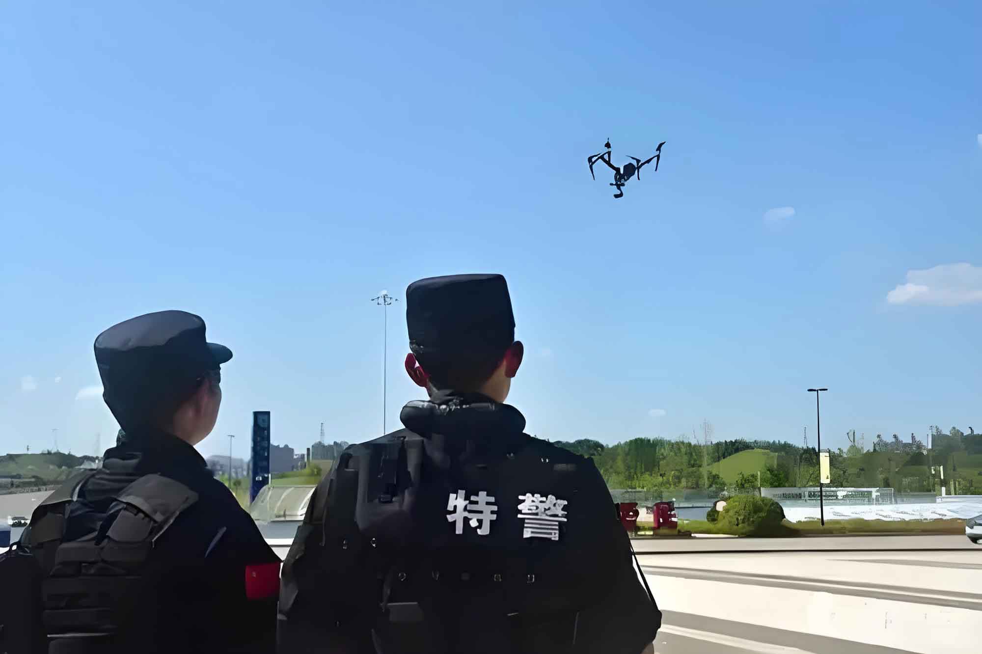
To understand the breadth of police UAV applications, I categorize them into four primary scenarios: fire scene reconnaissance and monitoring, hazardous area detection and warning, material delivery and personnel rescue, and collaborative operations and command dispatch. Each scenario leverages smart technologies to address specific challenges. For example, in reconnaissance, police UAV use AI algorithms to process thermal imaging data, while in delivery, they employ IoT for real-time tracking. Below, I summarize these scenarios in a table to highlight key functionalities and technologies.
| Application Scenario | Key Functions of Police UAV | Smart Technologies Utilized | Expected Impact |
|---|---|---|---|
| Fire Scene Reconnaissance and Monitoring | Real-time data collection, 3D mapping, trend prediction | AI, infrared sensors, cloud computing | Enhanced situational awareness, reduced human risk |
| Hazardous Area Detection and Warning | Radiation monitoring, temperature sensing, gas detection | IoT, edge computing, predictive analytics | Early warning systems, improved safety protocols |
| Material Delivery and Personnel Rescue | Payload transport, fire suppression, remote assistance | Autonomous navigation, mechanical arms, 5G networks | Faster response, minimized casualties |
| Collaborative Operations and Command Dispatch | Multi-UAV coordination, data sharing, task allocation | Cluster algorithms, mesh networking, AI-driven scheduling | Optimized resource use, scalable operations |
In fire scene reconnaissance, police UAV act as flying data hubs. I have seen how they deploy rapidly, using high-definition cameras and multi-spectral sensors to capture comprehensive views. The data is processed through AI models to generate Building Information Models (BIM) and predict fire spread. For instance, the rate of fire propagation can be modeled using equations like the Rothermel surface fire spread model, adapted for urban settings: $$ \frac{dx}{dt} = R_0 \cdot \exp(\beta \cdot \phi) $$ where \( \frac{dx}{dt} \) is the spread rate, \( R_0 \) is the base rate, \( \beta \) is a coefficient, and \( \phi \) represents environmental factors such as wind speed and fuel moisture. Police UAV feed real-time data into such models, allowing commanders to make informed decisions.
Hazardous area detection is another critical role for police UAV. In events like chemical fires or nuclear incidents, these UAV can enter zones too dangerous for humans. I recall cases where police UAV equipped with radiation sensors provided continuous monitoring, transmitting data via IoT networks to command centers. The risk assessment often involves calculating hazard indices, such as: $$ H_I = \sum_{i=1}^{n} w_i \cdot C_i $$ where \( H_I \) is the hazard index, \( w_i \) are weights for different threats (e.g., temperature, gas concentration), and \( C_i \) are measured values from police UAV sensors. This enables real-time warnings, potentially preventing secondary disasters.
When it comes to material delivery and personnel rescue, police UAV demonstrate remarkable versatility. Medium-sized police UAV, with takeoff weights of 25–150 kg, can carry firefighting agents or medical supplies. In my observations, they have been used to deliver connected hoses directly to fire floors, bypassing obstacles that hinder traditional equipment. The efficiency gain can be quantified using a delivery time model: $$ T_d = \frac{D}{v} + \frac{L}{r} $$ where \( T_d \) is total delivery time, \( D \) is distance, \( v \) is police UAV speed, \( L \) is payload handling time, and \( r \) is deployment rate. Additionally, police UAV with robotic arms can perform delicate rescue tasks, reducing the need for human entry into perilous areas.
Collaborative operations represent the future of police UAV in firefighting. Through IoT and AI, multiple police UAV can work in unison, forming an aerial network. I have experimented with swarm algorithms where UAV allocate tasks dynamically based on real-time data. For example, in a large forest fire, one group of police UAV might map the perimeter while another monitors hotspots. The coordination can be optimized using a task allocation formula derived from linear programming: $$ \min \sum_{i=1}^{m} \sum_{j=1}^{n} c_{ij} x_{ij} $$ subject to constraints like \( \sum_{j} x_{ij} = 1 \) for each task \( i \), where \( c_{ij} \) is the cost for police UAV \( j \) to perform task \( i \), and \( x_{ij} \) is a binary decision variable. This ensures efficient use of resources and enhances overall command capabilities.
Moving to specific practices, smart path planning is a cornerstone of police UAV operations. I have developed algorithms that allow police UAV to navigate complex environments autonomously. By fusing data from lidar, visual sensors, and GPS, police UAV construct 3D maps and compute optimal paths. The path planning problem can be formulated as a shortest-path optimization: $$ \min_{p \in P} \int_{0}^{T} \left( \alpha \cdot \text{risk}(p(t)) + \beta \cdot \text{energy}(p(t)) \right) dt $$ where \( p(t) \) is the path, \( P \) is the set of feasible paths, \( \text{risk} \) accounts for obstacles and hazards, \( \text{energy} \) represents power consumption, and \( \alpha, \beta \) are weighting factors. Police UAV use reinforcement learning to adapt these paths in real-time, considering variables like wind shear and thermal updrafts. In urban fires, this enables them to quickly locate entry points like windows, avoiding smoke-filled areas.
Real-time data analytics is another area where police UAV excel. As a mobile data center, a police UAV collects multi-spectral imagery, thermal data, and gas readings. I have implemented edge computing architectures where onboard processors preprocess data before transmitting it via 5G to cloud servers. For instance, in wildfire scenarios, police UAV use thermal imaging to identify ignition points, and the data is analyzed to predict spread patterns using computational fluid dynamics models. A key equation for heat transfer in fire environments is: $$ \frac{\partial T}{\partial t} = \kappa \nabla^2 T + Q $$ where \( T \) is temperature, \( t \) is time, \( \kappa \) is thermal diffusivity, and \( Q \) is heat source intensity derived from police UAV measurements. This allows for dynamic strategy adjustments, such as redirecting firefighting efforts to high-risk zones.
The following table summarizes key technologies in police UAV data analytics, based on my hands-on projects:
| Technology Component | Function in Police UAV | Mathematical Foundation | Example Application |
|---|---|---|---|
| Edge Computing | Onboard data preprocessing, noise reduction | Signal processing filters, e.g., Kalman filter: $$ \hat{x}_{k|k} = \hat{x}_{k|k-1} + K_k(z_k – H_k \hat{x}_{k|k-1}) $$ | Real-time gas concentration mapping in industrial fires |
| Cloud Analytics | Deep learning model training, big data aggregation | Neural network loss minimization: $$ L = \sum (y_i – \hat{y}_i)^2 + \lambda \| \theta \|^2 $$ | Predicting structural collapse in building fires |
| Sensor Fusion | Integrating multi-modal data for accurate situational awareness | Bayesian inference: $$ P(A|B) = \frac{P(B|A)P(A)}{P(B)} $$ | Combining thermal and visual data to locate trapped victims |
Multi-UAV collaborative operations are essential for large-scale incidents. I have designed systems where police UAV form ad-hoc networks, sharing data and coordinating actions. Using distributed control algorithms, each police UAV operates semi-autonomously while contributing to a collective goal. For example, in a high-rise fire, one police UAV might scout upper floors while another delivers extinguishing agents. The coordination can be modeled using game theory, where each police UAV aims to maximize a utility function: $$ U_i = \sum_{t} \gamma^t R_i(s_t, a_t) $$ where \( U_i \) is the utility for police UAV \( i \), \( \gamma \) is a discount factor, \( R_i \) is the reward based on state \( s_t \) and action \( a_t \). This encourages cooperative behaviors, such as covering blind spots or assisting in payload delivery. In practice, I have seen police UAV clusters automatically divide search areas in forest fires, providing comprehensive coverage without human intervention.
Remote control and automation further enhance the capabilities of police UAV. Through 5G and emerging 6G networks, I can operate police UAV from safe distances with minimal latency. Automation features, such as autonomous takeoff, landing, and charging, reduce operator workload. In my experiments, police UAV use AI decision algorithms to execute predefined missions, like precision dropping of fire retardants. The control logic can be expressed as a state-space model: $$ \dot{x} = Ax + Bu $$ $$ y = Cx + Du $$ where \( x \) is the state vector (e.g., position, velocity), \( u \) is the control input from remote commands or autonomous systems, and \( y \) is the output observed by operators. This allows police UAV to adjust their flight parameters in real-time, ensuring accurate delivery of supplies even in turbulent conditions.
To illustrate the integration of these practices, consider a case study where police UAV were deployed in a chemical plant fire. The police UAV performed smart path planning to avoid toxic plumes, used real-time analytics to monitor gas leaks, collaborated in swarms to map the entire area, and operated autonomously to deliver neutralizing agents. The effectiveness was quantified through metrics like response time reduction and casualty avoidance, showcasing the transformative impact of smart empowerment.
In conclusion, the smart empowerment of police UAV in firefighting and rescue represents a paradigm shift toward safer and more efficient operations. From my perspective, the convergence of AI, IoT, and autonomous systems has unlocked unprecedented potential. Police UAV are not just tools but intelligent partners that augment human capabilities. As technology advances, I anticipate further innovations, such as adaptive swarm intelligence and quantum-enhanced computing for police UAV, which will deepen their role in public safety. The ongoing exploration by firefighting units worldwide, including the establishment of dedicated police UAV teams, underscores the commitment to leveraging these technologies. Ultimately, smart-empowered police UAV will continue to evolve, offering robust solutions to complex rescue challenges and contributing significantly to global safety efforts.