
The proliferation of unmanned aerial vehicles (UAVs), commonly known as drones, represents a significant technological leap with profound implications for numerous sectors. From precision agriculture and logistics to infrastructure inspection and emergency response, drones offer efficiency, cost-effectiveness, and access to previously hard-to-reach areas. The railway industry itself stands to benefit immensely, with applications in automated track inspection, asset monitoring, and disaster assessment already under development and pilot. However, this rapid technological adoption and the democratization of drone usage introduce a complex and growing challenge: ensuring the safety and security of critical linear infrastructure like railways. The airspace above and adjacent to railway lines, particularly high-speed rail corridors, has become a new frontier for risk. Incidents involving drones—whether from loss of control, technical failure, or intentional misuse—pose a tangible threat to train operations, infrastructure integrity, and ultimately, passenger and public safety. This analysis, from my perspective as an observer immersed in this field, delves into the current state of drone safety management along railways, identifies systemic gaps, and proposes a multi-faceted framework for a more resilient and proactive control regime.
The operational environment along a railway is uniquely hazardous for uncoordinated drone activity. Trains operate at high speeds, leaving minimal reaction time. Overhead catenary systems carrying high-voltage electricity are sensitive to foreign object strikes. Signaling and communication systems can be susceptible to interference. A drone incident is not a mere nuisance; it can lead to catastrophic outcomes. The risks can be categorized and, to an extent, quantified. We can consider a basic risk model for a drone intrusion event:
$$R = P \times S$$
Where \(R\) is the overall risk, \(P\) is the probability of an intrusion or failure event, and \(S\) is the severity of the potential consequences. The severity \(S\) is inherently high given the criticality of rail operations. Therefore, the management strategy must focus overwhelmingly on minimizing \(P\)—the probability of a harmful event occurring. This probability is a function of several variables: the volume of drone activity near rails (\(V\)), the intrinsic reliability of drone systems (\(Q\)), the regulatory compliance level (\(C\)), and the effectiveness of countermeasures (\(E_m\)). We could express this as:
$$P = f(V, Q, C, E_m)$$
Current trends show \(V\) is increasing rapidly. The variable \(Q\) varies drastically between professional-grade and consumer drones. The variables \(C\) and \(E_m\) are where the most significant systemic shortcomings currently lie, forming the core of our present challenge.
The Current Landscape: A Patchwork of Policies and Reactivity
Globally, drone regulation is evolving. Many jurisdictions have established registration frameworks, geo-fencing requirements for sensitive areas like airports, and rules for visual line-of-sight operations. However, railway corridors often exist in a regulatory gray zone within these frameworks. The primary focus has historically been on aviation-centric infrastructure (airports) and national security sites. While legislation may grant authorities the power to declare railway airspace as restricted, the consistent, granular, and technically enforced application of such restrictions is lacking.
The prevailing management paradigm is often reactive. Security or operational personnel respond to visual sightings or, in rare cases, automated detections. The response typically involves locating the operator and issuing warnings or penalties after the fact. This “post-incident pursuit” model does little to prevent the initial breach. It fails to address the crucial window of risk where a drone is already in a position to cause harm. The legal consequences for operators are also frequently inconsistent or perceived as insufficiently deterrent, especially when weighed against the economic or recreational incentive to fly.
This reactive stance is compounded by a fragmented understanding of the threat. Drones near railways are not a monolithic threat. They vary dramatically in size, capability, intent, and operator skill. A taxonomy is essential for effective policy and technological response.
| UAV Category | Typical Mass/Range | Primary Use Cases Near Rails | Key Risk Factors |
|---|---|---|---|
| Consumer/Grade Recreational | < 2 kg, Short Range | Videography, Hobby Flying | Operator inexperience, lack of situational awareness, low reliability. |
| Professional Mapping/Surveying | 2-10 kg, Medium Range | Terrain mapping, construction surveys, corridor inspection (non-rail). | Flight planning may intersect rail corridors, higher-value payload (e.g., LiDAR). |
| Agricultural (Agri-drones) | 10-50+ kg, Medium Range | Crop spraying on adjacent farmland. | High mass & kinetic energy, chemical payloads, frequent low-altitude operations in rural areas bordering rails. |
| Logistics/Transport | Varies, Developing | Package delivery (potential future risk). | Automated BVLOS (Beyond Visual Line of Sight) operations, increased traffic density. |
Analysis of reported incidents globally highlights clear patterns. Agri-drones, due to their weight and operation in rural areas bordering rail lines, feature disproportionately in high-consequence incidents involving physical collisions with infrastructure. Consumer drone incidents are more frequent but often involve near-misses or temporary service disruptions due to precautionary measures. A significant root cause across all categories is inadequate drone training. Operator error—misjudging distance, losing orientation, failing to account for wind, or poorly planning battery management—is a leading contributor to loss-of-control events.
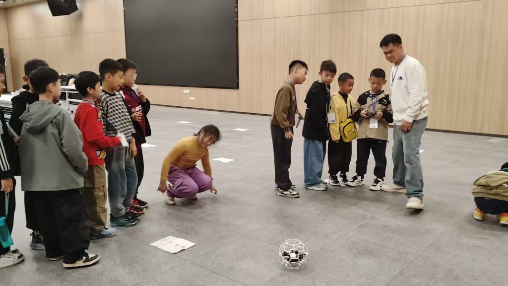
Effective drone training must extend beyond basic flight controls to encompass airspace literacy, risk assessment for specific environments like railways, and emergency procedures. The current standard curriculum for recreational or even some commercial pilots rarely includes modules on critical infrastructure protection. This represents a massive gap in the safety ecosystem.
Systemic Gaps: Technology, Coordination, and Mindset
The challenges are not merely regulatory but are deeply embedded in technological limitations and organizational silos.
1. The Sensing and Identification Deficit: Unlike airports, vast stretches of railway lines lack persistent, wide-area surveillance for low-altitude aerial objects. Radar systems are optimized for larger, faster aircraft. Acoustic detection has limited range. RF (Radio Frequency) scanning can identify some drone models and their controllers but struggles against drones using pre-programmed GPS waypoints or frequency-hopping protocols. The absence of a reliable, integrated detection layer means most intrusions are only discovered by chance, if at all, before an incident occurs. The probability of detection \(P_d\) over a railway segment of length \(L\) can be modeled as a function of sensor density \(ρ\) and individual sensor coverage radius \(r\):
$$P_d \approx 1 – e^{-ρ \cdot π r^2 \cdot L}$$
For most lines, \(ρ\) is effectively zero, making \(P_d\) negligible.
2. Impotent Countermeasures: Even when a drone is detected, safe and effective neutralization options are limited. Jamming or spoofing the drone’s command-and-control (C2) or GPS signals are common counter-drone (C-UAV) tactics. However, these are fraught with risk in the railway context. Indiscriminate RF jamming could potentially interfere with vital railway signaling (e.g., GSM-R) or other communication systems. The collateral damage risk is high. Kinetic solutions like nets or intercept drones raise serious safety concerns regarding falling debris. The lack of a “safe to fail” mitigation tool is a critical operational handicap.
3. The Data Silo Problem: Information sharing is asymmetric. Drone manufacturers, national aviation authorities, and commercial operators may have data on flight plans, registered drones, and pilot certifications. Railway operators and infrastructure security bodies rarely have real-time or even retrospective access to this data. There is no unified traffic picture for the low-altitude airspace above railways. An agricultural operator planning a spray mission near a rail line may file a plan with a local agricultural body but have no mechanism or requirement to automatically notify the railway network operator. This siloed approach prevents proactive risk management.
4. Regulatory Ambiguity and Jurisdictional Overlap: Where do railway authorities’ responsibilities end and national aviation authorities’ begin? Who has the authority to declare a “no-fly zone” along a 1000-km rail corridor? Can a railway police force confiscate a drone? The answers vary by country and region, creating enforcement uncertainty. This ambiguity is a barrier to investment in permanent detection systems or the establishment of standardized procedures.
Toward an Integrated Proactive Framework: A Multi-Layered Defense
Addressing this challenge requires shifting from a reactive, piecemeal approach to a proactive, integrated system-of-systems philosophy. The goal is to erect multiple, mutually reinforcing layers of defense to drive down the probability \(P\) of a harmful event.
Layer 1: Prevention Through Regulation and Geofencing
The most effective layer is to prevent unauthorized drones from physically entering the risk zone. This requires clear, legally enforceable rules. Railway corridors, especially within a defined distance (e.g., 500 meters laterally and a vertical buffer above tracks and catenary), should be unequivocally designated as restricted or prohibited airspace in national drone regulations and aeronautical publications.
This legal boundary must be translated into a digital one. Dynamic Geo-fencing—where the restricted polygon is embedded in drone firmware and updated in real-time via the internet—is paramount. Manufacturers must be mandated to implement and cannot override these geo-fences for critical infrastructure. The technical specification for the geofenced zone \(G\) around a track centerline can be defined parametrically:
$$G = \{ (x, y, z) \, | \, d_{\text{lat}}(x,y) \leq D_{\text{lat}}, \, 0 \leq z \leq D_{\text{vert}} \}$$
where \(d_{\text{lat}}\) is the lateral distance from the track, \(D_{\text{lat}}\) is the lateral threshold (e.g., 500m), and \(D_{\text{vert}}\) is the vertical altitude threshold. Drone firmware should prevent take-off inside \(G\) and auto-land or return-to-home if entering \(G\) from outside.
Layer 2: Deterrence and Detection
For drones that bypass or lack geo-fencing, a deterrence and early-warning layer is needed. This involves deploying a sensor network along high-risk or high-consequence sections (e.g., major junctions, dense urban areas, high-speed line portals). A multi-sensor fusion approach is optimal:
- RF Sensors: Passive detection of common drone C2 and video transmission frequencies.
- Radar: Small, focused radar for detecting micro-UAV movements, particularly effective in all weather.
- Electro-Optical/Infrared (EO/IR): Cameras with machine vision algorithms to classify and track visually.
The data from these sensors feeds into a Common Operational Picture (COP) for railway security, providing real-time alerts on drone type, location, trajectory, and estimated risk level.
Layer 3: Informed Response and Mitigation
Detection must trigger a calibrated response. The COP should integrate with operational systems. A low-risk drone sighting far from the track may warrant monitoring. A drone on a collision course or hovering near catenary requires immediate action. Here, the need for safe mitigation technology is acute. Research must be directed towards “rail-safe” C-UAV systems. This could include:
- Directed RF Inhibition: Highly focused, frequency-specific jamming that minimizes collateral impact on railway systems.
- GPS Spoofing to Safe Corridors: Precisely guiding an intruding drone to a pre-defined safe landing zone away from tracks.
- Automated Alerting to Air Traffic Management (UATM): For compliant drones in future U-Space, the railway COP could send a digital “force land” or “leave area” command via the UTM service provider.
The response protocol must be clear, practiced, and involve coordination between railway security, train control centers, and local law enforcement.
Layer 4: The Human Factor: Training and Collaboration
Technology alone is insufficient. The human element is crucial. This layer has two components:
1. Enhanced Drone Training and Certification: Mandatory drone training curricula for all commercial categories must include a dedicated module on “Operations Near Linear Critical Infrastructure.” This training would cover:
- Legal frameworks and restricted airspace.
- Physical and operational hazards of railways (catenary, signaling interference, high-speed trains).
- Emergency procedures for loss of link or control near hazardous areas.
- Pre-flight planning requirements, including checking for railway corridors.
A specialized, advanced certification could be required for operators whose work inherently brings them near infrastructure, such as agricultural spray operators. The effectiveness of training \(T_{eff}\) could be modeled as reducing the base error rate \(ε\) of an operator:
$$ε_{\text{trained}} = ε_{\text{untrained}} \cdot (1 – T_{eff})$$
where \(T_{eff}\) is a value between 0 (no effect) and 1 (perfect training).
2. Cross-Sectoral Collaboration and Data Sharing: A formal governance framework is needed. Railway authorities, national aviation regulators, law enforcement, and major drone user groups (agriculture, survey, media) must establish joint committees. The goals are:
- Standardize reporting procedures for incidents.
- Create shared databases for approved, railway-related drone work (e.g., inspection flights).
- Develop joint awareness campaigns for recreational users.
- Facilitate technical interoperability between UTM systems and railway security systems.
| Defense Layer | Core Objective | Key Tools & Measures | Outcome |
|---|---|---|---|
| 1. Prevention | Keep unauthorized drones out | Clear regulations, mandatory dynamic geo-fencing in drone firmware. | Reduces intrusion attempts at source. |
| 2. Deterrence & Detection | Know if a drone is present | Multi-sensor (RF, Radar, EO/IR) networks feeding a Common Operational Picture. | Provides early warning and situational awareness. |
| 3. Response & Mitigation | Safely neutralize a threat | Rail-safe C-UAV tech (directed RF, spoofing), integrated response protocols. | Minimizes consequence of an intrusion. |
| 4. Human Factor | Build competence & cooperation | Enhanced drone training curricula, cross-sector collaboration forums, data-sharing agreements. | Addresses root causes and improves systemic resilience. |
Conclusion: From Vulnerability to Resilience
The integration of drones into our airspace is irreversible and holds great promise. The security of our railways is non-negotiable. The current trajectory, where these two realities collide in an unmanaged fashion, is unsustainable. The path forward requires a conscious, strategic investment in an integrated management framework. This is not solely a task for railway security forces. It demands the active participation of regulators who must craft unambiguous laws; of technology developers who must build safer drones and smarter detection systems; of aviation authorities who must integrate railway corridors into national UTM architectures; and crucially, of the drone community itself, whose commitment to rigorous drone training and responsible operation is the first and most vital layer of defense.
By implementing a layered defense—combining robust geo-fencing, pervasive sensing, safe mitigation tools, and a foundational emphasis on education and collaboration—we can transform railway corridors from zones of vulnerability to exemplars of resilient, multi-modal infrastructure management. The cost of inaction, measured in potential disaster, far outweighs the investment required to build this proactive system. The time to architect this integrated future is now, ensuring that the skies above our railways remain a domain of safe innovation, not uncontrolled risk.