
The ever-growing global population places immense pressure on agricultural systems to ensure food security and sustainability. Among staple crops, maize (Zea mays L.) holds a pivotal position as a primary source of nutrition for humans and livestock. However, its productivity is persistently threatened by a complex array of pests and diseases, leading to significant yield and quality losses. Traditional control methods, predominantly reliant on broadcast spraying of chemical pesticides, are increasingly recognized as unsustainable. These methods suffer from poor precision, leading to excessive chemical use, environmental contamination, resistance development in pest populations, and potential risks to human health.
In this context, the emergence and rapid advancement of agricultural UAV (Unmanned Aerial Vehicle) technology, often termed drone plant protection, offers a paradigm-shifting solution. By integrating aerial platforms, advanced remote sensing, and precise application systems, agricultural UAVs are redefining the approach to crop management. This technology facilitates a transition from reactive, calendar-based spraying to proactive, data-driven, and site-specific intervention. This article, from my perspective as a practitioner and advocate of precision agriculture, delves into the principles, operational workflows, tangible advantages, and practical applications of agricultural UAV technology specifically for maize pest and disease control. Furthermore, it addresses the inherent challenges in widespread adoption and proposes actionable solutions, supported by quantitative analyses and formulas.
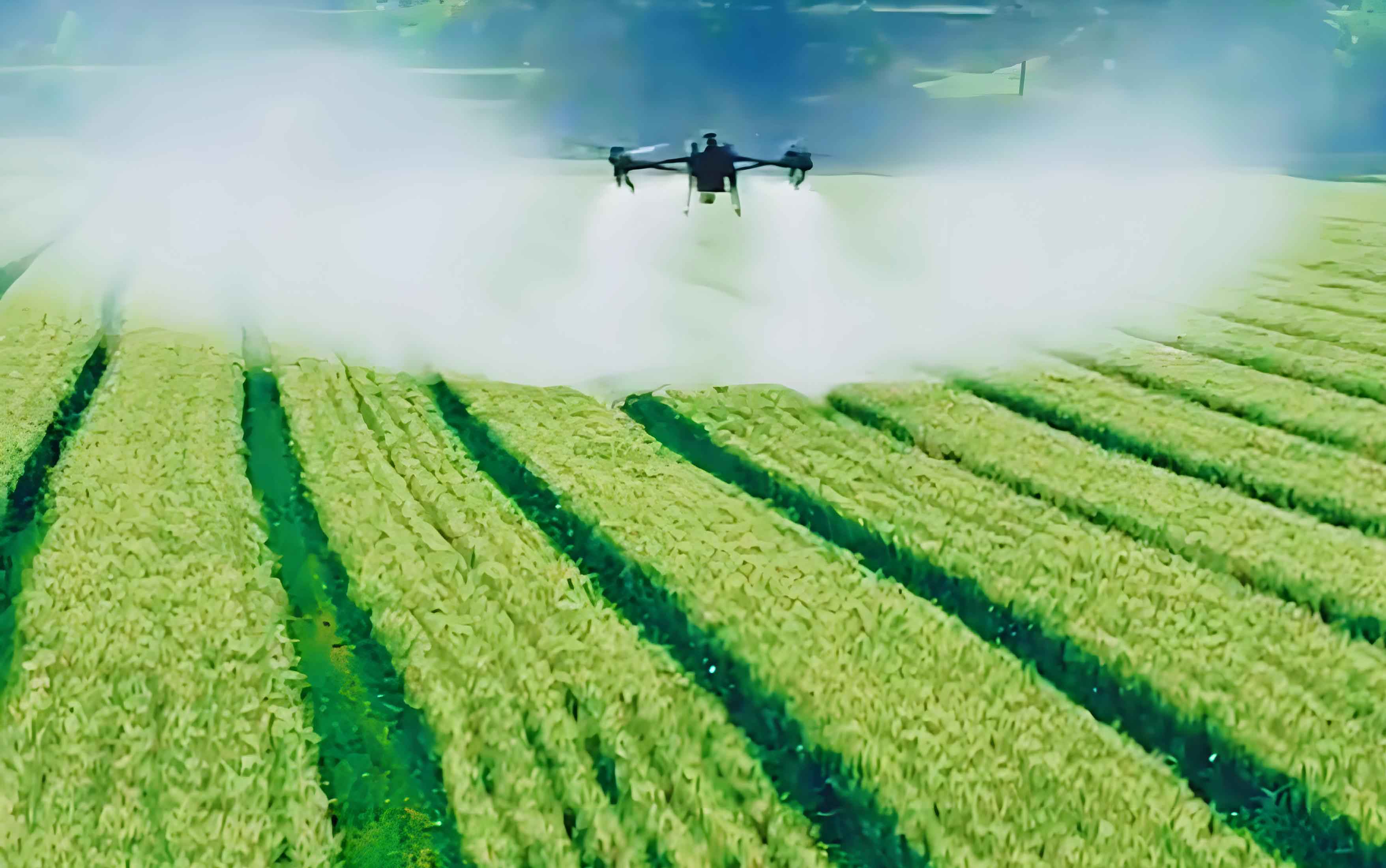
An agricultural UAV system for plant protection is a sophisticated integration of several core components: the multi-rotor or fixed-wing aerial platform, a high-precision Global Navigation Satellite System (GNSS) and Real-Time Kinematic (RTK) module for centimeter-level positioning, a suite of imaging sensors, and a variable-rate application system (often a tank and spray nozzles or a granular spreader). The true power of this system lies not in the flight itself, but in the data acquisition and processing pipeline it enables. The primary sensors include RGB cameras for visual assessment and, more critically, multispectral or hyperspectral cameras. These sensors capture reflected radiation from the crop canopy across specific wavelengths, including those invisible to the human eye, such as near-infrared (NIR) and red-edge.
The data from these sensors is processed to generate vegetative indices, which are mathematical combinations of reflectance from different spectral bands. These indices serve as robust proxies for plant health, stress, and biophysical parameters. The most fundamental index is the Normalized Difference Vegetation Index (NDVI), calculated as:
$$NDVI = \frac{(R_{NIR} – R_{Red})}{(R_{NIR} + R_{Red})}$$
where \(R_{NIR}\) is the reflectance in the near-infrared band and \(R_{Red}\) is the reflectance in the red band. Healthy, dense vegetation strongly reflects NIR and absorbs red light, resulting in high NDVI values (closer to 1). Stressed or diseased plants, due to chlorophyll degradation and structural damage, reflect less NIR and more red light, leading to lower NDVI values. For more specific stress detection, other indices are employed. For instance, indices utilizing the red-edge band are particularly sensitive to early-stage disease and nutrient deficiencies. The workflow begins with the agricultural UAV autonomously flying a pre-programmed grid pattern over the field, capturing georeferenced multispectral imagery. This data is then stitched into an orthomosaic map and analyzed using specialized software. The output is a prescription map—a geospatial file that delineates zones within the field based on their required treatment action (e.g., high, medium, low infestation zones). This map is subsequently loaded back into the UAV’s flight control system, guiding the variable-rate spray system to apply pesticides only where and in the amount needed.
The advantages of employing agricultural UAVs over conventional ground-based or manned aerial spraying methods are multifaceted and significant, as summarized in the table below.
| Aspect | Conventional Methods | Agricultural UAV-Based Method |
|---|---|---|
| Application Precision | Low; broadcast spraying, high off-target drift. | High; site-specific application guided by prescription maps. |
| Chemical Usage Efficiency | Low; uniform rate often leads to 30-50% over-application. | High; typically reduces pesticide volume by 30-70%. |
| Operational Efficiency | Slow; limited by terrain and machinery speed. | Very High; can cover 40-80 hectares per day per unit. |
| Crop Damage Risk | High for ground machinery (soil compaction, plant damage). | Negligible; operates from above without contact. |
| Data Acquisition | Limited, manual, and subjective. | Comprehensive, digital, and objective via remote sensing. |
| Environmental Impact | High chemical load, runoff, non-target effects. | Substantially reduced chemical load and drift. |
| Safety for Operators | High exposure risk to chemicals. | Minimal; operators remain at a safe distance. |
The core of precision lies in the variable-rate application logic. The required application rate \(A_r\) (in L/ha) for a specific zone can be derived from the vegetation index deviation and agronomic thresholds:
$$A_r = \frac{(D \times A_t)}{(E \times C)}$$
where \(D\) is a disease/pest severity index derived from sensor data (e.g., 1 – NDVI for that zone normalized to a 0-1 scale), \(A_t\) is the theoretical maximum application rate for the target pest, \(E\) is the efficacy coefficient of the chemical formulation, and \(C\) is a calibration constant for the spray system. This formula, while simplified, illustrates the data-driven decision-making process that replaces uniform spraying.
The application of agricultural UAV technology in maize cultivation spans the entire crop management cycle, with pest and disease control being a central pillar.
1. Proactive Monitoring and Early Detection: Before any chemical is dispensed, the agricultural UAV serves as a powerful scouting tool. Regular flights (e.g., weekly or bi-weekly) generate time-series data of vegetative indices. By analyzing spatial patterns and temporal trends, anomalies indicating the onset of disease (like Northern Corn Leaf Blight showing as elongated, low-NDVI lesions) or pest infestation (e.g., European corn borer causing localized stress) can be identified early. This enables intervention at the most effective, often pre-symptomatic or early infestation, stage. The growth rate of a pest population in a hotspot, if unchecked, can be modeled exponentially:
$$P(t) = P_0 e^{rt}$$
where \(P(t)\) is the population at time \(t\), \(P_0\) is the initial population, and \(r\) is the intrinsic rate of increase. Early detection via UAVs allows treatment when \(P_0\) is small, preventing exponential escalation and wider damage.
2. Targeted, Variable-Rate Application: This is the most direct application. Upon identifying problem zones, the prescription map directs the agricultural UAV to apply fungicides, insecticides, or even biological agents with high precision. For instance, a field map may show 20% of the area as a high-severity zone receiving 100% of the recommended dose, 30% as a moderate zone receiving 50%, and 50% as a healthy zone receiving no treatment. This spatial discrimination dramatically reduces the total chemical load. The table below exemplifies potential savings for a hypothetical 50-hectare maize field.
| Field Zone | Area (Ha) | Conventional Rate (L/Ha) | UAV Variable Rate (L/Ha) | Total Chemical Used (L) |
|---|---|---|---|---|
| High Infestation | 10 | 2.0 | 2.0 | 20.0 |
| Medium Infestation | 15 | 2.0 | 1.0 | 15.0 |
| Low/No Infestation | 25 | 2.0 | 0.0 | 0.0 |
| TOTAL | 50 | 2.0 (uniform) | — | 35.0 |
| Chemical Reduction | 65% (vs. 100L with conventional) | |||
3. Holistic Growth Environment Optimization: Beyond direct pest control, the data from agricultural UAVs supports integrated crop health management. Multispectral data can be correlated with soil moisture probes or used to create vigor maps that indirectly indicate nutrient or water stress—conditions that predispose plants to disease. For example, water stress weakens plants, making them more susceptible to pathogens. By identifying these suboptimal zones, farmers can undertake precise corrective measures like variable-rate irrigation or fertilization, thereby creating a more resilient crop stand less vulnerable to pest outbreaks.
Despite its clear benefits, the widespread adoption of agricultural UAV technology faces several hurdles.
Challenge 1: Technical Complexity and Skill Gap. Operating an end-to-end agricultural UAV system requires skills in flight planning, sensor operation, data processing, agronomy, and machinery maintenance. This multidisciplinary barrier can intimidate potential users.
Solution: Development of streamlined, user-friendly software with automated processing pipelines is crucial. Furthermore, establishing robust training and certification programs from public extension services, agricultural universities, and private service providers is essential to build a skilled workforce of pilots and data analysts.
Challenge 2: Economic Viability and Initial Investment. The upfront cost for a professional-grade agricultural UAV with advanced sensors and spraying capabilities is significant. For smallholder farmers, this investment can be prohibitive without clear and guaranteed returns.
Solution: The business case must be clearly demonstrated through Total Cost of Ownership (TCO) and Return on Investment (ROI) analyses. The ROI can be modeled as:
$$ROI = \frac{(S_c + Y_i – C_o)}{I_0} \times 100\%$$
where \(S_c\) is savings on chemical costs, \(Y_i\) is the income from yield increase or loss prevention, \(C_o\) is annual operational costs (batteries, maintenance, labor), and \(I_0\) is the initial investment. Service-for-hire models, where farmers pay per hectare for drone scouting and spraying services, effectively lower the entry barrier. Government subsidies or green financing schemes for precision agriculture equipment can also accelerate adoption.
Challenge 3: Regulatory and Safety Concerns. Airspace regulations, payload restrictions (for chemicals), and operator licensing vary by country and can be restrictive. Ensuring safe operations near populated areas and other aircraft is paramount.
Solution: Continuous dialogue between industry stakeholders and aviation authorities is needed to develop pragmatic, risk-based regulations that enable safe and scalable use. Geofencing technology and standardized training can mitigate many safety risks.
Challenge 4: Technical Adaptation and Agronomic Validation. The efficacy of variable-rate prescriptions depends on accurate agronomic models linking sensor data to pest severity and optimal treatment thresholds. These models need local calibration for different maize hybrids, pests, and climatic conditions.
Solution: This requires concerted, long-term agronomic research partnerships between technology companies, agricultural research institutions, and farmers to build and validate robust local decision-support models.
In conclusion, the integration of agricultural UAV technology into maize production systems represents a cornerstone of the precision agriculture revolution. It transforms pest and disease management from a blanket chemical exercise into a nuanced, data-centric science. The ability to monitor, diagnose, and treat with unprecedented spatial and temporal resolution promises substantial gains in input efficiency, environmental stewardship, and farm profitability. While challenges related to cost, skills, and regulation persist, they are not insurmountable. The trajectory is clear: as sensor technology becomes more affordable, artificial intelligence enhances data analytics, and business models evolve, the role of the agricultural UAV will expand from a specialized tool to a ubiquitous component of sustainable maize farming. The future lies in fully autonomous swarms of agricultural UAVs, integrated with ground robots and IoT sensors, creating a cognitively aware farm that manages its own health, optimizing every input for maximum output with minimal ecological footprint.