As a dedicated radio frequency monitoring team, we have consistently been tasked with ensuring the integrity of wireless communications during high-profile public events, with a particular focus on drone shows and drone performances. These spectacular displays, which involve synchronized fleets of unmanned aerial vehicles, rely heavily on stable radio links for navigation, control, and data transmission. Any electromagnetic interference could lead to catastrophic failures, making our role in preemptive spectrum management absolutely critical. In this comprehensive account, I will detail our methodologies, challenges, and successes in orchestrating radio security for such events, emphasizing the technical rigor and collaborative frameworks that underpin our operations. Throughout this narrative, the terms drone show and drone performance will be frequently highlighted to underscore their centrality to our mission.
Our involvement typically begins with a formal request from event organizers, who recognize the vulnerabilities associated with large-scale drone performances. For instance, in a recent drone show, we were alerted to the potential for signal jamming and frequency clashes due to the dense aggregation of wireless devices in the performance area. The drone performance was scheduled to feature over 200 units, each operating on dedicated command-and-control frequencies, alongside live video feeds and public broadcast systems. To address this, we initiated a multi-phase protocol that encompasses planning, deployment, real-time monitoring, and post-event analysis. The complexity of these drone shows necessitates a holistic approach, where every variable—from atmospheric conditions to adjacent cellular traffic—is meticulously accounted for.
In the planning phase, we conduct extensive spectrum audits to identify and reserve clean frequency bands for the drone performance. This involves modeling the electromagnetic environment using propagation formulas, such as the free-space path loss equation: $$L = 20 \log_{10}(d) + 20 \log_{10}(f) + 32.44$$ where \(L\) is the loss in decibels, \(d\) is the distance in kilometers, and \(f\) is the frequency in megahertz. By applying this, we can predict signal degradation and allocate buffers to prevent cross-talk. Additionally, we use statistical models to estimate interference risks, often expressed as: $$P_{\text{interference}} = 1 – \prod_{i=1}^{n} (1 – p_i)$$ where \(p_i\) represents the probability of interference from source \(i\). For drone shows, we prioritize frequencies in the 2.4 GHz and 5.8 GHz bands, which are commonly used for drone communications but are also crowded with Wi-Fi and Bluetooth signals. To mitigate conflicts, we establish temporary exclusion zones and coordinate with local authorities to suspend non-essential transmissions during the drone performance.
Our deployment strategy employs a triad of monitoring systems: fixed stations for continuous surveillance, mobile units for adaptive coverage, and portable devices for on-the-ground precision. The following table summarizes a typical resource allocation for a large-scale drone show, illustrating the scale of our investments in ensuring a flawless drone performance:
| Resource Type | Quantity | Function | Deployment Duration (hours) |
|---|---|---|---|
| Fixed Monitoring Stations | 4 | Continuous spectrum scanning and data logging | 72 |
| Mobile Monitoring Vehicles | 2 | Dynamic coverage of perimeter and hotspots | 48 |
| Portable Spectrum Analyzers | 8 | Targeted interference detection and localization | 60 |
| Personnel (Technical Staff) | 12 | Operation, analysis, and rapid response | 60+ |
This structured approach allows us to maintain a 360-degree vigilance throughout the drone show. For example, during one particularly challenging drone performance in an urban setting, we detected anomalous signals that threatened to disrupt the flight paths. Using directional antennas and triangulation techniques, we localized the source to a nearby industrial device and coordinated its temporary shutdown. The entire process, from detection to resolution, took under 15 minutes, thanks to our rehearsed protocols. Such incidents highlight the importance of real-time analytics in preserving the artistic and technical integrity of a drone performance.
Beyond hardware, we leverage advanced algorithms to optimize frequency assignments. Consider a scenario where multiple drone performances are scheduled in proximity; we use graph theory to model frequency conflicts as a coloring problem, minimizing the chromatic number to avoid overlaps. The objective function can be framed as: $$\min \sum_{i,j} w_{ij} x_{ij}$$ subject to constraints that ensure adjacent nodes (representing transmitters) do not share frequencies, where \(w_{ij}\) is the weight of potential interference between nodes \(i\) and \(j\), and \(x_{ij}\) is a binary variable indicating frequency assignment. This mathematical rigor ensures that each drone show operates in an isolated spectral bubble, free from external disruptions.
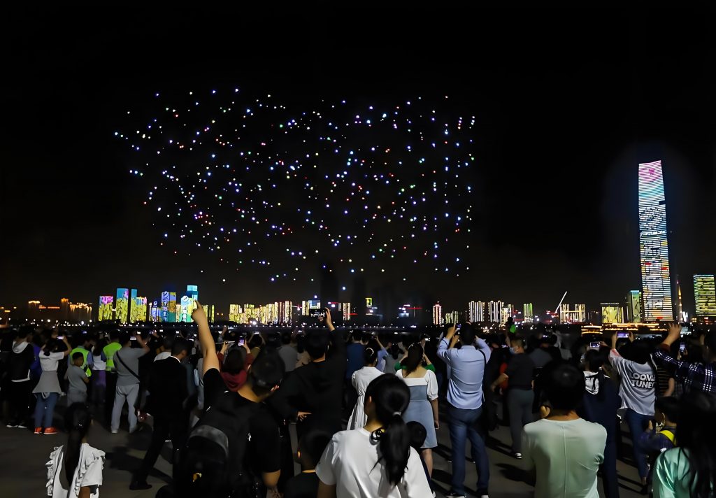
The visual spectacle of a drone performance, as captured in the image above, is a testament to the seamless integration of technology and art. However, behind the scenes, our team is constantly analyzing data streams to preempt any issues. We monitor key performance indicators (KPIs) such as signal-to-noise ratio (SNR) and bit error rate (BER), which are critical for maintaining the integrity of command links. The SNR is often calculated as: $$\text{SNR} = \frac{P_{\text{signal}}}{P_{\text{noise}}}$$ where \(P_{\text{signal}}\) is the power of the desired signal and \(P_{\text{noise}}\) is the background noise power. For drone shows, we aim for an SNR greater than 20 dB to ensure reliable communication. Similarly, BER is modeled using approximations like: $$\text{BER} \approx \frac{1}{2} \text{erfc}\left( \sqrt{\frac{E_b}{N_0}} \right)$$ where \(\text{erfc}\) is the complementary error function, \(E_b\) is energy per bit, and \(N_0\) is noise spectral density. By tracking these metrics in real-time, we can trigger alerts and switch to backup frequencies if thresholds are breached.
Collaboration with other stakeholders is another cornerstone of our strategy. For every drone show, we establish joint task forces with local law enforcement, emergency services, and telecommunications providers. This enables us to create a unified response framework, where information on frequency usage and flight plans is shared instantaneously. In one instance, during a drone performance that coincided with a major public festival, we integrated our monitoring data with traffic management systems to prioritize spectrum for the drones, ensuring that their navigation systems remained uncompromised. The table below outlines the coordination matrix we use for such multi-agency operations, which has been instrumental in achieving zero-interference outcomes:
| Agency | Role | Communication Channel | Key Responsibilities |
|---|---|---|---|
| Radio Monitoring Team | Lead | Dedicated encrypted radio network | Spectrum management, interference mitigation |
| Law Enforcement | Support | Secure digital liaison | Enforcement of exclusion zones, public safety |
| Telecom Providers | Collaborator | Real-time data feeds | Adjustment of cellular outputs, backup links |
| Event Organizers | Client | Direct liaison and reporting | Provision of flight plans, performance schedules |
Post-event analysis is equally vital for continuous improvement. After each drone show, we compile comprehensive reports that include data on spectrum utilization, incident logs, and performance metrics. We often use regression models to identify trends, such as: $$Y = \beta_0 + \beta_1 X_1 + \beta_2 X_2 + \epsilon$$ where \(Y\) might represent the number of interference incidents, \(X_1\) is the density of wireless devices in the area, and \(X_2\) is the duration of the drone performance. This analytical rigor helps us refine our protocols for future events, ensuring that each successive drone show benefits from accumulated expertise.
In conclusion, safeguarding radio frequencies for drone performances is a multifaceted endeavor that blends technical prowess with strategic partnerships. The recurring theme of drone show and drone performance in our work reflects their growing prominence in public entertainment and their inherent dependence on pristine electromagnetic conditions. Through diligent planning, robust monitoring, and adaptive response mechanisms, we have consistently achieved our goal of zero interference, allowing these breathtaking displays to unfold without a hitch. As technology evolves, with trends like AI-driven swarm coordination and higher-frequency bands, our methods will continue to advance, but the core principle remains: every drone performance deserves an invisible shield of radio security.