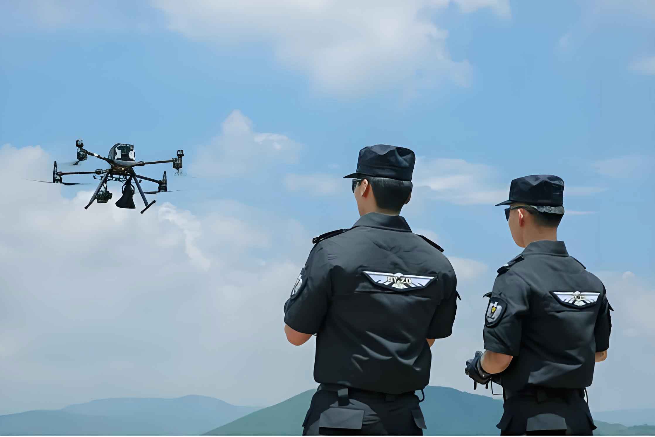
The hum of rotors cutting through the air has become a familiar, even reassuring, sound in recent times. From my perspective, operating these systems on the front lines, the evolution of the police UAV from a niche reconnaissance tool to a versatile force multiplier has been nothing short of revolutionary. The global health crisis served as a profound catalyst, accelerating their adoption and revealing capabilities far beyond initial expectations. No longer just “eyes in the sky,” these platforms have become dynamic partners in law enforcement, integrating deeply into daily operations and redefining the concept of omnipresent, responsive policing.
The initial and most visible application was in public communication and monitoring. In dense urban areas and sprawling communities, ensuring compliance with public health directives posed a significant challenge for ground units. This is where the inherent advantages of the police UAV shone. From my console, I could deploy a UAV equipped with a loudspeaker to a reported gathering within minutes. The ability to deliver clear, authoritative audio messages from an elevated, neutral position proved remarkably effective. It wasn’t just about volume; it was about presence. The sight and sound of an official police UAV created an immediate psychological impact, encouraging voluntary compliance without the need for physical confrontation. This “non-contact” enforcement became a cornerstone of our strategy, dramatically reducing potential exposure risks for both officers and the public. The efficiency equation was clear:
$$E_{compliance} = \frac{A_{coverage} \times I_{immediacy}}{R_{risk} \times T_{response}}$$
Where a high-coverage area \(A_{coverage}\) and immediate response \(I_{immediacy}\) are maximized, while officer risk \(R_{risk}\) and response time \(T_{response}\) are minimized, yielding maximum compliance efficiency \(E_{compliance}\).
However, the role of the police UAV rapidly expanded from broadcaster to operational workhorse. One critical mission was large-area disinfection. Traditional methods for sanitizing public spaces, industrial parks, or transportation hubs are labor-intensive, time-consuming, and often leave coverage gaps. We configured our larger multi-rotor police UAV platforms with spraying systems. The quantitative advantage was staggering. For a standard industrial zone, manual teams might require several hours and multiple personnel. A single police UAV could map the area, execute a precise pre-programmed flight path, and complete uniform dispersal of disinfectant in a fraction of the time. The metrics are compelling:
| Disinfection Method | Area per Hour (acres) | Personnel Required | Uniformity Coefficient | Access to Complex Structures |
|---|---|---|---|---|
| Manual Spraying (Backpack) | 0.5 – 2 | 4-6 | 0.6 – 0.8 | Low |
| Truck-Mounted System | 10 – 15 | 2-3 | 0.7 – 0.8 | Very Low |
| Police UAV (16L payload) | 25 – 40 | 1-2 (operators) | 0.85 – 0.95 | High |
The “Uniformity Coefficient” here, ranging from 0 to 1, is a measure of consistent fluid distribution. The police UAV’s automated flight ensures a near-perfect overlap in spray patterns, maximizing efficacy.
This multi-role capability defines the modern police UAV. In a single deployment cycle, one platform can sequentially perform multiple tasks:
1. Broadcast: Transmit pre-recorded or live audio advisories over a neighborhood.
2. Thermal Screening: Use its stabilized gyroscopic camera with thermal imaging to scan crowds in public spaces for individuals with elevated body temperature, a potential public health indicator.
3. Logistics Support: Transport small critical items, such as medical samples or emergency supplies, between isolated points, acting as a rapid aerial courier where ground transport is inefficient or risky.
4. Documentation: Record high-resolution video of public conditions or compliance levels for command center analysis.
The operational tempo during the peak period was intense. Our unit’s log provides a snapshot of the scalable impact of a police UAV fleet:
| Mission Type | Sorties Flown | Cumulative Flight Hours | Areas Monitored/Covered | Primary Payload Used |
|---|---|---|---|---|
| Aerial Patrol & Announcement | 278 | ~4,500 | 171 residential communities | Zoom Camera + Loudspeaker |
| Aerial Disinfection | 66 | ~2,400 | >700 acres of industrial parks | Liquid Spray System |
This data underscores a key principle: the utility of a police UAV is not linear; it scales exponentially with integration into command frameworks and operator proficiency. The learning curve shifted from simply piloting the aircraft to managing sensor data, coordinating with ground teams via the UAV’s live feed, and making real-time tactical decisions based on its unique vantage point.
Beyond crisis response, the value proposition of the police UAV in routine law enforcement is equally transformative. Let’s consider traffic management. During major events or accidents, ground-based officers have a limited field of view. A police UAV can be airborne in minutes, providing a sweeping, real-time overview of congestion patterns. It can track the flow of vehicles, identify secondary incidents, and even guide ground units to the most effective intervention points. For evidence collection at accident scenes, a UAV can perform a photogrammetric survey in minutes, creating a precise 3D model of the scene for investigators long after the vehicles have been cleared, preserving crucial spatial data. The reconstruction accuracy benefits from the orthogonal and oblique imagery a police UAV can capture, allowing for measurements with minimal error margins. The positional error in a photogrammetric model can be approximated by:
$$E_{pos} = GSD \times \sqrt{(N_{pixel})}$$
Where \(E_{pos}\) is the positional error, \(GSD\) is the Ground Sampling Distance (the size of a pixel on the ground, e.g., 2 cm), and \(N_{pixel}\) is the number of pixels in the measurement. A low GSD from a high-resolution police UAV camera yields highly accurate reconstructions.
In search and rescue (SAR) operations, the police UAV is a game-changer. Equipped with thermal imaging cameras, it can cover vast areas of difficult terrain—woodlands, mountains, waterways—much faster than ground teams. The thermal signature of a missing person, especially at night or in inclement weather, stands out clearly. The effective search rate comparison is telling:
$$R_{search(UAV)} = \frac{v_{UAV} \times w_{swath} \times t_{ops}}{E_{human-team}}$$
Here, \(v_{UAV}\) is the UAV’s search speed (e.g., 30 km/h), \(w_{swath}\) is the effective sensor swath width (e.g., 200m for a thermal imager at 100m AGL), \(t_{ops}\) is operational time, and \(E_{human-team}\) is the equivalent area a human team can cover in the same time. The ratio \(R_{search(UAV)}\) is often greater than 10, meaning one police UAV can outperform ten ground searchers in open area clearance.
For tactical operations, such as containing an armed suspect or monitoring a large-scale protest, the police UAV provides persistent surveillance without exposing officers to direct threat. It can relay live video to the tactical commander, identify potential threats or vulnerabilities in the perimeter, and even deploy non-lethal countermeasures in advanced configurations. The intelligence gathered is immediate and actionable.
The technological backbone of these capabilities is the sophisticated integration of various subsystems within a single police UAV platform. This is not merely a camera on a drone. It is a fusion of:
- Advanced Avionics: GPS/GLONASS for navigation, inertial measurement units (IMUs) for stability, and sophisticated flight controllers enabling automated missions and robust failsafe procedures.
- Multispectral Sensors: High-resolution visual cameras, thermal imaging, and sometimes multispectral or hyperspectral sensors for specific detection tasks (e.g., locating illicit crops).
- Secure Data Links: Encrypted communication channels for commanding the UAV and downlinking video/data, preventing interception or hijacking.
- Payload Interoperability: Standardized mounting systems allowing quick swaps between loudspeakers, spotlights, delivery mechanisms, or specialized sensors.
The operational effectiveness of a police UAV unit can be modeled as a function of these components:
$$O_{effectiveness} = \alpha(S_{sensor}) + \beta(R_{reliability}) + \gamma(I_{integration}) + \delta(P_{proficiency})$$
Where coefficients \(\alpha, \beta, \gamma, \delta\) represent the weighting of Sensor quality, System Reliability, Platform Integration (ease of use, payload swap), and Operator Proficiency, respectively. High scores in all areas are necessary for optimal effectiveness.
Data management and analysis form the next critical frontier. A single police UAV sortie can generate gigabytes of high-definition video and imagery. The power lies not just in collection, but in processing. Using machine learning algorithms, this data can be automatically analyzed to:
– Detect anomalies (unattended bags, unauthorized perimeter breaches).
– Count crowds and monitor density in real-time.
– Recognize specific vehicle types or read license plates over wide areas.
– Create accurate orthomosaic maps and 3D models of crime or accident scenes.
This transforms the police UAV from a data-gathering tool into an intelligent node in a larger “Internet of Police Things” (IoPT), feeding a common operational picture. The analytical throughput can be conceptualized as:
$$D_{processed} = \eta \times \sum_{i=1}^{n} (F_{data_i} \times A_{accuracy_i})$$
\(D_{processed}\) is the total processed intelligence value, \(\eta\) is the algorithm efficiency, \(F_{data}\) is the raw data flow from the i-th police UAV, and \(A_{accuracy}\) is the detection/recognition accuracy for the tasked objective.
Of course, operating a police UAV program is not without its challenges. Regulatory airspace integration is paramount. Ensuring safe flight beyond visual line of sight (BVLOS) in shared airspace requires robust detect-and-avoid technology and coordination with aviation authorities. Public perception and privacy concerns must be proactively addressed through clear policies on data collection, retention, and usage. Cybersecurity is another critical axis; the aircraft and its data link must be hardened against interference or malicious takeover attempts. The cost equation involves not just the initial acquisition of the police UAV platforms, but also continuous training, maintenance, software updates, and data management infrastructure.
Looking forward, the trajectory for police UAV technology is steeply ascending. Key areas of development include:
– Swarm Technology: Coordinated fleets of multiple, smaller police UAVs working in concert to cover massive areas, perform complex searches, or create communication networks in disaster zones. The coverage area of a swarm scales with the number of units \(n\), but not linearly—it’s a function of their coordinated search pattern.
– Enhanced Autonomy: Moving from automated flights to intelligent autonomy, where a police UAV can identify a predefined object or situation and make basic decisions (like maintaining tracking on a vehicle or moving to a better vantage point) with minimal human input.
– Advanced Power Systems: Development of longer-endurance power sources, such as hydrogen fuel cells or hybrid systems, to extend mission times from tens of minutes to multiple hours.
– Specialized Payloads: Integration of more sophisticated sensors, such as LiDAR for precise 3D mapping in all conditions, or advanced chemical “sniffers” for detecting hazardous materials.
The future police officer will likely be trained not just in firearms and ground tactics, but also in data analysis and the management of robotic assets like the police UAV. The concept of a single officer’s “sphere of influence” will expand from the immediate vicinity to kilometers around, mediated by their aerial partner. The formula for public safety efficacy is being rewritten:
$$S_{safety} \propto \frac{K_{knowledge}}{T_{time-lag}}$$
Where safety \(S_{safety}\) is proportional to the quality and speed of situational knowledge \(K_{knowledge}\), divided by the time lag \(T_{time-lag}\) in acquiring it. The police UAV dramatically increases \(K_{knowledge}\) while simultaneously driving \(T_{time-lag}\) towards zero, creating a powerful multiplier for public safety outcomes.
In conclusion, the journey from a novel gadget to an indispensable tool has been rapid and profound. The police UAV has proven its worth not only as a technological asset but as a strategic one, enhancing officer safety, expanding operational capabilities, and fostering a more proactive, data-driven approach to policing. It represents a perfect synergy of intelligent hardware, sophisticated software, and human expertise. As regulations mature and technology advances, the role of the police UAV will only deepen, cementing its position as a foundational element of modern, responsive, and effective law enforcement agencies worldwide. The sky is no longer the limit; it is the domain of a new generation of guardians.