
The establishment of a multi-dimensional patrol and crime prevention system has long been a key objective for public security authorities worldwide. While traditional methods rely on personnel, physical barriers, and technical defenses (forming a two-dimensional grid), the advent of police aviation has ushered in a true three-dimensional operational capability. Police UAVs (Unmanned Aerial Vehicles), as a core component of modern police aviation, have garnered significant attention. Their integration into routine patrols represents a shift from conventional policing towards intelligent, data-driven law enforcement. This model, focusing on the armed patrols of Special Police units, creates a networked, integrated air-ground grid for public security management.
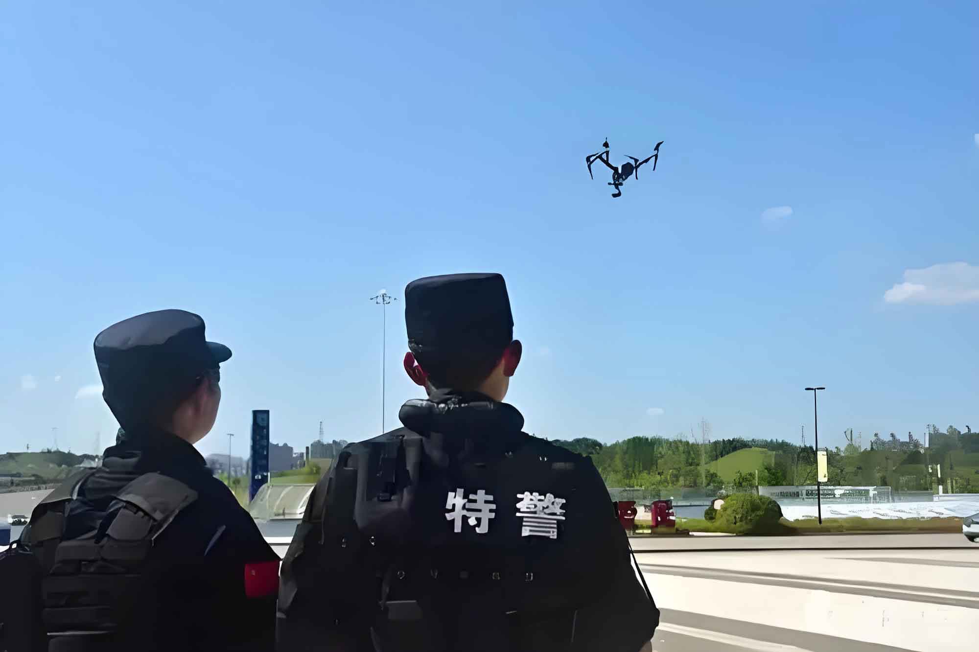
A police UAV is defined as an unmanned aircraft system used by law enforcement agencies to prevent and combat illegal activities, maintain social order, and protect life and property. Its operational use is strictly reserved for official police duties. Typically, a system includes the aerial vehicle itself, a ground control station (GCS), a data link, and various payloads such as electro-optical/infrared (EO/IR) cameras, loudspeakers, or spotlights.
Strategic Analysis of Police UAVs in Patrol Operations: A SWOT-OT Matrix
Effectively deploying police UAVs requires a thorough understanding of their inherent characteristics and the operational environment. A combined SWOT (Strengths, Weaknesses, Opportunities, Threats) and OT (Opportunities-Threats) matrix analysis provides a structured framework for this assessment, guiding the development of a robust patrol model.
| Internal Origin | Helpful | Harmful |
|---|---|---|
| Strengths |
|
– |
| Weaknesses | – |
|
| External Origin | Helpful | Harmful |
|---|---|---|
| Opportunities |
|
– |
| Threats | – |
|
This analysis highlights the critical path forward: leveraging strengths and opportunities while mitigating weaknesses and threats. The key lies in integrating the police UAV not as a standalone tool, but as a node within a broader, networked system.
Architecture of the “Police UAV+” Patrol Model
The “Police UAV+” model is a systematic, integrated air-ground patrol framework. It centers on a mobile command vehicle acting as a control hub, syncing aerial surveillance from police UAVs with ground response teams, all under the oversight of a central command and control (C2) center. The operational efficacy can be conceptualized through a system efficiency metric:
$$ E_{sys} = \alpha \cdot C_{data} + \beta \cdot R_{response} – \gamma \cdot T_{delay} $$
Where:
$E_{sys}$ = Overall System Efficiency,
$C_{data}$ = Quality/Completeness of data gathered (e.g., resolution, area coverage),
$R_{response}$ = Speed and appropriateness of ground unit response,
$T_{delay}$ = Latency in decision-making and communication,
$\alpha, \beta, \gamma$ = Weighting coefficients specific to the mission type.
Core Components
1. The Mobile Command & Control Vehicle (MCCV): This is the tactical nerve center. A modified Police Tactical Unit (PTU) vehicle houses the integrated system.
- Central Control Zone: Features multiple displays showing real-time UAV video feeds, GIS maps, and unit status. Commanders here conduct mission planning and real-time analysis.
- Pilot Station: Dedicated consoles for one or two certified police UAV pilots to control flight operations and sensor payloads.
- Communication Hub: Integrates UAV data links with police radio networks and connects to the central C2 center.
- Logistics Bay: Stores multiple police UAVs, batteries, spare parts, and specialized payloads (e.g., thermal cameras, loudhailers).
- Integrated Launch/Recovery Platform: A secure take-off and landing pad on the vehicle roof, potentially with automated deployment systems.
2. The Police UAV Mobile Command System (Software): This is the “brain” of the operation, a software platform integrating multiple functions. Its critical role can be modeled by an information value function:
$$ V_{info}(t) = \int_{0}^{t} I_{raw}(\tau) \cdot F_{proc}(\tau) \cdot L_{corr}(\tau) \, d\tau $$
Where:
$V_{info}(t)$ = Cumulative information value over time $t$,
$I_{raw}(\tau)$ = Raw data inflow rate from sensors,
$F_{proc}(\tau)$ = Processing function (e.g., object detection, tracking algorithms),
$L_{corr}(\tau)$ = Correlation function linking data with existing intelligence (e.g., suspect databases, BOLOs).
The software platform typically includes:
– Flight planning and automated navigation.
– Real-time video streaming and analysis (AI-powered object/face detection).
– Data management and secure storage.
– Interoperability interfaces with other law enforcement IT systems (e.g., records management, automatic license plate recognition).
3. The Certified Police UAV Pilot: The human element remains irreplaceable. Pilots require specialized training beyond basic flight skills, encompassing:
– Tactical flight patterns (e.g., orbit, creeping line search).
– Legal and regulatory knowledge for airspace deconfliction.
– Sensor operation and basic imagery analysis.
– Coordination procedures with ground units.
Pilot proficiency directly impacts operational outcomes and safety. A simple performance metric could be:
$$ P_{pilot} = \frac{N_{success}}{N_{total}} \cdot \frac{T_{ontarget}}{T_{total}} \cdot (1 – \frac{I_{incident}}{I_{threshold}}) $$
Where $P_{pilot}$ is a performance score, $N$ represents successful mission tasks, $T$ represents time efficiently used, and $I$ measures safety incidents against a threshold.
Operational Mechanism and Procedures
A structured, repeatable process is vital for safe and effective police UAV patrols.
| Phase | Key Actions | Control & Compliance Checks |
|---|---|---|
| 1. Pre-flight |
|
Flight plan approval by supervisor. Verification of pilot credentials and UAV registration. |
| 2. Launch & Execution |
|
Maintain VLOS or approved BVLOS protocol. Monitor link status and battery levels continuously. Adhere to altitude and geofence restrictions. |
| 3. Post-flight & Sustainment |
|
Data handling per evidence protocols. Maintenance logs updated. Inventory check of equipment. |
The operational range of a police UAV from its MCCV is a function of several factors, which can be approximated for planning:
$$ R_{op} = \min(R_{data}, R_{control}, \sqrt{(V \cdot E \cdot \eta) / (2 \cdot P_{avg})}) $$
Where:
$R_{op}$ = Effective Operational Radius,
$R_{data}$ = Maximum reliable data link range,
$R_{control}$ = Maximum reliable command link range,
$V$ = Average UAV velocity,
$E$ = Total battery energy capacity,
$\eta$ = Powertrain efficiency factor,
$P_{avg}$ = Average power consumption during mission.
Tactical Functions: From Routine Patrol to Dynamic Response
The “Police UAV+” model enables two primary operational modes, each with distinct tactical functions that enhance the patrol mission profile.
A. Persistent Area Security (Routine Point Patrols)
This involves pre-programmed, automated flights over designated high-value or high-risk areas (e.g., transportation hubs, commercial districts, large public events). The police UAV acts as a persistent aerial sentinel. The coverage effectiveness can be modeled. For a UAV performing a lawnmower search pattern over an area $A$, the time to achieve a probability of detection $P_d$ is related to the sensor sweep width $W$ and speed $v$:
$$ T_{cover} \approx \frac{A}{W \cdot v} \cdot \left( \frac{-\ln(1 – P_d)}{P_s} \right) $$
Where $P_s$ is the single-pass probability of detection. Key functions include:
– Deterrence: Visible presence discourages criminal activity.
– Crowd Monitoring: Assessing density, flow, and identifying anomalies in large gatherings.
– Infrastructure Inspection: Monitoring critical infrastructure for vulnerabilities or threats.
– Traffic Flow Observation: Providing a broad view of congestion and accident sites.
B. Responsive Tactical Deployment (Dynamic Mission Flight)
This mode is triggered by an incident, either reported via dispatch or detected during routine patrol. The MCCV deploys a police UAV as a first responder to gather critical intelligence. Its effectiveness in supporting ground operations can be expressed through an operational advantage coefficient:
$$ C_{adv} = \frac{S_{sit} + D_{early} + T_{reduce}}{R_{risk}} $$
Where:
$C_{adv}$ = Operational Advantage,
$S_{sit}$ = Enhanced situational awareness score,
$D_{early}$ = Value of early threat detection/intervention,
$T_{reduce}$ = Reduction in total mission time for ground units,
$R_{risk}$ = Residual risk to officers and public.
Specific dynamic functions include:
– Initial Scene Assessment: Providing a safe, overhead view of active incidents (robberies, fights, pursuits) before ground units arrive.
– Tactical Tracking: Maintaining visual contact with fleeing suspects or vehicles, guiding ground units into position. The UAV’s ability to maintain pursuit over barriers is a key force multiplier.
– Search Operations: Systematically scanning large or difficult areas (parks, wooded areas, building rooftops) for missing persons or suspects, often using thermal imaging.
– Hostile Reconnaissance: Safely inspecting potentially dangerous environments (barricaded subjects, hazardous material scenes).
– Communication & Negotiation Support: Using onboard loudspeakers for announcements or communication in standoff situations.
– Evidence Collection: Documenting crime scenes or large-scale accidents from optimal angles, creating orthomosaic maps or 3D models for analysis.
Conclusion and Future Trajectory
The “Police UAV+” integrated patrol model represents a significant evolution in modern policing tactics. It transcends the simple addition of a drone to a patrol car; it is the deliberate fusion of aerial intelligence, mobile command, and ground response into a cohesive, networked system. By conducting routine automated surveillance and providing rapid, eyes-on dynamic response, police UAVs create a powerful deterrent and force-multiplying effect. The model enhances officer safety, accelerates response times, and increases the probability of successful incident resolution.
The future development of this model will be driven by technological advancements and deeper systemic integration. Key areas for evolution include:
– Advanced Autonomy: Development of more sophisticated AI for automated threat detection, anomaly recognition, and adaptive flight path planning in complex environments.
– Swarm Tactics: Coordinated deployment of multiple, heterogeneous police UAVs to cover larger areas, perform parallel tasks, or provide redundant coverage.
– Enhanced Stealth and Endurance: Technological solutions for noise reduction, low-visibility designs, and hybrid or fuel-cell powertrains to extend mission duration significantly.
– Deep Data Fusion: Seamless, real-time integration of UAV-derived data (video, thermal, LiDAR) with city-wide IoT sensors, facial recognition systems, and predictive policing algorithms.
– Standardized Training and Doctrine: Establishment of comprehensive, scenario-based training curricula and standardized tactical manuals for police UAV operations across different jurisdictions.
The integrated air-ground patrol framework is not merely an option but an inevitable direction for contemporary and future public security strategy. As the technology matures and operational protocols are refined, the police UAV will become an indispensable tool, fundamentally transforming the efficiency and effectiveness of patrol and crime prevention missions.