
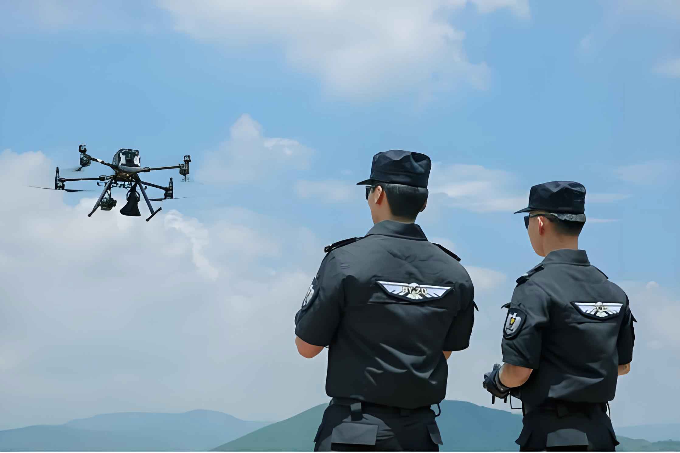
The rapid evolution of unmanned aerial vehicle (UAV) technology has catalyzed a paradigm shift in modern policing and public safety operations. From my perspective as a practitioner and researcher in this field, the integration of the police UAV into daily law enforcement workflows is no longer a novelty but an operational necessity. These systems provide an unparalleled combination of an elevated vantage point, rapid deployment, and sophisticated sensor integration, fundamentally augmenting traditional ground-based methods. The core strength of a police UAV lies in its ability to deliver real-time situational awareness and persistent surveillance over areas that are difficult, dangerous, or time-consuming for human officers to access. However, the effective deployment of a police UAV transcends mere platform operation; it requires the development and systematic application of specialized aerial reconnaissance tactics, techniques, and procedures (TTPs). This article aims to delve into the primary tactical methodologies for aerial reconnaissance, analyze current limitations from an operational standpoint, and project the future trajectory of police UAV integration into the broader security architecture.
Operational Context and Current Deployments of the Police UAV
The contemporary police UAV has found utility across a diverse spectrum of public safety missions. Its value proposition is particularly high in scenarios demanding rapid aerial intelligence. Common operational deployments include, but are not limited to: large-scale public event security, where a police UAV monitors crowd dynamics and traffic flow; search and rescue (SAR) operations in rugged terrain; forensic documentation of major accident or crime scenes; tactical support during barricaded suspect or hostage situations; and environmental monitoring during disasters like floods or wildfires. The sensor suites carried by a modern police UAV—typically high-resolution visual cameras, thermal imaging sensors, and sometimes multispectral or LiDAR payloads—transform it from a simple flying camera into a mobile data acquisition platform. Despite this technological maturity, I observe that the doctrinal framework—comprising standardized training protocols, theoretical underpinnings, and a codified library of tactical methods—often lags behind the hardware’s capabilities. Bridging this gap is essential for maximizing the return on investment and ensuring the safe, effective, and lawful use of police UAV assets.
Core Aerial Reconnaissance Tactics for the Police UAV
Aerial reconnaissance tactics are systematic approaches that combine the unique capabilities of the police UAV flight platform with core investigative principles. These methods leverage aerial imagery, video, and derived data products (like orthomosaics or 3D models) to answer critical investigative questions about space, time, and event sequencing. Based on extensive operational analysis, I categorize and elaborate on six fundamental tactics below.
1. On-Scene Aerial Sweep
This is the most direct and frequently employed tactic. It involves using a police UAV to conduct a methodical visual search of an area from an aerial perspective, streaming live video to ground personnel. The key advantage is the rapid coverage of large or complex areas. The effectiveness \( E_{sa} \) of an aerial sweep can be conceptualized as a function of several variables:
$$E_{sa} = k \cdot \frac{A_{cov}}{t_{m}} \cdot S_{res}$$
Where:
- \( A_{cov} \) = Area covered (m²)
- \( t_{m} \) = Mission time (minutes)
- \( S_{res} \) = Sensor resolution (a qualitative/quantitative factor)
- \( k \) = Operator skill and search pattern efficiency constant
Primary Applications:
| Environment | Search Target | Sensor Used | Tactical Advantage |
|---|---|---|---|
| Open fields, rural landscapes | Discarded evidence (weapons, clothing), stolen property | Visual (Zoom) | Overcomes terrain obstacles, provides broad overview. |
| Multi-story residential buildings | Suspects on balconies, rooftop hideouts, unusual activity | Visual | Vertical, discreet inspection without entering the building. |
| Nighttime, dense foliage, large-scale areas | Missing persons, fugitives | Thermal Imaging | Detects heat signatures invisible to the naked eye. |
2. Aerial Panoramic Spatiotemporal Analysis
This tactic moves beyond live video to create a static, yet interactively explorable, geospatial product. A police UAV captures a series of overlapping images from a central point, which are then stitched into a 360° spherical panorama. This panorama is geotagged and can be annotated with key evidentiary markers, witness viewpoints, or event timestamps. It serves as a durable, shareable “common operational picture” for investigators to analyze spatial relationships and temporal sequences of events from a fixed aerial perspective. The process flow is methodical:
- Reconnaissance & Mission Planning: Define the Point of Interest (POI) and required altitude.
- Data Acquisition: The police UAV executes an automated or manual rotation, capturing images with significant overlap.
- Data Processing: Images are merged using photogrammetry software.
- Analysis & Annotation: Investigators embed multimedia tags (photos, notes, links) into the panorama.
- Dissemination & Collaboration: The interactive file is shared for remote analysis and courtroom presentation.
This tactic is invaluable for reconstructing traffic accidents, analyzing crowd movements during incidents, and documenting complex crime scenes for later review.
3) Large-Scale Outdoor Crime Scene Documentation
This is a forensic-specific application of the police UAV, formalizing aerial photography for evidentiary standards. For expansive scenes (e.g., mass casualty incidents, outdoor homicide sites, wildfire origins), traditional ground photography suffers from perspective distortion and fails to convey the overall spatial context. A police UAV conducts a systematic nadir (straight-down) grid flight, capturing hundreds of high-resolution, georeferenced images. These are processed to create orthomosaic maps (geometrically corrected “bird’s-eye-view” maps) and digital surface models (DSMs). The precision is sufficient for accurate in-image measurements. The core technical requirement is maintaining a consistent Ground Sample Distance (GSD):
$$GSD = \frac{H \cdot S_{w}}{f \cdot I_{w}}$$
Where:
- \( GSD \) = Ground Sample Distance (cm/pixel)
- \( H \) = Flight altitude above ground (m)
- \( S_{w} \) = Sensor width (mm)
- \( f \) = Focal length (mm)
- \( I_{w} \) = Image width (pixels)
A smaller GSD yields higher resolution. This tactic provides an objective, scaled, and comprehensive record of the scene, preserving spatial relationships between pieces of evidence with centimeter-level accuracy, which is often admissible in court.
4. Policing-Specific Spatial Mapping
This advanced tactic employs photogrammetric techniques like oblique (tilted) photography to generate true 3D geo-models of an environment. A police UAV flies a pre-planned “lawnmower” pattern with a camera capturing images at multiple angles. Using Structure from Motion (SfM) algorithms, software reconstructs a photorealistic 3D model complete with precise XYZ coordinates. This model becomes a digital twin of the location for analysis and simulation.
| Application | Use Case | Analytical Benefit |
|---|---|---|
| Investigative Reconstruction | Shooting trajectory analysis, witness line-of-sight verification, crime scene walkthrough. | Allows investigators to test hypotheses and visualize events in an accurate 3D space. |
| Security Planning | Designing protection perimeters for VIP visits or major events. | Enables identification of blind spots, optimal camera placement, and simulation of breach scenarios. |
| Intelligence Fusion | Creating a 3D GIS by layering demographic data, crime reports, or asset locations onto the model. | Provides commanders with a rich, spatially-aware intelligence dashboard for resource allocation. |
The model allows for direct measurement of distances, heights, and volumes, providing tactical intelligence that is impossible to glean from 2D maps or photographs.
5. Aerial Live-Video Feed for Command & Control
This tactic focuses on real-time information dominance for dynamic incident management. A police UAV is deployed as an airborne broadcasting unit, streaming low-latency, high-definition video directly to a mobile command post or headquarters. The value lies in empowering decision-makers with a live, overarching view of an evolving situation. The end-to-end latency \( L_{total} \) is a critical performance metric:
$$L_{total} = L_{capture} + L_{encode} + L_{transmit} + L_{decode} + L_{display}$$
Minimizing \( L_{total} \) through efficient codecs (e.g., H.265) and robust data links (4G/5G, dedicated RF) is essential for tactical relevance. This police UAV tactic is indispensable during natural disaster response for assessing damage and directing resources, managing large public gatherings to spot disturbances, and during major tactical operations to monitor perpetrator movement without exposing officers.
6. Counter-“Low, Slow, Small” (LSS) Airspace Denial
This defensive tactic addresses the threat posed by unauthorized or hostile drones. A police UAV unit must often protect critical infrastructure (airports, government buildings) or VIPs from intrusive LSS aircraft. The tactic involves a layered defense system:
- Detection: Deploying a network of radar, radio frequency (RF) scanners, and acoustic sensors to identify LSS threats.
- Identification: Classifying the detected object (bird, authorized drone, threat).
- Tracking: Maintaining a track on the threat’s flight path.
- Decision: Assessing the threat level and selecting a response.
- Interdiction: Executing the response, which may involve:
- Locate the Pilot: Using direction-finding to find the operator.
- Electronic Countermeasures: Employing a police UAV interceptor or ground-based jammer to disrupt control signals, forcing a landing or return-to-home.
- Kinetic Defeat: As a last resort, using nets or other methods to physically disable the threat.
The effectiveness of this police UAV defense tactic hinges on integrated technology and clear rules of engagement.
Operational Limitations and Technical Challenges for the Police UAV
Despite their transformative potential, police UAV operations face significant constraints that impact mission planning and effectiveness. A clear-eyed assessment of these limitations is crucial.
1. Energy Density Bottleneck: The single most limiting factor for a police UAV is endurance, dictated by battery technology. Most multirotor police UAV platforms offer flight times between 20-45 minutes under optimal conditions. This severely restricts time-on-station for prolonged surveillance or large-area mapping. The challenge is encapsulated in the pursuit of higher specific energy:
$$E_{density} = \frac{C}{m}$$
Where \( C \) is battery capacity (Wh) and \( m \) is battery mass (kg). Advances in battery chemistry are incremental, creating a hard ceiling for mission duration without resorting to gas-powered or hybrid systems, which bring their own complexities (noise, emissions).
2. Environmental Susceptibility: The operational envelope of a police UAV is narrow compared to manned aircraft. Performance degrades rapidly in suboptimal conditions:
- Temperature: Cold weather accelerates battery discharge (\( C_{effective} = C_{rated} \cdot f(T) \), where \( f(T) < 1 \) for low T), reducing flight time. Extreme heat can cause overheating.
- Precipitation: Most commercial-grade police UAV platforms are not waterproof, making flight in rain or snow risky.
- Wind: High winds increase power consumption for station-keeping (\( P_{hover} \propto V_{wind}^2 \)) and can make stable imaging impossible, threatening flight safety.
- Visibility: Fog, smoke, or darkness severely degrades the performance of optical sensors, though thermal cameras can partially mitigate darkness.
3. Doctrinal and Theoretical Gaps: The hardware has outpaced the development of standardized doctrine. Key gaps I have identified include:
| Gap Area | Specific Challenge | Consequence |
|---|---|---|
| Forensic Standards | Lack of universally accepted protocols for aerial crime scene photography (flight patterns, overlap, GSD requirements for evidence admissibility). | Inconsistent quality, potential challenges to evidence validity in court. |
| Tactical Taxonomy | Absence of a codified, widely taught library of police UAV tactics like those presented here. | Reinvention of methods, inefficient training, and suboptimal mission execution. |
| Training Pipeline | Shortage of dedicated instructor cadres and advanced, scenario-based training curricula. | Operators may be proficient fliers but lack tactical acuity for complex public safety missions. |
Future Trajectories: The Next Generation of Police UAV Integration
Looking forward, the role of the police UAV will evolve from a manually deployed tool to an autonomous node within a networked intelligent security grid. Several key trends are emerging.
1. Indoor and Confined-Space Reconnaissance: The next frontier for the police UAV is operation within buildings. Miniaturized drones equipped with collision avoidance sensors (ultrasonic, LiDAR) and Visual Inertial Odometry (VIO) will be capable of autonomously exploring hazardous indoor environments. This has profound implications for tactical entries in active shooter scenarios or searching unstable structures post-disaster. These micro-police UAV platforms could generate real-time interior 3D maps using simultaneous localization and mapping (SLAM) algorithms, represented conceptually as:
$$x_t = f(x_{t-1}, u_t) + w_t$$
$$z_t = h(x_t) + v_t$$
Where \( x_t \) is the drone’s state (position, orientation), \( u_t \) is control input, \( z_t \) is sensor observation, and \( w_t \), \( v_t \) represent noise. This allows a police UAV to map an unknown interior without GPS.
2. Networked Autonomous Patrol and 5G Integration: The advent of 5G networks, with their ultra-low latency and high bandwidth, will enable the concept of the permanently airborne or rapidly deployable police UAV patrol. Imagine networks of “nesting stations” across a city. A police UAV could autonomously launch from a station, patrol a pre-defined route, stream continuous 4K video via 5G, and return to its station for automatic battery swapping and data upload, all with minimal human intervention. This creates a persistent aerial surveillance layer.
3. Artificial Intelligence (AI) for Edge Processing: Future police UAV platforms will embed AI chips capable of processing video data onboard in real-time. Instead of streaming all footage for human review, the police UAV itself will identify and alert on anomalies: detecting unattended bags, recognizing specific vehicle types or colors, counting people in a crowd, or identifying anomalous behavior patterns. This transforms the police UAV from a data pipe into an intelligent sensor, drastically reducing the data burden on analysts and enabling proactive response. The decision process can be modeled as a classification function \( C() \) applied to each video frame \( I_t \):
$$Alert = \begin{cases}
1 & \text{if } C(I_t) \in \{\text{Threat Classes}\} \\
0 & \text{otherwise}
\end{cases}$$
In conclusion, the police UAV has firmly established itself as a cornerstone of modern aerial reconnaissance. Its effectiveness, however, is maximized not by the technology alone, but by the deliberate application of specialized tactics such as panoramic analysis, spatial mapping, and live-feed command support. While challenges related to endurance, weather, and doctrinal development persist, they are being actively addressed. The future points towards a deeply integrated ecosystem where AI-powered, networked, and increasingly autonomous police UAV systems operate in concert with ground units and command centers, creating a safer and more responsive public security environment. The ongoing task for agencies is to invest not only in the platforms but equally in the development of the tactics, training, and regulatory frameworks that will govern their next-generation use.