
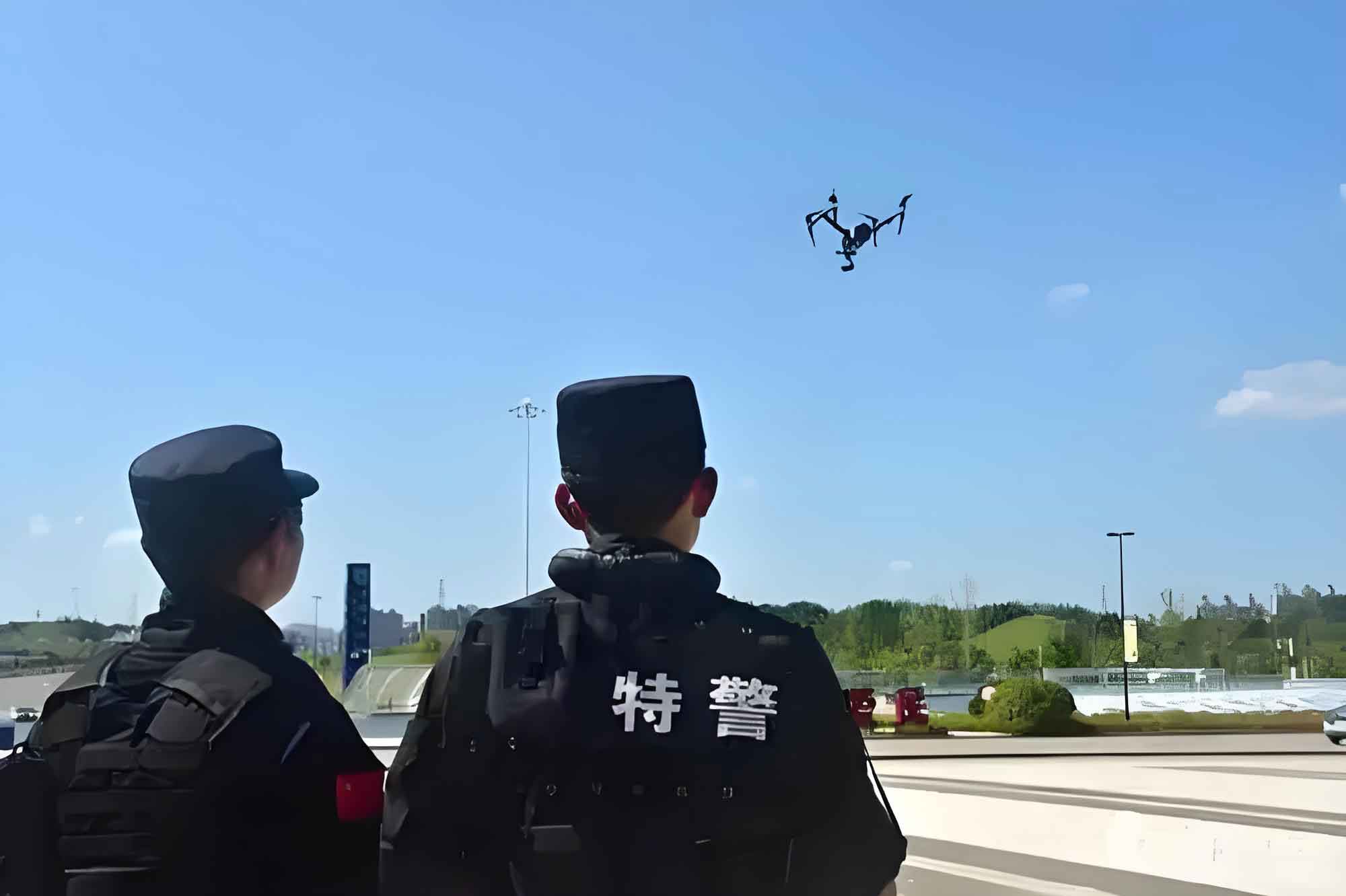
The integration of Unmanned Aerial Vehicles (UAVs) into law enforcement, commonly termed police UAVs or police drones, represents a significant technological evolution in public security operations. Originating in military domains, the proliferation of advanced positioning, energy, and chip technologies has facilitated the transition of UAVs into civilian and specialized law enforcement applications. In China, the adoption of police UAVs traces back to the 1990s, with their operational value becoming prominently recognized during major national events like the 2008 Beijing Olympics. The subsequent formulation of national standards and management regulations, particularly between 2016 and 2017, provided a structured framework for their deployment. The COVID-19 pandemic further accelerated their utilization for non-contact patrols and public monitoring, cementing their role as indispensable assets in modern policing. This growing importance is reflected in an expanding body of academic literature. This article employs a bibliometric analysis, utilizing data from the CNKI database (January 2012 to January 2023) and visualized through CiteSpace software, to map the intellectual structure, identify core research hotspots, and forecast emerging trends in the field of police UAV research.
Methodology and Data Analysis
The analysis is based on 141 relevant academic works indexed in the CNKI database. Using CiteSpace (version 5.3), a scientometric software, we performed co-authorship, co-occurrence, and cluster analysis on key metadata including authors, institutions, keywords, and publication years. This approach allows for the visualization of knowledge networks, the identification of seminal research themes, and the tracking of thematic evolution over time.
1. Research Output and Evolutionary Stages
The annual publication volume serves as a primary indicator of a field’s activity and developmental rhythm. The trend in publications on police UAVs aligns with the Price’s Law of scientific literature growth, showing distinct developmental phases.
| Stage | Time Period | Characteristics | Annual Publication Trend |
|---|---|---|---|
| Germination Stage | 2012-2015 | Limited publications; focus on conceptual introduction and comparative studies. | Low, sporadic output. |
| Rapid Growth Stage | 2016-2019 | Significant increase driven by national regulatory frameworks (e.g., “Interim Provisions on the Management of Police Unmanned Aircraft”). | Steady and marked increase. |
| New Development Stage | 2020-Present | Sustained high output; applications diversified and normalized, especially post-pandemic. | High, stable output. |
The growth can be modeled as a phased exponential function:
$$ N(t) = \begin{cases}
N_0 e^{k_1 t} & \text{for } t \in [2012, 2015] \\
N_1 e^{k_2 t} & \text{for } t \in [2016, 2019] \\
N_2 e^{k_3 t} & \text{for } t \in [2020, 2023]
\end{cases} $$
where \( N(t) \) is the number of publications per year, and \( k_1 < k_2 \approx k_3 \), indicating the shift from slow to rapid growth.
2. Disciplinary Distribution and Core Research Areas
The research on police UAVs is interdisciplinary, spanning technical, operational, and legal domains. The primary disciplines, as categorized by CNKI, are presented below:
| Research Discipline | Primary Focus Areas | Proportion of Literature |
|---|---|---|
| Public Security / Policing | Operational application in patrol, traffic control, counter-terrorism, criminal investigation; team management and training protocols. | Dominant (~60-70%) |
| Aerospace Science & Engineering | Airframe design, flight control systems, propulsion, and aerodynamic performance of UAV platforms. | Significant (~15-20%) |
| Military Technology & Armament | Payload integration (e.g., non-lethal weapons, surveillance packages), counter-UAV systems, and ruggedized designs. | Moderate (~10%) |
| Administrative Law & Legal Regulation | Privacy concerns, regulatory frameworks, airspace compliance, and balancing public safety with civil liberties. | Growing (~5-10%) |
3. Core Research Institutions and Collaboration Networks
Analysis of authorship and institutional affiliation reveals the central actors in this field. Public security universities and operational police departments are the primary knowledge producers.
| Rank | Institution | Publication Count | Research Emphasis |
|---|---|---|---|
| 1 | People’s Public Security University of China | 11 | Comprehensive (Applications, Management, Law) |
| 2 | National Police University of China / Railway Police College | 6 | Operational tactics and scenario-based training |
| 3 | Various Provincial Police Departments (e.g., Hubei, Sichuan) | 4-6 | Practical field applications and case studies |
However, the collaboration network density is low. The network density for institutions is only 0.0032 and for authors is 0.0028, indicating that most research is conducted within isolated teams or single institutions rather than through broad, interdisciplinary collaboration. The People’s Public Security University of China acts as a central node, connecting a few other police academies and agencies.
4. Research Hotspots and Knowledge Structure
Keyword co-occurrence and cluster analysis uncover the central themes within police UAV research. The intellectual landscape is predominantly divided into two major, interconnected clusters: Practical Applications and UAV System Technologies.
4.1 Hotspot 1: Practical Applications of Police UAVs
This cluster focuses on the deployment of police UAVs in specific law enforcement scenarios. The core application domains are summarized as follows:
| Application Domain | Specific Use Cases | Key Advantages & Research Focus |
|---|---|---|
| Traffic Management & Control | Crowd monitoring, accident scene documentation, traffic flow analysis, violation detection (e.g., illegal parking, speeding). | Rapid deployment, aerial perspective for congestion management, and evidence collection. Research focuses on optimal patrol algorithms and integration with ground units. A simple model for UAV-assisted accident response time is: $$ T_{response}^{UAV} = \frac{D}{V_{UAV}} + T_{setup} $$ where \( D \) is distance, \( V_{UAV} \) is cruise speed, and \( T_{setup} \) is deployment time, typically lower than ground vehicle response. |
| Criminal Investigation & Surveillance | Crime scene aerial photography, 3D mapping, suspect tracking in complex terrain (e.g., mountains, forests), search and rescue operations. | Non-intrusive evidence gathering, access to difficult terrain. Research emphasizes photogrammetry, thermal imaging, and search pattern optimization (e.g., expanding square search algorithms). |
| Emergency Response & Public Safety | Disaster assessment (fire, flood), crowd management during large events, handling of hazardous materials (HazMat), and counter-terrorism operations. | Safety for officers, real-time situational awareness. Studies explore payloads for crisis communication, delivery of life-saving equipment, and integration with command centers. |
4.2 Hotspot 2: Enabling Technologies for Police UAVs
This cluster encompasses the technological advancements that make sophisticated police UAV applications possible. Key technological research streams include:
| Technology Stream | Research Objectives | Examples & Technical Notes |
|---|---|---|
| Communication & Data Link | Secure, real-time, high-bandwidth transmission for video and sensor data. | Integration of 5G networks for ultra-reliable low-latency communication (URLLC), enabling real-time HD video streaming and AI processing at the edge. |
| Image Processing & Computer Vision | Enhancing aerial imagery for identification, tracking, and mapping. | Use of algorithms like PROSAC for robust image stitching and matching under varying conditions. An objective function for image registration can be: $$ \min_{H} \sum_i \rho( \| x’_i – Hx_i \|^2 ) $$ where \( H \) is the homography matrix, \( x_i, x’_i \) are corresponding points, and \( \rho \) is a robust loss function. |
| Flight Control & Autonomy | Stable flight in dynamic environments, obstacle avoidance, and automated mission execution. | Development of advanced flight controllers using sensor fusion (IMU, GPS, vision). Path planning using algorithms like A* or RRT* for efficient area coverage: $$ J(path) = \int_{t_0}^{t_f} (w_1 \cdot risk(p(t)) + w_2 \cdot energy(p(t))) dt $$ |
| Counter-UAV & Security | Protecting critical infrastructure from malicious or unauthorized drones (“rogue drones”). | Research into detection (radar, RF, acoustic) and mitigation (jamming, spoofing, net capture) technologies to secure the operational airspace for legitimate police UAVs. |
| Data Fusion & Swarm Intelligence | Coordinating multiple police UAVs for large-scale operations. | Research on Simultaneous Localization and Mapping (SLAM) for multi-agent systems and efficient data sharing protocols to create cohesive operational pictures. |
5. Research Frontiers and Trajectory Analysis
The timeline visualization of keyword evolution indicates shifting research frontiers. The trajectory is moving from foundational platform studies and generic applications toward more specialized, integrated, and normative research.
Current and Emerging Trends:
- Deep Integration with New-Generation IT: The convergence of police UAVs with Artificial Intelligence (AI), Big Data analytics, and the Internet of Things (IoT) is a dominant frontier. Research focuses on AI-powered real-time video analytics for automatic threat detection, predictive policing models using data gathered by UAV fleets, and IoT connectivity for seamless operation within smart city ecosystems.
- Refinement of Tactical Applications: Moving beyond generic use cases, research is delving into highly specialized scenarios. This includes standardized operating procedures (SOPs) for evidence collection admissible in court, optimized tactics for indoor surveillance, and the development of advanced training simulators and certification programs for police UAV pilots.
- Legal Framework and Ethical Governance: As the use of police UAVs expands, so does scholarly attention on the legal and ethical implications. This is the most rapidly growing frontier, addressing:
- Privacy-Security Calculus: Formulating a legal and technical framework to balance the undeniable public safety benefits of aerial surveillance with the protection of individual privacy rights. This involves defining “reasonable expectation of privacy” in the aerial domain and implementing data minimization and anonymization techniques.
The trade-off can be conceptualized as an optimization problem: $$ \max_{P} \left( \alpha \cdot Security\_Gain(P) – \beta \cdot Privacy\_Cost(P) \right) $$ where \( P \) represents the police UAV operation policy, and \( \alpha, \beta \) are societal weights. - Regulatory Harmonization: Researching comprehensive airspace management regulations specific to law enforcement operations, liability frameworks for accidents, and standardization of technical compliance.
- Privacy-Security Calculus: Formulating a legal and technical framework to balance the undeniable public safety benefits of aerial surveillance with the protection of individual privacy rights. This involves defining “reasonable expectation of privacy” in the aerial domain and implementing data minimization and anonymization techniques.
6. Critical Research Gaps and Future Directions
Despite significant progress, the bibliometric analysis reveals notable gaps:
- Underdeveloped Legal Scholarship: Compared to the volume of technical and applied research, in-depth legal and ethical analyses remain sparse. There is a critical need for interdisciplinary studies that involve legal scholars, ethicists, and technologists to build robust governance models for police UAV operations.
- Fragmented Collaboration Networks: The low density of co-authorship networks suggests siloed research. Future progress depends on fostering stronger collaboration between universities, police departments, industry partners, and legal institutions.
- Human-Factor and Organizational Studies: Research is needed on the organizational change management required to integrate police UAVs effectively, including impact on traditional policing models, workforce training, and public perception management.
Conclusion
The bibliometric review delineates a field in dynamic evolution. Police UAV research has matured from introductory explorations to a structured domain focused on sophisticated applications and enabling technologies. The current trajectory is decisively pointing towards an intelligent, integrated, and legally-conscious future. The next wave of innovation will be characterized by AI-augmented autonomous systems, deeply embedded within the broader public security IT infrastructure, and governed by evolving ethical and legal standards designed to harness the power of police UAVs while safeguarding fundamental civil liberties. Addressing the identified gaps in legal scholarship and interdisciplinary collaboration will be paramount for the sustainable and socially responsible advancement of police UAV technology.