The eruption of a major infectious disease presents a profound crisis, characterized by immense complexity and uncertainty. As a researcher focused on public safety and technological integration, I have observed that the core of an effective response lies not merely in medical intervention, but in the rapid, accurate, and dynamic management of information. The pathogen’s behavior, transmission pathways, and population movement patterns constitute a vast, evolving dataset. Success in containment and societal stability hinges on the ability to acquire this critical information, process it, and disseminate actionable intelligence across a coordinated response network. In this context, the emergence of the police drone as a versatile aerial platform has fundamentally reshaped the information landscape for public safety agencies during pandemics.
From an informational perspective, pandemic management is a continuous博弈 (game) between dynamic situational developments and procedural countermeasures. This process requires both horizontal coupling and feedback of information among various subsystems (e.g., public health, law enforcement, transportation) and vertical feedback between decision-making and execution units. The flow of information must form a closed loop. Therefore, ensuring the timely collection of comprehensive decision-support data and its fluid interchange among multiple actors is the key to efficient, high-quality decision-making and ultimate victory. The traditional ground-based methods of information gathering—patrols, checkpoints, manual reporting—are often too slow, resource-intensive, and limited in scope during a fast-moving crisis. The police drone fills this critical gap. Its characteristics of long endurance, high flexibility, and relatively low operational cost allow it to transcend environmental restrictions, becoming a pivotal node in an aerial information network. This network is essential for constructing an integrated air-ground collaborative prevention and control格局 (structure), improving the mechanisms for managing major public health emergencies, and contributing to a robust national emergency response system.
The Informational Core of Pandemic Response
Information is the lifeblood of scientific decision-making during a crisis. Reliable, authentic, and spatio-temporally complete information forms the foundational element influencing the correctness of decision-makers’ actions. Decision-making devoid of robust information support is like a tree without roots or water without a source. Following the outbreak of a major infectious disease, a deluge of杂乱无章 (disordered) information emerges. The management work is, in essence, a process involving the collection, screening, judgment, and analysis of pandemic-related information, the creative formulation of plans, and their evaluation, selection, and execution.
This informational framework can be modeled by its source and channel. The effectiveness of the response depends on several factors: Can the content from the information source be acquired promptly and accurately by first responders? Is the communication channel unobstructed? Does the recipient possess the capability to effectively utilize information from multiple channels? Each of these factors influences the final decision outcome. We can conceptualize the informational value $V_{info}$ of a data point in a pandemic context as a function of its accuracy $A$, timeliness $T$, relevance $R$, and completeness $C$:
$$V_{info} = f(A, T, R, C) = \alpha \cdot A + \beta \cdot \log(1/T) + \gamma \cdot R + \delta \cdot C$$
where $\alpha, \beta, \gamma, \delta$ are weighting coefficients specific to the crisis phase. The police drone directly optimizes $T$ (timeliness) and $C$ (completeness of spatial coverage) while providing a platform to enhance $A$ (accuracy through sensors). Only when information sources are clear,传播渠道 (communication channels) are畅通无阻 (unimpeded), and the two are well-matched does the “window of opportunity” for effective emergency decision-making appear.
| Informational Challenge | Traditional Method Limitation | Police Drone Mitigation Strategy | Key Information Metric Enhanced |
|---|---|---|---|
| Spatial Coverage of Surveillance | Limited line-of-sight, physical barriers, resource-intensive for wide areas. | Aerial vantage point provides wide-area, unobstructed panoramic monitoring. | Completeness (C), Timeliness (T) |
| Dynamic Situational Awareness | Static CCTV, delayed reporting, inability to track moving or transient situations. | On-demand, real-time video feeds and tracking of crowd movements, traffic flows. | Timeliness (T), Relevance (R) |
| Access to High-Risk or Inaccessible Zones | Risk of infection to personnel, physical inaccessibility (e.g., sealed neighborhoods, rough terrain). | Remote, non-contact sensing and observation from a safe stand-off distance. | Accuracy (A) via remote sensors, Safety of personnel |
| Rapid Population Health Screening | Bottlenecks at checkpoints, slow throughput, close-contact risk for screeners. | Wide-area infrared thermography allowing simultaneous, remote screening of multiple individuals. | Timeliness (T), Scale of data collection |
Acquiring the Information Source: Aerial Data Collection
Abundant and high-fidelity information sources are the critical foundation for all subsequent work. Comprehensive grasp of data such as population body temperatures, crowd aggregation status, and traffic conditions creates the necessary conditions for implementing informed decisions. Urban governance, underpinned by technological support, can effectively enhance its resilience to risks. The police drone is instrumental in this endeavor, enabling key area inspection, ground personnel temperature screening, and aerial panoramic reconnaissance.
1. Strategic Area Inspection and Patrol
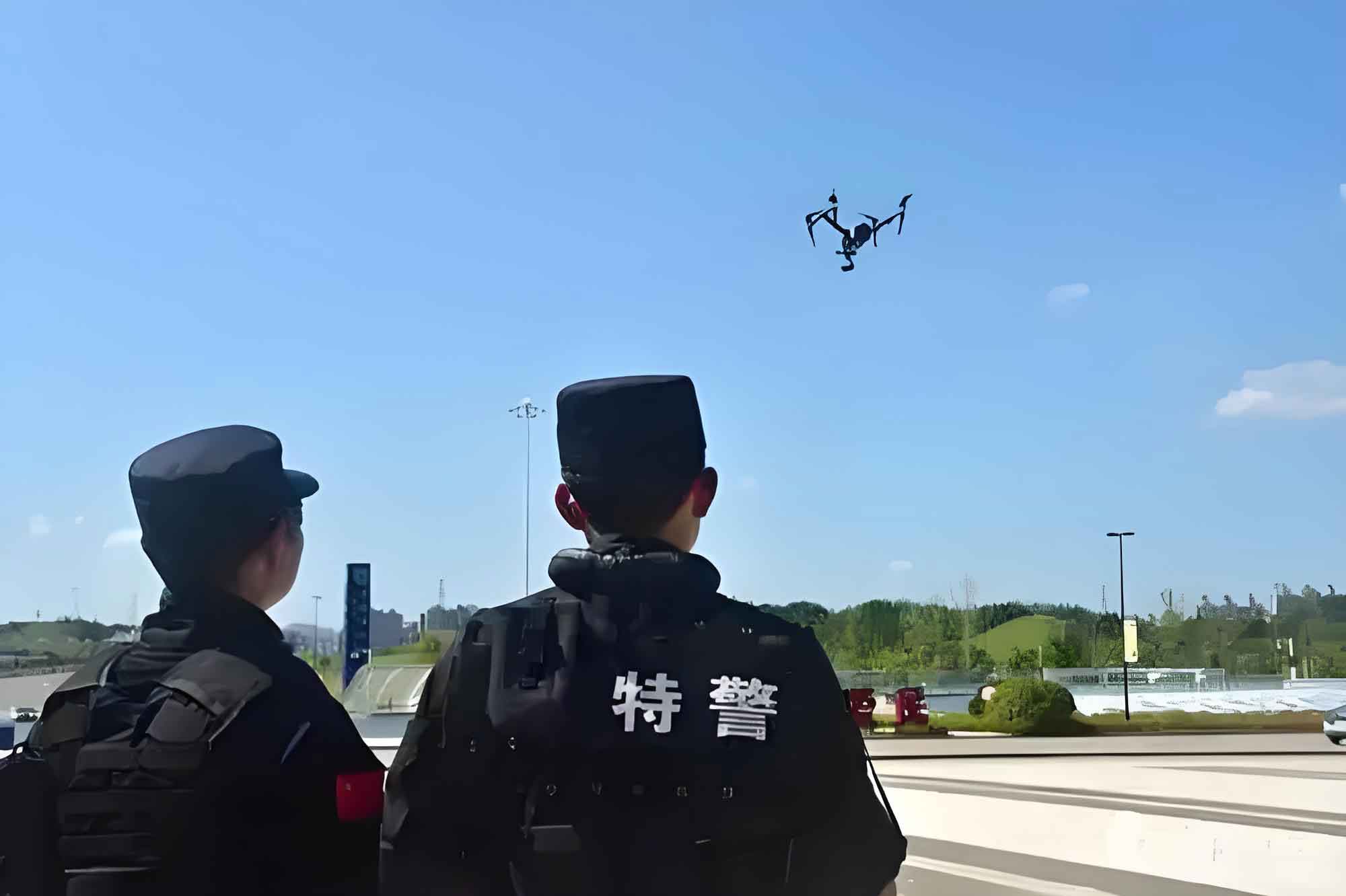
Ensuring societal stability while managing pandemic control requires a meticulous balance, such as overseeing the safe resumption of work in enterprises. How can we efficiently and comprehensively grasp the status of复工 (work resumption) and防疫 (epidemic prevention) at factories and construction sites? How can we deter crowd gatherings in parks, on rooftops, or other open areas? Faced with escalating pandemic control demands, traditional patrol methods reveal shortcomings: insufficient police resources, limited monitoring scope, and unavoidable blind spots, which constrain foundational information collection.
The机动灵活 (maneuverable), wide-visual-range, and easily operated police drone can play a corresponding auxiliary role. Its utility can be expressed in terms of aerial侦察覆盖范围 (reconnaissance coverage area) $S_{cover}$:
$$S_{cover} = v \cdot t \cdot w + A_{hover}$$
where $v$ is the drone’s patrol speed, $t$ is its flight time (endurance), $w$ is the effective sensor width (field of view at altitude), and $A_{hover}$ is the area continuously monitored during stationary hovering. This formula highlights how a police drone exponentially increases patrol efficiency compared to a ground officer’s linear path.
- Public Space Monitoring: For streets, communities, transport hubs, and public squares, the police drone enables all-weather, large-scale, three-dimensional air-ground monitoring. It provides a commanding view to grasp public security dynamics, identify potential hazards, and monitor in real-time for anomalies like crowd gatherings or traffic congestion.
- Large Event Security: During necessary public activities, the police drone can operate at safe altitudes, either providing an overarching panoramic view or zooming in for close observation, assisting in monitoring human and vehicular flow to promptly identify safety risks.
- High-Risk Zone Surveillance: For医疗区 (medical zones),隔离区 (quarantine zones), and安置区 (resettlement zones), the police drone can follow pre-programmed flight paths, assisting in the dynamic, 24/7管控 (control and management) of key personnel and locations within its jurisdiction.
Furthermore, the police drone can integrate with other emerging technologies. For instance, by interfacing with 3D realistic electronic maps, it can help establish防控热力图 (prevention and control heat maps) for key areas, visually representing risk levels and enabling command centers to efficiently track developments and deploy resources. The live feed from high-definition cameras provides immediate situational awareness, forming a critical information pillar for command-level analysis and decision-making.
2. Remote Population Temperature Screening
During global public health emergencies, body temperature often serves as a primary screening criterion. While existing non-contact infrared thermometers (stand-alone units, handheld devices) offer high精度 (precision) and reliability, they face severe limitations in urban environments with massive daily population movement: low throughput and increased risk of close-contact exposure for screeners.
The police drone, equipped with a calibrated infrared thermography system, presents a scalable solution. Based on the principle that human thermal radiation is relatively stable and distinguishable from the ambient environment within a specific range, the drone-based system performs remote screening. A key metric here is筛查效率 (screening efficiency) $E_{screen}$:
$$E_{screen} = \frac{N_{persons}}{t_{scan}} \cdot A_{detect}$$
where $N_{persons}$ is the number of individuals scanned simultaneously in the camera’s field of view, $t_{scan}$ is the time required to acquire and process the thermal data for that group, and $A_{detect}$ is the probability of accurate detection (accuracy). Integrating facial recognition technology allows the system to precisely target the forehead or facial region, map it to the thermal camera, and, using compensation algorithms, estimate body surface temperature. The advent of 5G connectivity empowers the police drone with capabilities for long-distance, multi-person simultaneous scanning and real-time recording of individual images paired with temperature data.
Experimental tests show that after integrating a calibrated reference source (a简易黑体 “simple black body”) into the thermal camera’s field of view, the measurement accuracy of a properly calibrated drone-based system can reach ±0.5°C at distances of 2-3 meters. This is sufficient for non-contact screening of individuals at highway checkpoints or within controlled communities. Upon detecting an individual with an abnormal temperature, the system triggers an alert on the drone operator’s screen, prompting ground personnel for secondary verification. This method is highly efficient, meeting防疫 (epidemic prevention) needs while significantly reducing the infection risk for frontline personnel.
3. Covert Case Reconnaissance and Evidence Gathering
During pandemic restrictions, while visible street crime may decrease,隐蔽性 (covert) offenses such as illicit gatherings for gambling, drug use, or other activities in confined spaces often see an uptick. These activities are highly mobile, frequently changing locations, and pose significant social harm, presenting serious challenges for investigation and enforcement.
The police drone acts as an “aerial scout,” seamlessly integrating with other advanced technologies. It provides a rapid, overhead assessment of terrain, facilitates personnel identification, and analyzes the surrounding environment, proving valuable in the stages of evidence collection, reconnaissance, and containment operations. For instance, in scenarios involving remote or complex locations where suspects employ counter-surveillance measures (e.g., lookouts), a police drone can covertly occupy a high vantage point. It conducts precise terrain勘探 (reconnaissance), gathering data on access routes, building layouts, and suspect positioning. This aerial intelligence, after analysis, enables the formulation of effective operational plans and can guide ground teams during interventions.
| Application Task | Primary Sensor/ Payload | Information Output | Impact on Decision-Making |
|---|---|---|---|
| Strategic Area Patrol | HD Zoom Camera, GIS Integration | Real-time video, geotagged imagery, crowd density analytics, traffic flow data. | Enables dynamic resource allocation, identifies emerging hotspots, verifies compliance. |
| Temperature Screening | Calibrated Infrared Thermography Camera, Facial Recognition | Temperature data streams linked to individual visuals, anomaly alerts. | Triggers secondary screening protocols, informs health surveillance models, maps potential fever clusters. |
| Covert Reconnaissance | Low-light/ Thermal Camera, Silent Propulsion | Covert imagery of locations and persons, terrain mapping, tactical situational overview. | Supports operational planning for raids or arrests, provides evidence, enhances officer safety. |
Clearing Information Channels: Aerial Information Dissemination
Effective crisis communication is paramount. Public health guidance must be disseminated widely and clearly to inform the public, promote protective behaviors, and alleviate social panic. Traditional methods (online posts, loudspeaker vehicles, pamphlets) are essential but have limitations in reach and adaptability. The police drone becomes a powerful mobile broadcast node in the information dissemination network.
1. Public Awareness and Guidance Broadcasts
Communities and neighborhoods are the frontline of pandemic defense. However, within locked-down areas, direct physical interaction is limited. The police drone, equipped with a high-power loudspeaker, can巡航 (cruise) over designated areas, broadcasting pre-recorded or live audio messages. Its coverage advantage is clear: one police drone can deliver clear audio announcements across multiple blocks or a large residential complex from a central aerial position, a task that would require multiple ground vehicles or personnel.
When the drone’s live video feed identifies inappropriate behavior (e.g., lack of masks, large gatherings, non-compliance), it can be swiftly directed to the location. The operator can then use the loudspeaker to provide targeted, real-time reminders and guidance. This method of “talking from the sky” represents an agile and responsive communication tool, effectively reaching the “last mile” of public messaging with活语言 (live language) and活题材 (relevant context).
2. Traffic Flow Management and Monitoring
Pandemic conditions often alter traffic patterns, potentially leading to new congestion points or necessitating the monitoring of travel restrictions. The police drone offers a non-contact method for交通勘测 (traffic surveying). Integrated with HD cameras and 5G transmission, it provides real-time, high-altitude views of major intersections, critical road sections, and traffic infrastructure. This aids in analyzing congestion characteristics, causes, and spatial extent.
In the event of accidents or illegal parking that impede flow, the police drone can arrive quickly, assess the situation from above, and assist ground officers in managing the incident. Coupled with its loudspeaker, it can directly address drivers involved, issuing instructions to move vehicles or clear lanes, thereby accelerating resolution times and reducing secondary risks. This空中宣传 (aerial publicity) also serves to broadcast general appeals for compliance with traffic regulations.
3. Facilitating Multi-Agency Information Fusion and Shared Situational Awareness
The complexity of urban systems means no single agency has a complete picture, leading to potential防控 “盲点” (“blind spots”). Furthermore, differing risk perceptions among agencies (public health, police, emergency management, local government) can hinder a unified response. Effective risk communication and shared situational awareness are vital. A police drone network can serve as a common data-gathering layer feeding into a unified command information system.
From a law enforcement perspective, cities can be divided into management grids. Police drones, combined with ground patrols, conduct coordinated air-ground surveillance of these grids. When a drone or officer detects an incident (e.g., a求助 request “request for help”, a gathering), the information—including geotagged imagery—is instantly relayed to a central command platform. The platform categorizes the event and assigns it to the relevant agency (health, police, social services) for resolution within a set timeframe, with the system tracking completion. This creates accountability and transparency.
Moreover, data collected by police drones, such as aggregated temperature readings or the location of quarantine perimeters, can be visualized on a common operational map. Different colors or codes can denote various risk levels, health statuses (inspired by systems like健康码 “health code” triage), or resource locations. This shared visual tool allows all responding entities to operate from the same informational baseline, enabling coordinated action and helping the public make informed decisions about movement. The integration of intelligent data collectors like the police drone with the specific needs of various agencies enhances efficiency across the entire cycle of prevention, response, and review.
| Communication/Fusion Scenario | Drone-enabled Action | Channel Cleared/Information Type | Benefit to Multi-Agency Response |
|---|---|---|---|
| Public Guidance & Order | Aerial loudspeaker announcements, targeted verbal intervention. | Official directives, behavioral instructions -> Public. | Rapid, scalable, and adaptable public messaging, reduces need for direct contact. |
| Traffic Management | Real-time aerial traffic feeds, direct-to-driver audio instructions. | Situational traffic data -> Command; Instructions -> Drivers. | Enhances traffic incident response speed, provides overarching flow perspective to command. |
| Situational Awareness Fusion | Feeding geotagged video and sensor data into a Common Operational Picture (COP) platform. | Standardized situational data -> All responding agencies (Health, Police, EM). | Creates a single source of truth, breaks down information silos, enables synchronized actions. |
Technical Considerations, Risks, and the Path Forward
The effective deployment of police drones in pandemic response is not without its requirements and challenges. The technology demands robust operational protocols, skilled pilots, and clear legal and ethical guidelines.
Technical and Operational Requirements:
A successful police drone program requires:
- Robust Platform and Sensors: Drones with sufficient payload, endurance, and stability, equipped with appropriate HD, thermal, and acoustic payloads.
- Secure Data Links: Encrypted communications for video and command to prevent interception or interference.
- Training and Certification: Pilots (飞手 “flyers”) must be highly trained not only in flight but also in sensor operation, data protection laws, and tactical deployment.
- Integration Software: Platforms to manage drone fleets, process sensor data (e.g., AI for crowd counting, anomaly detection), and feed information into command center systems.
Risk Mitigation and Ethical Governance:
As the use of police drones expands, so must the framework governing them:
- Privacy Protection: Clear policies must balance public safety needs with individual privacy rights. Data collection should be purposeful, limited, and securely stored, with strict controls on retention and use.
- Safety and Security: Risks of mid-air collisions, system failures, or malicious hacking must be addressed through technical safeguards, geofencing, and contingency plans.
- Regulatory Compliance: Operations must adhere to national and local aviation regulations, and industry standards (e.g., for drone detection and counter-drone systems in sensitive areas) must be developed and refined.
- Public Trust: Transparency about the capabilities, purposes, and governance of police drone programs is essential to maintain public trust and legitimacy.
Conclusion
Major pandemics present severe tests characterized by high complexity and uncertainty. From a public safety standpoint, prevailing in this challenge necessitates an information-centric approach. Law enforcement must closely monitor new societal dynamics, analyze evolving situations, and coordinate decisive actions with partner agencies. Recognizing that superior information acquisition and management form the bedrock of timely and accurate decision-making is paramount; it is the “gold standard” against which command execution is measured in emergencies.
The police drone has emerged as a transformative tool within this informational paradigm. From the perspective outlined in this analysis, its value in major public health crises is multifaceted: it acts as a powerful collector of essential source information (surveillance, screening, reconnaissance) and as a dynamic node for clearing information channels (broadcasting, directing traffic, feeding data fusion systems). The application of police drones aids in exploring new pathways for comprehensively acquiring and visualizing city-wide pandemic data, thereby supporting more precise policy implementation by both public health and public security authorities.
Moving forward, police drone technology will continue to evolve, with applications becoming more specialized and sophisticated. The imperative for relevant authorities is to proactively identify potential risks, strengthen oversight,完善 (perfect) industry standard systems, enhance operator资质建设 (qualification development), and steadfastly uphold the balance between public interest and the protection of citizens’ personal privacy. The goal must be to wield this powerful technological tool with one hand focused on epidemic control and the other firmly safeguarding security and rights, thereby ensuring overall societal harmony and stability.