This article presents a comprehensive bibliometric analysis and review of academic literature concerning police drones, utilizing data extracted from the China National Knowledge Infrastructure (CNKI) database spanning January 2012 to January 2023. Employing the CiteSpace software for scientific knowledge mapping, this study visualizes and interprets the developmental trajectory, research focal points, intellectual structure, and emerging frontiers within the domain of police drone research. The findings delineate distinct phases of growth, identify core research clusters primarily centered on practical applications and technological integration, and project future trends towards sophisticated data fusion, regulatory balance, and the convergence with next-generation information technologies. This analysis aims to provide a structured, data-driven overview for researchers, law enforcement practitioners, and policymakers engaged in the evolution of unmanned aerial systems in public safety operations.
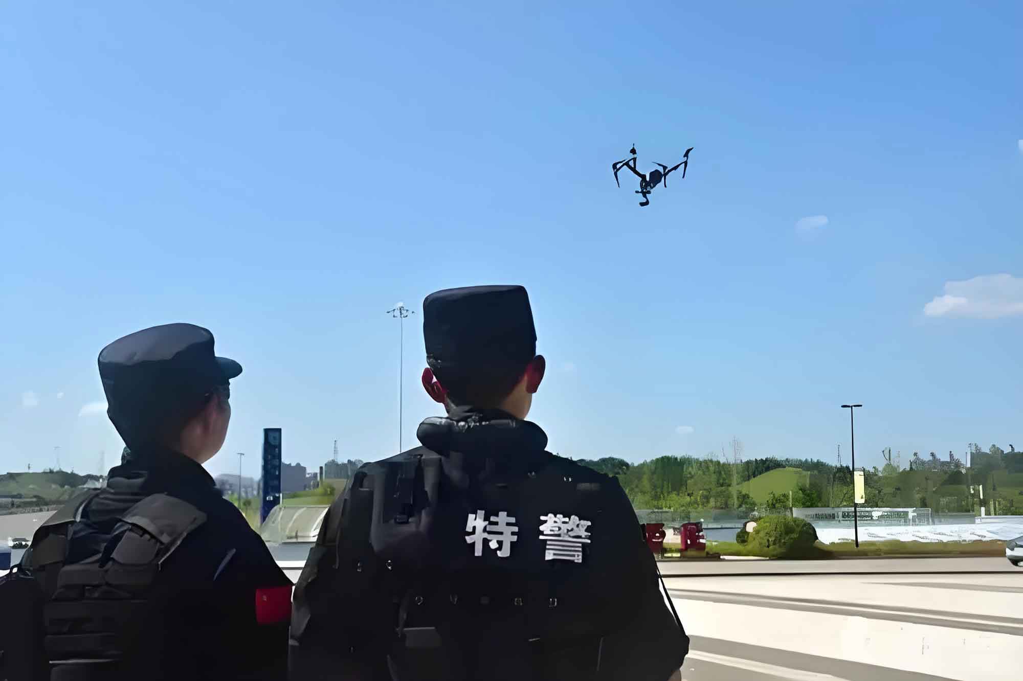
The operational value of a police drone lies in its function as an aerial platform. By equipping it with various mission-specific modules—such as loudspeakers, night-vision cameras, thermal imaging sensors, or non-lethal payload dispensers—law enforcement agencies can create “drone-plus” solutions. This capability is pivotal in scenarios ranging from traffic management and large-scale event security to counter-terrorism operations and search-and-rescue missions, ultimately aiming to enhance operational efficiency and optimize the allocation of human resources.
1. Introduction and Methodology
The inception of unmanned aerial vehicles (UAVs) dates back to the early 20th century, primarily for military reconnaissance and targeting. The 21st century, however, witnessed a transformative shift with rapid advancements in miniaturization, global positioning systems (GPS), battery technology, and data communication. This technological democratization propelled drones from exclusive military assets into the civilian and commercial spheres. Law enforcement agencies globally began recognizing the strategic potential of these systems. The adoption of the first police drone helicopter by a Chinese municipal bureau in 1993 marked a seminal moment in Asia, integrating UAVs into the modern public safety toolkit. The operational success of police drone units during major events like the 2008 Beijing Olympics underscored their utility, leading to widespread procurement. A significant acceleration occurred during the COVID-19 pandemic, where police drone platforms were deployed for aerial patrols, public address, and monitoring, highlighting their role in crisis management and non-contact policing. Concurrently, regulatory frameworks evolved; for instance, between 2016 and 2017, relevant authorities issued provisional regulations and industry standards governing the management, registration, and technical specifications of police drone systems, aiming to standardize their use and ensure public safety.
As the application of police drone technology has expanded, so has the volume of associated scholarly research. However, a synthesized, macroscopic, and visually intuitive analysis of this research landscape has been lacking. This study addresses that gap by employing bibliometric methods and the visualization capabilities of CiteSpace (version 5.3). The primary data source is the CNKI database. The search was conducted using “警用无人机” (police drone) as the thematic keyword, covering the period from January 2012 to January 2023. After meticulous screening to exclude conference notices, news reports, and non-relevant publications, a final corpus of 141 academic articles was obtained for analysis. The methodology involves quantitative examination of publication trends, co-authorship and institutional networks, keyword co-occurrence, and cluster analysis to map the intellectual structure and dynamic evolution of the field.
2. Analytical Results and Discussion
2.1 Temporal Evolution of Publication Volume
The annual publication count serves as a key indicator of research activity and maturity within a field. The trend analysis reveals a clear upward trajectory in the number of publications on police drones, conforming broadly to Price’s law of scientific literature growth. This trajectory can be segmented into three distinct phases, as illustrated in the conceptual trend analysis below and correlated with key socio-technological events.
Table 1: Phases of Police Drone Research Evolution (2012-2023)
| Phase | Time Period | Characteristics | Key Catalysts/Events |
|---|---|---|---|
| Germination Phase | 2012 – 2015 | Low publication volume; exploratory and conceptual studies; focus on introductory reviews and comparative analyses. | Initial experimentation and adoption by pioneering law enforcement departments. |
| Rapid Growth Phase | 2016 – 2019 | Sharp increase in publications; expansion into applied research and technical investigations. | Promulgation of national-level provisional regulations and technical standards governing police drone management and systems. |
| New Development Phase | 2020 – Present | Sustained high-volume output; maturation of application studies and emergence of new thematic concerns (e.g., privacy, advanced integration). | Widespread, highly visible deployment of police drones for pandemic response and public health enforcement, normalizing their use. |
The growth can be modeled conceptually. Let $N(t)$ represent the cumulative number of publications by year $t$. The observed trend suggests a piecewise function with different growth rates $r$ for each phase:
$$ N(t) \approx \begin{cases}
N_0 e^{r_1 t} & \text{for } t \in \text{Phase 1 (low } r_1\text{)} \\
N_1 e^{r_2 t} & \text{for } t \in \text{Phase 2 (high } r_2\text{)} \\
N_2 e^{r_3 t} & \text{for } t \in \text{Phase 3 (moderate } r_3\text{)}
\end{cases} $$
where $N_0, N_1, N_2$ are constants. This pattern highlights how policy intervention (regulations) and societal need (pandemic) act as significant accelerants for research in applied technological fields like police drone operations.
2.2 Distribution of Research Disciplines
The research on police drones is inherently interdisciplinary. Analysis of the subject categories assigned to the literature corpus reveals a strong concentration in applied fields, with “Public Security” being the predominant domain. This is followed by “Aeronautical and Aerospace Science & Engineering,” “Military Technology,” and “Administrative Law & Legal System.” This distribution underscores the dual nature of police drone research: a primary focus on practical law enforcement applications (deployment, tactics, training) and a secondary but critical focus on the underlying platform technologies (aerodynamics, control systems, payloads) and the legal-regulatory framework governing their use. The legal scholarship primarily grapples with balancing the law enforcement utility of police drones with fundamental rights, such as privacy—a tension that is becoming increasingly salient.
2.3 Core Research Authors and Institutions
Identifying prolific authors and institutions helps map the intellectual centers of gravity within the field. The data indicates that research output is concentrated within a select group of police universities and a few operational law enforcement agencies. The following table summarizes the most active contributors based on publication count within the analyzed corpus.
Table 2: Leading Contributors in Police Drone Research (2012-2023)
| Rank | Author | Publication Count | Primary Research Focus (Inferred) |
|---|---|---|---|
| 1 | Author A | 5 | Legal regulation and policy framework for police drones. |
| 2 | Author B | 4 | Comparative analysis of national regulations. |
| 3 | Author C | 3 | Practical applications in frontline policing. |
Table 3: Leading Institutions in Police Drone Research (2012-2023)
| Rank | Institution | Publication Count | Institution Type |
|---|---|---|---|
| 1 | Police University A | 11 | Higher Education |
| 2 | Police University B | 6 | Higher Education |
| 3 | Police University C | 6 | Higher Education |
The dominance of police universities suggests that academic institutions are the primary engines generating theoretical and applied research, often in collaboration with or directly informed by operational agencies. The research focus of the top authors is predominantly on practical application, with only a minority engaging deeply with legal and regulatory issues.
2.4 Collaboration Network Analysis
The network maps for both authors and institutions reveal a relatively fragmented collaborative landscape. The density of the institutional collaboration network is calculated at a very low value (approximately 0.0032), and the author collaboration network density is similarly low (approximately 0.0028). These metrics indicate that while there are centers of activity (notably Police University A and Police University B, which occupy central positions in the network), sustained and extensive collaborative partnerships across different organizations are not yet the norm. Most research appears to be conducted within institutional silos or in small, stable teams. Strengthening interdisciplinary and inter-organizational collaboration could be a key to driving more innovative and holistic solutions in police drone technology and policy.
2.5 Research Hotspots: Keyword Co-occurrence and Cluster Analysis
Keyword analysis is fundamental to uncovering the core themes and research hotspots. Using CiteSpace’s clustering functionality on keywords yields a map highlighting several major research clusters. The most frequent keywords, after consolidation, include: “UAV/Drone” (24 occurrences), “Public Security Organs” (14), “Practical Application” (13), “Epidemic Prevention and Control” (13), “Expressway” (6), and “Legal Regulation” (5). The clustering analysis consolidates these into two overarching, interconnected research directions:
1. Practical Applications in Policing: This is the most substantial cluster, focusing on deploying police drones in specific operational contexts.
- Traffic Management: Applications include aerial command and surveillance during congestion, violation detection (e.g., illegal parking, reckless driving), monitoring of construction zones, and rapid response to accidents. Research here often discusses optimal fleet configuration, crew training models, and integrated patrol strategies combining police drones with ground units.
- Criminal Investigation: Police drones are used for crime scene documentation and 3D mapping, aerial surveillance for gathering intelligence and evidence, and assisting in the pursuit and apprehension of suspects, especially in difficult terrain. Studies emphasize the need for better data integration with investigation workflows and specialized training for forensic aerial photography.
- Emergency Response and Public Safety: This encompasses counter-terrorism operations, search and rescue (SAR), handling hazardous materials (HazMat), and crowd management during large public events. For example, research explores police drone-deployed life-saving equipment in water rescue scenarios, reducing risk to human first responders.
2. Enabling Technologies and Systems: This cluster addresses the technical foundations that make the above applications possible. Research focuses on:
- Flight Control & Navigation: Stability algorithms, obstacle avoidance, and beyond-visual-line-of-sight (BVLOS) operations.
- Data Link & Communication: Secure, real-time video transmission, and the impact of 5G technology on enabling advanced applications like real-time facial recognition and dense urban operations.
- Sensor Payloads: Development and optimization of optical, thermal, LiDAR, and multispectral sensors for various missions.
- Data Processing: Algorithms for image stitching, enhancement, and real-time analysis of aerial footage. For instance, studies propose improved feature-matching algorithms (e.g., enhancements to ORB or PROSAC methods) to increase the accuracy and usability of police drone-captured imagery.
- Counter-UAS Technology: As the threat of malicious “rogue drones” grows, research into detecting, tracking, and mitigating unauthorized UAVs is crucial for protecting sensitive areas. Technologies studied include radar, RF detection, electro-optical systems, and neutralization methods like jamming or net capture.
The technological challenges often involve optimizing performance parameters. For instance, a key equation in multi-drone collaborative mapping (SLAM) involves minimizing the error in pose estimation and map alignment across several police drone platforms:
$$ E = \sum_{i,j} \rho \left( \left\| z_{ij} – \hat{z}_{ij}(X_i, X_j, M) \right\|^2_{\Sigma_{ij}} \right) $$
where $E$ is the total error, $z_{ij}$ is the actual observation between drone $i$ and feature $j$, $\hat{z}_{ij}$ is the predicted observation based on estimated drone poses $X$ and map $M$, $\Sigma_{ij}$ is the covariance, and $\rho$ is a robust cost function. Research aims to solve such optimization problems efficiently for real-time, collaborative police drone operations.
Table 4: Key Technology Focus Areas for Police Drones
| Technology Area | Specific Research Topics | Operational Impact |
|---|---|---|
| Sensing & Imaging | High-resolution cameras, thermal imaging, hyperspectral sensors, LiDAR for 3D mapping. | Enhanced situational awareness, night operation capability, forensic scene reconstruction. |
| Communication | 5G/6G integration, secure data links, anti-jamming protocols, mesh networking for drone swarms. | Real-time HD video streaming, reliable command & control in complex environments, coordinated swarm tactics. |
| Data Analytics & AI | Real-time video analytics, automatic object/behavior detection, predictive policing models based on aerial data. | Reduced operator workload, proactive threat identification, data-driven decision support. |
| Platform & Autonomy | Long-endurance designs (fixed-wing, hybrid VTOL), advanced flight controllers, autonomous navigation and mission execution. | Extended patrol duration, reduced pilot skill dependency, complex mission automation. |
| Counter-UAS | Detection (radar, RF, acoustic), classification, and mitigation (kinetic, RF jamming, spoofing) systems. | Protection of critical infrastructure and public events from malicious drone threats. |
2.6 Research Frontiers and Evolution: Keyword Timeline Analysis
The timeline view of keyword clusters illustrates the dynamic evolution of research themes. Key observations include:
- The core term “police drone/UAV” has persisted throughout, with its associated research evolving from basic technical specifications (e.g., algorithms, endurance) to sophisticated operational applications and, recently, to curriculum development for operator training.
- The focus of “Public Security Organs” shifted notably around 2020, moving from general applications to a specific emphasis on “Epidemic Prevention and Control,” before branching again into areas like “Security for Major Events.”
- Research on “Data Sharing” has progressed from conceptual discussions to technical implementations focusing on functional development and secure architectures for multi-agency data fusion.
- “Fixed-wing” drone research began with applications on “Expressways” (for long-range patrol) and has advanced to studies on vertical take-off and landing (VTOL) capabilities and specialized applications like monitoring illegal fishing.
- The cluster for “Mission Payloads” has evolved from general imaging packages to specialized “Video Investigation Kits.”
- “Intelligent Policing” (or “Smart Policing”) linked with police drones has transitioned from secure image transmission to broader themes of “Public Order Prevention and Control” and “Standardized Law Enforcement.”
- The overarching theme of “Practical Application” is currently trending towards “Data Fusion,” indicating a move from using drones as simple video platforms to integrating their data with other sources (e.g., CCTV, GIS, biometric databases) for comprehensive intelligence and decision-making.
2.7 Identified Research Gaps
While technological and applied research is thriving, the analysis reveals a significant relative gap in studies addressing the concomitant legal, ethical, and social implications. The advent of any powerful surveillance technology like the police drone introduces dual-use risks. Safety risks (e.g., mid-air collisions, ground impact) are tangible but often addressable through engineering and procedural protocols. The more profound and enduring challenge lies in the domain of privacy and civil liberties. The pervasive, persistent, and highly capable surveillance enabled by police drones—especially when equipped with advanced sensors and analytics—poses a fundamental tension between public safety imperatives and the individual’s right to privacy. The bibliometric data shows that publications focusing on “Legal Regulation” are fewer in number compared to those on applications or technology. This imbalance suggests a pressing need for more interdisciplinary research involving law, ethics, social science, and public policy to develop robust, privacy-preserving frameworks for police drone deployment.
3. Conclusion and Future Trajectories
This bibliometric review synthesizes the research landscape for police drones from 2012 to 2023. The field has progressed through germination, rapid growth, and into a phase of consolidated development, driven by regulatory action and real-world operational demands. Research hotspots are firmly anchored in practical law enforcement applications—traffic management, investigation, and emergency response—and the enabling technologies of sensing, communication, and data processing. Core research originates predominantly from police universities, though collaboration networks remain sparse.
Based on the analysis of trends and frontiers, the future trajectory of police drone research is projected to evolve along three primary vectors:
- Deep Integration with Next-Generation Information Technologies: The convergence of police drones with 5G/6G networks, Artificial Intelligence (AI), the Internet of Things (IoT), and big data analytics will transition their role from isolated data collectors to intelligent nodes within a broader “smart policing” ecosystem. Research will focus on edge computing for real-time AI inference on the police drone, swarm intelligence for coordinated autonomous missions, and blockchain for secure, auditable data logging.
- Refinement and Specialization of Tactical Applications: Research will move beyond general use cases into highly specialized, scenario-driven applications. This includes standardized operating procedures (SOPs) for complex environments (e.g., indoor active shooter response, dense urban canyons), advanced evidence collection protocols admissible in court, and the development of sophisticated training simulators and certification programs for police drone operators and tactical commanders.
- Balancing Law Enforcement Efficacy with Rights Protection: This is poised to become a dominant research frontier. Scholars will increasingly grapple with designing technical and policy mechanisms for accountable police drone use. Key topics will include: privacy-by-design in police drone software (e.g., automated redaction), geofencing and automated compliance logging, transparent public oversight frameworks, and the development of clear legal doctrines defining reasonable expectations of privacy in the age of aerial surveillance. The goal is to establish a sustainable equilibrium where the public safety benefits of police drone technology are realized without eroding fundamental civil liberties.
In conclusion, as police drones become an integral component of modern law enforcement arsenals globally, a nuanced understanding of their research landscape—past, present, and future—is essential. This bibliometric analysis provides a foundational map, highlighting both the robust areas of development and the critical gaps that require focused interdisciplinary attention to ensure the responsible and effective integration of aerial systems into public safety operations.