
The integration of police drone systems into modern law enforcement represents a paradigm shift in operational capabilities. To fulfill the mandate for comprehensive, scenario-based tactical training across all police units, a focused study and dissemination of police drone tactics and techniques are imperative. This is a direct response to the need for practical combat readiness and represents a critical requirement for enhancing the capacity to combat crime effectively.
In the contemporary landscape, the application of police drone technology often encounters limitations such as superficial use, rigid operational thinking, and low levels of system integration. Conducting realistic, scenario-based training is therefore a key measure for boosting the operational effectiveness of police forces. This article explores concrete applications of various police drone tactical methodologies in law enforcement activities, aiming to provide actionable solutions to existing operational dilemmas. Analyzing, researching, and training in these tactics, grounded in the practical realities of police work, holds significant importance for maintaining public order and combating crime.
1. Conceptual Foundation and Taxonomy of Police Drone Tactics
The term “Unmanned Aerial Vehicle” (UAV or drone) broadly refers to any aircraft that does not carry a human pilot on board. A police drone, specifically, is an aircraft equipped by law enforcement agencies, suitable for executing policing missions, and includes both autonomous and remotely piloted systems, excluding models, balloons, and special manned police aircraft.
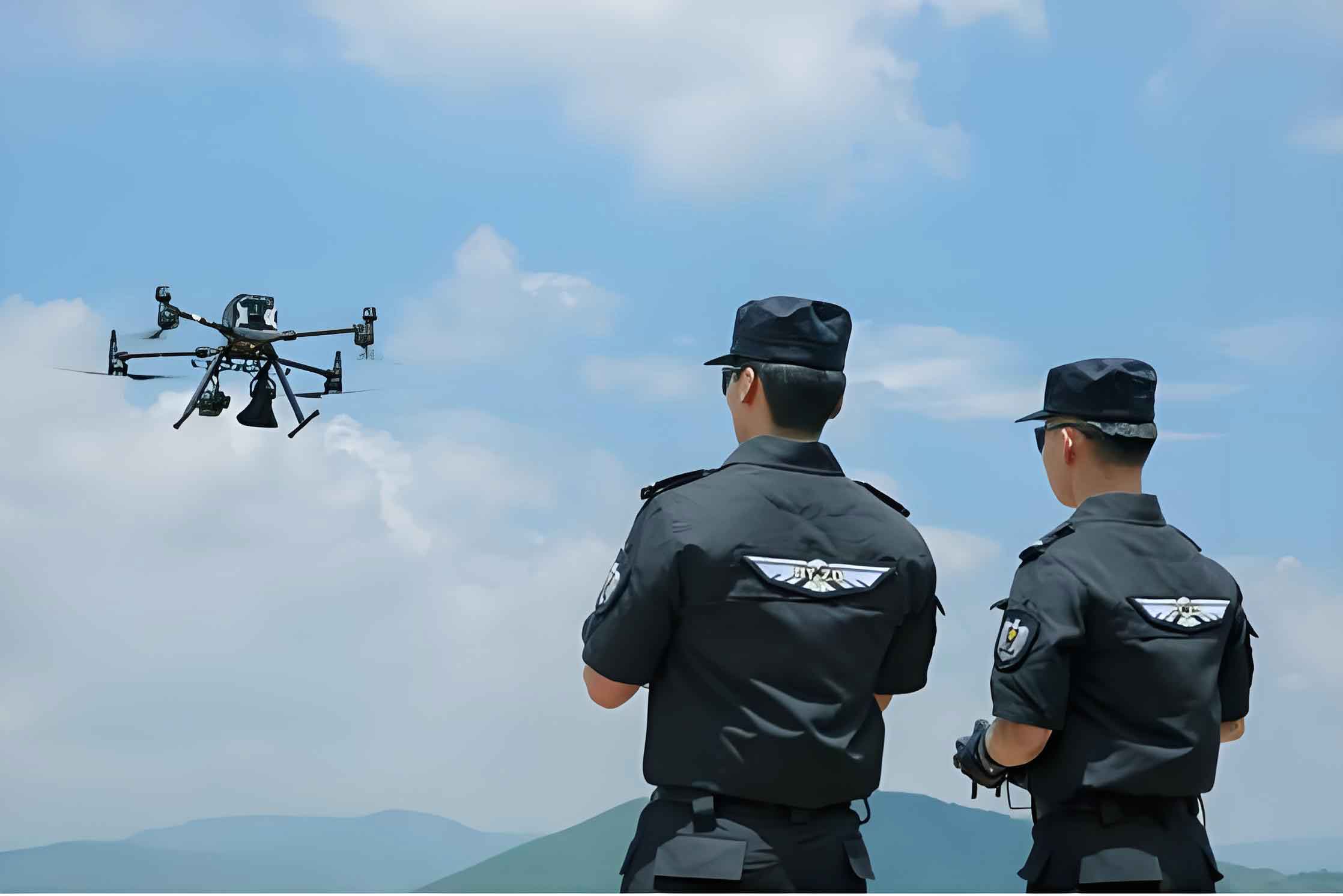
Police Drone Tactics and Techniques refer to the specific skills and combat methods employed by police personnel in complex environments. These methods involve operating police drone systems equipped with various mission payloads to independently or assistively complete a range of policing tasks such as reconnaissance and evidence collection, patrol and surveillance, security management, prevention and early warning, and area localization.
To systematically explore and research these tactics, a scientific and logical classification is essential. Based on the distinct policing missions executed, police drone tactics can be categorized as follows. This classification facilitates targeted application and systematic study.
| Tactical Category | Primary Mission Objective | Core Actions |
|---|---|---|
| Emergency Response & Disruption | De-escalate and control volatile public order incidents. | Loudspeaker announcement, non-lethal engagement (e.g., net guns, tear gas), psychological pressure via flight patterns. |
| Cruise & Comparative Analysis | Detect changes or anomalies over large, complex areas. | Pre-planned automated patrols, multi-temporal image acquisition and comparison. |
| Prevention, Control & Early Warning | Provide persistent, wide-area surveillance for threat detection. | Persistent Area Surveillance (PAS), real-time monitoring of crowds or critical infrastructure. |
| Covert Reconnaissance | Gather intelligence on targets without alerting them. | Stealthy approach, use of quiet drones or long-range optics, “S-pattern” scanning. |
| Area Localization & Pinpointing | Identify and geo-locate specific targets or activity hotspots. | Thermal imaging for heat signatures, spectral analysis, precise GPS tagging. |
| Containment & Apprehension | Support the isolation and capture of suspects. | Aerial perimeter patrol, suspect tracking and marking, coordination with K-9 and ground units. |
Currently, the application of police drone tactics shows promising development. Some agencies effectively use Cruise & Comparative Analysis and Prevention & Early Warning tactics for area monitoring, while others deploy Area Localization and Covert Reconnaissance for criminal investigations. As a highly targeted and synergistic tactical asset, the police drone is building an aerial shield for police work. However, challenges remain in perfectly aligning tactics with operational demands, refining training scenarios, deepening application layers, and enhancing system integration.
2. Operational Challenges in Police Drone Deployment
Despite being a powerful new tool, the tactical application of police drone systems faces several significant hurdles that limit their full potential.
2.1. Superficial Application & Underdeveloped Tactics
Often, the police drone is utilized merely as an “eye in the sky” for basic reconnaissance. The deep tactical integration for coordinated strikes, apprehensions, and complex air-ground synergy is under-explored. The transition from a simple surveillance platform to a node in a networked tactical system is incomplete.
2.2. Cognitive Rigidity & Narrow Role Definition
A prevalent mindset confines the police drone to static video feed duties,固化 its role. This is compounded by a predominant reliance on small multi-rotor and fixed-wing models, which inherently limits tactical diversity. Tactics are often pre-scripted for generic environments rather than being dynamically adapted. While the potential for communication disruption, non-lethal engagement, and decisive action is acknowledged, distilling these capabilities into coherent, reliable, and widely adopted战术 playbooks remains a considerable gap.
2.3. Poor System Integration & Data Silos
A major challenge is the ineffective对接 between police drone operations and broader警务 applications. Technologically, integration is in nascent stages. The workflow often halts at现场 data collection, creating a temporal and analytical disconnect from back-end processing and intelligence fusion. The lack of universal technical standards and operational protocols hinders functional integration and optimal operational applicability, preventing the police drone from achieving its full potential as a quick, efficient force multiplier.
2.4. Inconsistent Professional Proficiency
Training is frequently limited to basic piloting skills, lacking a sophisticated curriculum tailored to tactical employment, mission management, and data exploitation. This results in a disconnect between操控 skills and实战 processes. As the number of deployed police drone units grows, the shortage of highly skilled operators and tactical analysts becomes acute, necessitating specialized training programs to build professional teams capable of unlocking new operational paradigms.
3. Research on Practical Application of Police Drone Tactics
With rapid technological advancement, the development and application of police drone tactics are evolving. Contextual analysis of policing scenarios is crucial for deepening tactical applications. Addressing the challenges outlined above, this section details six core战术 methodologies, providing a direction for tactical training and potential solutions.
3.1. Practical Application of “Emergency Response & Disruption Tactics”
This tactic is designed for public order incidents. Coordinating police drone units with ground forces can significantly enhance处置 efficiency and minimize casualties or property damage. The police drone team, based on mission requirements, equips drones with payloads like powerful spotlights, loudspeakers, net guns, tear gas, flashbangs, or acoustic weapons.
The operational sequence involves immediate launch and hover. Using the loudspeaker, operators can communicate directly with perpetrators. Multi-drone formations employing战术 flight patterns like “formation hover,” “orbiting patrol,” and “low-altitude往返巡飞,” combined with the intimidating noise of low-flying drones, can induce psychological pressure,暗示包围, and disrupt the will to continue unlawful acts. Operator focus and precision are paramount, especially when flying low near suspects to avoid counter-attacks or accidents.
| Phase | Police Drone Action | Payload / Tactic | Desired Effect |
|---|---|---|---|
| Initial Deployment | Rapid launch to vantage point. | High-definition camera, loudspeaker. | Situational awareness, establish communication channel. |
| Psychological Pressure | Multi-drone formation flying (orbits, low passes). | Acoustic / visual presence (lights, sirens). | Create sense of containment and overwhelming presence. |
| Controlled Escalation | Precision positioning for non-lethal engagement. | Net gun, tear gas deployment (if justified). | Neutralize specific threat with minimal collateral risk. |
3.2. Practical Application of “Cruise & Comparative Analysis Tactics”
This method is ideal for monitoring vast, difficult terrain like forests. Rugged topography and limited human access make such areas prone to illicit activities (e.g., illegal gambling, drug cultivation, wildlife poaching) or natural disasters. The police drone conducts automated patrols along pre-set waypoints, capturing aerial imagery (orthophotos).
The core of the tactic lies in comparing images from different time periods ($I_{t1}$, $I_{t2}$, … $I_{tn}$). Changes ($\Delta I$) between these periods highlight anomalies. The comparative analysis function can be represented as finding significant deviations:
$$
\Delta I_{t(n+1), t(n)} = |I_{t(n+1)} – I_{t(n)}| \quad \text{for} \quad n \ge 1
$$
For drug crop detection, a police drone equipped with a multispectral camera captures data. Different plant species have unique spectral signatures ($S_{species}$). By analyzing the spectral data of vegetation patches ($S_{patch}$) and comparing it to known signatures for illicit crops ($S_{illicit}$), potential cultivation sites can be flagged:
$$
\text{Anomaly Score} = f( \min( \lVert S_{patch} – S_{illicit} \rVert ) )
$$
For railway security,航拍 images are compared across time to detect intrusions on the track, damage to fencing, or new obstructions near the right-of-way, allowing for proactive threat mitigation.
| Application Area | Police Drone Sensor | Comparative Metric ($\Delta I$) | Target Anomaly |
|---|---|---|---|
| Forest / Rural Patrol | RGB Camera, Multispectral | New structures, vegetation type/health changes | Illicit labs, drug crops, poaching camps |
| Railway & Infrastructure | High-Res RGB Camera | Breaches in fence, objects on track, ground disturbance | Vandalism, theft, sabotage attempts |
| Construction Site Monitoring | RGB Camera | Site progress, unauthorized activity after hours | Theft, regulatory violations |
3.3. Practical Application of “Prevention, Control & Early Warning Tactics”
This tactic is suited for persistent surveillance of extended linear infrastructure (e.g., railways) or large crowded venues. Railways, due to their length and often remote sections, are vulnerable. Traditional foot patrols are inefficient. Using fixed-wing police drone for巡航, flight paths are plotted along the railway, with additional航点 at critical sections like road crossings, bridges, and villages. For重点路段, altitude and speed are reduced, and航点 density increased to gather higher-fidelity data for effective预警.
The area coverage efficiency of a fixed-wing police drone on a linear patrol can be modeled. Let $L$ be the total length of the track to patrol, $v$ be the drone’s cruising speed, $w$ be the effective sensor swath width (coverage perpendicular to the flight path), and $T$ be the available flight time. The maximum track length that can be comprehensively covered in one sortie, assuming a back-and-forth pattern, is approximately:
$$
L_{max} \approx \frac{v \cdot T \cdot w}{2 \cdot D}
$$
Where $D$ is the desired overlap between adjacent passes for complete coverage. This formula highlights the advantage of the police drone for covering large $L$ efficiently.
For crowded places (squares, stadiums), this tactic supplements fixed cameras. A quick-deploy police drone provides an overview, while a tethered UAV offers persistent station-keeping for prolonged events. Multiple drones can form a comprehensive, mobile aerial surveillance network, capturing街边信息点 rapidly.
3.4. Practical Application of “Area Localization & Pinpointing Tactics”
This tactic is key for investigating crimes like illegal gatherings or counterfeit operations. These activities often occur in secluded locations (remote compounds, dense neighborhoods) with strong反侦查 measures. The police drone, equipped with thermal imaging cameras, can locate anomalous heat signatures indicative of human congregation in otherwise quiet areas at night.
The probability of detecting a heat signature depends on factors like the thermal contrast ($\Delta T$) between the target and background, atmospheric conditions, and sensor resolution. A simplified detection model might consider the signal-to-noise ratio (SNR):
$$
\text{SNR} \propto \frac{\Delta T \cdot A_{target}}{ \text{NEDT} \cdot \sqrt{R}}
$$
where $A_{target}$ is the apparent area of the target, NEDT is the Noise-Equivalent Delta Temperature of the sensor, and $R$ is the range. A police drone can optimize detection by reducing $R$ (flying closer) or by using sensors with lower NEDT.
For counterfeit production sites, the police drone can safely overfly suspicious compounds, using zoom cameras to identify equipment, materials, and activities inside walled courtyards, providing crucial evidence for warrant applications.
3.5. Practical Application of “Covert Reconnaissance Tactics”
Essential for investigating organized crime (gambling, drug production, pollution) where overt approach would compromise the operation. The police drone conducts秘密侦查, often using quiet electric drones or flying at a high altitude with powerful optical zoom.
The process involves: 1) Pre-mission environmental assessment (cell towers, power lines, weather). 2) Detailed route planning to avoid detection and obstacles. 3) Execution using战术 like the “High-to-Low, Gradual Approach” and the “S-pattern Scan” for systematic coverage of a target area (e.g., a polluting factory). The “S-pattern” ensures complete, overlapping coverage of a rectangular area. The drone follows a path defined by a series of parallel legs connected by turns. The collected high-resolution images are later stitched into orthomosaics, on which analysts can annotate suspect positions, sentry locations, and entry points, providing an invaluable operational blueprint for raid planning.
3.6. Practical Application of “Containment & Apprehension Tactics”
This tactic is deployed during the final stages of apprehending dangerous suspects, often in complex terrain. The police drone provides real-time aerial oversight of the containment area and its periphery.
It works in synergy with ground units: performing aerial perimeter patrols to detect breakouts, using its spotlight or designator laser to “mark” a fleeing suspect ($\text{Target}_{marked}$) for ground teams, and creating dynamic containment. Tactics like “feigned opening” can be used, where one escape route is made to seem viable (but is actually covered) while another is actively patrolled by the noisy police drone, influencing the suspect’s choice. The协同作战 can be modeled as an optimization problem minimizing the time to containment ($T_c$):
$$
\min T_c = f( P_{drone}(t), P_{K9}(t), P_{ground}(t), P_{suspect}(t) )
$$
Subject to constraints: $P_{drone}(t)$ provides continuous LOS on $P_{suspect}(t)$, and $\lVert P_{ground}(t) – P_{suspect}(t) \rVert$ decreases over time. Here, $P_x(t)$ denotes the position vector of entity $x$ over time. The police drone is critical for maintaining the Line-of-Sight (LOS) constraint and guiding other units.
4. Synthesis and the Path Forward
The guiding principle must be “train as you fight, and specialize in what is most needed,” emphasizing practical utility and effectiveness to ensure training is fully aligned and integrated with real-world operations. Supported by a robust framework of战术, the police drone is poised to become a decisive tool in the modern policing arsenal. Although current applications face challenges of uneven development and depth, police agencies, as the primary users and proving grounds for these tactics, have both the obligation and the capacity to vigorously promote the research, practical application, and training of police drone tactical methodologies. This will elevate operational效能 and propel police work to new levels of effectiveness and sophistication.
The future lies in moving from isolated tools to an integrated system. The true power of the police drone is unlocked not just by the aircraft itself, but by its seamless connection to command and control (C2) systems, real-time data analytics platforms, and other law enforcement assets. The ultimate tactical formula is one of synergy:
$$
\text{Operational Effectiveness}_{Total} = \alpha \cdot (\text{Drone Capability}) + \beta \cdot (\text{Data Integration}) + \gamma \cdot (\text{Tactical Training}) + \delta \cdot (\text{Inter-Unit Coordination})
$$
Where the coefficients $\alpha, \beta, \gamma, \delta$ represent the relative weighting and maturity of each component. Our focus must be on maximizing all terms in this equation, ensuring the police drone evolves from a novel gadget to a foundational pillar of 21st-century policing strategy.