
In recent years, the application of unmanned aerial vehicles (UAVs), particularly police drones, has expanded into various civilian domains, including highway rescue operations. As a researcher in industrial design, I have explored the integration of police drone systems into emergency response on highways, aiming to enhance safety and efficiency. This article delves into the feasibility, design requirements, and operational workflows for deploying police drones in highway rescue scenarios, supported by technical analyses, tables, and formulas to summarize key points.
The evolution of drones from military to civilian use has opened new avenues for public safety. Police drones, equipped with advanced technologies, offer unique advantages in monitoring, data collection, and rapid response. On highways, where accidents often lead to severe outcomes due to high speeds and congestion, police drones can play a pivotal role in mitigating risks. I will discuss how police drone systems can be designed and implemented to address common emergency situations, drawing from existing research and practical considerations.
Background and Context
From a societal perspective, highway safety management has become increasingly critical. Statistical data indicate a rise in traffic accidents on expressways, resulting in significant losses and injuries. The demand for smooth traffic flow emphasizes order maintenance, while safety concerns focus on accident handling. Police drones can bridge these needs by providing real-time surveillance and intervention. Technologically, drones have matured with miniaturized onboard equipment, improved collision avoidance, and enhanced signal transmission. Key technologies include wireless remote sensing, perception and avoidance, and aerial photography, which form the core of police drone operations.
To illustrate the technological foundations, consider the following table summarizing the core technologies of police drones:
| Technology | Description | Application in Police Drones |
|---|---|---|
| Wireless Remote Sensing | Control and data acquisition via onboard computers or radio remote control. | Enables real-time maneuvering and information gathering for highway monitoring. |
| Perception and Avoidance | Detection of flight conflicts using sensors to avoid obstacles. | Ensures safe operation in congested highway environments, preventing collisions. |
| Aerial Photography | Image capture and analysis through remote sensing devices. | Facilitates accident scene assessment and traffic condition analysis. |
The effectiveness of police drones can be quantified using formulas. For instance, the response time reduction achieved by deploying police drones can be expressed as:
$$ \Delta T = T_{traditional} – T_{drone} $$
where \( T_{traditional} \) is the response time without drones, and \( T_{drone} \) is the time with police drone intervention. This reduction is crucial in highway emergencies, where every second counts.
Feasibility of Police Drones in Highway Rescue
The feasibility of police drones in highway rescue stems from their ability to address specific emergency scenarios. Based on accident data, highway incidents often involve vehicle failures, human errors, and traffic factors, leading to severe consequences. Police drones can be deployed to preempt or manage these situations efficiently.
In some regions, police drones have already been used for traffic management, such as during holidays in Chongqing for road疏导, or in Jiangxi for information collection. These applications demonstrate the potential for police drones to enhance highway safety. By categorizing emergencies, we can tailor police drone responses accordingly.
A comprehensive analysis of highway emergencies reveals three primary factors: vehicle-related, human-related, and traffic-related. Each factor necessitates distinct approaches, which police drones can support through specialized modes. The table below classifies these factors and corresponding police drone interventions:
| Emergency Factor | Common Scenarios | Police Drone Role |
|---|---|---|
| Vehicle Factors | Tire bursts, brake failures, lighting malfunctions. | Tracking faulty vehicles, isolating them from traffic, and providing early warnings. |
| Human Factors | Speeding, fatigue driving, improper distancing, pedestrians on highways. | Surveillance and audible warnings to deter violations and prevent accidents. |
| Traffic Factors | Congestion due to accidents or high volume, leading to secondary incidents. | Real-time traffic guidance, information dissemination, and scene assessment. |
Police drones excel in these roles due to their mobility and versatility. For highway police, who work in 24-hour shifts with intense patrol duties, police drones can alleviate workload by automating surveillance and initial response. The integration of police drones into rescue systems can be modeled using efficiency formulas. For example, the probability of preventing secondary accidents with police drones can be estimated as:
$$ P_{prevention} = 1 – e^{-\lambda t} $$
where \( \lambda \) is the rate of incident occurrence, and \( t \) is the time saved by police drone deployment. This highlights how police drones contribute to risk reduction.
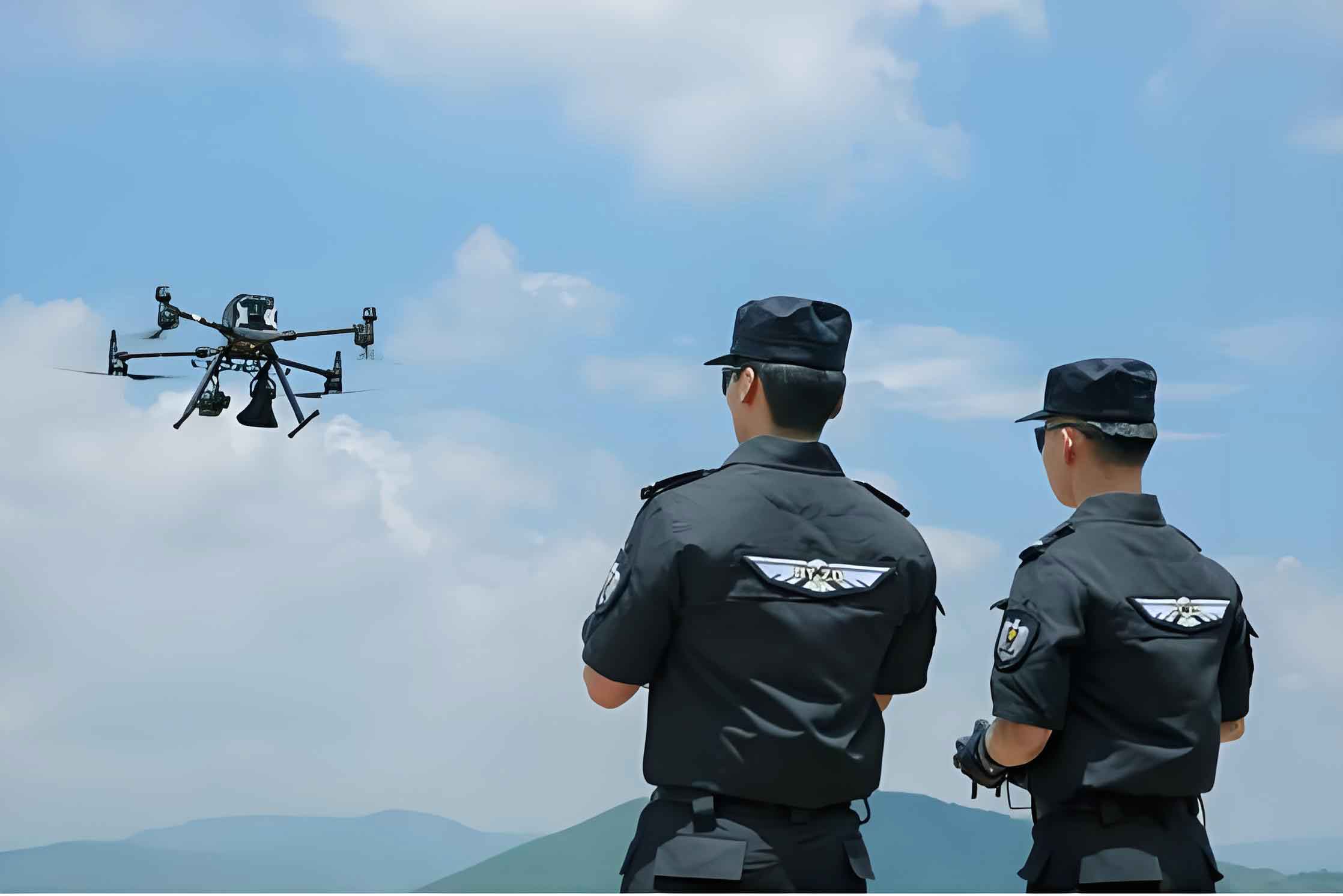
The image above illustrates a typical police drone used in highway scenarios, showcasing its compact design and operational readiness. In my design approach, I emphasize that police drones must be tailored for highway rescue, incorporating both aesthetic and functional elements.
Design Requirements for Police Drone Platform
Based on my analysis of highway rescue needs, I propose specific design requirements for police drones. These encompass造型 and functional aspects, ensuring that police drones are effective and authoritative in their operations.
造型 Design Requirements
The造型 of police drones should balance aerodynamics and professionalism. Inspired by biomimicry, as seen in early aircraft, police drones can feature streamlined forms to minimize wind resistance and extend flight duration. Given their limited fuel capacity, optimizing structure is crucial. Moreover, police drones should exhibit a authoritative appearance, consistent with highway traffic systems, to command respect and deter violations. The aerodynamic efficiency can be represented by the drag coefficient formula:
$$ C_d = \frac{2F_d}{\rho v^2 A} $$
where \( C_d \) is the drag coefficient, \( F_d \) is the drag force, \( \rho \) is air density, \( v \) is velocity, and \( A \) is reference area. Reducing \( C_d \) through sleek design enhances the police drone’s performance.
Functional Design Requirements
Police drones must integrate core technologies with additional modules for highway rescue. Beyond wireless remote sensing and perception avoidance, police drones should include loudspeakers for audible warnings and signal lights for traffic alerts. These features enable police drones to address the three emergency factors effectively. The functional scope can be summarized in a table:
| Function | Module | Purpose |
|---|---|---|
| Surveillance | High-resolution cameras, sensors | Real-time video transmission for scene assessment. |
| Communication | Loudspeakers, wireless transmitters | Issuing warnings and instructions to drivers. |
| Safety Alerts | LED signal lights, GPS tracking | Marking hazard zones and guiding traffic. |
The overall effectiveness of a police drone system can be evaluated using a multi-criteria formula. For instance, the utility function \( U \) for a police drone in rescue operations might be:
$$ U = \alpha \cdot S + \beta \cdot R + \gamma \cdot C $$
where \( S \) represents surveillance capability, \( R \) denotes response speed, \( C \) indicates cost-efficiency, and \( \alpha, \beta, \gamma \) are weighting factors based on highway priorities.
Rescue Process Design with Police Drones
Implementing police drones in highway rescue requires a systematic workflow. I have designed a rescue process that integrates police drones from alert reception to on-site management, ensuring seamless coordination with human responders. The process involves three modes tailored to emergency types, as depicted in the flowchart below.
The rescue system initiates when a distress signal is sent via a mobile app to the highway police control center. The control center dispatches nearby police and activates a police drone based on GPS location. The police drone operates in one of three modes, each with a specific sequence:
- Mode 1: Vehicle故障 Response – For issues like tire bursts or brake failures, the police drone tracks the affected vehicle, warns surrounding traffic, and isolates the area until rescue teams arrive.
- Mode 2: Accident Scene Management – In cases of collisions or追尾, the police drone arrives first to capture images, assess damage, and guide traffic to keep emergency lanes clear.
- Mode 3: Traffic Congestion Control – During heavy congestion or post-accident jams, the police drone provides real-time指挥 via loudspeakers and live feeds, aiding in疏导.
To quantify the process efficiency, we can use a time-based model. Let \( T_{total} \) be the total rescue time, composed of:
$$ T_{total} = T_{alert} + T_{drone\_flight} + T_{assessment} + T_{human\_response} $$
By optimizing \( T_{drone\_flight} \) and \( T_{assessment} \) through police drone deployment, overall救援时间 is minimized. Empirical data from pilot projects could validate this, but theoretical models suggest significant improvements with police drones.
Furthermore, the integration of police drones into existing highway infrastructure can be represented as a network flow problem. Consider a graph \( G = (V, E) \), where vertices \( V \) represent rescue points, and edges \( E \) denote paths for police drones. The objective is to minimize travel time for police drones to cover all critical points, expressed as:
$$ \min \sum_{e \in E} c_e x_e $$
subject to coverage constraints, where \( c_e \) is travel cost and \( x_e \) is a binary variable for edge usage. This formulation underscores the logistical benefits of police drones in highway networks.
Conclusion and Future Perspectives
In conclusion, police drones hold immense promise for revolutionizing highway rescue systems. My exploration of design requirements and process workflows highlights how police drones can address vehicle, human, and traffic factors effectively. By leveraging advanced technologies and tailored functionalities, police drones enhance response speed, reduce accidents, and support highway police in their demanding roles.
However, the widespread adoption of police drones faces challenges, including regulatory frameworks and technical refinements. Future research should focus on enhancing police drone autonomy, extending battery life, and integrating artificial intelligence for predictive analytics. As I envision it, police drones will become integral to smart highway management, fostering safer and more efficient travel.
The journey of police drones in civilian applications is ongoing, and my contributions aim to spur innovation in this field. By continuing to refine police drone systems, we can pave the way for a future where highway emergencies are mitigated swiftly, saving lives and resources. The formulas and tables presented herein serve as a foundation for further analysis, encouraging interdisciplinary collaboration to realize the full potential of police drones.
Ultimately, the success of police drones in highway rescue hinges on continuous improvement and adaptation. As technology evolves, so too will the capabilities of police drones, making them indispensable tools in public safety. I remain committed to advancing this cause through design and research, ensuring that police drones deliver tangible benefits to society.