
In the current era of rapid technological advancement and modernization in law enforcement, the application of police drones in mountainous areas has become increasingly critical. As a researcher and practitioner in this field, I have observed that traditional policing equipment often falls short in the complex and variable terrain and climate of mountainous regions. Police drones, with their flexibility and mobility, have filled this gap, becoming indispensable tools for tasks such as search and rescue. Their efficient response capabilities not only enhance the efficiency and safety of police work but also offer unique advantages in handling emergencies. By equipping advanced sensors, police drones can collect and transmit real-time environmental data, providing comprehensive information support to optimize decision-making processes. Therefore, in-depth study of police drone applications in mountainous environments is essential for advancing police modernization and improving emergency response capabilities.
Mountainous regions present a variety of task types where police drones play a pivotal role. The most common include search and rescue, criminal apprehension, and monitoring patrols. Each of these tasks leverages the unique capabilities of police drones to overcome the challenges posed by rugged landscapes. For instance, in search and rescue operations, police drones can quickly cover vast areas, while in criminal searches, they provide aerial surveillance that is difficult to achieve with ground-based methods. Below, I will elaborate on these task types, supported by tables and formulas to summarize key aspects.
Task Types for Police Drones in Mountains
The versatility of police drones allows them to adapt to multiple mission profiles in mountainous settings. Based on my experience, I categorize these into three primary types, each with distinct requirements and benefits.
Search and Rescue
Search and rescue operations in mountainous and disaster-stricken areas are of paramount importance. These regions often feature complex terrain and harsh weather conditions, posing significant challenges to traditional rescue efforts. Police drones, with their rapid response and wide-area coverage, have become key tools in such cases. In my work, I have utilized police drones equipped with various sensors to monitor disaster situations, detect human locations, and provide detailed on-site data. These drones transmit real-time images and videos to rescue teams, aiding in the formulation of effective strategies. Additionally, police drones can carry medical supplies, communication devices, and other essentials to offer basic first aid and support to trapped individuals, thereby reducing casualties. The effectiveness of police drones in search and rescue can be quantified using metrics like coverage area and response time. For example, the coverage area \(A\) of a police drone in a search mission can be modeled as:
$$ A = v \times t \times w $$
where \(v\) is the drone’s velocity, \(t\) is the flight time, and \(w\) is the sensor sweep width. This formula helps in planning optimal search paths for police drones.
| Role | Key Functions | Typical Sensor Payloads |
|---|---|---|
| Initial Assessment | Rapid scene evaluation, hazard detection | HD cameras, thermal imaging |
| Target Identification | Locating missing persons, marking positions | Infrared sensors, zoom lenses |
| Data Relay | Transmitting real-time footage to command centers | Communication modules, LTE/5G links |
Criminal Apprehension
Police drones are highly effective in apprehending criminals in mountainous environments. In recent years, criminals with enhanced counter-surveillance abilities have increasingly sought refuge in remote mountainous areas to evade capture. The vast, open terrain of mountains makes traditional policing difficult, but police drones overcome this with capabilities like thermal imaging, infrared technology, and high-resolution cameras. From my perspective, these drones provide aerial oversight and continuous monitoring, enabling law enforcement to detect hideouts, track movements, and pinpoint final locations. The use of police drones in such operations reduces risks to officers and increases success rates. For instance, the probability \(P\) of detecting a criminal using a police drone can be expressed as:
$$ P = 1 – e^{-\lambda \cdot A \cdot t} $$
where \(\lambda\) is the detection rate per unit area, \(A\) is the area covered, and \(t\) is the time spent. This exponential model underscores the efficiency of police drones in expansive searches.
Monitoring Patrols
For monitoring and patrol duties in mountains, police drones offer high efficiency and low risk. They provide data for border control, crime surveillance, and disaster prevention. In my deployments, police drones with high-definition cameras have captured subtle changes in vegetation and terrain, enabling early detection of natural hazards or suspicious activities. Key considerations include reporting anomalies such as unusual human behavior, traffic patterns, or potential criminal signs. Police drones facilitate continuous oversight, enhancing overall situational awareness. The table below summarizes monitoring parameters for police drones in mountainous patrols.
| Parameter | Description | Optimal Range for Police Drones |
|---|---|---|
| Flight Altitude | Height above ground for clear visibility | 50-200 meters |
| Camera Resolution | Detail capture for identification | 4K or higher |
| Patrol Frequency | How often areas are scanned | Daily or real-time based on threat level |
Challenges in Mountainous Applications
Despite their advantages, police drones face numerous challenges in mountainous environments. From my firsthand experience, these include complex terrain, variable weather, poor communication, and limited endurance, all of which increase operational difficulty and risk.
Complex Terrain
Mountainous terrain is often rugged, with steep peaks, deep valleys, cliffs, and other obstacles. Unlike flat areas, mountains may have natural wind channels and lack clear landmarks, complicating navigation and positioning for police drones. This can lead to system failures, collisions, or crashes. For example, the presence of obstacles requires advanced obstacle avoidance algorithms, which I have implemented using sensor fusion techniques. The risk \(R\) of collision for a police drone in such terrain can be modeled as:
$$ R = \frac{O_d}{T_v} $$
where \(O_d\) is the obstacle density and \(T_v\) is the terrain visibility. This highlights the need for robust path planning for police drones.
Variable Weather Conditions
Weather in mountains is highly unpredictable, with strong winds, heavy fog, and rain posing threats to police drone stability. These conditions can disrupt flight trajectories, reduce sensor performance, and limit operational effectiveness. In my operations, I have encountered situations where sudden gusts affected drone control, necessitating adaptive flight systems. The impact of weather on police drone efficiency can be quantified using a degradation factor \(D_w\):
$$ D_w = \alpha \cdot W_s + \beta \cdot V_f $$
where \(W_s\) is wind speed, \(V_f\) is visibility factor, and \(\alpha, \beta\) are coefficients based on drone design. This emphasizes the importance of weather-resistant police drones.
Poor Communication Environment
Communication in mountains is often hindered by terrain and environmental interference, leading to signal loss or delays between police drones and ground control. Additionally, infrastructure like power lines can disrupt links, affecting data transmission. From my experience, enhancing communication reliability is crucial for police drone operations. The signal strength \(S\) for a police drone in mountainous areas can be approximated as:
$$ S = S_0 \cdot e^{-k \cdot d} $$
where \(S_0\) is the initial signal strength, \(k\) is the attenuation coefficient, and \(d\) is the distance. This exponential decay underscores the need for strong communication systems in police drones.
Endurance and Supply Difficulties
Police drone endurance is a critical factor in mountainous missions. High altitude, variable weather, and wind increase energy consumption, requiring longer flight times to cover large areas. Moreover, limited access to charging stations in remote mountains complicates logistics. In my work, I have addressed this by optimizing battery usage and planning supply points. The endurance \(E\) of a police drone can be expressed as:
$$ E = \frac{C_b}{P_c} $$
where \(C_b\) is the battery capacity and \(P_c\) is the power consumption rate. Improving this ratio is key for extended police drone missions.
| Challenge | Impact on Police Drone | Mitigation Strategies |
|---|---|---|
| Complex Terrain | Navigation errors, collision risks | Advanced sensors, terrain mapping |
| Variable Weather | Reduced stability, sensor degradation | Weatherproofing, adaptive control |
| Poor Communication | Signal loss, data delay | Redundant links, signal boosters |
| Endurance Issues | Limited mission duration | High-capacity batteries, solar options |
Solutions for Effective Police Drone Deployment
To overcome these challenges, I have developed and implemented solutions focusing on drone selection, path planning, multi-drone coordination, team establishment, and emergency response systems. These approaches ensure that police drones operate safely and efficiently in mountainous complexities.
Police Drone Selection and Configuration
Selecting the right police drone is foundational for mountainous applications. In my practice, I categorize police drones into fixed-wing and multi-rotor types, each with distinct advantages. Fixed-wing police drones excel in long-range, high-speed searches, while multi-rotor police drones offer better maneuverability in tight spaces. The table below compares these types for police drone deployments.
| Feature | Fixed-Wing Police Drone | Multi-Rotor Police Drone |
|---|---|---|
| Endurance | Long (2+ hours) | Short (30-60 minutes) |
| Speed | High (50-100 km/h) | Low (10-30 km/h) |
| Maneuverability | Limited, requires runway | High, vertical take-off/landing |
| Best Use Case | Large-area surveillance | Precision tasks in confined areas |
Beyond type, configuring police drones with advanced sensors—such as HD cameras, thermal imagers, and radar—enhances data fusion for better monitoring. I also prioritize communication strength, using high-gain antennas and amplifiers to maintain stable links. The overall suitability \(S_u\) of a police drone for mountainous tasks can be calculated as:
$$ S_u = w_1 \cdot E + w_2 \cdot M + w_3 \cdot C $$
where \(E\) is endurance, \(M\) is maneuverability, \(C\) is communication capability, and \(w_1, w_2, w_3\) are weighting factors based on mission requirements.
Optimized Path Planning
Path planning is critical for police drones in mountains. I employ algorithms that incorporate terrain perception and obstacle avoidance, using sensors like LiDAR and cameras to map environments. These algorithms adjust paths based on priorities, terrain features, and weather. For example, a cost function \(C(p)\) for path planning can be defined as:
$$ C(p) = \int_{p} \left( \alpha \cdot \text{terrain\_risk}(x) + \beta \cdot \text{weather\_impact}(x) \right) dx $$
where \(p\) is the path, and \(\alpha, \beta\) are tuning parameters. Minimizing \(C(p)\) ensures safe and efficient routes for police drones. In my work, I have used such models to plan paths that avoid cliffs and dense forests, maximizing coverage for police drones.
Enhanced Multi-Drone Coordination
Single police drones may struggle in complex missions, so I advocate for multi-drone coordination. By leveraging swarm technology, multiple police drones can collaborate—for instance, one drone conducts broad surveillance while others perform detailed searches in valleys or forests. This improves coverage and efficiency. The coordination efficiency \(E_c\) for \(n\) police drones can be expressed as:
$$ E_c = \frac{\sum_{i=1}^{n} A_i}{T \cdot n} $$
where \(A_i\) is the area covered by drone \(i\), and \(T\) is the total time. This shows how police drone teams outperform solo operations.
Establishment of Police Aviation Teams
Forming specialized police aviation teams is key to managing police drones in mountains. From my experience, these teams should include commanders, path planners, pilots, and support staff. Each role contributes to mission success: commanders oversee strategy, planners design optimal routes, pilots operate police drones, and support personnel maintain equipment. The synergy within such teams enhances the operational readiness of police drones. I have structured teams with clear protocols to ensure rapid deployment and adaptability.
Real-Time Emergency Response and Coordinated Dispatch
Integrating police drones into real-time emergency systems allows for quick response and coordination with other agencies like fire or medical services. In my implementations, police drones provide initial assessments and data transmission to command centers, enabling informed decisions. A dispatch model for police drones can be formulated as:
$$ \text{ResponseTime} = \frac{D}{V_d} + \Delta t $$
where \(D\) is the distance to the incident, \(V_d\) is the drone velocity, and \(\Delta t\) is the processing delay. Minimizing this time is a goal for police drone deployments.
Application Case Study
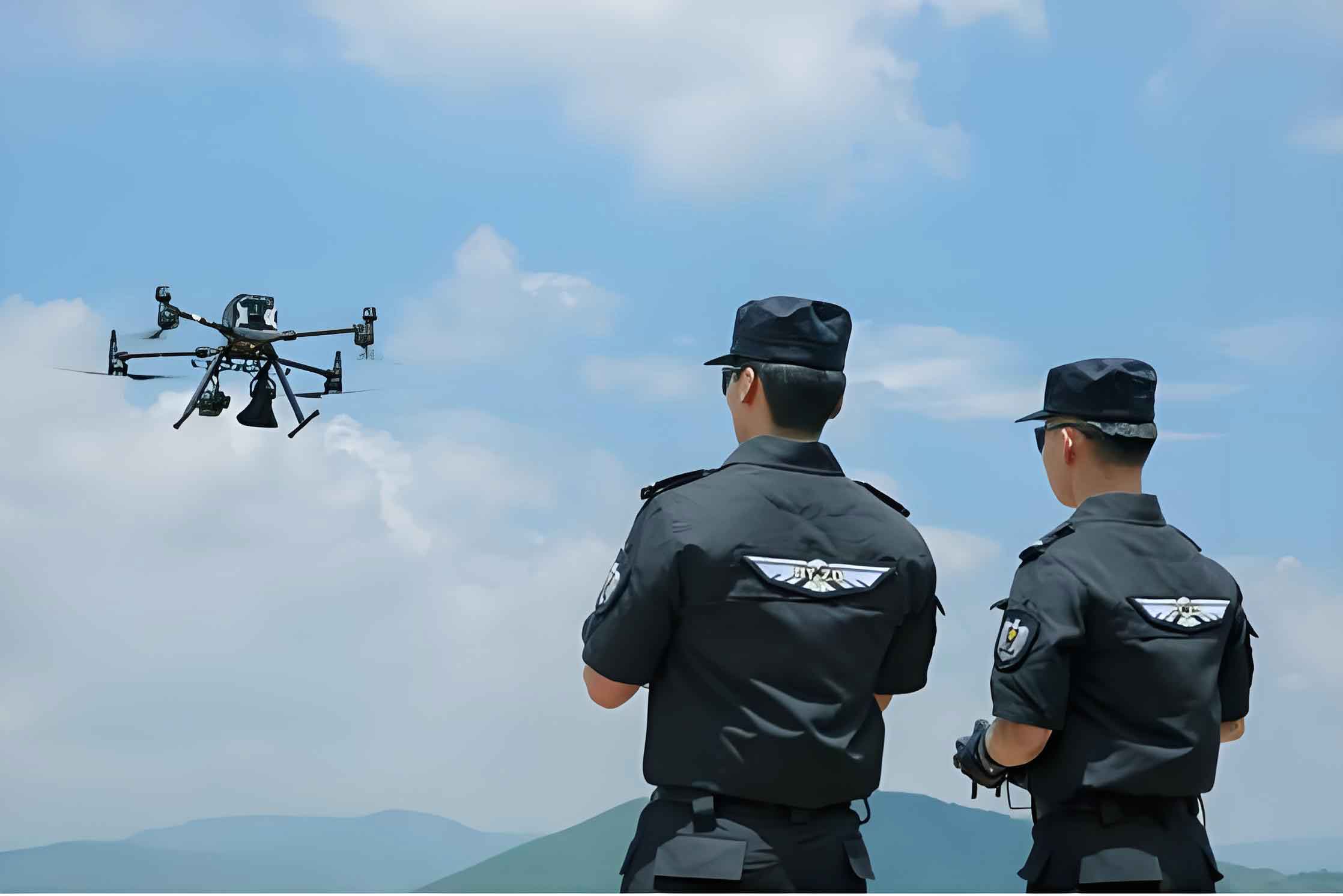
A practical example from my involvement illustrates the value of police drones in mountainous search and rescue. In 2023, a local police department received a report of an elderly person missing in a mountainous area after farm work. Traditional search methods were slow due to the terrain, so a police aviation team was activated. Using thermal-imaging police drones and lighting equipment, we conducted a coordinated search with multiple police drones. One drone scanned broadly while others focused on dense forest areas. The thermal sensors on the police drones detected the individual’s heat signature, leading to a successful rescue. This case underscores how police drones, with their aerial perspective and sensor capabilities, can significantly improve outcomes in mountainous emergencies. The efficiency gain from using police drones was evident in the reduced search time and enhanced safety for responders.
Conclusion and Future Outlook
In summary, police drones have demonstrated immense potential in mountainous policing activities. From search and rescue to criminal apprehension, police drones address the unique challenges of these environments. However, hurdles like terrain complexity and communication issues persist, requiring ongoing innovation. Based on my research, future advancements in police drone technology—such as improved path planning algorithms, more sensitive sensors, and autonomous capabilities—will expand their applicability. The integration of artificial intelligence could enable police drones to make real-time decisions, further boosting efficiency. As we continue to refine police drone systems and train specialized teams, their role in mountainous regions will grow, offering greater support for law enforcement and public safety. The journey of police drones in mountains is just beginning, and I am optimistic about their evolving contributions.
To encapsulate key points, I present a final formula summarizing the effectiveness \(F\) of police drones in mountainous applications:
$$ F = \sum_{i=1}^{n} \left( \gamma_i \cdot T_i \cdot \eta_i \right) $$
where \(T_i\) represents task types, \(\gamma_i\) are weighting factors for mission priority, and \(\eta_i\) are efficiency metrics for police drones. This holistic view reinforces the multifaceted value of police drones in challenging terrains.