
Chemical industrial parks, characterized by high temperatures, high pressures, and dense concentrations of toxic and hazardous substances, are inherently prone to risks such as flammable and explosive materials and toxic gas leaks. Traditional manual inspection methods suffer from low efficiency, high risk, and insufficient coverage. In recent years, Unmanned Aerial Vehicles (UAV drones) have gradually emerged as a valuable tool for chemical safety inspection due to their flexibility and extensive monitoring range. Equipped with high-precision gas sensors and thermal imaging equipment, these UAV drones can rapidly detect abnormal concentrations of harmful gases and equipment temperatures, thereby significantly enhancing inspection efficiency. However, within complex chemical environments, the return path planning for UAV drones faces numerous challenges. Traditional fixed-route return methods struggle to adapt to dynamically changing risks, often leading to collisions or crashes of the UAV drones. During multi-UAV drones coordinated return, issues such as communication delays and uneven energy consumption become more pronounced. Furthermore, UAV drones often lack a reliable data-driven mechanism for real-time obstacle avoidance and path re-planning.
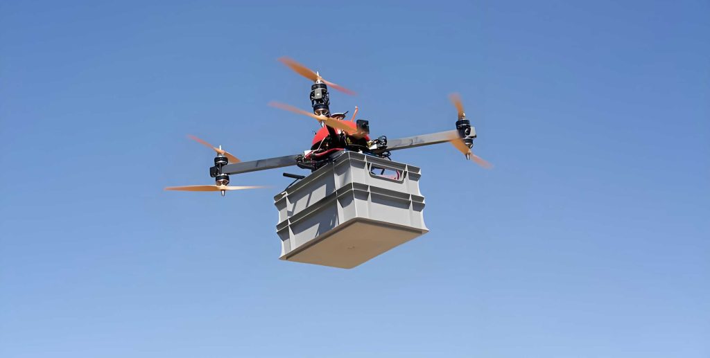
Addressing the aforementioned problems, this article proposes a dynamic optimization method for the return path of UAV drones in chemical safety applications. The core components include: integrating real-time hyperspectral monitoring with historical data to construct a dynamic identification model for hazardous road segments, thereby improving risk warning accuracy; designing a spectral-path collaborative optimization mechanism that enhances the A* algorithm to generate risk-weighted paths, enabling proactive avoidance of sudden leaks and high-temperature zones; and proposing a master-slave formation strategy combined with an adaptive energy consumption scheduling model to reduce the overall energy consumption of the UAV drones cluster and extend its endurance. Experiments demonstrate that this method can significantly enhance the safety of UAV drones during return, providing robust technical support for intelligent inspection in high-risk chemical environments.
Current Application Status of UAV Drones in the Chemical Sector
Existing research indicates that UAV drones equipped with high-precision gas sensors for detecting harmful gases such as hydrogen sulfide and volatile organic compounds have become a significant application direction in the chemical field. These sensors are highly sensitive and accurate, capable of rapidly detecting concentrations of harmful gases within complex chemical environments. Through aerial inspection by UAV drones, comprehensive, three-dimensional monitoring of chemical areas can be achieved, providing critical data for personnel evacuation, accident warning, and emergency response. This significantly improves the safety of chemical production and reduces the risk of hazardous gas leakage incidents.
Furthermore, UAV drones are widely used for thermal imaging inspection of chemical equipment. Thermal imaging technology can capture the surface temperature distribution of equipment in real-time, promptly identifying abnormal areas to prevent fire and explosion risks. In chemical production, equipment overheating can easily trigger accidents. UAV drones-based thermal imaging inspections enable non-contact, long-distance monitoring of equipment, improving inspection efficiency and accuracy. This aids in the timely discovery and handling of equipment hazards, ensuring the stable operation of chemical production.
Although UAV drones have achieved significant results in gas detection and thermal imaging inspection within the chemical field, numerous challenges remain in practical application. The planning of the return path for UAV drones is a pressing issue that requires resolution. Chemical plant areas feature complex environments with numerous obstacles and interfering factors. Ensuring that UAV drones can safely and efficiently return to their launch point after completing tasks is a current technical difficulty. While existing path-planning algorithms have been applied in practice, they still exhibit limitations when dealing with complex chemical environments. There is an urgent need for new technical solutions to further enhance the overall performance of UAV drones in chemical settings.
Technical Framework for Optimizing UAV Drones Return Path
During the return phase, the flight path and recorded data from the UAV drones are acquired to analyze factors influencing the return journey and to identify multiple hazardous road segments. First, basic return control is executed based on the flight path and a preset tracking distance, with real-time positioning data obtained. Next, based on the positioning data, the current hazardous road segment and its distance are determined, the required number of formation passages is calculated, and the returning formation groups are partitioned. Finally, escort monitoring UAV drones are selected to provide护航 at the entry or exit points of the hazardous road segment, and optimized control is applied to the returning formation groups.
Dynamic Identification of Hazardous Road Segments
Combining the layout of chemical facilities and historical accident data, three categories of hazardous road segments are defined: static, dynamic, and composite (see Table 1). Among these, dynamic hazardous road segments, due to their unpredictability, impose higher demands on the return path planning for UAV drones.
| Hazard Segment Type | Risk Source | Specific Examples | Challenge to UAV Drones |
|---|---|---|---|
| Static Hazard Segment | Fixed Facilities | Thermal radiation from high-temperature reactors, explosive pressure from high-pressure pipelines | Affects electronic devices, power systems; can cause battery failure or airframe damage. |
| Dynamic Hazard Segment | Factors changing based on real-time monitoring data | Trends in gas leak diffusion, changes in temporary construction zones | Interferes with sensor accuracy and communication stability, increasing return risk. |
| Composite Hazard Segment | Superimposition of static and dynamic factors | Areas with concurrent corrosive gas leaks and electromagnetic interference | Corrodes外壳, damages components, interferes with navigation; reduces structural strength, induces positioning偏差. |
Based on data from hyperspectral sensors and infrared cameras, real-time monitoring of risks such as gas leaks and temperature anomalies in chemical plant areas is conducted. This is integrated with historical accident data to build a hazard source distribution model. By analyzing UAV drones flight records and real-time positioning data, hazardous road segments near potential leak points, high-temperature zones, etc., within the return path are identified, and the hazardous road segment database is dynamically updated.
Collaborative Partitioning of Return Formations
Multiple returning UAV drones are divided into several return formation groups. Based on the actual distance of the current road segment and a pre-set return tracking distance, the required number of formation passages is precisely calculated.
The number of formation passages is calculated according to the current road segment distance and the return tracking distance, as shown in Equation (1).
$$ N = \left\lceil \frac{L_A}{L_B} \right\rceil + 1 $$
Where: $N$ is the number of formation passages; $L_A$ is the current road segment distance; $L_B$ is the return tracking distance.
Based on the precise number of formation passages, the returning UAV drones are initially and reasonably partitioned to establish several basic passage formations. Combined with a predetermined queue order, the escort readiness of these basic passage formations is further optimized and adjusted, ultimately determining multiple efficient and orderly return passage formations.
Spectral-Path Closed-Loop Optimization
Spectral-path collaborative optimization enhances the safety and efficiency of UAV drones returning in complex chemical environments by integrating hyperspectral data with dynamic path planning. Its core functions include: 1) Real-time identification of risks such as gas leaks and temperature anomalies to avoid explosion hazards; 2) Reducing the monitoring energy consumption of the UAV drones cluster to enhance endurance; 3) Achieving closed-loop feedback between risk data and path decision-making, strengthening the system’s real-time responsiveness.
Based on the absorption spectra of gases such as H₂S and CH₄ collected in real-time by hyperspectral sensors, combined with the Beer-Lambert law to invert concentration distributions, a hazard source heat map is generated. The system performs collaborative optimization in the following steps: First, data-driven path planning is conducted. The coordinates of hazard sources are input into an improved A* algorithm, which uses risk level as a weighting factor to dynamically generate detour paths. Second, formation协同 control is carried out. Returning formations are partitioned according to the length of the hazardous road segment. Escort UAV drones are deployed at the entry/exit points to perform monitoring tasks, while the remaining formations fly along the optimized path in a low-power mode to reduce active sensing energy consumption. Finally, real-time closed-loop updating is performed. Monitoring data from the escort UAV drones is transmitted back via 5G networks, triggering path re-planning to ensure dynamic adjustment of the flight轨迹 under突发 risks such as secondary leaks.
Key Technologies for UAV Drones Return Path Optimization in Chemical Environments
Real-time Monitoring of Hazardous Road Segments
Escort UAV drones are equipped with hyperspectral sensors and long-wave infrared thermal imagers to construct a multi-modal perception system. This system integrates hyperspectral imaging and infrared thermal imaging technologies to achieve comprehensive monitoring of hazardous road segments. Hyperspectral imaging technology can capture characteristic absorption peaks of specific gases, such as H₂S at 1.38 μm and CH₄ at 1.65 μm. Combined with the Beer-Lambert law, the gas concentration distribution is inverted.
The infrared thermal imager is used to detect temperature anomalies, such as pipeline surface temperatures exceeding the safety threshold of 300°C, and to generate thermal gradient maps.
To achieve precise monitoring, a spectral-visual协同 algorithm based on multi-source data fusion is proposed: First, data alignment and noise reduction are performed. Affine transformation is used for spatial registration of hyperspectral data and infrared images, and wavelet transform is applied to eliminate environmental noise. Second, feature fusion and classification are conducted. Convolutional Neural Networks (CNNs) are used to extract spectral and infrared features, which are then input into a Random Forest model for classification into low/medium/high risk levels. Third, dynamic visualization and decision-making are enabled. RGB-HSI fusion technology maps invisible gas leaks onto pseudo-color overlay images. Combined with a digital twin platform, a three-dimensional risk map is constructed.
Experimental results show that the gas recognition accuracy reaches 98.2%, which is a relative improvement of 15% compared to traditional electrochemical sensors; the response time for temperature anomaly detection is less than 0.5 seconds, representing a 60% improvement in response speed compared to traditional methods, meeting the requirements for real-time monitoring. When the system detects a high-risk area, it can generate obstacle avoidance commands in real-time through edge computing nodes. These commands are then issued to the UAV drones cluster via a 5G network, triggering dynamic adjustment of the flight path. These experimental results fully verify the effectiveness and reliability of the system.
Energy Optimization and Endurance Assurance
A “master-slave” formation partitioning strategy is adopted, where only the escort UAV drones perform high-power-consumption monitoring tasks, while the remaining UAV drones maintain low-power flight. An improved Hungarian algorithm is used to dynamically match escort UAV drones with ordinary UAV drones, considering factors such as remaining battery power, monitoring task priority, and environmental risk level. Escort UAV drones are equipped with high-power-consumption devices such as hyperspectral sensors, infrared thermal imagers, and 5G communication modules, responsible for real-time monitoring and data transmission of hazardous road segments. Ordinary UAV drones perform only basic navigation tasks, with non-essential sensors turned off to reduce energy consumption.
To further optimize energy consumption, an adaptive battery scheduling model is employed. This model dynamically adjusts flight speed ($v$) and task cycle ($T$) based on the return distance ($D_{return}$) and remaining battery power ($E_{remain}$). The constraints satisfied by the model are shown in Equation (2).
$$ E_{remain} \geq \alpha \cdot D_{return} \cdot v^{-1} + \beta \cdot T $$
Where: $\alpha$ is the energy consumption coefficient and $\beta$ is the task load coefficient, determined through offline calibration experiments. Through this model, UAV drones can intelligently adjust their flight speed and task cycle based on their current status and mission requirements to achieve optimal energy consumption.
To reduce communication energy consumption, a lightweight communication protocol based on Long Range Radio (LoRa) is studied. Ordinary UAV drones adopt a sleep-wake mechanism, activating the communication module only when receiving path update instructions. This reduces standby power consumption to 2.1 W, a 65% reduction compared to traditional Wi-Fi protocols. This design effectively reduces the energy consumption of UAV drones in standby mode, improving their endurance (see Table 2).
| Metric | Traditional Full-Node Monitoring Mode | Proposed Optimization Scheme | Improvement/Comparison |
|---|---|---|---|
| Overall Cluster Energy Consumption Reduction (%) | — | 32.7 | 32.7% reduction compared to traditional mode. |
| Average Power Consumption of Escort UAV Drones (W) | 192.0 | 128.5 | 33.1% power reduction. |
| Average Power Consumption of Ordinary UAV Drones (W) | 85.6 | 38.2 | 55.4% power reduction. |
| Maximum Return Distance (km) | 8.2 | 9.5 | 15.9% distance increase. |
| Single UAV Drone Endurance Time (min) | 33.5 | 42.0 | 25.4% endurance extension. |
| Packet Loss Rate under Strong Electromagnetic Interference (%) | 4.8 | 1.2 | 75% reduction in packet loss. |
A comparative experiment was conducted in a simulated chemical plant area containing 10 dynamic hazardous road segments. The UAV drones cluster scale was 20 units, including 4 escort UAV drones. Experiments showed that compared to the traditional full-node monitoring mode, the difference in energy consumption primarily stemmed from variations in sensor load, resulting in a 32.7% reduction in overall cluster energy consumption. The average power consumption of escort UAV drones was 128.5 W, while that of ordinary UAV drones decreased to 38.2 W. With the same 6000 mAh battery capacity, the maximum return distance of the optimized UAV drones cluster increased from 8.2 km to 9.5 km, a 15.9% improvement. The single UAV drone endurance time extended to 42 minutes, a 25.4% increase. In environments with strong electromagnetic interference (field strength ≥30 V/m), the packet loss rate of the low-power communication protocol was only 1.2%, effectively ensuring the stability of command transmission.
Application Scenario Analysis
Chemical Plant Area Inspection and Return
After performing inspection tasks in high-risk chemical areas such as chlorine storage tank zones and reaction kettles, UAV drones intelligently adjust their return routes based on real-time gas concentration data to绕开 potential leak points. The equipped hyperspectral sensors and infrared thermal imagers monitor gas concentration and temperature changes. Combined with past accident records, hazardous zones (such as areas near leak points and high-temperature regions) are identified and avoided to ensure flight safety. To ensure the safe return of the UAV drones cluster, the system assigns escort UAV drones to each group based on the position of each UAV drone and the estimated return path. These escorts monitor the critical road segments during the entry and exit of the formation, responding to potential risks. Furthermore, the UAV drones achieve intelligent synergy between spectral data and path planning. By deeply analyzing hyperspectral data in real-time, their flight routes are adjusted to effectively avoid newly emerging risk points, reducing the probability of collisions or crashes and ensuring the efficiency and safety of UAV drones operations.
Hazardous Material Transport Monitoring
In missions transporting toxic chemicals, the UAV drones cluster exhibits high safety and intelligence. During the return journey, multi-spectral imaging technology is utilized to assess potential threats along the transport route periphery. Flight parameters are flexibly adjusted to prevent collisions and leakage accidents. The system can also integrate terrain data to automatically generate three-dimensional obstacle avoidance paths, precisely绕开 obstacles and危险 areas. This ensures the safe and efficient transport of toxic chemicals, setting a new safety benchmark for hazardous material transportation.
Accident Emergency Response
Following an accident at a chemical plant, the UAV drones cluster responds swiftly to execute data collection tasks. During the return process, infrared thermal imaging technology is leveraged to avoid high-temperature fire sources, ensuring flight safety. Simultaneously, key collected data is transmitted to the command center via a real-time communication network. This aids emergency teams in formulating precise emergency handling plans, highlighting the critical value of infrared thermal imaging technology and real-time communication networks.
Conclusion
Addressing the optimization problem of UAV drones return path planning in complex chemical environments, a multi-modal perception system utilizing hyperspectral sensors and infrared thermal imagers enables real-time monitoring and precise localization. Combined with an improved A* algorithm and a master-slave formation partitioning strategy, obstacle avoidance paths are dynamically generated and energy consumption分配 is optimized. Experiments demonstrate that in typical scenarios within chemical plant areas, this method achieves a hazardous road segment identification accuracy of 98.2%, increases path avoidance success rate to 95%, reduces overall cluster energy consumption by 32.7%, and extends single UAV drone endurance by 25.4%. Compared to traditional fixed-route modes, this research shows significant advantages in safety, efficiency, and adaptability, providing reliable technical support for chemical safety inspection using UAV drones.