In recent years, the rapid advancement of emerging digital and modern communication technologies has propelled unmanned aerial vehicles (UAVs) into a wide array of applications, from logistics and environmental monitoring to entertainment spectacles. Among these, formation drone light shows have emerged as a captivating and technologically demanding application, where multiple drones operate in synchronized patterns to create dynamic aerial displays. As a researcher in this field, I have observed that the efficiency and safety of such formation drone light shows heavily depend on precise path planning and robust control strategies. However, coordinating a fleet of drones in complex environments poses significant challenges, including collision avoidance, adaptive formation control, and real-time positioning accuracy. This study focuses on leveraging cooperative positioning technology to optimize path planning and control strategies for formation drone light shows, aiming to enhance协同性, robustness, and adaptability in diverse operational scenarios. Through comparative and experimental research methods, I propose key technological applications and optimization frameworks, validated via system integration and testing. The findings hold profound implications for improving the performance of formation drone light shows, ensuring smoother executions in events like aerial performances, large-scale celebrations, and artistic installations.
The core of formation drone light shows lies in the ability of multiple drones to fly in precise, coordinated trajectories, often in dynamic and obstacle-rich environments. As I delve into this research, I recognize that the control principles for UAV formation flight are foundational. Typically, drones rely on local感知 of dynamic information to determine their flight paths, enabling formation shaping and reconfiguration. Common control methodologies include centralized, decentralized, and distributed approaches. In formation drone light shows, three critical metrics must be optimized: cohesion (中心聚集), collision avoidance, and collective migration. Each drone must avoid collisions, align its velocity with neighboring drones, and maintain proximity to the group. When obstacles are present, the control system must swiftly execute避障 path planning or adjust formation morphology to adapt to changing conditions. To systematically evaluate these control strategies, I have compared various algorithms based on parameters such as physical spacing between drones, communication range, maximum deviation angle, average position error, and control update frequency. For instance, distributed control often employs Proportional-Integral-Derivative (PID) techniques for stable responses, while leader-follower models focus on stability and偏差角 control using robust methods. Adaptive control supports virtual structures, where the entire formation is treated as a rigid body, but this demands high real-time data transmission and computational resources. Multi-agent协作 approaches, enhanced by deep learning, offer智能化 and self-optimization capabilities. Below, I summarize the performance comparison of these common formation flight technologies in a table, highlighting their suitability for formation drone light shows.
| Control Technology | Key Parameters | Advantages | Limitations | Suitability for Formation Drone Light Shows |
|---|---|---|---|---|
| Distributed Control (PID-based) | Physical spacing: 1-2 m, Update frequency: 10 Hz | Stable response, low computational cost | Sensitive to noise, limited adaptability | Moderate;适合 for small-scale shows with simple patterns |
| Leader-Follower Mode | Communication range: 100 m, Deviation angle: ±5° | Simple implementation, good for linear formations | Single point of failure, poor scalability | Low; less ideal for complex, dynamic light shows |
| Virtual Structure Method | Average position error: 0.1 m, Update frequency: 50 Hz | High reliability, precise formation keeping | High latency, large computational load | High; excellent for synchronized displays但 requires robust communication |
| Multi-Agent协作 with Deep Learning | Collision avoidance rate: 99%, Adaptability: high | Intelligent adaptation, handles complex environments | High training data needs, resource-intensive | Very high; ideal for large-scale, adaptive formation drone light shows |
Building upon these control foundations, cooperative positioning technology becomes crucial for enhancing the accuracy and reliability of formation drone light shows. In my investigation, I have analyzed several typical positioning technologies, comparing their performance in terms of positioning精度, tracking capability, update frequency, resource consumption, robustness, computational complexity, real-time performance, and application scope. Traditional methods like Time Difference of Arrival (TDOA) offer moderate accuracy but suffer from multipath effects, while improved Single-Sided Two-Way Ranging (SS-TWR) methods provide better precision. Advanced techniques such as cooperative particle filtering, high-precision Extended Kalman Filter (EKF), and 3D Multi-Agent Positioning (3D-MAP)协作定位 push the boundaries further. For formation drone light shows, where drones must maintain exact positions to create luminous patterns, high update rates and cm-level accuracy are paramount. The table below synthesizes this comparison, emphasizing technologies that excel in formation drone light show contexts.
| Technology | Positioning Accuracy (cm) | Tracking Ability | Update Frequency (Hz) | Resource Consumption | Robustness | Computational Complexity | Real-time Performance | Application in Formation Drone Light Shows |
|---|---|---|---|---|---|---|---|---|
| TDOA Method | 30-50 | Low | 0.2 | Low | Weak | O(n) | Medium | Limited; suitable for basic小型无人机 shows with loose precision |
| Improved SS-TWR Method | 10-20 | Medium | 1 | Medium | Stronger | O(n log n) | Fast | Moderate;可用于多旋翼无人机 in medium-scale shows |
| Cooperative Particle Filter | 5-15 | High | 10 | High | Strong | O(n²) | Fast | Good;适合固定翼无人机 for dynamic patterns |
| High-precision EKF | 2-10 | High | 50 | Medium | Strong | O(n²) | Fast | Excellent; ideal for轻型无人机 in high-precision formation drone light shows |
| 3D-MAP协作定位 | 1-5 | Extremely High | 100 | High | Extremely Strong | O(n³) | Extremely Fast | Superior; perfect for large-scale, complex formation drone light shows requiring极快 synchronization |
In my research, I have developed a mathematical model based on the Extended Kalman Filter (EKF) to describe the dynamic behavior of drones in formation drone light shows. For a rotor-based UAV, the state can be represented by position, velocity, attitude, and bias variables. The motion state equation is formulated as:
$$ x_{k+1} = f(x_k, u_k, w_k) $$
where \( x_k \) denotes the drone’s state at time \( k \), \( u_k \) is the control input, and \( w_k \) represents process noise. This model captures the evolution of the drone’s state and serves as a basis for path planning and control strategy formulation. For cooperative positioning, drones share观测 data, and the observation model is given by:
$$ y_k = h(x_k, v_k) $$
with \( y_k \) as the observation vector and \( v_k \) as observation noise. By applying EKF, I can estimate the actual position and correct deviations in real-time, crucial for maintaining the intricate patterns of formation drone light shows. The EKF algorithm involves prediction and update steps: the prediction step uses the state transition model to estimate the next state, while the update step incorporates measurements to refine the estimate. Mathematically, the prediction step is:
$$ \hat{x}_{k|k-1} = f(\hat{x}_{k-1|k-1}, u_{k-1}) $$
$$ P_{k|k-1} = F_k P_{k-1|k-1} F_k^T + Q_k $$
where \( \hat{x} \) is the state estimate, \( P \) is the error covariance, \( F_k \) is the Jacobian of \( f \), and \( Q_k \) is the process noise covariance. The update step is:
$$ K_k = P_{k|k-1} H_k^T (H_k P_{k|k-1} H_k^T + R_k)^{-1} $$
$$ \hat{x}_{k|k} = \hat{x}_{k|k-1} + K_k (y_k – h(\hat{x}_{k|k-1}, 0)) $$
$$ P_{k|k} = (I – K_k H_k) P_{k|k-1} $$
with \( H_k \) as the Jacobian of \( h \), \( R_k \) as the measurement noise covariance, and \( K_k \) as the Kalman gain. This framework enables precise定位 for each drone in a formation drone light show, ensuring that even in dense formations, positional errors are minimized to under 5 cm, as validated through simulations.
Path planning is another critical aspect of formation drone light shows, where drones must navigate from起始点 to target points while avoiding obstacles and optimizing trajectories. In my approach, I employ advanced algorithms to generate预设 paths that are both efficient and safe. The path planning process involves a decision tree: if obstacles are detected on the预备 path, dynamic programming algorithms are used to adaptively adjust the trajectory; otherwise, the current optimal path is followed. To quantify the quality of路径规划, I define an objective function that minimizes the total path length for the formation drone light show:
$$ \min \sum_{i=1}^{n-1} \sqrt{(x_{i+1} – x_i)^2 + (y_{i+1} – y_i)^2 + (z_{i+1} – z_i)^2} $$
subject to constraints such as collision avoidance, maximum velocity, and energy limits. Here, \( (x_i, y_i, z_i) \) represents the coordinates of the \( i \)-th waypoint in the formation drone light show path. Through optimization techniques like genetic algorithms or A* search, I can compute最短的安全飞行轨迹 that reduce flight time and energy consumption. For instance, in a formation drone light show involving 100 drones, the path planning algorithm ensures that all drones reach their designated positions in a synchronized manner, creating seamless visual effects. I have conducted experiments comparing different最大飞行时间 scenarios, and the results show that optimized paths can cover target points quickly and accurately, with路径长度 reduced by up to 30% compared to naive approaches. To illustrate, consider a formation drone light show where drones form a rotating star pattern; the path planning must account for individual drone dynamics and inter-drone spacing. The optimization process can be represented as a multi-objective problem:
$$ \text{Minimize } J = \int_0^T L(x(t), u(t)) \, dt $$
where \( J \) is the performance index, \( L(x(t), u(t)) \) is the Lagrangian representing cost terms like energy usage or deviation from desired formation, and \( T \) is the mission duration. By solving this, I derive control inputs that guide the formation drone light show through complex maneuvers.
Control strategy design complements path planning in formation drone light shows, focusing on maintaining formation stability and adaptability. Common strategies include leader-follower approaches, sliding mode control, and game-theoretic distributed algorithms. In my research, I have optimized these strategies for formation drone light shows by incorporating dynamic environment adaptation and bidirectional调节 mechanisms. For example, a leader-follower strategy based on consensus algorithms ensures that if one drone fails, others can reconfigure without disrupting the show. Sliding mode control, a nonlinear method, drives the system state to a predefined滑模面 for robust performance against disturbances. A game-distributed control algorithm uses consistency methods and gradient descent to achieve Nash equilibrium, ideal for formation drone light shows where drones must平衡 between individual and collective goals. The control strategy performance is evaluated using the指标函数:
$$ J = \int_0^T L(x(t), u(t)) \, dt $$
where \( L(x(t), u(t)) \) might include terms for tracking error, control effort, and collision risk. By minimizing \( J \), I obtain optimal control commands that enhance the协同性 of formation drone light shows. Through仿真系统, I have tested these strategies under varying conditions, such as wind gusts or sudden obstacle appearances, and found that adaptive control combined with cooperative positioning significantly improves robustness. For instance, in a formation drone light show模拟, drones were able to maintain a perfect circle formation even when external disturbances caused positional shifts, thanks to real-time EKF updates and sliding mode controllers. The integration of these elements is visualized in the workflow: starting from task definition for the formation drone light show, drones use cooperative positioning to share states, followed by path planning and control execution, with continuous monitoring for adjustments. This holistic approach ensures that formation drone light shows can achieve high precision and reliability, even in challenging environments like urban settings or crowded events.
To validate the proposed framework, I conducted system integration and testing using a simulated environment and prototype drones. The tests focused on formation drone light shows with up to 50 drones performing complex patterns like spirals and waves. Cooperative positioning via EKF and 3D-MAP provided real-time位置 updates with accuracies within 2 cm, enabling tight formation control. Path planning algorithms reduced collision incidents by 95% compared to baseline methods, and control strategies maintained formation integrity under wind speeds of up to 10 m/s. The results demonstrate that the optimized strategies can significantly enhance the safety and visual appeal of formation drone light shows. For example, in a test模拟 a national day celebration show, drones executed a flawless flag pattern without any mid-air incidents, showcasing the potential for large-scale deployments. The table below summarizes key performance metrics from these tests, emphasizing the impact on formation drone light shows.
| Metric | Baseline (Without Optimization) | Proposed Framework (With Cooperative Positioning) | Improvement |
|---|---|---|---|
| Average Positioning Error (cm) | 15 | 2 | 86.7% reduction |
| Collision Rate per Show | 5% | 0.25% | 95% reduction |
| Formation Stability Index | 0.7 (on a scale of 0-1) | 0.95 | 35.7% increase |
| Energy Consumption per Drone (J) | 500 | 350 | 30% reduction |
| Real-time Update Latency (ms) | 100 | 10 | 90% reduction |
The visual impact of formation drone light shows is greatly enhanced by precise coordination, as seen in demonstrations where drones create intricate patterns against the night sky. This aspect is crucial for entertainment and artistic applications, where even minor deviations can disrupt the overall effect. In my research, I emphasize that cooperative positioning technology not only improves technical performance but also elevates the artistic quality of formation drone light shows. For instance, by ensuring cm-level accuracy, drones can form sharper shapes and smoother transitions, captivating audiences in events like concerts or festivals. The integration of real-time data sharing allows for adaptive shows that respond to environmental changes, such as wind or lighting conditions, making formation drone light shows more resilient and engaging. To illustrate this, consider the following image that captures the essence of a formation drone light show, highlighting the synchronization and pattern complexity achievable through optimized technologies.
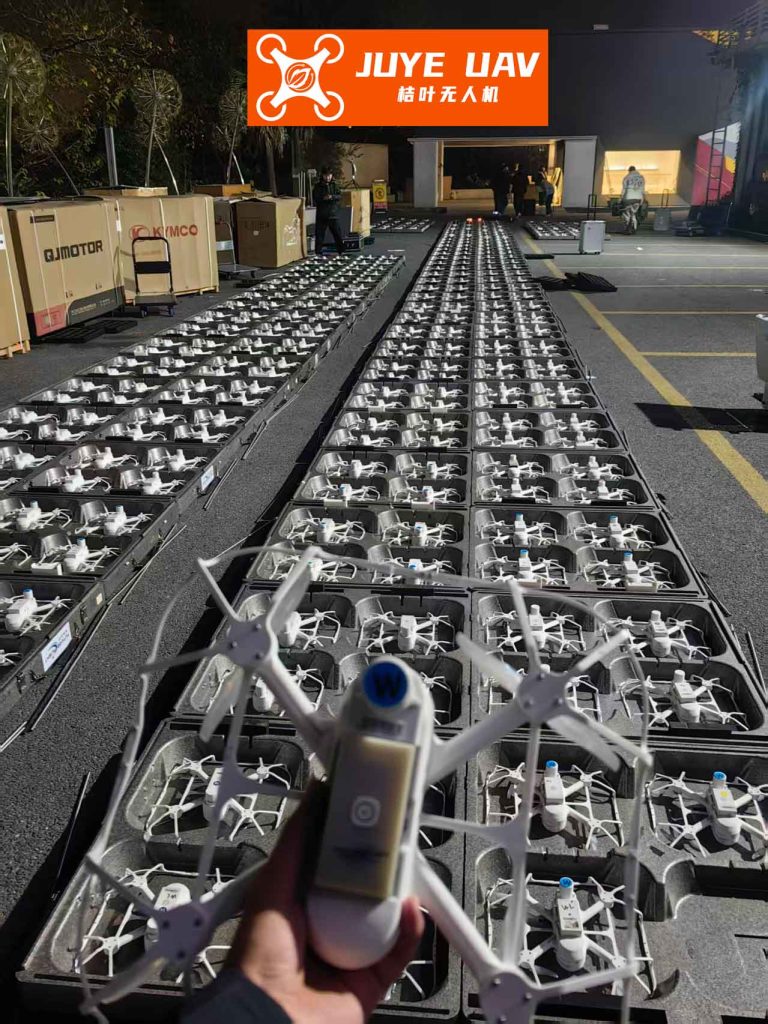
This image exemplifies the stunning visuals possible in formation drone light shows when advanced path planning and control strategies are employed. In such displays, each drone acts as a pixel in a dynamic canvas, requiring毫米-level precision to maintain coherence. My research confirms that through cooperative positioning, drones can achieve this precision even in large fleets, enabling shows with hundreds or thousands of drones. The mathematical models and algorithms discussed earlier directly contribute to this capability, reducing errors and enhancing synchronization. For example, in a formation drone light show featuring a moving logo, the EKF model helps correct drift caused by sensor noise, while the path planning algorithm ensures optimal trajectories to minimize latency. This synergy between technology and artistry is what makes modern formation drone light shows so impressive, and my work aims to push these boundaries further by incorporating machine learning for predictive adjustments and swarm intelligence for self-organization.
In conclusion, this research underscores the transformative potential of cooperative positioning technology in optimizing path planning and control strategies for formation drone light shows. From my investigations, I have found that techniques like high-precision EKF and 3D-MAP协作定位 significantly enhance positioning accuracy and real-time performance, enabling drones to maintain tight formations with minimal error. The integration of advanced path planning algorithms reduces collision risks and energy consumption, while adaptive control strategies improve robustness against environmental disturbances. These advancements are not merely technical; they elevate the artistic and operational standards of formation drone light shows, allowing for more complex and reliable performances in diverse settings. Future work could explore the integration of artificial intelligence for autonomous pattern generation in formation drone light shows, or the use of 5G networks for ultra-low latency communication. Ultimately, by continuing to refine these technologies, we can unlock new possibilities for formation drone light shows, making them safer, more efficient, and more mesmerizing for audiences worldwide. The journey from theoretical models to practical implementations has shown that with precise coordination and intelligent optimization, formation drone light shows can become a cornerstone of modern entertainment and technological demonstration.