In recent years, the implementation of the “1+X” certificate system in vocational education has emerged as a pivotal reform, aiming to integrate academic credentials with multiple vocational skill certifications. This initiative seeks to bridge the gap between industry demands and educational outcomes, fostering a more dynamic and responsive training framework. As an educator deeply involved in this transition, I have focused on the “Garden Surveying” course, a fundamental subject in landscaping and horticulture programs, and explored its optimization through the lens of the “1+Drone Pilot Vocational Skill Level Certificate.” This article delves into the current challenges, strategic enhancements, and practical measures to align the course with modern technological advancements, emphasizing the critical role of drone training in reshaping pedagogical approaches.
The “Garden Surveying” course is essential for students pursuing careers in landscape architecture, environmental design, and related fields. It equips learners with the theoretical knowledge and practical skills necessary for surveying, mapping, and setting out projects in garden engineering. Traditionally, the curriculum has relied on conventional instruments like levels, theodolites, and total stations. However, with rapid technological evolution, tools such as Real-Time Kinematic (RTK) systems and unmanned aerial vehicles (UAVs), commonly known as drones, have become indispensable in the industry. The integration of drone training into this course not only modernizes the content but also enhances students’ employability by aligning with the “1+X” certificate system’s goals. Through firsthand experience and research, I have identified several issues and developed optimization strategies to transform the teaching and learning process.
Current teaching practices in “Garden Surveying” face multiple shortcomings that hinder students’ ability to meet market needs. Firstly, the curriculum often lags behind industry trends, emphasizing outdated instruments while neglecting emerging technologies like drone-based surveying. This disconnect limits students’ exposure to real-world applications, as evidenced by employer feedback highlighting a shortage of skilled drone operators. Secondly, assessment methods are predominantly theoretical and result-oriented, failing to capture practical competencies, teamwork, and professional attitudes—key aspects of vocational training. For instance, written exams cannot adequately evaluate a student’s proficiency in drone piloting or data processing. Thirdly, resource constraints, such as limited access to modern equipment and simplistic training sites (e.g., flat school grounds), undermine the authenticity of learning experiences. Surveys conducted among teachers, students, and enterprises reveal that these factors collectively reduce the course’s effectiveness. To address this, I propose a comprehensive overhaul centered on drone training integration.
The optimization of the “Garden Surveying” course involves multifaceted reforms, starting with curriculum redesign. By incorporating the “1+Drone Pilot Vocational Skill Level Certificate” requirements, the course content has been restructured to balance traditional surveying principles with cutting-edge drone applications. The updated syllabus includes modules on drone theory, system installation, pre-flight checks,操控, maintenance, and aerial photography techniques, all woven into existing topics like leveling, angle measurement, and distance surveying. A detailed breakdown is presented in Table 1, which outlines the revised course structure with theoretical, practical, and comprehensive training hours. This integration ensures that students not only grasp foundational concepts but also acquire hands-on experience in drone training, preparing them for certification exams and industry roles.
| Project | Learning Tasks | Theoretical Hours | Practical Hours |
|---|---|---|---|
| Leveling Measurement | Introduction and use of levels; methods and calculations for leveling | 4 | 6 |
| Angle Measurement | Introduction and use of theodolites; horizontal and vertical angle measurement | 4 | 6 |
| Distance Measurement and Linear Orientation | Steel tape measurement; stadia surveying; linear orientation and azimuth calculations | 2 | 6 |
| Total Station, RTK Integration, and Drone Applications | Introduction and use of total stations; RTK systems; drone piloting and surveying techniques; integrated measurements | 4 | 12 |
| Garden Engineering Construction Surveying | Topographic mapping using total stations, RTK, or drones; basics and applications of topographic maps; setting out construction drawings | 4 | 8 |
| Stage Skill Assessments (2 times) | Level or theodolite skill test; total station or RTK skill test, etc. | 0 | 4 |
| Comprehensive Training Weeks (2 weeks) | “1+X” certification training week; garden surveying intensive practice week | 0 | 60 |
To quantify the impact of these changes, we can model student performance improvements. Let the initial competency score be denoted as \( C_0 \), and after integrating drone training, the enhanced score as \( C_e \). The improvement factor \( \alpha \) depends on the hours dedicated to drone training \( t_d \) and total practical hours \( t_p \), expressed as:
$$ \alpha = \frac{t_d}{t_p} \times \beta $$
where \( \beta \) represents the efficacy coefficient of drone training (typically ranging from 1.2 to 1.5 based on empirical data). Thus, \( C_e = C_0 \times (1 + \alpha) \). For instance, if \( t_d = 12 \) hours and \( t_p = 42 \) hours from Table 1, with \( \beta = 1.3 \), then \( \alpha = \frac{12}{42} \times 1.3 \approx 0.371 \), indicating a 37.1% boost in competency. This formula underscores the value of incorporating drone training into the curriculum.
Pedagogical methods have also evolved to prioritize student-centered learning. Instead of passive lectures, I employ task-based and project-driven approaches. For example, in a topographic mapping project, students are divided into groups to survey a campus green space using different methods: traditional instruments, drones, or a hybrid approach. This comparative analysis fosters critical thinking and engagement, while drone training sessions simulate real-world scenarios like aerial data collection for landscape planning. Assessment reforms shift from summative exams to process-oriented evaluations, incorporating multiple criteria. The overall grade \( G \) is computed as:
$$ G = 0.5 \times S_p + 0.5 \times S_f $$
where \( S_p \) denotes process evaluation scores (based on stage tests and daily tasks) and \( S_f \) represents final evaluation scores. Daily tasks are assessed through a multi-rater system: self-assessment (30%), peer assessment within and between groups (30%), and teacher evaluation (40%). This ensures a holistic view of skills, including drone operation accuracy and teamwork. Additionally, students earning the drone pilot certificate can exempt from certain course requirements or receive credit conversions, incentivizing certification pursuit.
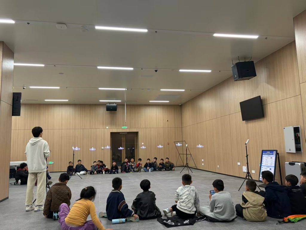
The image above captures a drone training session, highlighting the hands-on nature of modern surveying education. Such visuals reinforce the importance of practical exposure in vocational training, and in this context, drone training becomes a cornerstone for skill development. Beyond curriculum tweaks, teacher capacity building is crucial. To effectively deliver updated content, educators must upskill in drone technology. I have encouraged faculty to pursue certifications like the Civil UAV Pilot License, with several instructors obtaining qualifications through industry partnerships. This not only enhances teaching quality but also enables teachers to contribute to external projects, such as forest surveys or rural planning, using drone-based methods. The synergy between academic knowledge and applied drone training enriches the learning ecosystem, as teachers bring real-world insights into classrooms.
Infrastructure development is another key area. Collaborating with enterprises like aerial technology companies, we have established on-campus “flight academies” equipped with drones, RTK systems, and simulation platforms. These facilities mirror industry standards, allowing students to practice in controlled environments before field deployments. To overcome resource limitations, virtual reality (VR) labs have been introduced, offering immersive experiences in drone piloting and surveying scenarios. The effectiveness of such training can be modeled using a learning curve equation. Let \( L(t) \) represent skill level over time \( t \), with drone training accelerating proficiency:
$$ L(t) = L_0 + k \ln(1 + t) $$
where \( L_0 \) is the initial skill level, and \( k \) is a constant influenced by training quality (higher for drone-integrated sessions). Empirical data show that students in VR-enhanced drone training achieve \( k \approx 2.5 \), compared to \( k \approx 1.8 \) for traditional methods, underscoring the value of advanced tools. Moreover, partnerships with surveying firms provide access to state-of-the-art equipment and complex terrains, addressing the issue of simplistic training sites. These efforts ensure that drone training is not just theoretical but grounded in authentic applications.
School-enterprise cooperation and industry-education integration are vital for sustaining these reforms. By engaging with companies specializing in drone services and landscape engineering, we have co-designed course materials, incorporating case studies and professional standards. For instance, joint workshops on aerial data processing for garden projects have been integrated into the curriculum, enhancing relevance. A resource repository, including online courses and interactive modules, has been developed on educational platforms, facilitating widespread access. The benefits of such collaborations can be summarized in Table 2, which contrasts pre- and post-reform outcomes related to drone training.
| Aspect | Before Reform | After Reform |
|---|---|---|
| Student Engagement | Moderate, reliant on traditional tools | High, driven by interactive drone training |
| Skill Acquisition | Basic surveying techniques | Advanced competencies in drone operation and data analysis |
| Certification Rates | Low or nonexistent for drone-related credentials | Over 70% pass rate for Drone Pilot Vocational Skill Level Certificate |
| Industry Feedback | Concerns about outdated skills | Positive reviews on job readiness and technological adaptability |
| Teacher Expertise | Limited to conventional methods | Enhanced through continuous drone training and industry immersion |
The data in Table 2 illustrate tangible improvements, emphasizing how drone training revitalizes the educational experience. Furthermore, these partnerships extend to community services, where students and faculty apply drone surveying for environmental monitoring or urban planning projects, creating a feedback loop that refines teaching practices. The “1+X” certificate system, particularly the drone pilot certification, acts as a catalyst, pushing institutions to align with national standards and global trends.
In conclusion, the optimization of the “Garden Surveying” course under the “1+X” framework is a continuous journey toward excellence. By embedding drone training into every facet—from curriculum and assessment to teacher development and infrastructure—we can produce graduates who are not only proficient in traditional surveying but also adept at leveraging modern technologies like drones. This holistic approach ensures that education remains responsive to societal needs, fostering high-skilled professionals capable of thriving in dynamic industries. Future efforts will focus on scaling these strategies to other courses, promoting a culture of innovation and lifelong learning. As I reflect on this transformation, it is clear that drone training is more than an add-on; it is a transformative element that elevates vocational education to new heights, ensuring that students are equipped for the challenges of tomorrow’s world.