In recent years, the rapid expansion of power grid infrastructure has heightened the demand for efficient and reliable inspection methods to ensure the safety and stability of electrical systems. Traditional manual inspection approaches, while foundational, are often hindered by inefficiencies, safety risks, and limitations imposed by challenging terrains and weather conditions. To address these challenges, we have developed a comprehensive system leveraging multirotor drone technology integrated with advanced sensor systems, communication protocols, and artificial intelligence processing techniques. This system aims to automate the detection of power line defects and tree obstacles through intelligent image recognition, thereby enhancing the overall intelligence and effectiveness of power line maintenance. Our approach focuses on achieving high accuracy, real-time performance, and robustness in diverse operational environments, with the multirotor drone serving as the core platform for data acquisition and analysis.
The proliferation of multirotor drone applications in industrial settings has opened new avenues for automating inspection tasks. In the context of power line inspection, multirotor drones offer unparalleled advantages, including maneuverability, accessibility to remote areas, and the ability to carry multiple sensors simultaneously. Our system design emphasizes the integration of high-definition cameras, infrared thermal imagers, and laser radar devices mounted on a multirotor drone, enabling comprehensive data collection. The captured data is processed using deep learning algorithms, which facilitate rapid localization and identification of potential hazards such as structural defects or vegetation encroachments. This paper details the system architecture, algorithmic implementations, experimental validations, and future directions, with a consistent emphasis on the role of multirotor drone technology in revolutionizing power line inspection paradigms.
System Architecture and Design
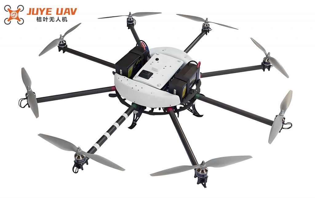
The proposed system is built on a modular and scalable architecture that combines hardware and software components to achieve autonomous power line inspection. The core of this architecture is the multirotor drone platform, which is equipped with a suite of sensors for image acquisition, a robust communication system for data transmission, and an onboard processing unit for real-time analysis. The system architecture, as illustrated in the embedded figure below, comprises five main modules: the multirotor drone platform, image acquisition system, data processing and analysis system, communication system, and ground control station. Each module is designed to work synergistically, ensuring seamless operation from data capture to defect identification.
The multirotor drone platform is engineered for stability and endurance, incorporating adaptive control algorithms and PID strategies to maintain precise flight姿态 even under adverse weather conditions. For instance, the flight control system utilizes a proportional-integral-derivative (PID) controller, which can be modeled as:
$$ u(t) = K_p e(t) + K_i \int_0^t e(\tau) d\tau + K_d \frac{de(t)}{dt} $$
where \( u(t) \) represents the control output, \( e(t) \) is the error signal, and \( K_p \), \( K_i \), and \( K_d \) are the proportional, integral, and derivative gains, respectively. This ensures that the multirotor drone can hover steadily while capturing high-quality images. The power system employs high-efficiency electric motors and optimized battery management, allowing for extended flight times of up to 60 minutes, which is critical for covering long stretches of power lines. Additionally, the payload system is designed with modularity in mind, enabling easy swapping of sensors based on specific inspection requirements. Safety features, such as obstacle avoidance sensors and automated return-to-home functions, are integrated to mitigate risks during operation.
The image acquisition system is a pivotal component, as it directly influences the quality of data used for analysis. It consists of a high-definition camera with a Sony Exmor R CMOS sensor capable of 4K video recording, an infrared thermal imager for detecting temperature anomalies, and a laser radar for capturing three-dimensional structural data. The image transmission devices employ Coded Orthogonal Frequency Division Multiplexing (COFDM) modulation and Multiple-Input Multiple-Output (MIMO) technologies to ensure reliable and high-speed data transfer, even in environments with significant electromagnetic interference. The data processing and analysis system leverages deep learning algorithms, including convolutional neural networks (CNNs) and support vector machines (SVMs), to extract features and classify defects. This system is supported by a real-time data streaming framework that enables immediate alert generation upon detecting anomalies. The communication system facilitates bidirectional data flow between the multirotor drone and the ground control station, while the ground station provides a user interface for monitoring and controlling the inspection process.
Algorithm Implementation for Image Processing and Recognition
The algorithmic framework of our system is designed to process and analyze the images captured by the multirotor drone, with a focus on accuracy and efficiency. It involves three key stages: image preprocessing, feature extraction, and classification recognition. Each stage employs mathematical models and computational techniques to enhance the system’s ability to identify power line defects and tree obstacles.
Image Preprocessing
Image preprocessing is crucial for improving the quality of raw images, which may be affected by noise, poor contrast, or blurriness due to environmental factors. We apply a series of operations, including denoising, enhancement, and sharpening, to prepare the images for subsequent analysis. Denoising is performed using a wavelet transform approach, which effectively removes noise while preserving important image details. The mathematical representation of this process is:
$$ I_{\text{denoised}} = I_{\text{original}} – W_{\text{threshold}}(W_{\text{transform}}(I_{\text{original}})) $$
where \( I_{\text{original}} \) denotes the original image, \( W_{\text{transform}} \) is the wavelet transform function, \( W_{\text{threshold}} \) is the thresholding function, and \( I_{\text{denoised}} \) is the denoised image. For contrast enhancement, we use the Contrast Limited Adaptive Histogram Equalization (CLAHE) algorithm, which adapts to local image characteristics to improve visibility. The enhanced image \( I_{\text{enhanced}}(x, y) \) is obtained as:
$$ I_{\text{enhanced}}(x, y) = \text{CLAHE}(I_{\text{denoised}}(x, y)) $$
Sharpening is then applied using the Laplacian operator to accentuate edges and fine details, which is essential for detecting small defects. The sharpened image \( I_{\text{sharpened}} \) is computed as:
$$ I_{\text{sharpened}} = I_{\text{enhanced}} + \alpha \cdot (\text{Laplacian}(I_{\text{enhanced}})) $$
where \( \alpha \) is a sharpening intensity coefficient. These preprocessing steps collectively increase the signal-to-noise ratio (SNR) and contrast enhancement factor (CEF), making the images more amenable to feature extraction.
Feature Extraction
Feature extraction is performed using a convolutional neural network (CNN), which excels at capturing spatial hierarchies in images. The CNN architecture comprises multiple convolutional layers, pooling layers, and activation functions. The convolutional operation for a given layer can be expressed as:
$$ f(x) = (k \ast g(x)) + b $$
where \( f(x) \) is the output feature map, \( k \) is the convolution kernel, \( g(x) \) is the input image or previous layer output, and \( b \) is the bias term. Pooling layers, specifically max-pooling, are used to reduce spatial dimensions and computational complexity:
$$ \text{downsampled}(x) = \max_{x’} (x’) $$
where \( x \) represents the input region and \( x’ \) denotes sub-regions within it. The ReLU activation function introduces non-linearity, defined as \( \text{ReLU}(x) = \max(0, x) \), enabling the network to learn complex patterns. The CNN outputs a feature vector of dimension 1,024, which is then used for classification. To quantify the effectiveness of feature extraction, we compute a feature separability index \( F \) as:
$$ F = \frac{\sum_{k=1}^{C} (\mu_k – \mu)^T S^{-1} (\mu_k – \mu)}{C} $$
where \( \mu_k \) is the mean feature vector of class \( k \), \( \mu \) is the overall mean vector, \( S \) is the within-class scatter matrix, and \( C \) is the number of classes. This index helps assess the discriminative power of the extracted features.
Classification Recognition
For classification, we employ a support vector machine (SVM) with a radial basis function (RBF) kernel. The SVM aims to find an optimal hyperplane that separates different classes in the feature space. The decision function for classification is:
$$ f(x) = \text{sign}(w^T \phi(x) + b) $$
where \( w \) is the weight vector, \( \phi(x) \) maps the input to a high-dimensional space, and \( b \) is the bias term. The optimization problem for SVM is formulated as:
$$ \min_{w, \xi} \frac{1}{2} \| w \|^2 + C \sum_{i} \xi_i $$
subject to \( y_i (w^T \phi(x_i) + b) \geq 1 – \xi_i \) and \( \xi_i \geq 0 \), where \( C \) is the penalty parameter and \( \xi_i \) are slack variables. This approach ensures high accuracy in distinguishing between normal power lines, defective lines, and tree obstacles.
Experimental Validation and Performance Analysis
To evaluate the system’s performance, we conducted extensive experiments in three distinct power line regions, each characterized by varying terrain, line types, and tree densities. The multirotor drone was deployed to capture images and sensor data, which were then processed using our algorithms. The experimental setup and results are detailed below, with a focus on quantitative metrics such as accuracy, processing time, and robustness.
Experimental Environment
The experiments were carried out in areas with different environmental conditions to test the adaptability of the multirotor drone-based system. The characteristics of these regions are summarized in Table 1.
| Region ID | Terrain Type | Power Line Category | Tree Density Level | Total Line Length (km) | Inspection Duration (hours) |
|---|---|---|---|---|---|
| 1 | Mountainous | High-Voltage Transmission | High | 120 | 8 |
| 2 | Plain | Low-Voltage Distribution | Medium | 80 | 5 |
| 3 | Suburban | Mixed Lines | Low | 50 | 3 |
The multirotor drone used in these experiments was equipped with GPS for precise navigation and the sensor suite described earlier. Each inspection mission involved autonomous flight paths programmed to cover the entire length of the power lines, with the multirotor drone capturing data at regular intervals.
Results and Discussion
The performance of the image preprocessing, feature extraction, and classification stages was analyzed using various metrics. For preprocessing, we measured the signal-to-noise ratio (SNR) and contrast enhancement factor (CEF) to assess image quality improvements. The SNR is calculated as:
$$ \text{SNR} = 10 \log_{10} \left( \frac{\sum_{i=1}^{N} I_i^2}{\sum_{i=1}^{N} (I_i – \bar{I})^2} \right) $$
where \( I_i \) are pixel values and \( \bar{I} \) is the mean pixel value. After denoising, the average SNR increased by 15.2 dB across all regions. The CEF, defined as:
$$ \text{CEF} = \frac{\sum_{i=1}^{N} (I_i – \bar{I})^2}{\sum_{i=1}^{N} (J_i – \bar{J})^2} $$
where \( J_i \) represents pixel values after enhancement, yielded an average value of 1.75, indicating significant contrast improvement.
For feature extraction and classification, the CNN and SVM models achieved high performance in detecting defects and tree obstacles. The feature separability index \( F \) averaged 876.5, demonstrating strong class separation. Classification results, including accuracy, recall, and F1-score, are presented in Table 2.
| Category | Accuracy (%) | Recall (%) | F1-Score (%) |
|---|---|---|---|
| Normal Lines | 98.6 | 99.1 | 98.9 |
| Defective Lines | 95.2 | 94.7 | 94.9 |
| Tree Obstacles | 96.8 | 97.4 | 97.1 |
The real-time performance of the system was evaluated by measuring the processing time from image acquisition to classification. The distribution of processing times is shown in Figure 2, with an average of 0.75 seconds per image, meeting the requirements for real-time inspection. The multirotor drone’s ability to maintain stable flight and transmit data efficiently contributed to this performance.
Conclusion and Future Directions
In this paper, we have presented a robust system for power line inspection and tree obstacle detection using a multirotor drone integrated with intelligent image recognition technologies. The system demonstrates high accuracy, real-time processing capabilities, and adaptability to various environmental conditions. The use of deep learning algorithms, particularly CNNs and SVMs, has proven effective in identifying defects and vegetation encroachments with precision. The multirotor drone platform serves as a reliable and versatile tool for data acquisition, highlighting its potential in automating critical infrastructure maintenance tasks.
Looking ahead, we plan to further optimize the algorithms to enhance the system’s adaptability and robustness. This includes exploring advanced neural network architectures, such as transformers for image analysis, and incorporating multi-sensor fusion techniques to improve detection reliability. Additionally, we aim to address challenges related to data privacy and algorithmic bias by developing secure and transparent AI models. The integration of the multirotor drone with emerging technologies like 5G communication and edge computing could also enhance real-time data processing and decision-making. Ultimately, we envision expanding the application of this system to other domains, such as railway or pipeline inspection, leveraging the versatility of multirotor drone technology to drive innovation in automated maintenance solutions.